Menu

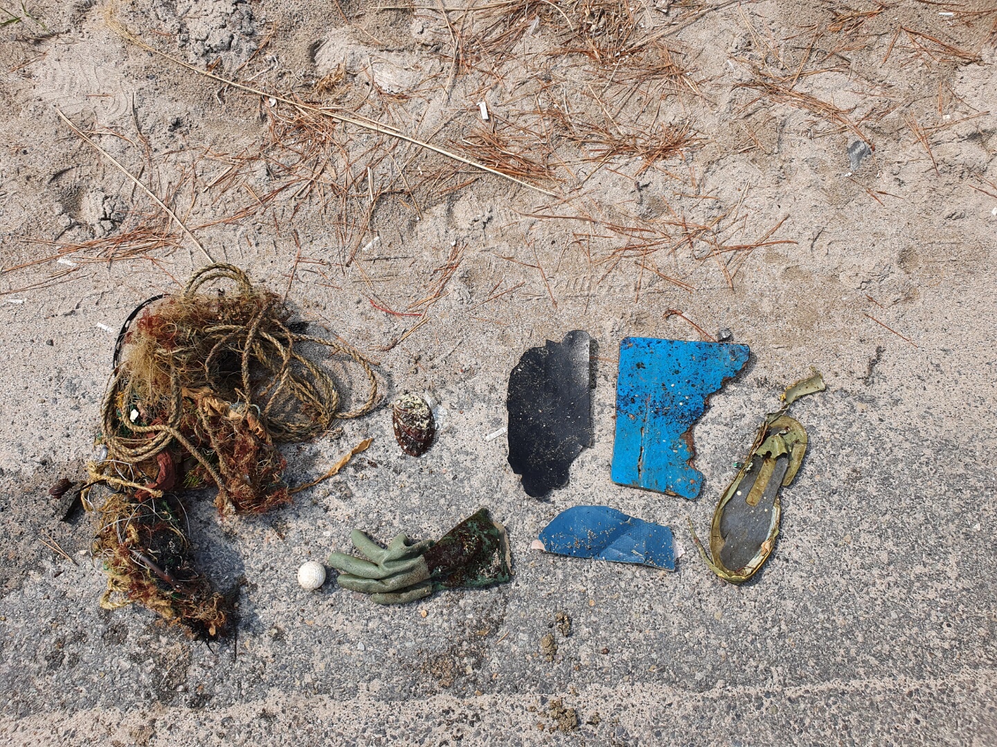
Guryong-po

3

35.999611111111, 129.57205555556

1
rock
PADI/MKSleisure
kidae kwon
1
1
4.50
30
15.00
9.00
measured
15.00
1
On
kilograms
I have debris data to report
Calm (glassy to rippled) for waves 0 – 0.1 meter high
1
m2
meters
rocky reef
South Korea
State\Province
kyoungsangbuk-do
City
pohang
Map Help


Dive Location

If you know your survey site coordinates, enter them manually in decimal degrees using WGS84 Map Datum. Use the minus sign for latitudes south of the equator and longitudes west of the Prime Meridian to 180 degrees.

If you do not know your survey site coordinates, click the “Map Location” tab to use the map to zoom into your survey site and drop the pin on the map to fall within your survey dive site in the water (not on land or the beach). Ensure you zoom in as much as possible to ensure data accuracy.

Entangled Help


Use the vertical tabs below to record any entangled animals you found of each type.

Joe Patti II

sand
15

30.225756408997, -87.20870154929

Tropical storm, high winds
Victoria Sengelman
7
3.00
36
100.00
72.00
estimated
6
1000.00
Fishing Line
Fishing hooks
Fishing Sinkers
On
pounds
I have debris data to report
Calm (glassy to rippled) for waves 0 – 0.1 meter high ft2
2
feet
other
United States
State\Province
Fl
City
Pensacola
Map Help


Dive Location

If you know your survey site coordinates, enter them manually in decimal degrees using WGS84 Map Datum. Use the minus sign for latitudes south of the equator and longitudes west of the Prime Meridian to 180 degrees.

If you do not know your survey site coordinates, click the “Map Location” tab to use the map to zoom into your survey site and drop the pin on the map to fall within your survey dive site in the water (not on land or the beach). Ensure you zoom in as much as possible to ensure data accuracy.

Entangled Help


Use the vertical tabs below to record any entangled animals you found of each type.

Ecosystem Other
Wreck reef

Oceanwind Tug

30.108232248522, -87.296301336524

sand
17

30.084260590661, -86.913051967711

Tropical storm, high winds
Victoria Sengelman
7
6.00
44
85.00
68.00
estimated
9
27889.00
Fishing line
Fishing hooks
Fishing sinkers
On
pounds
I have debris data to report
Calm (glassy to rippled) for waves 0 – 0.1 meter high ft2
feet
other
1
United States
State\Province
FL
City
Pensacola
Map Help


Dive Location

If you know your survey site coordinates, enter them manually in decimal degrees using WGS84 Map Datum. Use the minus sign for latitudes south of the equator and longitudes west of the Prime Meridian to 180 degrees.

If you do not know your survey site coordinates, click the “Map Location” tab to use the map to zoom into your survey site and drop the pin on the map to fall within your survey dive site in the water (not on land or the beach). Ensure you zoom in as much as possible to ensure data accuracy.

Entangled Help


Use the vertical tabs below to record any entangled animals you found of each type.

Ecosystem Other
Wreck reef

TEST 1

rock
1

33.615924976431, -117.93930641633

Test
Test
Jack
2
1
1
1
1
1
2.00
45
50.00
10.00
measured
10000.00
On
pounds
I have debris data to report
Smooth (wavelets) for waves 0.1 - 0.5 meter high ft2
feet
rocky reef
United States
City
Test City
Map Help


Dive Location

If you know your survey site coordinates, enter them manually in decimal degrees using WGS84 Map Datum. Use the minus sign for latitudes south of the equator and longitudes west of the Prime Meridian to 180 degrees.

If you do not know your survey site coordinates, click the “Map Location” tab to use the map to zoom into your survey site and drop the pin on the map to fall within your survey dive site in the water (not on land or the beach). Ensure you zoom in as much as possible to ensure data accuracy.

Entangled Help


Use the vertical tabs below to record any entangled animals you found of each type.

Abana

0
0
100

5.1076999965872, 115.070667

0
0
0
sand
0
0
0
2
0
Choppy
0
0
0
0
0
0
0
0
0
0
0
0
0
0
0
0
0
0
0
0
Oceanic Quest
Doris chin
0
0
0
0
0
0
0
0
0
0
0
0
0
0
0
0
0
0
0
8
0
0
0
0
0
0
5
0
0
0
0
0
0
0
5.00
45
10.00
8.00
1
estimated
0
0
200.00
0
0
0
0
0
Ghost fishnets
0
On
kilograms
0
I have debris data to report
0
0
0
Smooth (wavelets) for waves 0.1 - 0.5 meter high
0
0
0
0
0
0
0
m2
0
0
meters
coral reef
0
0
0
0
0
0
0
0
0
0
0
0
0
0
0
0
0
0
0
0
0
0
0
0
0
0
0
0
Brunei
State\Province
Brunei Muara
City
Muara
Map Help


Dive Location

If you know your survey site coordinates, enter them manually in decimal degrees using WGS84 Map Datum. Use the minus sign for latitudes south of the equator and longitudes west of the Prime Meridian to 180 degrees.

If you do not know your survey site coordinates, click the “Map Location” tab to use the map to zoom into your survey site and drop the pin on the map to fall within your survey dive site in the water (not on land or the beach). Ensure you zoom in as much as possible to ensure data accuracy.

Entangled Help


Use the vertical tabs below to record any entangled animals you found of each type.

Rig 2

0
0
250

5.1066999977682, 114.951883

0
0
0
sand
0
0
0
2
0
Dead
Choppy
0
0
0
0
0
0
0
0
0
0
0
0
0
0
0
0
0
0
0
0
Oceanic Quest
Doris chin
0
0
0
0
0
0
0
0
0
0
0
0
0
0
0
0
0
0
0
8
0
0
0
0
0
0
20
0
0
0
0
0
0
0
16.00
20
18.00
10.00
2
estimated
0
2
200.00
0
0
0
0
0
Ghost fish net
0
On
kilograms
0
I have debris data to report
0
0
0
Smooth (wavelets) for waves 0.1 - 0.5 meter high
0
0
0
Fishing net
Crab
Dead
1
0
0
0
0
m2
2
0
meters
other
0
0
0
0
0
0
0
0
0
0
0
0
0
0
0
0
0
0
0
0
0
0
0
0
0
0
0
0
Brunei
State\Province
Brunei Muara
City
Muara
Map Help


Dive Location

If you know your survey site coordinates, enter them manually in decimal degrees using WGS84 Map Datum. Use the minus sign for latitudes south of the equator and longitudes west of the Prime Meridian to 180 degrees.

If you do not know your survey site coordinates, click the “Map Location” tab to use the map to zoom into your survey site and drop the pin on the map to fall within your survey dive site in the water (not on land or the beach). Ensure you zoom in as much as possible to ensure data accuracy.

Entangled Help


Use the vertical tabs below to record any entangled animals you found of each type.

Boca’s Hidden Ledge

2
6
0

26.338194808737, -80.061062885782

1
0
0
coral
0
2
0
10
0
General boating
Little plastic tea pot
Rain and Windy
1
0
0
0
0
0
0
0
0
0
0
0
0
0
0
0
0
0
0
0
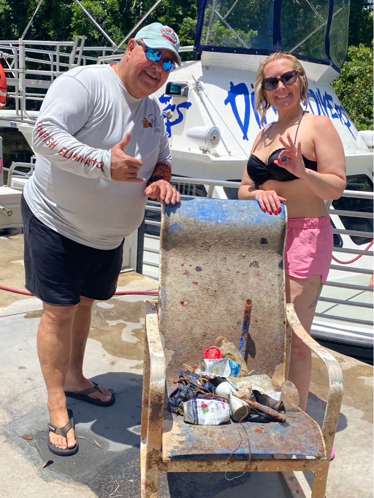
Chair
Dixie Divers
WolfPod
0
0
0
4
0
0
0
0
1
0
0
0
0
0
0
0
0
0
0
5
0
0
1
0
0
0
0
0
0
3
0
0
0
0
15.00
75
70.00
50.00
1
estimated
0
2
4802.28
0
0
0
0
0
Plastic
Fishing line
Cans
0
On
pounds
0
I have debris data to report
0
0
0
Slight for waves 0.5 -1.25 meter high
0
0
0
0
2
0
0
ft2
1
0
feet
coral reef
0
0
0
0
0
0
0
0
0
1
0
0
0
0
0
0
8
0
0
0
0
0
0
0
0
0
0
0
United States
State\Province
Florida
City
Boca Raton
Map Help


Dive Location

If you know your survey site coordinates, enter them manually in decimal degrees using WGS84 Map Datum. Use the minus sign for latitudes south of the equator and longitudes west of the Prime Meridian to 180 degrees.

If you do not know your survey site coordinates, click the “Map Location” tab to use the map to zoom into your survey site and drop the pin on the map to fall within your survey dive site in the water (not on land or the beach). Ensure you zoom in as much as possible to ensure data accuracy.

Entangled Help


Use the vertical tabs below to record any entangled animals you found of each type.

ADS571 - Saonek Monde

204
0
0

-0.44928800005451, 130.800922

5
0
1
sand
1
7
0
0
0
N/A
N/A
N/A
Metal cooking pot
Raining and cloudy
1
0
0
0
0
0
0
0
0
0
0
0
0
0
0
0
0
0
0
0
Face Mask
Meridian Adventure Dive Resort
Luke Braun
0
0
0
62
0
0
0
0
0
0
0
0
0
0
18
0
0
0
0
10
0
0
0
0
0
0
0
0
0
0
0
0
0
0
35.00
40
15.00
5.00
0
estimated
0
0
8147.74
0
0
1
0
0
Plastic wrappers
Plastic water containers
Diapers
0
On
kilograms
0
I have debris data to report
11
0
0
Smooth (wavelets) for waves 0.1 - 0.5 meter high
0
0
5
2
0
1
0
m2
0
0
meters
coral reef
1
0
0
0
0
0
0
0
0
10
0
0
0
0
0
0
9
0
0
1
0
0
0
0
0
0
0
0
Indonesia
State\Province
West Pupua
City
Waisai, Raja Ampat
Map Help


Dive Location

If you know your survey site coordinates, enter them manually in decimal degrees using WGS84 Map Datum. Use the minus sign for latitudes south of the equator and longitudes west of the Prime Meridian to 180 degrees.

If you do not know your survey site coordinates, click the “Map Location” tab to use the map to zoom into your survey site and drop the pin on the map to fall within your survey dive site in the water (not on land or the beach). Ensure you zoom in as much as possible to ensure data accuracy.

Entangled Help


Use the vertical tabs below to record any entangled animals you found of each type.

The Crash

8
11
0

12.115689167744, -68.965485862904

0
0
0
sand
1
4
0
53
1
Good
0
0
0
0
0
0
0
0
0
0
0
0
0
0
0
0
0
0
0
0
Goby Divers
Ândhiela
0
0
0
4
0
0
0
0
1
0
1
0
0
0
0
0
0
1
3
2
0
0
2
0
0
0
0
0
0
0
0
0
0
0
7.00
65
7.00
1.00
0
estimated
0
7
9777.12
0
0
0
0
0
0
On
kilograms
0
I have debris data to report
1
0
0
Slight for waves 0.5 -1.25 meter high
0
0
1
0
5
0
0
m2
0
0
meters
coral reef
0
0
0
0
0
3
0
0
0
4
0
0
1
0
0
1
3
0
0
0
0
0
0
0
0
0
0
0
Netherlands Antilles
State\Province
Curaçao
City
Willemstad
Map Help


Dive Location

If you know your survey site coordinates, enter them manually in decimal degrees using WGS84 Map Datum. Use the minus sign for latitudes south of the equator and longitudes west of the Prime Meridian to 180 degrees.

If you do not know your survey site coordinates, click the “Map Location” tab to use the map to zoom into your survey site and drop the pin on the map to fall within your survey dive site in the water (not on land or the beach). Ensure you zoom in as much as possible to ensure data accuracy.

Entangled Help


Use the vertical tabs below to record any entangled animals you found of each type.

The Crash

0
5
0

12.115643152394, -68.96544425903

0
0
0
sand
0
0
0
22
0
Good
1
1
0
0
0
0
0
0
0
0
0
0
0
0
0
0
0
0
0
0
Hat
Shoe inside liner
Goby Divers
Jarima
0
0
0
4
0
0
0
0
0
0
0
0
0
0
0
0
0
1
0
11
0
0
0
0
0
0
0
0
0
0
0
0
0
0
5.00
60
12.00
1.00
0
estimated
0
35
16934.50
0
0
1
0
0
1
On
kilograms
0
I have debris data to report
6
0
0
Slight for waves 0.5 -1.25 meter high
0
0
0
0
4
0
0
m2
0
0
meters
coral reef
0
0
0
0
0
0
0
2
0
0
0
0
2
0
0
3
0
0
0
0
0
3
0
0
0
0
0
0
Netherlands Antilles
State\Province
Curaçao
City
Willemstad
Map Help


Dive Location

If you know your survey site coordinates, enter them manually in decimal degrees using WGS84 Map Datum. Use the minus sign for latitudes south of the equator and longitudes west of the Prime Meridian to 180 degrees.

If you do not know your survey site coordinates, click the “Map Location” tab to use the map to zoom into your survey site and drop the pin on the map to fall within your survey dive site in the water (not on land or the beach). Ensure you zoom in as much as possible to ensure data accuracy.

Entangled Help


Use the vertical tabs below to record any entangled animals you found of each type.

Subscribe to