Cais dos Pescadores e Praia dos Pescadores
0
14
1
38.697155208225, -9.4181608237324
0
0
0
sand
1
0
1
0
0
We cleaned underneath the pier and on both sides of the pier but I wasn’t able to select two areas on the map
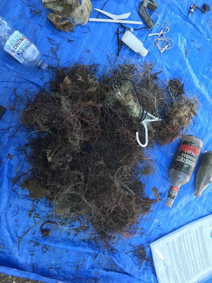
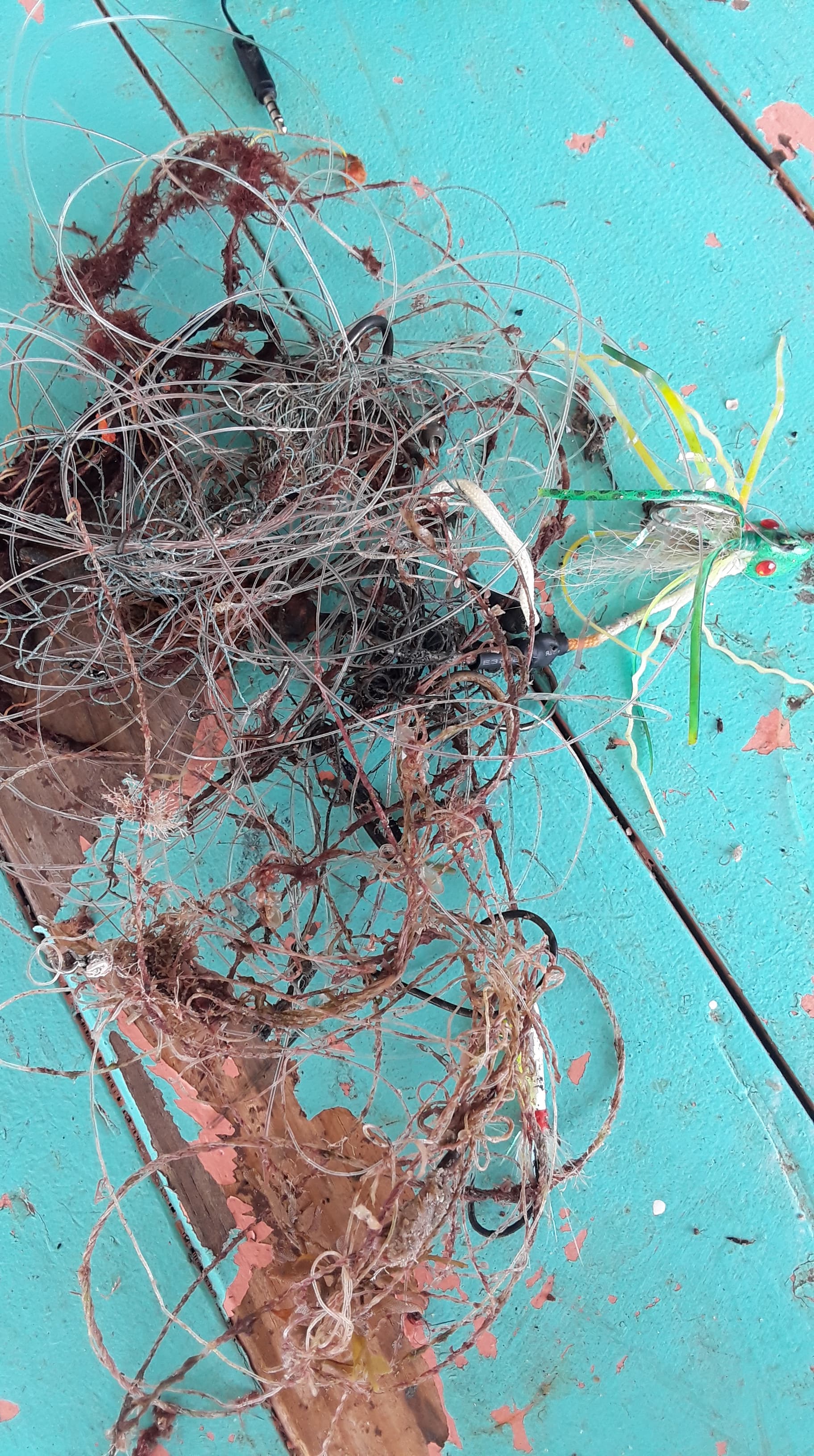
Fishing activities
Fins had been removed
3
13
0
0
0
0
0
0
0
0
0
0
0
0
0
0
0
0
0
0
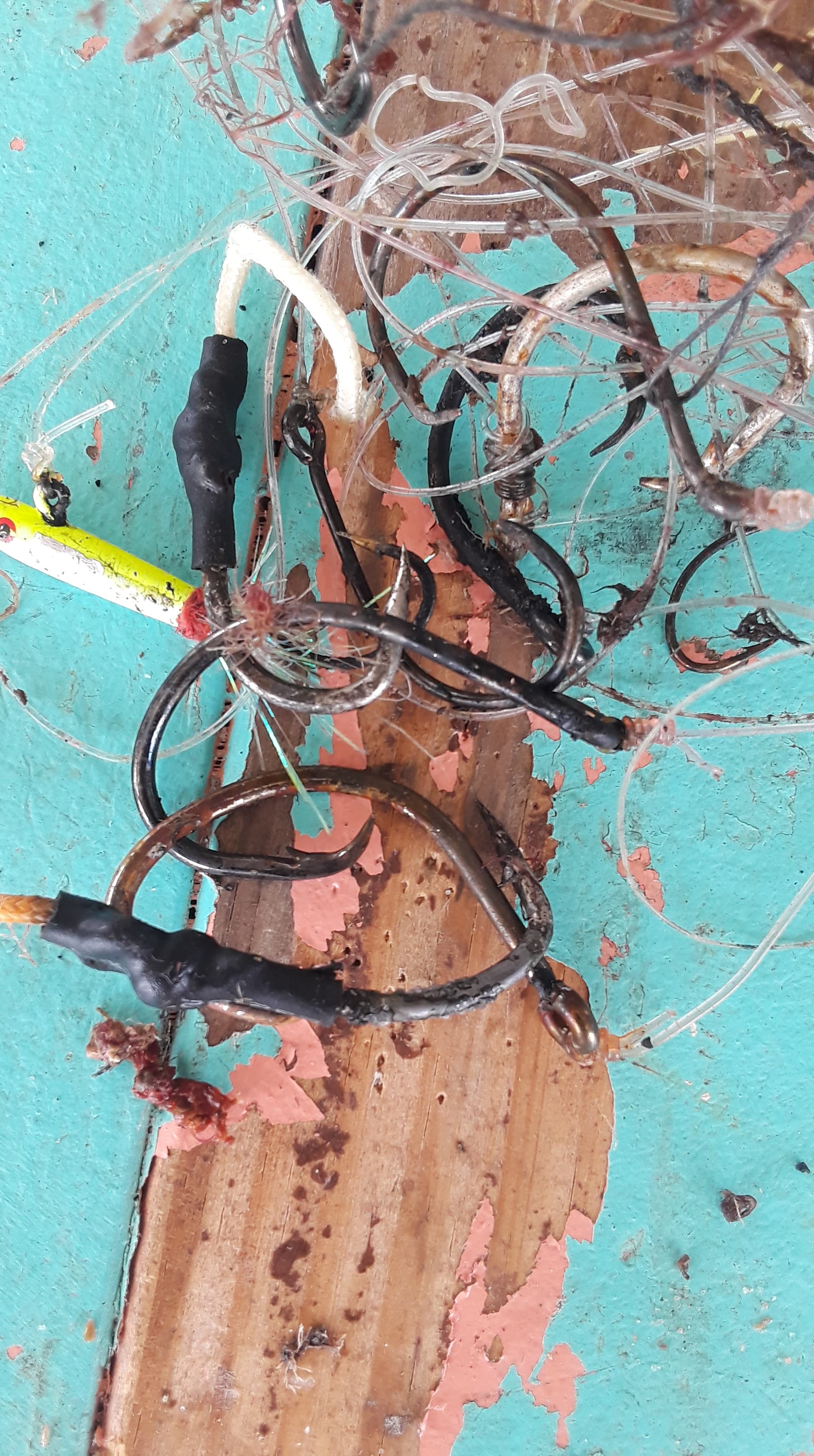
Anchor
Fishing: traps & pots (plastic)
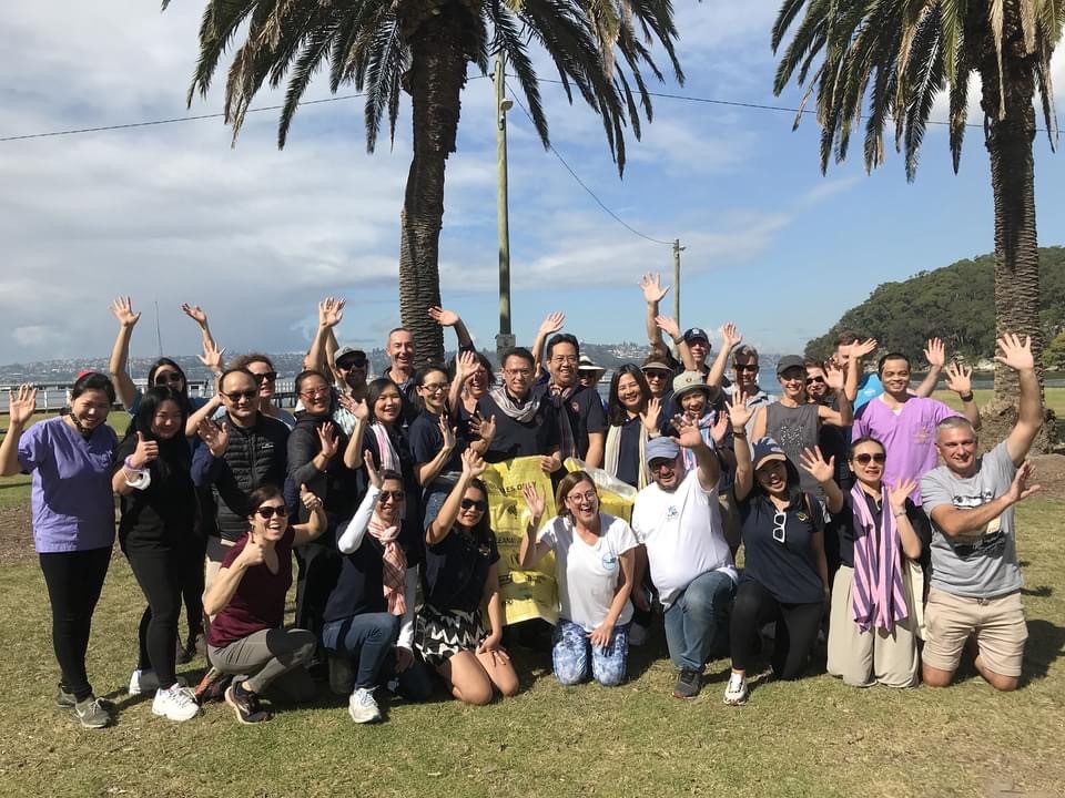
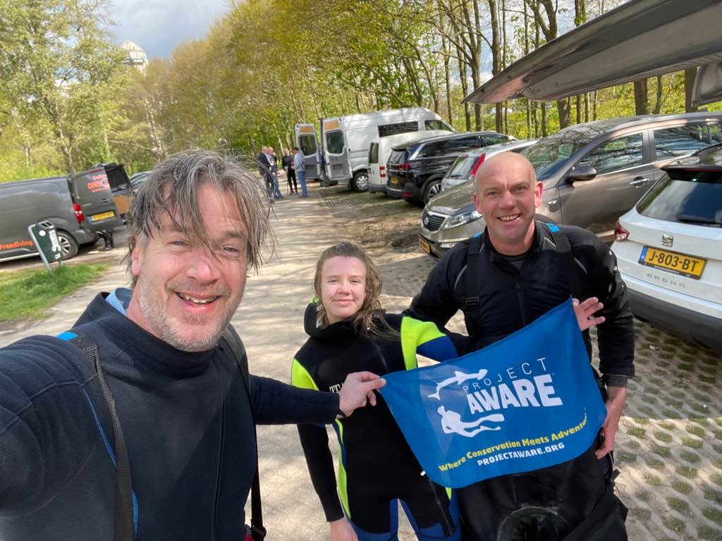
Clube Naval de Cascais
Teresa Vale e Carolina Gonçalves
0
0
10
2
0
0
0
0
0
0
0
0
0
0
0
0
1
0
0
23
0
0
0
0
0
0
0
3
0
0
0
0
0
0
500.00
41
5.00
2.00
2
estimated
0
0
595.65
2
12
1
2
0
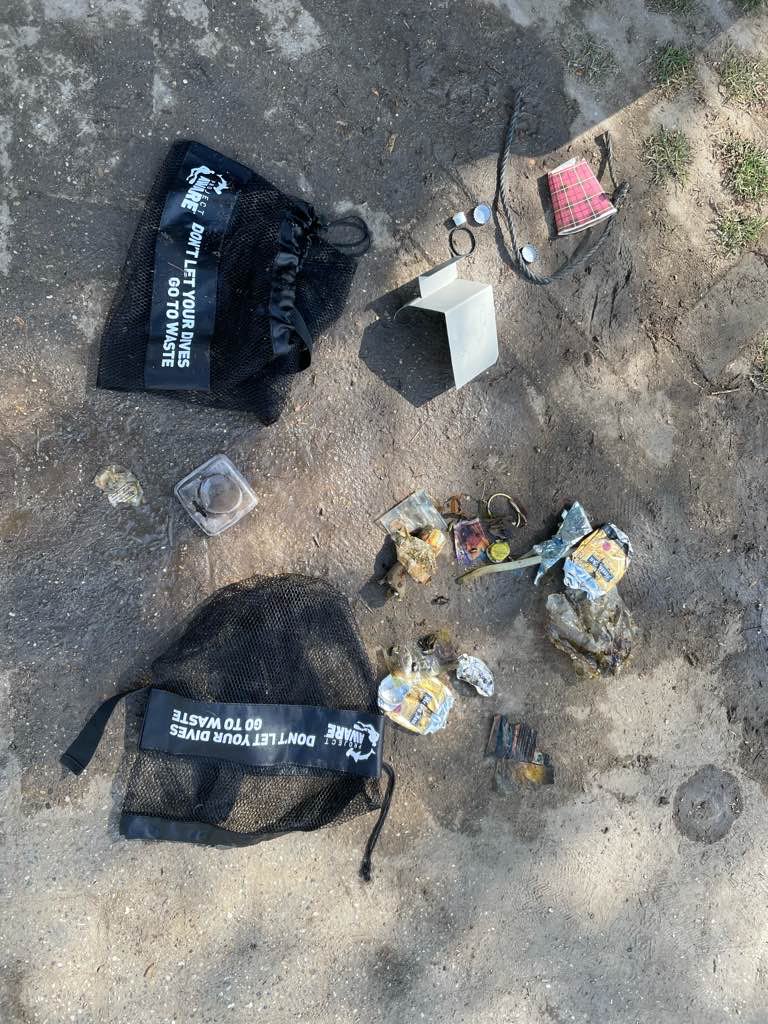
Fishing materials (traps and ropes)
Tires
Plastic fragments
0
On
kilograms
0
I have debris data to report
12
0
0
Calm (glassy to rippled) for waves 0 – 0.1 meter high
7
0
0
Dead
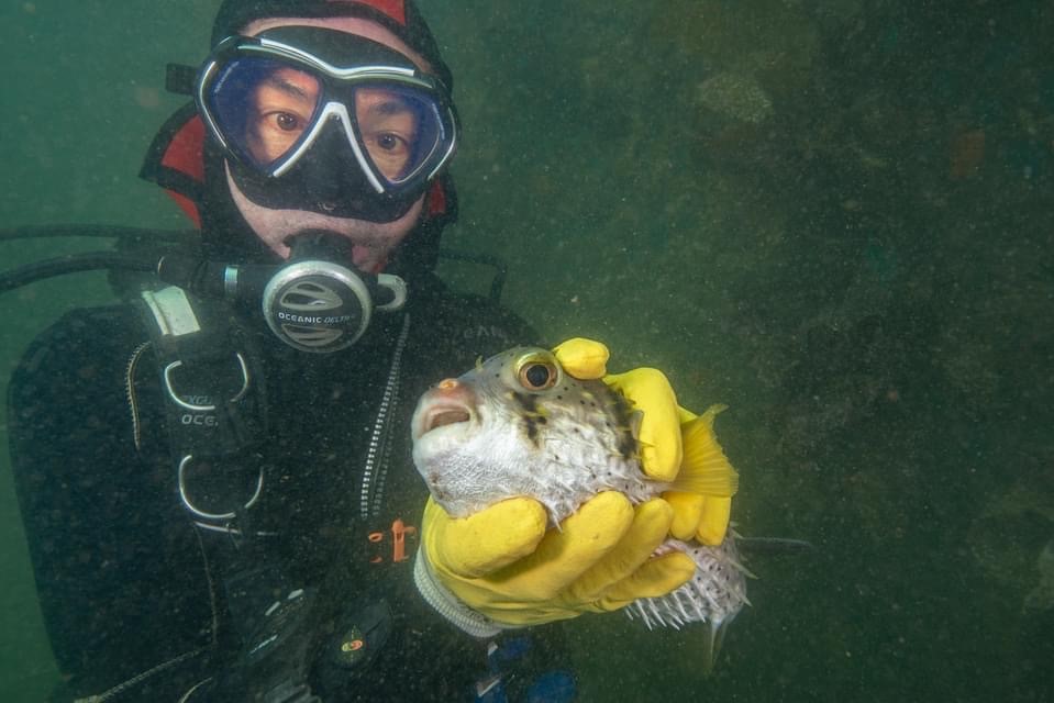
Ray And Shark
2
0
3
2
0
m2


4
0
1
Was caught up in an abandoned fishing trap
Octopus
Released Unharmed
meters
other
NA
0
0
0
0
0
0
0
0
0
0
0
0
0
0
0
0
4
0
0
2
0
4
0
0
0
0
0
0
State\Province
Lisbon
City
Cascais
Map Help
Dive Location
If you know your survey site coordinates, enter them manually in decimal degrees using WGS84 Map Datum. Use the minus sign for latitudes south of the equator and longitudes west of the Prime Meridian to 180 degrees.
If you do not know your survey site coordinates, click the “Map Location” tab to use the map to zoom into your survey site and drop the pin on the map to fall within your survey dive site in the water (not on land or the beach). Ensure you zoom in as much as possible to ensure data accuracy.
Entangled Help