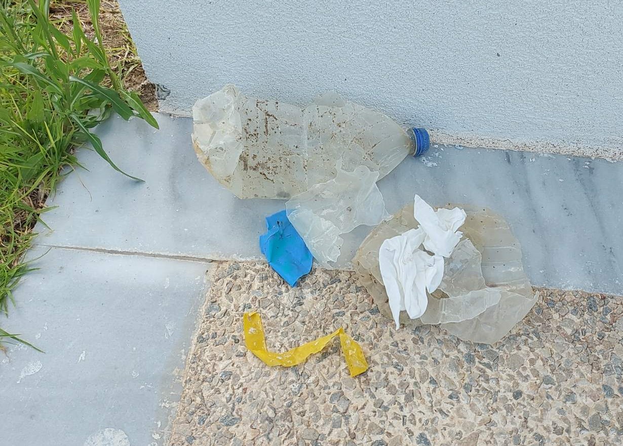
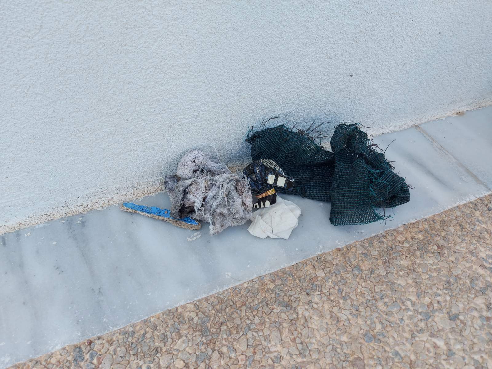
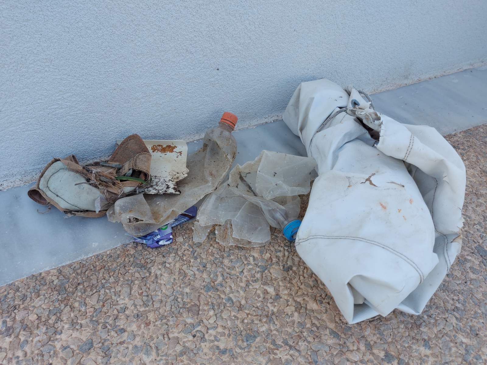
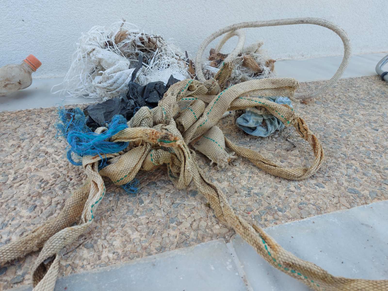
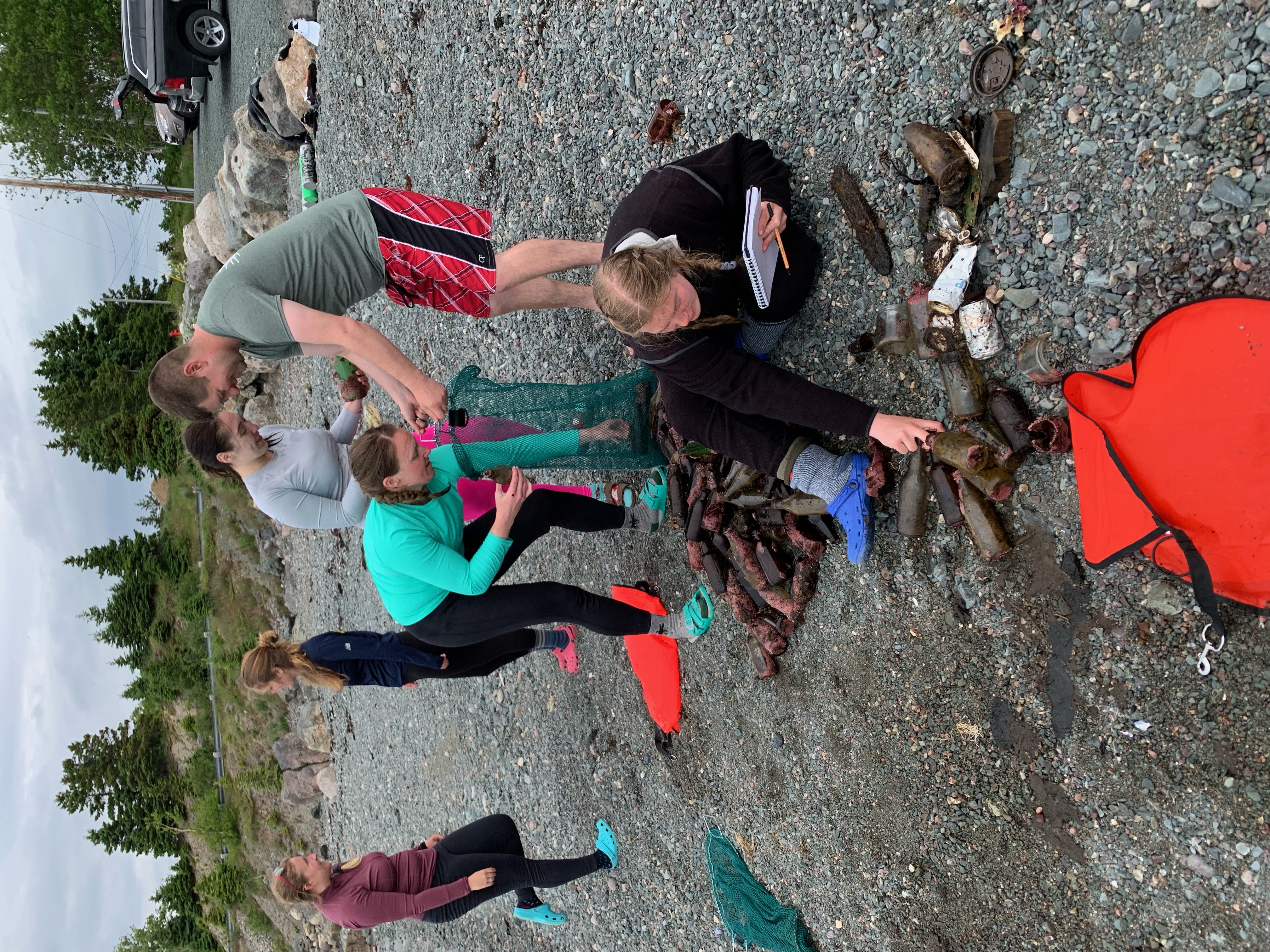
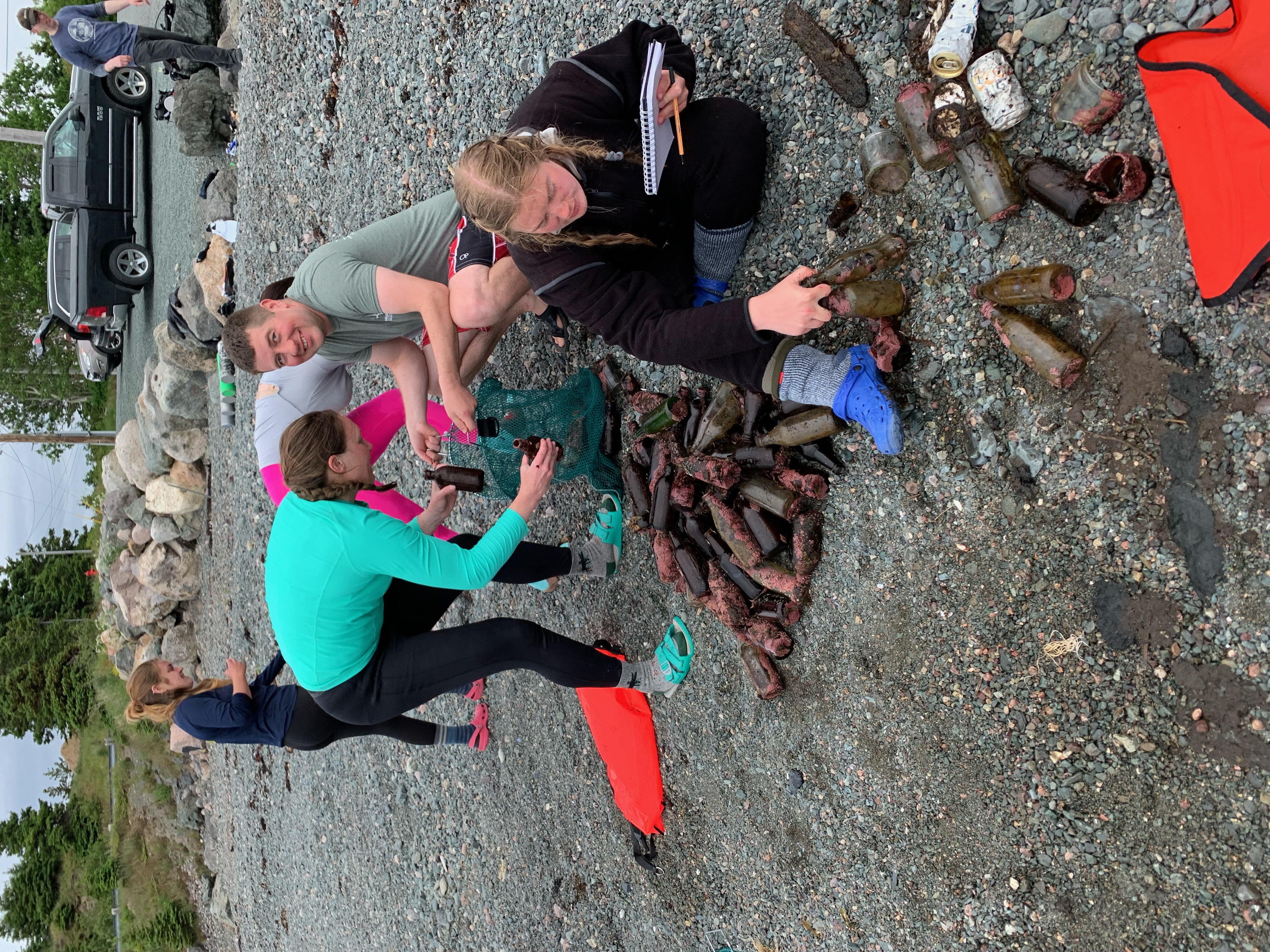
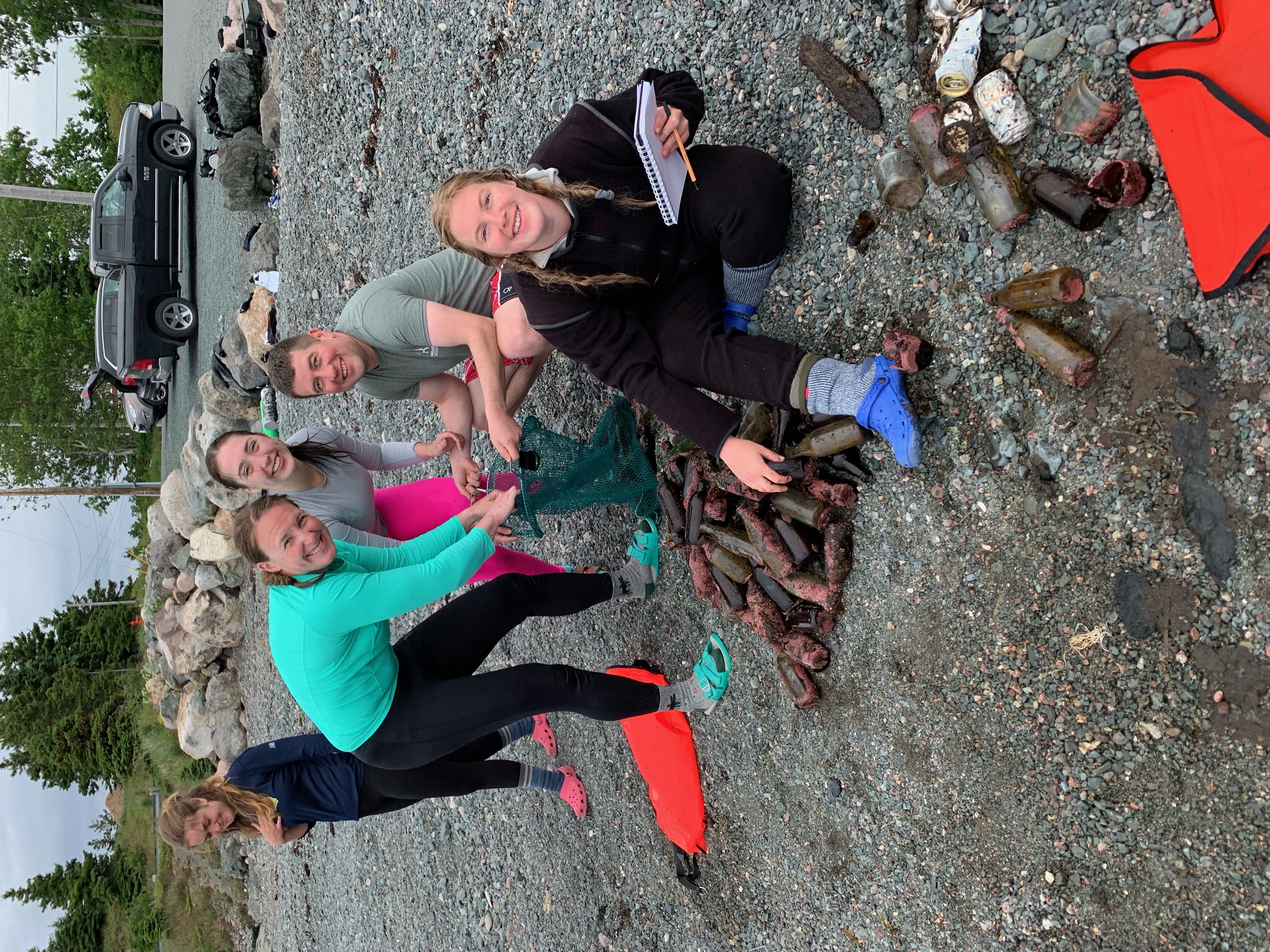
Another day that presented us with three seasons. This is Newfoundland. We only missed snow to have all four seasons. But that did not deter the Gander Gang who completed their open water diver and drysuit certification today, along with a single townie! Andrea B, Paul F, Kenzie D and Rachel M were supported by DMs Geoff Z and Ken K. There was a hint of competition the outset but as the bottom got mucked up and vis fell the collection bags got mixed up so who knows who won. In there end we all won. I got to pondering . . . it has been assumed that most of the debris we collect was deposited by recreational boaters who frequented the area. I now have an inkling that the boaters are not exclusively at fault. Holyrood, at one time, was the squid jigging capital of Canada. That designation is celebrated annually during "Squidfest." And what about the lobster fishery? It has come to my attention that the odd fisherman enjoyed a chilled beverage while on the seas. There is no doubt that most of the debris was heaved overboard from a vessel, recreational or fishery related. Glad to be accompanied by enthusiastic divers who want to do their bit sand remove debris from our ocean.
Windy, cool
Ocean Quest Adventures
McGowan Mark
7
34.00
20
37.00
20.00
estimated
2500.00
Glass beverage containers
On
pounds
I have debris data to report
77
Calm (glassy to rippled) for waves 0 – 0.1 meter high
ft2
feet
kelp
7
Canada
State\Province
NL
City
Holyrood
Map Help
Dive Location
If you know your survey site coordinates, enter them manually in decimal degrees using WGS84 Map Datum. Use the minus sign for latitudes south of the equator and longitudes west of the Prime Meridian to 180 degrees.
If you do not know your survey site coordinates, click the “Map Location” tab to use the map to zoom into your survey site and drop the pin on the map to fall within your survey dive site in the water (not on land or the beach). Ensure you zoom in as much as possible to ensure data accuracy.
Entangled Help
Use the vertical tabs below to record any entangled animals you found of each type.
Calm (glassy to rippled) for waves 0 – 0.1 meter high
m2
1
meters
rocky reef
Language
English
Greece
Map Help
Dive Location
If you know your survey site coordinates, enter them manually in decimal degrees using WGS84 Map Datum. Use the minus sign for latitudes south of the equator and longitudes west of the Prime Meridian to 180 degrees.
If you do not know your survey site coordinates, click the “Map Location” tab to use the map to zoom into your survey site and drop the pin on the map to fall within your survey dive site in the water (not on land or the beach). Ensure you zoom in as much as possible to ensure data accuracy.
Entangled Help
Use the vertical tabs below to record any entangled animals you found of each type.
Calm (glassy to rippled) for waves 0 – 0.1 meter high
1
m2
2
meters
rocky reef
Language
English
Greece
Map Help
Dive Location
If you know your survey site coordinates, enter them manually in decimal degrees using WGS84 Map Datum. Use the minus sign for latitudes south of the equator and longitudes west of the Prime Meridian to 180 degrees.
If you do not know your survey site coordinates, click the “Map Location” tab to use the map to zoom into your survey site and drop the pin on the map to fall within your survey dive site in the water (not on land or the beach). Ensure you zoom in as much as possible to ensure data accuracy.
Entangled Help
Use the vertical tabs below to record any entangled animals you found of each type.
Calm (glassy to rippled) for waves 0 – 0.1 meter high
m2
meters
rocky reef
Language
English
Greece
City
Kefalos
Map Help
Dive Location
If you know your survey site coordinates, enter them manually in decimal degrees using WGS84 Map Datum. Use the minus sign for latitudes south of the equator and longitudes west of the Prime Meridian to 180 degrees.
If you do not know your survey site coordinates, click the “Map Location” tab to use the map to zoom into your survey site and drop the pin on the map to fall within your survey dive site in the water (not on land or the beach). Ensure you zoom in as much as possible to ensure data accuracy.
Entangled Help
Use the vertical tabs below to record any entangled animals you found of each type.
Calm (glassy to rippled) for waves 0 – 0.1 meter high
m2
meters
rocky reef
1
Language
English
Greece
State\Province
Dodecanese
City
Kefalos
Map Help
Dive Location
If you know your survey site coordinates, enter them manually in decimal degrees using WGS84 Map Datum. Use the minus sign for latitudes south of the equator and longitudes west of the Prime Meridian to 180 degrees.
If you do not know your survey site coordinates, click the “Map Location” tab to use the map to zoom into your survey site and drop the pin on the map to fall within your survey dive site in the water (not on land or the beach). Ensure you zoom in as much as possible to ensure data accuracy.
Entangled Help
Use the vertical tabs below to record any entangled animals you found of each type.
Calm (glassy to rippled) for waves 0 – 0.1 meter high
2
ft2
feet
other
6
1
2
28
1
Language
English
Canada
State\Province
British Columbia
City
North Vancouver
Map Help
Dive Location
If you know your survey site coordinates, enter them manually in decimal degrees using WGS84 Map Datum. Use the minus sign for latitudes south of the equator and longitudes west of the Prime Meridian to 180 degrees.
If you do not know your survey site coordinates, click the “Map Location” tab to use the map to zoom into your survey site and drop the pin on the map to fall within your survey dive site in the water (not on land or the beach). Ensure you zoom in as much as possible to ensure data accuracy.
Entangled Help
Use the vertical tabs below to record any entangled animals you found of each type.
Calm (glassy to rippled) for waves 0 – 0.1 meter high
ft2
feet
other
5
Language
English
Canada
State\Province
British Columbia
City
North Vancouver
Map Help
Dive Location
If you know your survey site coordinates, enter them manually in decimal degrees using WGS84 Map Datum. Use the minus sign for latitudes south of the equator and longitudes west of the Prime Meridian to 180 degrees.
If you do not know your survey site coordinates, click the “Map Location” tab to use the map to zoom into your survey site and drop the pin on the map to fall within your survey dive site in the water (not on land or the beach). Ensure you zoom in as much as possible to ensure data accuracy.
Entangled Help
Use the vertical tabs below to record any entangled animals you found of each type.
Mostly cloudy with occasional squally winds, heavy showers and thunderstorms. Moderate to fresh southeasterly winds
Blue Ocean Club Hong Kong
Eian KEE
1
1
26
1
5
2
2
1
1
30.20
50
10.00
2.00
measured
1500.00
On
kilograms
I have debris data to report
4
Slight for waves 0.5 -1.25 meter high
fishing nets
crabs
Dead
10
Injured
1
1
m2
1
meters
rocky reef
4
10
7
1
Language
English
Hong Kong S.A.R., China
City
Hong Kong
Map Help
Dive Location
If you know your survey site coordinates, enter them manually in decimal degrees using WGS84 Map Datum. Use the minus sign for latitudes south of the equator and longitudes west of the Prime Meridian to 180 degrees.
If you do not know your survey site coordinates, click the “Map Location” tab to use the map to zoom into your survey site and drop the pin on the map to fall within your survey dive site in the water (not on land or the beach). Ensure you zoom in as much as possible to ensure data accuracy.
Entangled Help
Use the vertical tabs below to record any entangled animals you found of each type.
Smooth (wavelets) for waves 0.1 - 0.5 meter high
m2
meters
coral reef
Language
English
South Korea
State\Province
Gangwon-do
City
Yangyang
Map Help
Dive Location
If you know your survey site coordinates, enter them manually in decimal degrees using WGS84 Map Datum. Use the minus sign for latitudes south of the equator and longitudes west of the Prime Meridian to 180 degrees.
If you do not know your survey site coordinates, click the “Map Location” tab to use the map to zoom into your survey site and drop the pin on the map to fall within your survey dive site in the water (not on land or the beach). Ensure you zoom in as much as possible to ensure data accuracy.
Entangled Help
Use the vertical tabs below to record any entangled animals you found of each type.
Great vis. As I mentioned in a previous survey (I think) this year there seems to be an abundance of new marine plant life. So far what I am finding is that many many pieces of random nylon string are getting tangled in these plants.
Also there seems to be more fish than usual for this time of year in the area (many schools, and suddenly this year many John Dory fish have inhabited the area. I saw one or two the first year and never again over these 5 years until this year and they are abundant.
Video of full dive here: https://youtu.be/XRKtZBgqoAY
I really wish this survey form allowed for spacing of paragraphs in the "additional information" section after submitting the survey.. That information would be much easier to read if I could separate info, but despite spacing paragraphs when typing, once submitted however its all smashed together.
rubber shoe
Mostly Clear. Calm waves for previous 2-3 days prior.
Dive Against Debris Korea (Daegu)
William Henderson
3
2
9.00
74
5.00
1.00
30
estimated
2
7
130.00
4
string/rope
metal bars
On
kilograms
I have debris data to report
Smooth (wavelets) for waves 0.1 - 0.5 meter high
1
1
17
3
1
m2
10
meters
rocky reef
5
6
1
1
1
1
1
Language
English
South Korea
State\Province
Gyeongbukdo
City
Pohang
Map Help
Dive Location
If you know your survey site coordinates, enter them manually in decimal degrees using WGS84 Map Datum. Use the minus sign for latitudes south of the equator and longitudes west of the Prime Meridian to 180 degrees.
If you do not know your survey site coordinates, click the “Map Location” tab to use the map to zoom into your survey site and drop the pin on the map to fall within your survey dive site in the water (not on land or the beach). Ensure you zoom in as much as possible to ensure data accuracy.
Entangled Help
Use the vertical tabs below to record any entangled animals you found of each type.