Menu

Kyra Panagia island and Vasilikos bay (Peristera island)

220
2
140

39.201258, 23.977631

2
2
5
gravel
3
10
12

39.1925618, 23.9249888

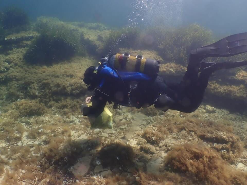
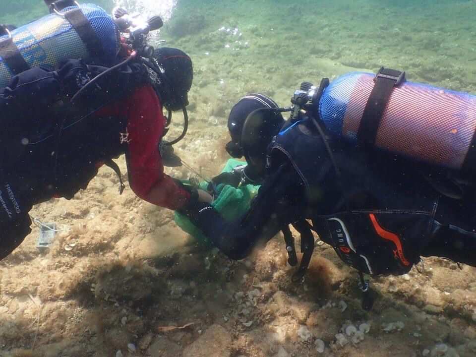
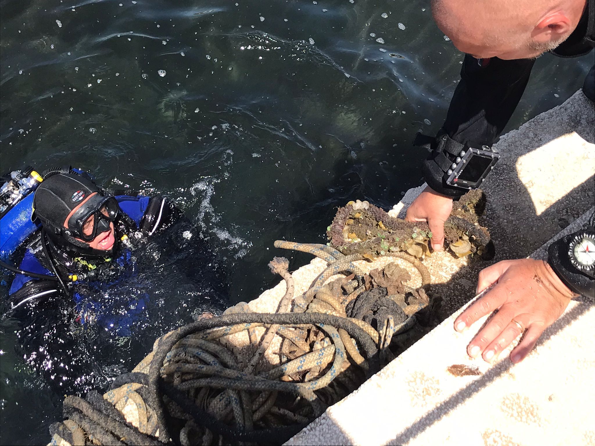
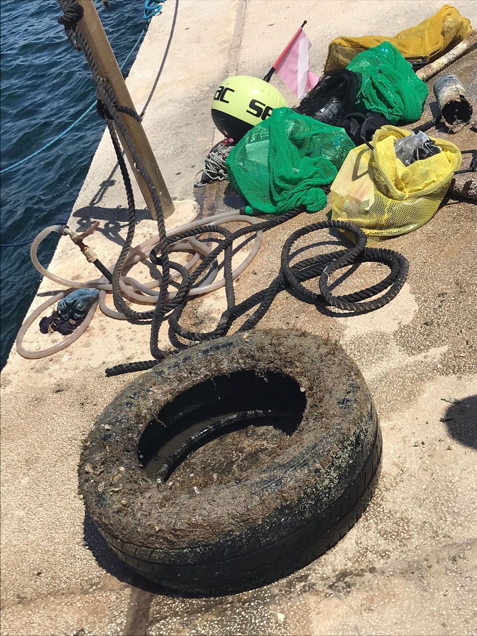
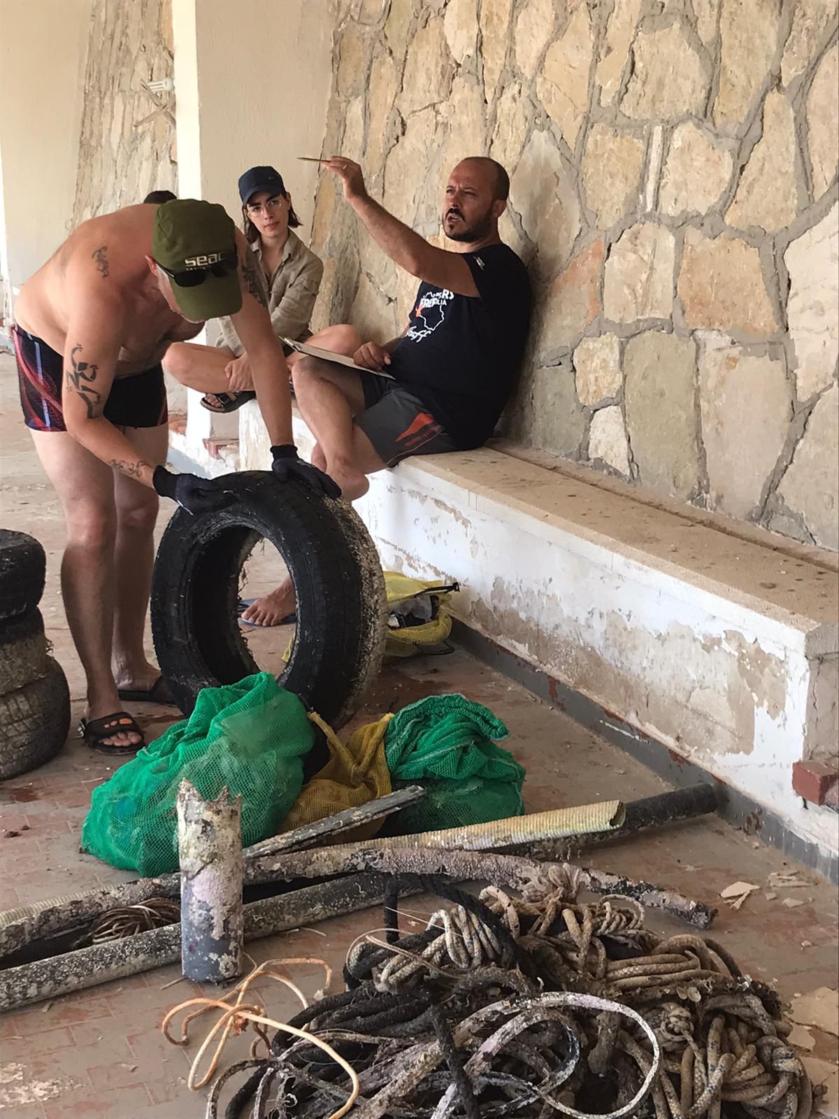
The fact that Kyra Panagia island is an unihabited island and in addition there are permanent (for many decades now) restrictions for any kind of diving activities as it it declared an archaelogical site, is the main reason for the accumulation of debris and thrash that has been found and collected.
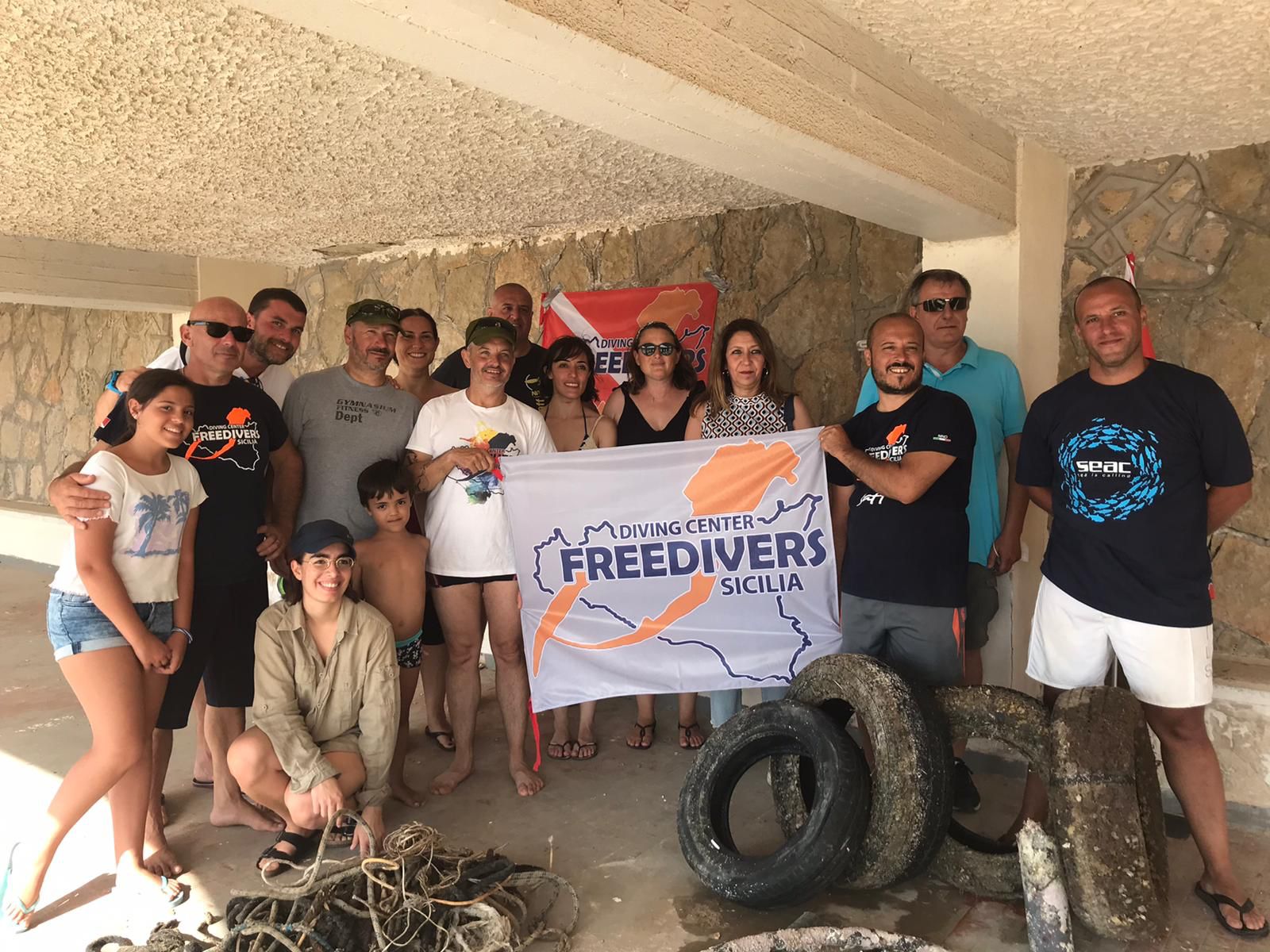
The Clean Up dive was organised by Thalassa Foundation, in collaboration with other local entities (public & private) with the contribution of the local dive centers. A special permission was taken from the Ephorate of Underwater Activities to perform the dives Against Debris which was undertaken with great success.
Sunny weather with no wind.
Ikion Diving (Skopelos Dive Center's Branch)
Ikion Diving Center
3
3
2
30
3
1
2
80
5
6
4
5
2
24
3
15
1
2
110.00
55
20.00
5.00
6
estimated
8
1
500.00
1
50
On
kilograms
I have debris data to report
Calm (glassy to rippled) for waves 0 – 0.1 meter high
2
4
m2
2
meters
rocky reef
2
9
10
1
Greece
State\Province
Thessaly
City
Alonissos
Map Help


Dive Location

If you know your survey site coordinates, enter them manually in decimal degrees using WGS84 Map Datum. Use the minus sign for latitudes south of the equator and longitudes west of the Prime Meridian to 180 degrees.

If you do not know your survey site coordinates, click the “Map Location” tab to use the map to zoom into your survey site and drop the pin on the map to fall within your survey dive site in the water (not on land or the beach). Ensure you zoom in as much as possible to ensure data accuracy.

Entangled Help


Use the vertical tabs below to record any entangled animals you found of each type.

ADS148 - Twin Peaks

1

10.117279, 99.812562

sand
1
Sunny with some mild breeze
1
Cable Tie
Eco Koh Tao - Crystal Divers
Jennifer Dowling
4
1
0.10
52
15.00
5.00
12
estimated
45.00
3
On
kilograms
I have debris data to report
Smooth (wavelets) for waves 0.1 - 0.5 meter high
1
m2
meters
coral reef
Thailand
State\Province
Surat Thani
City
Koh Tao
Map Help


Dive Location

If you know your survey site coordinates, enter them manually in decimal degrees using WGS84 Map Datum. Use the minus sign for latitudes south of the equator and longitudes west of the Prime Meridian to 180 degrees.

If you do not know your survey site coordinates, click the “Map Location” tab to use the map to zoom into your survey site and drop the pin on the map to fall within your survey dive site in the water (not on land or the beach). Ensure you zoom in as much as possible to ensure data accuracy.

Entangled Help


Use the vertical tabs below to record any entangled animals you found of each type.

Bachelor Beach Test/Data Marked for Future Use.

21

12.125379734736, -68.287461840287

coral
5

33.6431093, -117.9219772

Found SCUBA Weight. Michel really likes to return Scuba weight to their owners! Reported to PADI AWARE. This was part of our ongoing efforts to keep Bachelor's Beach clean, for all the amazing people of Bonaire!

Make sure to tag us at PADI AWARE!

@PADI AWARE Foundation (Facebook)
@PADIAWARE (Instagram)

Hashtags: #PADIAWARE #diveagainstdebris #everydiveasurveydive
Example: Fishing gear was found, likely due to local fishing.

Example: SCUBA Weights were found, likely due to recent SCUBA Activities.
Example: Crabs were found crawling on the gear, we carefully removed them and returned them to the ocean!
SCUBA Weights!
We took great care to remove the hook from the Queen Parrotfish, however, we could tell it was hurt a little bit. We are happy it was released nonetheless.
Calm, it is Bonaire!
1
Example: 1650's Dutch Anchor! (Example)
Beyond The Corals
Beyond The Corals
2
5
1.00
35
12.00
1.00
estimated
2000.00
1650's Dutch Anchor!
On
kilograms
I have debris data to report
2
Calm (glassy to rippled) for waves 0 – 0.1 meter high
Crabs were living on the fishing line
Injured
Queen Parrotfish
Crab
Released Unharmed
3
1
Attached to the Fishing Hook
m2
meters
coral reef
2
Netherlands Antilles
State\Province
Bonaire
City
Kralendijk
Map Help


Dive Location

If you know your survey site coordinates, enter them manually in decimal degrees using WGS84 Map Datum. Use the minus sign for latitudes south of the equator and longitudes west of the Prime Meridian to 180 degrees.

If you do not know your survey site coordinates, click the “Map Location” tab to use the map to zoom into your survey site and drop the pin on the map to fall within your survey dive site in the water (not on land or the beach). Ensure you zoom in as much as possible to ensure data accuracy.

Entangled Help


Use the vertical tabs below to record any entangled animals you found of each type.

Town Island (South)

8
9
1
18

22.329608813612, 114.36288057631

3
1
sand
2
1
Swimming Lilo
Sai Kung Scuba
Jeffrey Lee
6
1
2
13
3
1
10.20
48
8.00
1.00
measured
2
406.64
3
1
Abandoned Traps
On
kilograms
I have debris data to report
Smooth (wavelets) for waves 0.1 - 0.5 meter high
1
3
1
m2
meters
rocky reef
12
2
Hong Kong S.A.R., China
State\Province
New Territories
City
Sai Kung
Map Help


Dive Location

If you know your survey site coordinates, enter them manually in decimal degrees using WGS84 Map Datum. Use the minus sign for latitudes south of the equator and longitudes west of the Prime Meridian to 180 degrees.

If you do not know your survey site coordinates, click the “Map Location” tab to use the map to zoom into your survey site and drop the pin on the map to fall within your survey dive site in the water (not on land or the beach). Ensure you zoom in as much as possible to ensure data accuracy.

Entangled Help


Use the vertical tabs below to record any entangled animals you found of each type.

East Dam

7
27
11

22.360209257394, 114.37543792285

2
1
sand
3
13
LED Light bulb
Black Rainstorm, swells, heavy rain
Sai Kung Scuba
Jeffrey Lee
1
3
8
1
14
2
2
1
2
9.20
50
11.00
2.00
measured
349.00
1
1
Ghost Nets
Fishing Lures
Boat Waste
On
kilograms
I have debris data to report
1
Smooth (wavelets) for waves 0.1 - 0.5 meter high
5
7
m2
9
2
meters
other
1
3
2
1
3
2
Hong Kong S.A.R., China
State\Province
New Territories
City
Sai Kung
Map Help


Dive Location

If you know your survey site coordinates, enter them manually in decimal degrees using WGS84 Map Datum. Use the minus sign for latitudes south of the equator and longitudes west of the Prime Meridian to 180 degrees.

If you do not know your survey site coordinates, click the “Map Location” tab to use the map to zoom into your survey site and drop the pin on the map to fall within your survey dive site in the water (not on land or the beach). Ensure you zoom in as much as possible to ensure data accuracy.

Entangled Help


Use the vertical tabs below to record any entangled animals you found of each type.

Ecosystem Other
Artificial Dam

Pizzolungo - Porticciolo Hotel Tirreno e fondali scogliera

4

38.05, 12.55

sand
2
5
Human activities
Light NE wind - Calm or smooth sea
Diving Center Freedivers Sicilia
Freedivers
4
2
10
7
10
1
1
5
10
55.00
50
8.00
1.00
6
estimated
6528.33
1
4
2
Plastic fragment
Beverage bottle
Ropes
On
kilograms
I have debris data to report
Smooth (wavelets) for waves 0.1 - 0.5 meter high
5
32
m2
20
meters
rocky reef
0
1
-2
2
Italy
State\Province
Trapani
City
Pizzolungo
Map Help


Dive Location

If you know your survey site coordinates, enter them manually in decimal degrees using WGS84 Map Datum. Use the minus sign for latitudes south of the equator and longitudes west of the Prime Meridian to 180 degrees.

If you do not know your survey site coordinates, click the “Map Location” tab to use the map to zoom into your survey site and drop the pin on the map to fall within your survey dive site in the water (not on land or the beach). Ensure you zoom in as much as possible to ensure data accuracy.

Entangled Help


Use the vertical tabs below to record any entangled animals you found of each type.

ADS116 - Tunnelen

67.234674, 14.604692

5
rock
5
NORD&NE
Fredric Ihrsen
1
1.40
46
27.00
5.00
measured
12
2500.00
On
kilograms
I have debris data to report
Smooth (wavelets) for waves 0.1 - 0.5 meter high m2
meters
kelp
Norway
Map Help


Dive Location

If you know your survey site coordinates, enter them manually in decimal degrees using WGS84 Map Datum. Use the minus sign for latitudes south of the equator and longitudes west of the Prime Meridian to 180 degrees.

If you do not know your survey site coordinates, click the “Map Location” tab to use the map to zoom into your survey site and drop the pin on the map to fall within your survey dive site in the water (not on land or the beach). Ensure you zoom in as much as possible to ensure data accuracy.

Entangled Help


Use the vertical tabs below to record any entangled animals you found of each type.

ADS10 - Ørneset

67.225682, 14.616451

4
rock
20
NORD&NE
Fredric Ihrsen
1
2.00
44
23.00
3.00
measured
20
1500.00
On
kilograms
I have debris data to report
Smooth (wavelets) for waves 0.1 - 0.5 meter high m2
meters
kelp
Norway
Map Help


Dive Location

If you know your survey site coordinates, enter them manually in decimal degrees using WGS84 Map Datum. Use the minus sign for latitudes south of the equator and longitudes west of the Prime Meridian to 180 degrees.

If you do not know your survey site coordinates, click the “Map Location” tab to use the map to zoom into your survey site and drop the pin on the map to fall within your survey dive site in the water (not on land or the beach). Ensure you zoom in as much as possible to ensure data accuracy.

Entangled Help


Use the vertical tabs below to record any entangled animals you found of each type.

ADS566 - Shell Bay

140
200
15
1

22.53333, 114.48333

2
sand
250
2
Plastic bags.
Southwestly wind
Dive4love
Angelica
1
2
11
45
22
127.20
50
5.50
2.00
measured
1
4000.00
On
kilograms
I have debris data to report
1
Slight for waves 0.5 -1.25 meter high
20
1
2
13
m2
8
meters
rocky reef
1
1
1
1
4
2
China
State\Province
Guangdong
City
Shenzhen
Map Help


Dive Location

If you know your survey site coordinates, enter them manually in decimal degrees using WGS84 Map Datum. Use the minus sign for latitudes south of the equator and longitudes west of the Prime Meridian to 180 degrees.

If you do not know your survey site coordinates, click the “Map Location” tab to use the map to zoom into your survey site and drop the pin on the map to fall within your survey dive site in the water (not on land or the beach). Ensure you zoom in as much as possible to ensure data accuracy.

Entangled Help


Use the vertical tabs below to record any entangled animals you found of each type.

Shore Dive - Josh, Millie, Nic, Amy

2

18.280426, -87.833699

sand

18.2804705, -87.8350525

Found a big rope that seemed to be anchored to the reef. It had coral growing on it so we left it there
Lack of waste management system,
Rope anchored to a rock
rain, then a bit of wind, then some more rain. Windy for the past few days except yesterday
Xtc Dive Center
Kaila
6
0.30
43
2.00
1.00
estimated
10000.00
plastic
On
kilograms
I have debris data to report
1
Calm (glassy to rippled) for waves 0 – 0.1 meter high m2
meters
seagrass
Mexico
State\Province
Quintana Roo
City
Xcalak
Map Help


Dive Location

If you know your survey site coordinates, enter them manually in decimal degrees using WGS84 Map Datum. Use the minus sign for latitudes south of the equator and longitudes west of the Prime Meridian to 180 degrees.

If you do not know your survey site coordinates, click the “Map Location” tab to use the map to zoom into your survey site and drop the pin on the map to fall within your survey dive site in the water (not on land or the beach). Ensure you zoom in as much as possible to ensure data accuracy.

Entangled Help


Use the vertical tabs below to record any entangled animals you found of each type.

Subscribe to