Menu

Purple Haze

0
0
0
0

12.059199, 93.010519

0
0
0
rock
0
0
0
1
0
Fishing
Entire fishing line with the hook and base
Sunny
Lacadives
Denzil
0
0
0
0
0
0
0
0
0
0
0
0
0
0
0
0
0
0
0
2
0
0
0
0
0
0
0
0
0
0
0
0
0
0
0
0
0.10
50
13.00
8.00
0
estimated
0
0
0
1
12408.90
0
0
0
0
0
Fishing line
0
On
kilograms
0
I have debris data to report
0
0
0
Smooth (wavelets) for waves 0.1 - 0.5 meter high
0
0
0
0
0
0
0
m2
0
0
meters
coral reef
0
0
0
0
0
0
0
0
0
0
0
0
0
0
0
0
0
0
0
0
0
0
0
0
0
0
0
0
0
India
State\Province
Andaman & Nicobar Islands
City
Havelock Island
Map Help


Dive Location

If you know your survey site coordinates, enter them manually in decimal degrees using WGS84 Map Datum. Use the minus sign for latitudes south of the equator and longitudes west of the Prime Meridian to 180 degrees.

If you do not know your survey site coordinates, click the “Map Location” tab to use the map to zoom into your survey site and drop the pin on the map to fall within your survey dive site in the water (not on land or the beach). Ensure you zoom in as much as possible to ensure data accuracy.

Entangled Help


Use the vertical tabs below to record any entangled animals you found of each type.

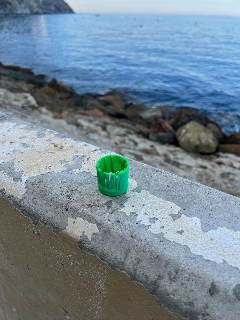
Casino Point Dive Park

rock
0

33.349106880789, -118.32470331074

Sunny
Spencer Moore
1
2
0
0.50
35
32.00
12.00
estimated
200.00
On
pounds
I have debris data to report
1
Smooth (wavelets) for waves 0.1 - 0.5 meter high ft2
feet
kelp
United States
State\Province
Ca
Map Help


Dive Location

If you know your survey site coordinates, enter them manually in decimal degrees using WGS84 Map Datum. Use the minus sign for latitudes south of the equator and longitudes west of the Prime Meridian to 180 degrees.

If you do not know your survey site coordinates, click the “Map Location” tab to use the map to zoom into your survey site and drop the pin on the map to fall within your survey dive site in the water (not on land or the beach). Ensure you zoom in as much as possible to ensure data accuracy.
Entangled Help


Use the vertical tabs below to record any entangled animals you found of each type.

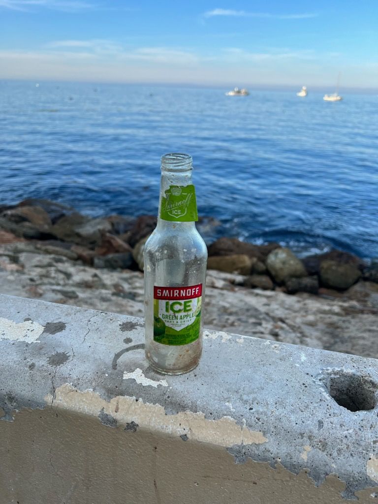
Plaaya las vistas

5

28.0492422, -16.7226063

sand
73
Street concert on 7/11/2024
Calima phenomena
3
1
Hair bandade
cleanex
SEE YOU DIVING
Alice glenda bianchi
2
3
3
9
0.12
35
8.00
6.00
8
estimated
449.62
Fishing line
ropes
bandages
11
On
kilograms
I have debris data to report
Calm (glassy to rippled) for waves 0 – 0.1 meter high
1
m2
1
ropes + algae
Fire worm
meters
rocky reef
Spain
State\Province
SANTA CRUZ DE TENERIFE
City
LOS CRISTIANOS
Map Help


Dive Location

If you know your survey site coordinates, enter them manually in decimal degrees using WGS84 Map Datum. Use the minus sign for latitudes south of the equator and longitudes west of the Prime Meridian to 180 degrees.

If you do not know your survey site coordinates, click the “Map Location” tab to use the map to zoom into your survey site and drop the pin on the map to fall within your survey dive site in the water (not on land or the beach). Ensure you zoom in as much as possible to ensure data accuracy.
Entangled Help


Use the vertical tabs below to record any entangled animals you found of each type.

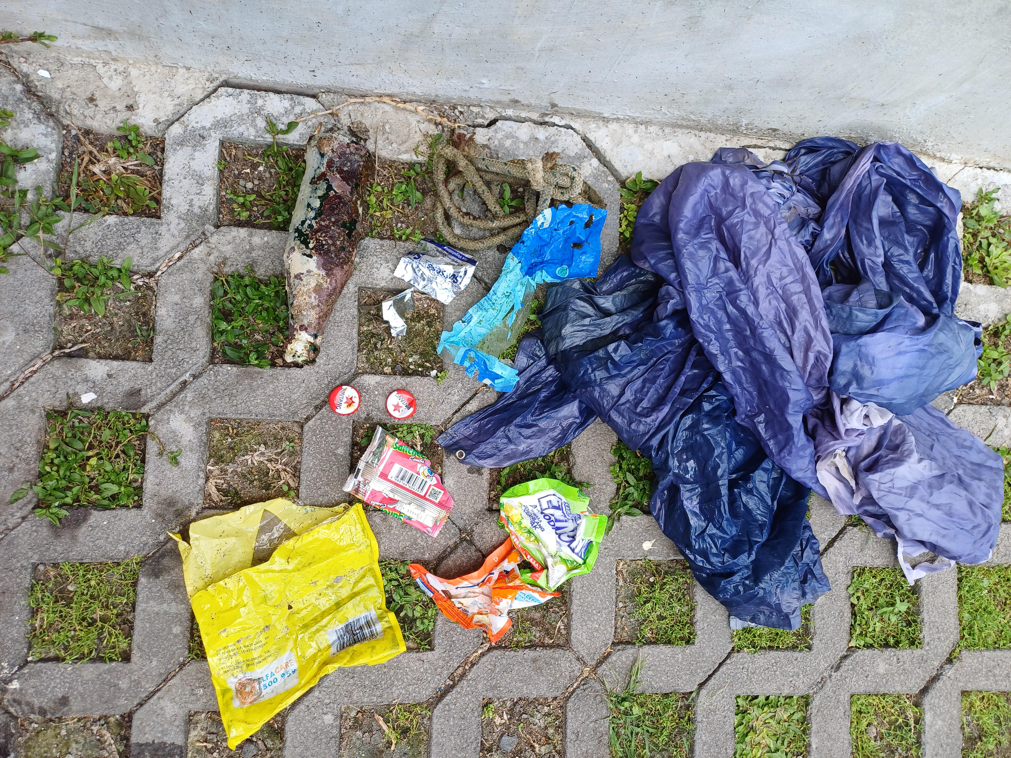
DOGS POINT SANUR HARBOUR BLUE SITE

-8.7063280981417, 115.26831094898

sand

-8.7063280981417, 115.26831094898

This dive was conducted on dive 2 of PADI open water course
plastic rain coat
flat sea no wind or current
Bali Diving Academy
Mark Cornell
1
4
6
1
1.00
55
7.00
3.00
1
estimated
10.00
On
kilograms
I have debris data to report
1
Calm (glassy to rippled) for waves 0 – 0.1 meter high m2
meters
rocky reef
2
Indonesia
State\Province
Bali
City
Kota Denpasar
Map Help


Dive Location

If you know your survey site coordinates, enter them manually in decimal degrees using WGS84 Map Datum. Use the minus sign for latitudes south of the equator and longitudes west of the Prime Meridian to 180 degrees.

If you do not know your survey site coordinates, click the “Map Location” tab to use the map to zoom into your survey site and drop the pin on the map to fall within your survey dive site in the water (not on land or the beach). Ensure you zoom in as much as possible to ensure data accuracy.
Entangled Help


Use the vertical tabs below to record any entangled animals you found of each type.

Ilha dos Papagaios - Enseada 3

2

-22.898235398353, -41.98236164847

sand
Dive Against Debris Team:
01. Flávio Mayrink
02. Vitor Hugo Cabral
03. Jullio Ferreira
No
1
1
grill
denim shorts
Dive Soul
Flávio Mayrink
2
3
1.00
55
14.00
5.00
estimated
10000.00
On
kilograms
I have debris data to report
Calm (glassy to rippled) for waves 0 – 0.1 meter high m2
meters
coral reef
1
5
1
Brazil
State\Province
Rio de Janeiro
City
Cabo Frio
Map Help


Dive Location

If you know your survey site coordinates, enter them manually in decimal degrees using WGS84 Map Datum. Use the minus sign for latitudes south of the equator and longitudes west of the Prime Meridian to 180 degrees.

If you do not know your survey site coordinates, click the “Map Location” tab to use the map to zoom into your survey site and drop the pin on the map to fall within your survey dive site in the water (not on land or the beach). Ensure you zoom in as much as possible to ensure data accuracy.

Entangled Help


Use the vertical tabs below to record any entangled animals you found of each type.

Ilha dos Papagaios - Enseada 3

sand

-22.898235398353, -41.98236164847

Dive Against Debris Team
01. Flávio Mayrink
02. Vitor Hugo Cabral
03. Jullio Ferreira
No
1
1
1
1
1
Sunglasses
Grill
Wristwatch
Smartwatch
Jean Shorts
Dive Soul
Flávio Mayrink
1
3
3.00
43
14.00
6.00
estimated
2
12507.90
Plastic Cup
Sunglasses
On
kilograms
I have debris data to report
Calm (glassy to rippled) for waves 0 – 0.1 meter high m2
1
meters
rocky reef
3
1
Brazil
State\Province
Rio de Janeiro
City
Cabo Frio
Map Help


Dive Location

If you know your survey site coordinates, enter them manually in decimal degrees using WGS84 Map Datum. Use the minus sign for latitudes south of the equator and longitudes west of the Prime Meridian to 180 degrees.

If you do not know your survey site coordinates, click the “Map Location” tab to use the map to zoom into your survey site and drop the pin on the map to fall within your survey dive site in the water (not on land or the beach). Ensure you zoom in as much as possible to ensure data accuracy.

Entangled Help


Use the vertical tabs below to record any entangled animals you found of each type.

Lake Phoenix S22073

0
0
0
0

36.9519568, -77.7658117

0
0
0
silt
0
0
0
0
0
Caribiner
Sunny and calm
Blue Planet DC
Michelle Swiger
0
0
0
0
0
0
0
0
0
0
0
0
0
0
0
0
0
0
0
5
0
0
0
0
0
0
0
0
0
0
0
0
0
0
0
0
1.00
26
31.00
10.00
0
estimated
0
0
0
0
67545.00
0
0
0
0
0
Beverage Can
0
On
pounds
0
I have debris data to report
0
1
0
Calm (glassy to rippled) for waves 0 – 0.1 meter high
0
0
0
0
0
0
0
ft2
0
0
feet
other
1
0
3
0
0
0
0
0
0
0
0
0
0
0
0
0
0
1
0
0
0
0
0
0
0
0
0
0
0
United States
State\Province
Virginia
City
Rawlings
Map Help


Dive Location

If you know your survey site coordinates, enter them manually in decimal degrees using WGS84 Map Datum. Use the minus sign for latitudes south of the equator and longitudes west of the Prime Meridian to 180 degrees.

If you do not know your survey site coordinates, click the “Map Location” tab to use the map to zoom into your survey site and drop the pin on the map to fall within your survey dive site in the water (not on land or the beach). Ensure you zoom in as much as possible to ensure data accuracy.

Entangled Help


Use the vertical tabs below to record any entangled animals you found of each type.

Ecosystem Other
Other

Lighthouse / Bannerfish Bay

0
255
1
0

28.498747009884, 34.51991

0
0
0
sand
0
0
0
1
0
No
Wallet
Windy and sunny
50
1
6
1
1
Chewing gum
False nails
Shisha clips
Wet wipes
Wallet
Red Sea Tribe
Rachel Shelley
0
0
0
20
478
0
0
0
0
0
0
0
0
6
0
0
0
1
190
13
0
0
0
0
0
0
4
0
0
0
0
0
0
0
0
0
2.00
49
21.00
1.00
0
estimated
0
1
4074.44
0
0
0
4
0
Cigarette butts
Plastic fragments
Glass and ceramic fragments
5
On
kilograms
0
I have debris data to report
0
0
0
Smooth (wavelets) for waves 0.1 - 0.5 meter high
8
0
0
Probably clothing piece
Small crab
Released Unharmed
2
0
0
0
0
m2
0
0
meters
coral reef
7
0
0
0
0
9
0
9
0
69
0
0
0
13
0
0
0
2
0
0
0
0
173
0
0
0
0
0
0
Egypt
State\Province
South Sinai
City
Dahab
Map Help


Dive Location

If you know your survey site coordinates, enter them manually in decimal degrees using WGS84 Map Datum. Use the minus sign for latitudes south of the equator and longitudes west of the Prime Meridian to 180 degrees.

If you do not know your survey site coordinates, click the “Map Location” tab to use the map to zoom into your survey site and drop the pin on the map to fall within your survey dive site in the water (not on land or the beach). Ensure you zoom in as much as possible to ensure data accuracy.

Entangled Help


Use the vertical tabs below to record any entangled animals you found of each type.

Exiles Malta

35.918393, 14.495926

seagrass
150
220
1
Sunny
Malta Trash Hunt / dive systems
Tom Carleer
40
78
0
0
102
0
0
0
6
1668.00
60
15.00
2.00
measured
43036.80
26
tires
fishing lines
On
kilograms
I have debris data to report
290
Smooth (wavelets) for waves 0.1 - 0.5 meter high
32
15
m2
meters
rocky reef
617
36
Malta
City
sliema
Map Help


Dive Location

If you know your survey site coordinates, enter them manually in decimal degrees using WGS84 Map Datum. Use the minus sign for latitudes south of the equator and longitudes west of the Prime Meridian to 180 degrees.

If you do not know your survey site coordinates, click the “Map Location” tab to use the map to zoom into your survey site and drop the pin on the map to fall within your survey dive site in the water (not on land or the beach). Ensure you zoom in as much as possible to ensure data accuracy.

Entangled Help


Use the vertical tabs below to record any entangled animals you found of each type.

otomi

0
0
0
0

35.539614, 135.500954

0
0
0
sand
0
0
0
0
1
calm
cocomo
riho fukushima
0
0
0
0
0
0
0
0
0
0
0
0
0
0
0
0
0
0
0
4
0
0
0
0
0
0
0
0
0
0
0
0
0
0
0
0
0.70
45
8.00
5.00
0
measured
0
0
0
0
5573.00
0
0
0
0
0
0
On
kilograms
0
I have debris data to report
1
0
0
Calm (glassy to rippled) for waves 0 – 0.1 meter high
0
0
0
0
0
0
0
m2
1
0
meters
rocky reef
0
0
0
0
0
0
0
0
0
0
0
0
0
0
0
0
1
0
0
0
0
0
1
0
0
0
0
0
0
Japan
State\Province
otomi
City
takahama
Map Help


Dive Location

If you know your survey site coordinates, enter them manually in decimal degrees using WGS84 Map Datum. Use the minus sign for latitudes south of the equator and longitudes west of the Prime Meridian to 180 degrees.

If you do not know your survey site coordinates, click the “Map Location” tab to use the map to zoom into your survey site and drop the pin on the map to fall within your survey dive site in the water (not on land or the beach). Ensure you zoom in as much as possible to ensure data accuracy.

Entangled Help


Use the vertical tabs below to record any entangled animals you found of each type.

Subscribe to