
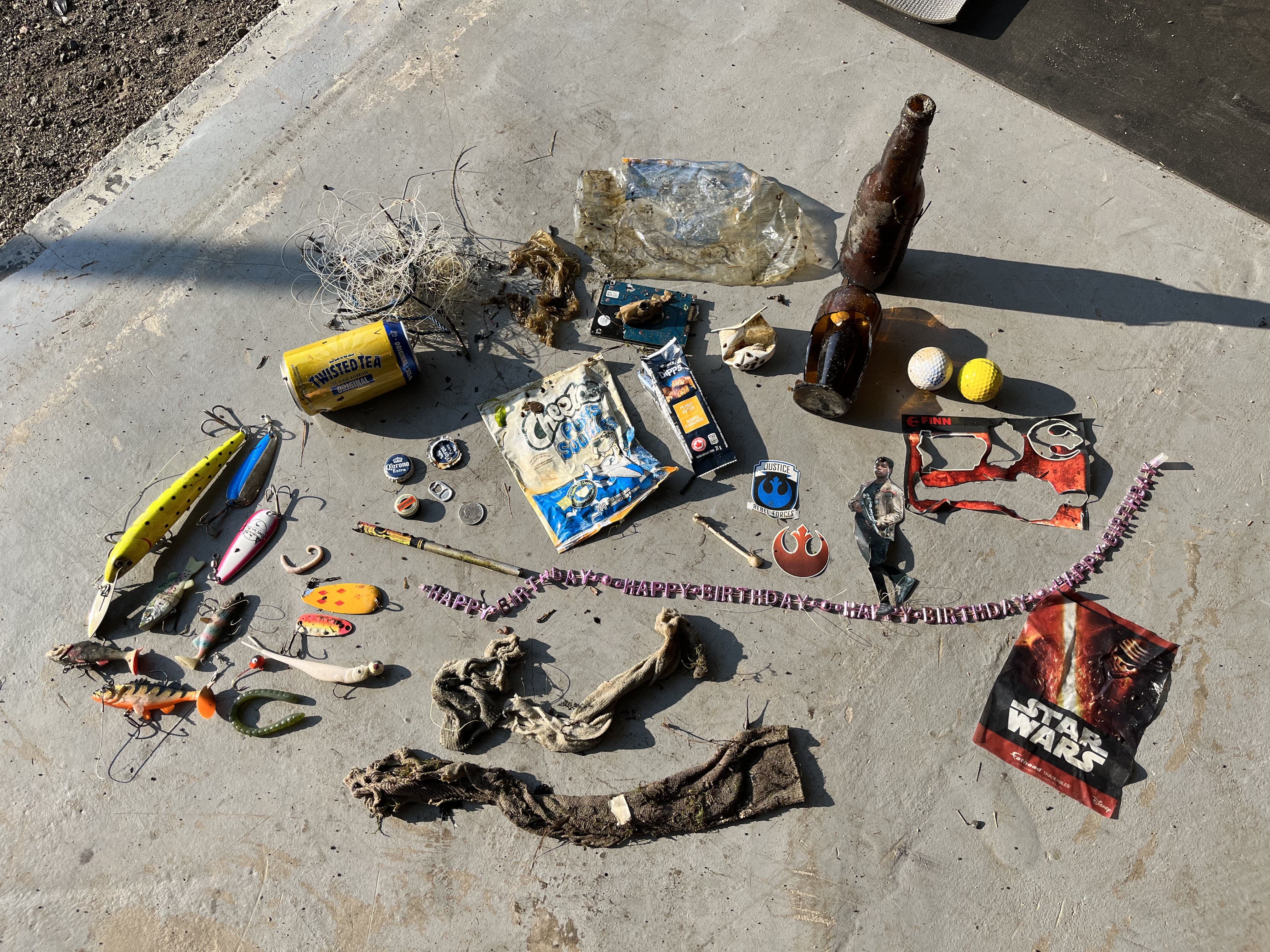
Cold Lake Breakwater
5
7
sand
1
54.466474095034, -110.17154301036
no
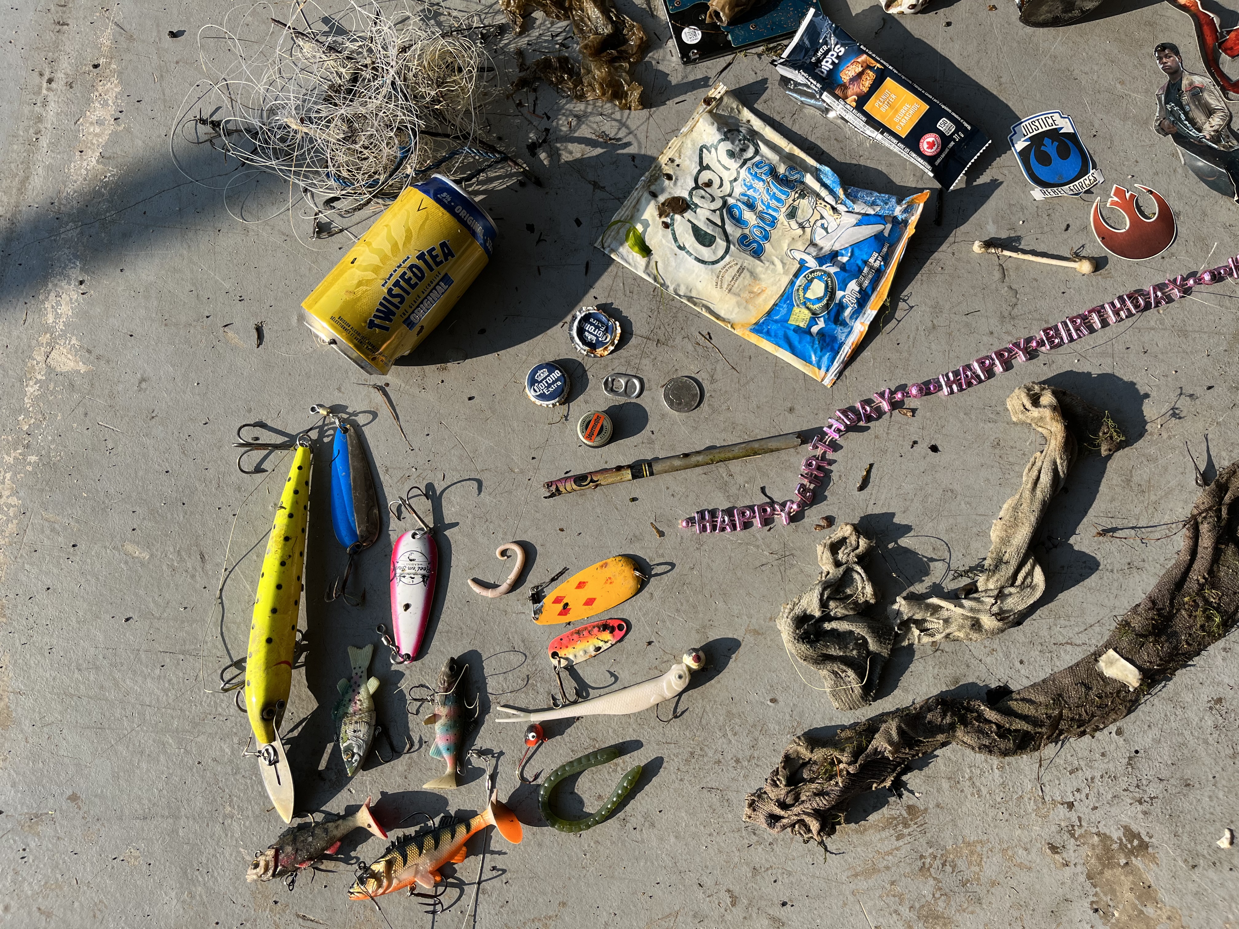
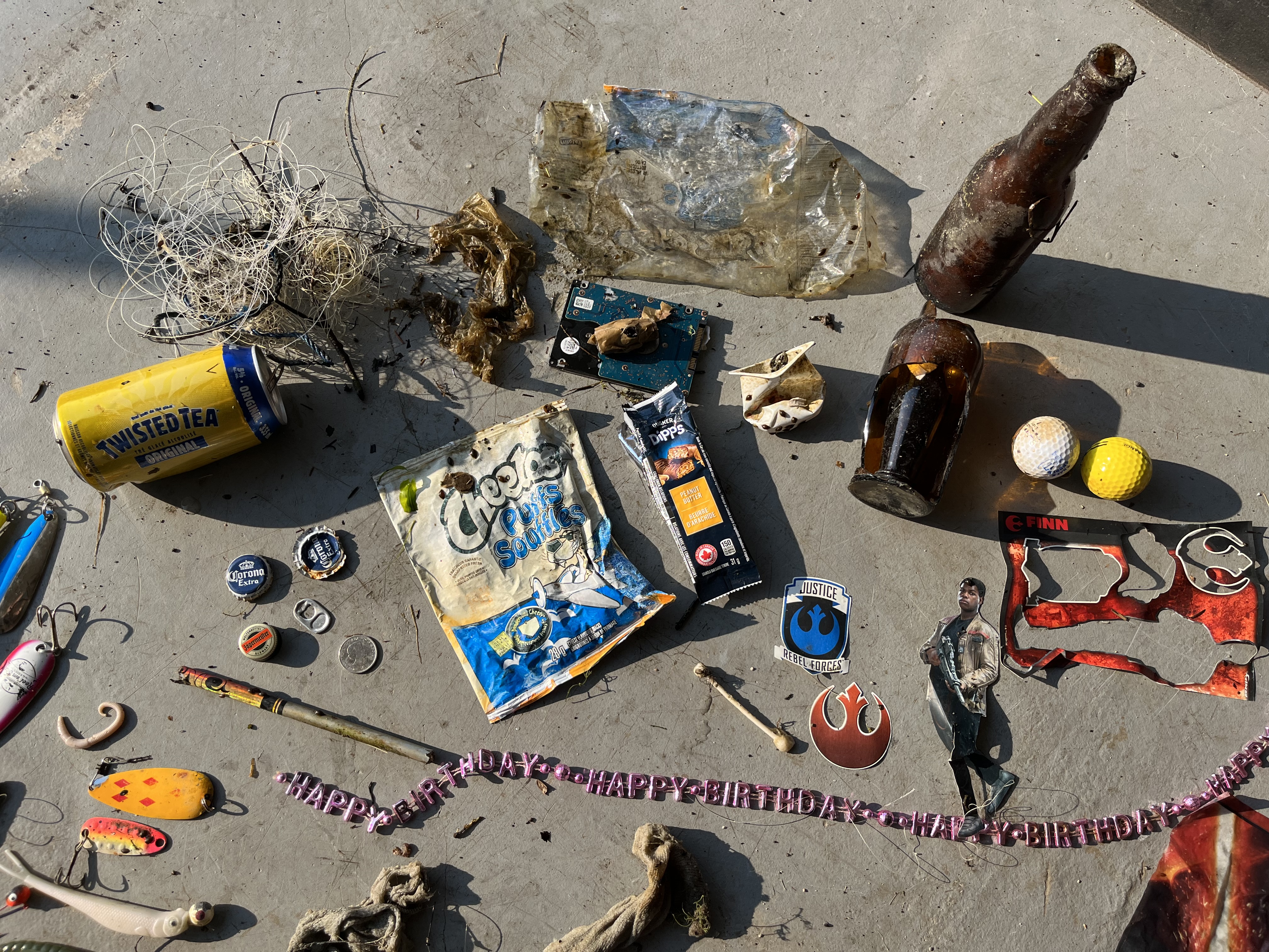
computer hard drive. reported to rcmp
sunny. little to no wind
1
5
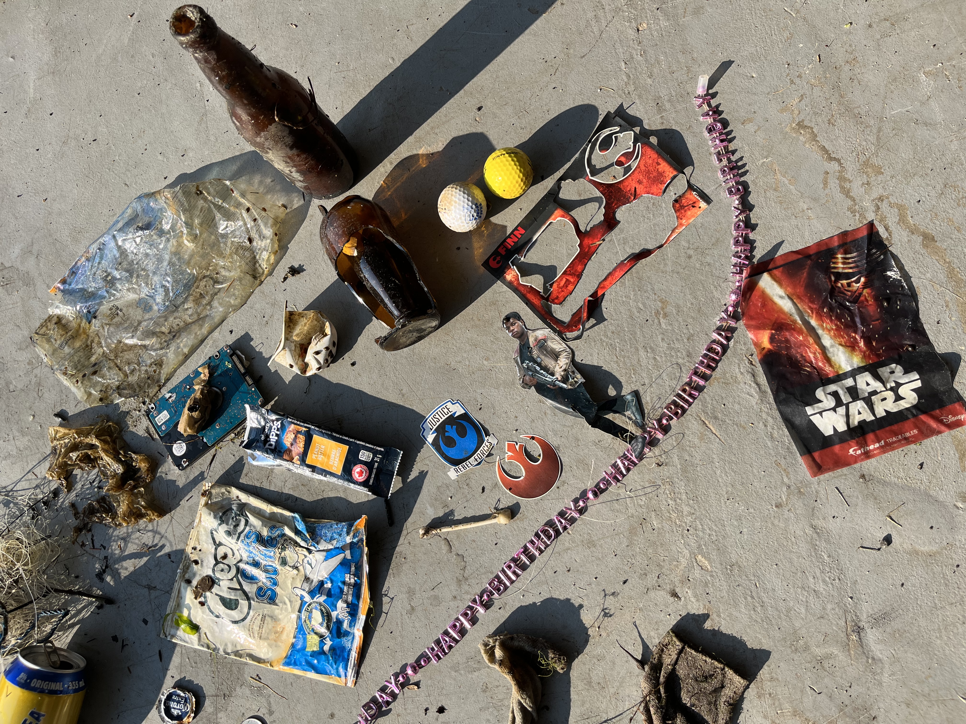
necklace
star war stickers
Dunnill’s Diving Services
Stuart Dunnill
2
1
1
2
14.00
53
13.40
5.50
1
estimated
4
2000.00
firework cardboard
On
pounds
I have debris data to report
2
Moderate to rough for waves greater than 1.25 meters
2
ft2
feet
other
2
1
2
1
1
1
State\Province
alberta
City
cold lake
Map Help
Dive Location
If you know your survey site coordinates, enter them manually in decimal degrees using WGS84 Map Datum. Use the minus sign for latitudes south of the equator and longitudes west of the Prime Meridian to 180 degrees.
If you do not know your survey site coordinates, click the “Map Location” tab to use the map to zoom into your survey site and drop the pin on the map to fall within your survey dive site in the water (not on land or the beach). Ensure you zoom in as much as possible to ensure data accuracy.
Entangled Help