
Dive Against Debris Data Submission
Uleung mongdol beach
13 July, 2021
- Team Leader
- Hyunju Kim
- Number of Participants
- 16
- Total Debris Collected
- 7 kgs (estimated)
37.4844171, 130.9058002
Survey Information
- Location Name
- Uleung mongdol beach
- Organization/Dive Centre
- Country
- South Korea
- Date
- 13 July, 2021
- Survey Duration
- 40 Minutes
- GPS Coordinates
- Latitude: 37.4844171
Longitude: 130.9058002
- Weather Conditions
- Survey Depth Range
- 5–10 meters
- Area Surveyed
- 100 m2
- Dominant Substrate
- sand
- Ecosystem
- rocky reef
- Wave Conditions
- Calm (glassy to rippled) for waves 0 – 0.1 meter high
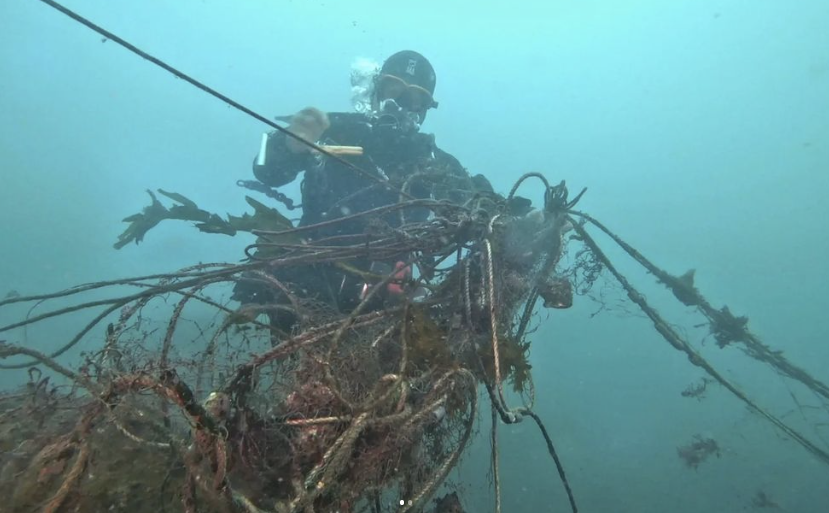
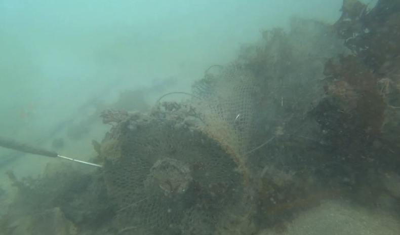
Survey Photos

Debris Items Collected
| plastic materials collected | |
|---|---|
| Buoys & Floats (plastic & Foamed) | 1 |
| Fishing: Line | 9 |
| Fishing: Lures, Rods/poles | 1 |
| Fishing: Nets & Pieces Of Nets | 3 |
| metal materials collected | |
|---|---|
| Wire, Wire Mesh & Barbed Wire | 1 |
| cloth materials collected | |
|---|---|
| Rope And String (cloth) | 3 |
| Entangled Animals | |
|---|---|
| Other Fish | |
| Species or Common Name | wrasse |
| Number Entangled | 3 |
| Status | dead |
| Type of Debris | netting |


