
Dive Against Debris Data Submission
Sea Cave / Fish Trap, SE Oahu
22 June, 2019
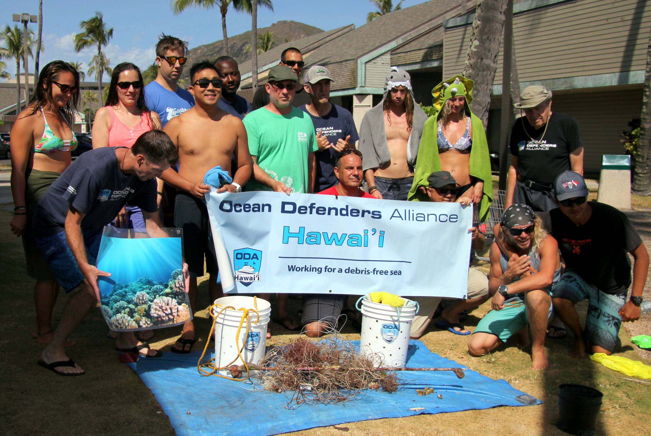
- Team Leader
- Andrew Monnig, OWSI 398573
- Number of Participants
- 16
- Total Debris Collected
- 80 lbs (estimated)
21.260442, -157.697762
Survey Information
- Location Name
- Sea Cave / Fish Trap, SE Oahu
- Organization/Dive Centre
- Ocean Defenders Alliance w Island Divers Hawaii
- City
- Hawaii Kai
- Country
- United States
- Date
- 22 June, 2019
- Survey Duration
- 40 Minutes
- GPS Coordinates
- Latitude: 21.260442
Longitude: -157.697762
- Weather Conditions
-
2 to 4 ft east swell wrapping around to south
- Survey Depth Range
- 46–74 feet
- Area Surveyed
- 7500 ft2
- Dominant Substrate
- rock
- Ecosystem
- coral reef
- Wave Conditions
- Moderate to rough for waves greater than 1.25 meters
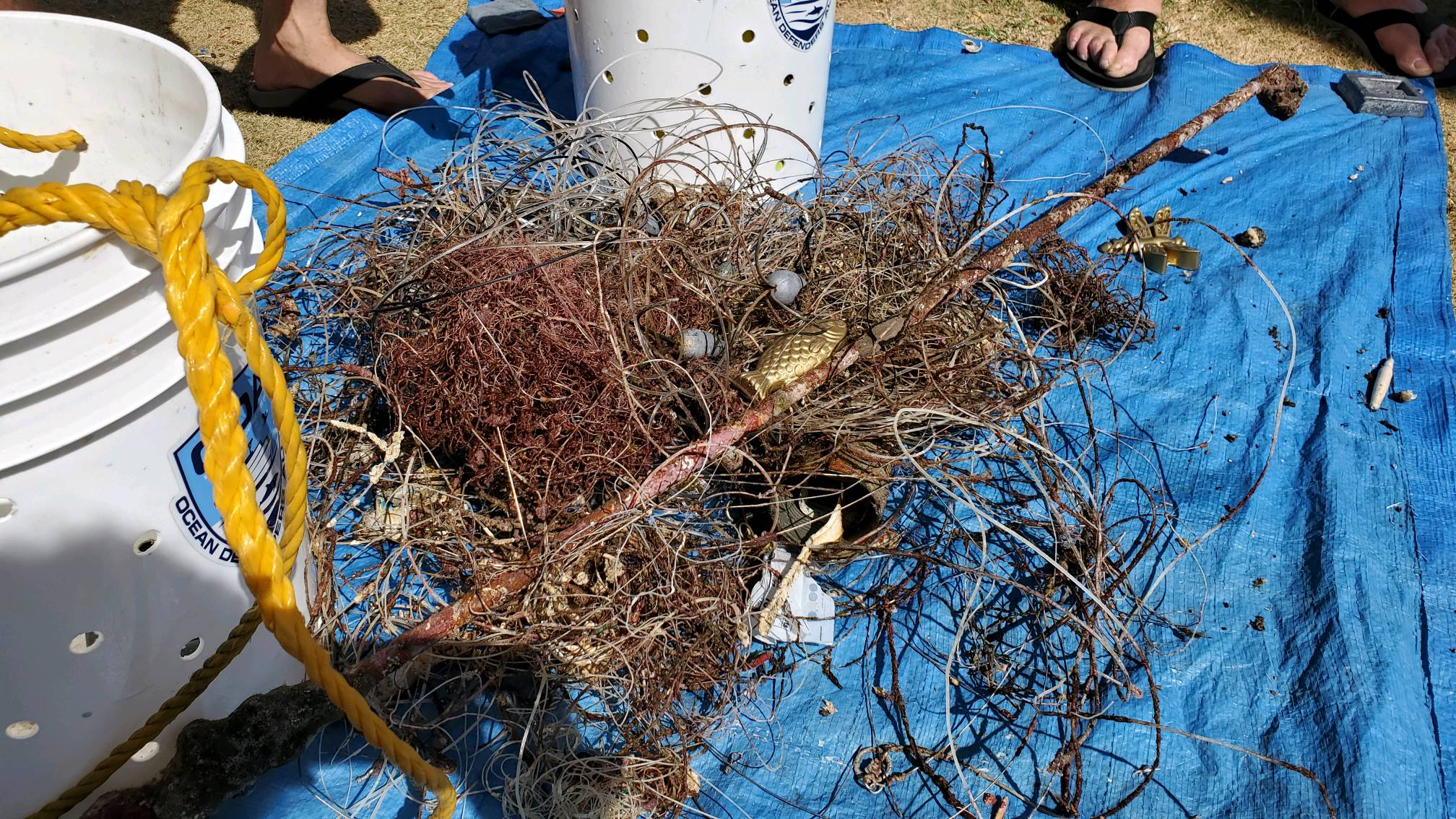
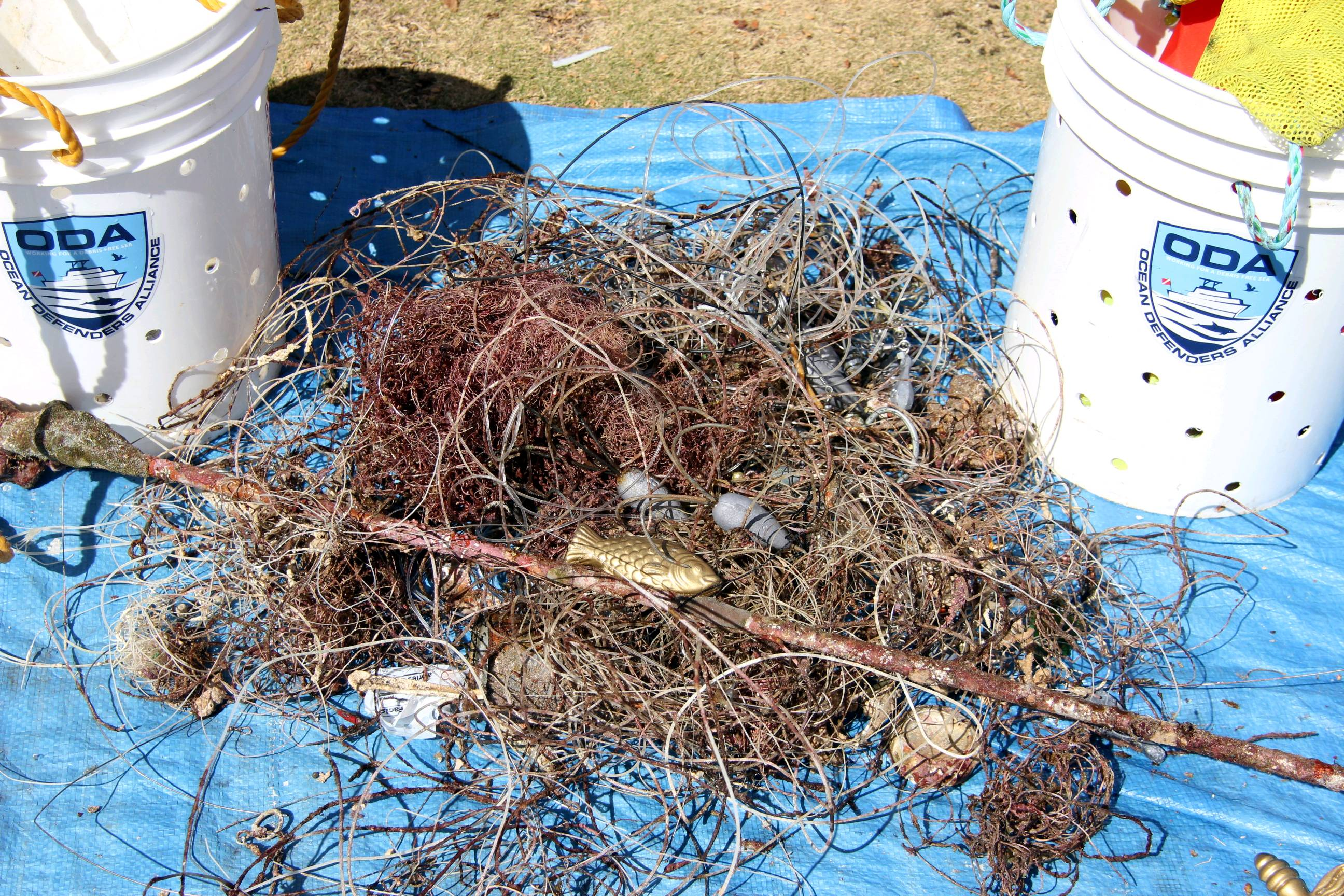
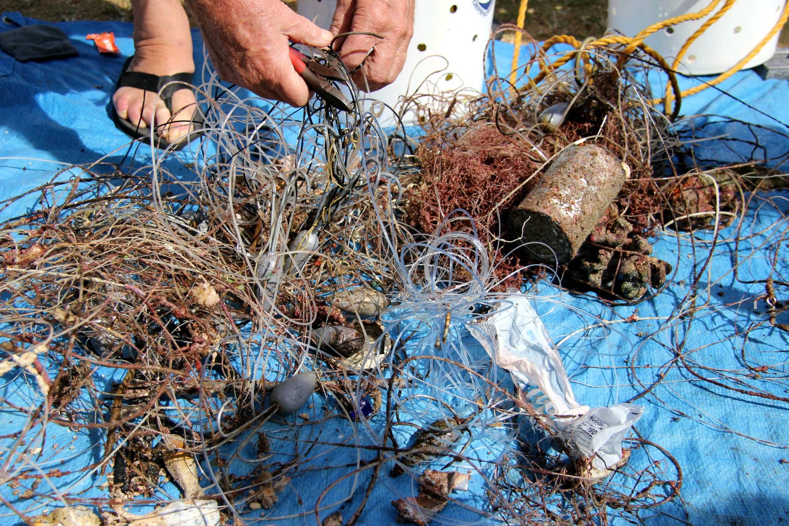
Survey Photos
Debris Items Collected
| plastic materials collected | |
|---|---|
| Beverage Bottles: Less Than 2 Litres (plastic) | 2 |
| Containers: Fast Food, Lunch Boxes & Similar | 2 |
| Fishing: Line | 100 |
| Fishing: Lures, Rods/poles | 7 |
| metal materials collected | |
|---|---|
| Beverage Cans (aluminium) | 6 |
| Cans: Food/juice, Other (tin) | 3 |
| Fishing: Sinkers, Lures, Hooks | 50 |
| Entangled Animals | |
|---|---|
| Other Fish | |
| Species or Common Name | Giant Porcupine Fish |
| Number Entangled | 1 |
| Status | injured |
| Type of Debris | Giant hook through his eye, lots of tackle trailing, could not remove hook |
| Comments | Need pliers, wire cutters to flatten barbs for removal |
Additional Information
Popular fishing area for ulua (giant trevaly), big jacks, ahi
Fishing pole or tent pole
Heavy fishing line, massive hooks which kill fish and turtles
Comments and Feedback
Mainly fishing line today, usually more lead weights. Also I entered 7500 sq ft but it's showing as 80,000.
Need link for DETAILS on recording fishing line. I am counting 10 yards as 1 unit. 100 = 1000 yards.


