
Dive Against Debris Data Submission
Port Gawler mangroves
8 February, 2025
- Team Leader
- Number of Participants
- 1
- Total Debris Collected
- 8.54 kgs (measured)
-34.670176595089, 138.44374143606
Survey Information
- Location Name
- Port Gawler mangroves
- Organization/Dive Centre
- City
- Adelaide
- Country
- Australia
- Date
- 8 February, 2025
- Survey Duration
- 82 Minutes
- GPS Coordinates
- Latitude: -34.670176595089
Longitude: 138.44374143606
- Weather Conditions
- Survey Depth Range
- 2–3.2 meters
- Area Surveyed
- 907.14 m2
- Dominant Substrate
- sand
- Ecosystem
- mangroves
- Wave Conditions
- Smooth (wavelets) for waves 0.1 - 0.5 meter high
Survey Photos
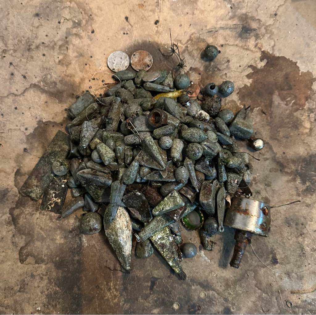
Debris Items Collected
| plastic materials collected | |
|---|---|
| Fishing: Line | 20 |
| Fishing: Lures, Rods/poles | 1 |
| Plastic Fragments | 8 |
| metal materials collected | |
|---|---|
| Caps & Lids (metal) | 1 |
| Metal Fragments | 21 |
| Fishing: Sinkers, Lures, Hooks | 220 |
| other materials collected | |
|---|---|
| Coins | 6 |


