
Dive Against Debris Data Submission
Point Panic
28 April, 2019
- Team Leader
- Ryan Scalf
- Number of Participants
- 3
- Total Debris Collected
- 4 lbs (estimated)
21.290273888186, -157.86101206625
Survey Information
- Location Name
- Point Panic
- Organization/Dive Centre
- City
- Oahu
- Country
- United States
- Date
- 28 April, 2019
- Survey Duration
- 30 Minutes
- GPS Coordinates
- Latitude: 21.290273888186
Longitude: -157.86101206625
- Weather Conditions
-
Rain and wind
- Survey Depth Range
- 5–20 feet
- Area Surveyed
- 700 ft2
- Dominant Substrate
- sand
- Ecosystem
- coral reef
- Wave Conditions
- Smooth (wavelets) for waves 0.1 - 0.5 meter high
Survey Photos
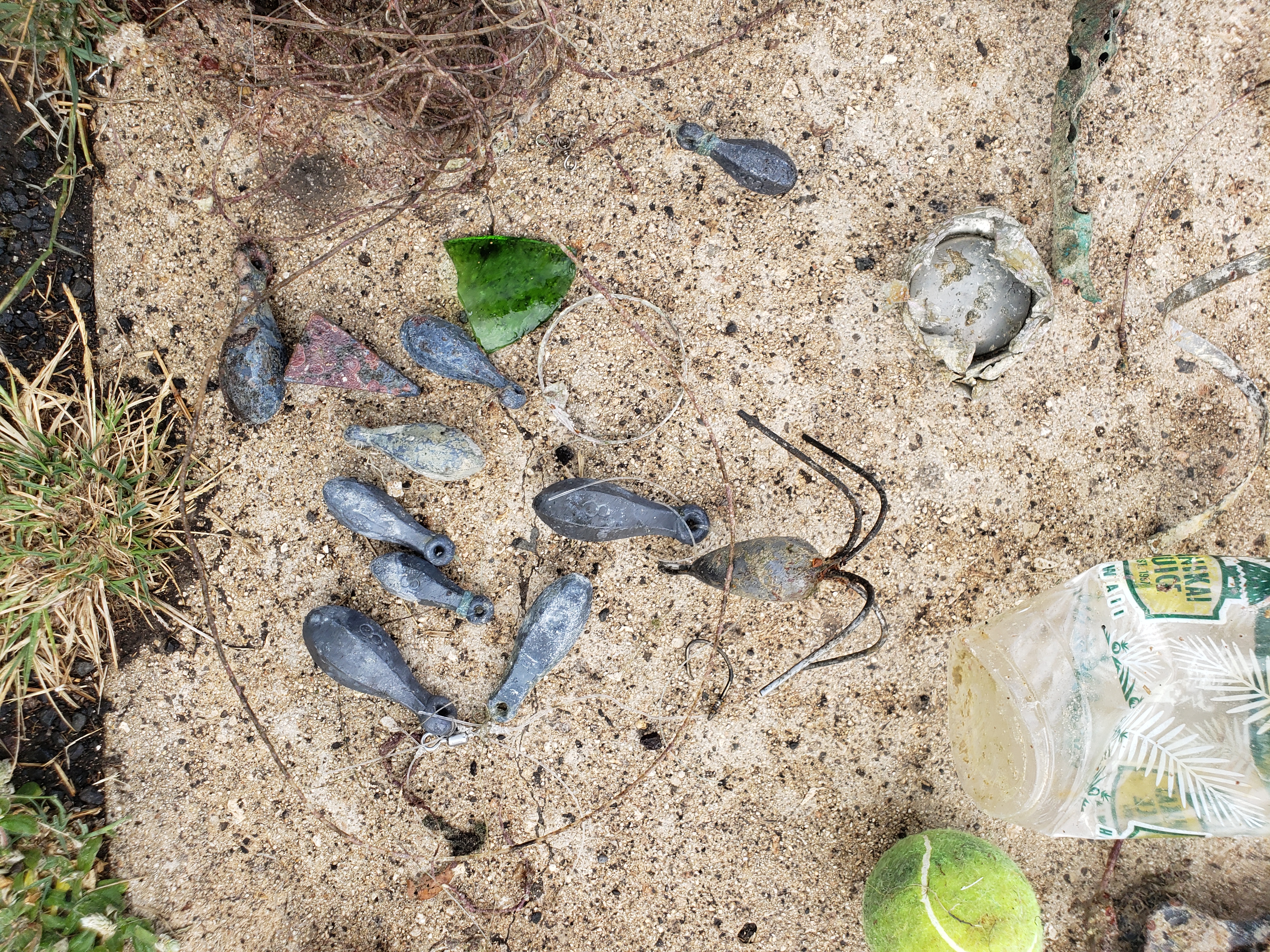
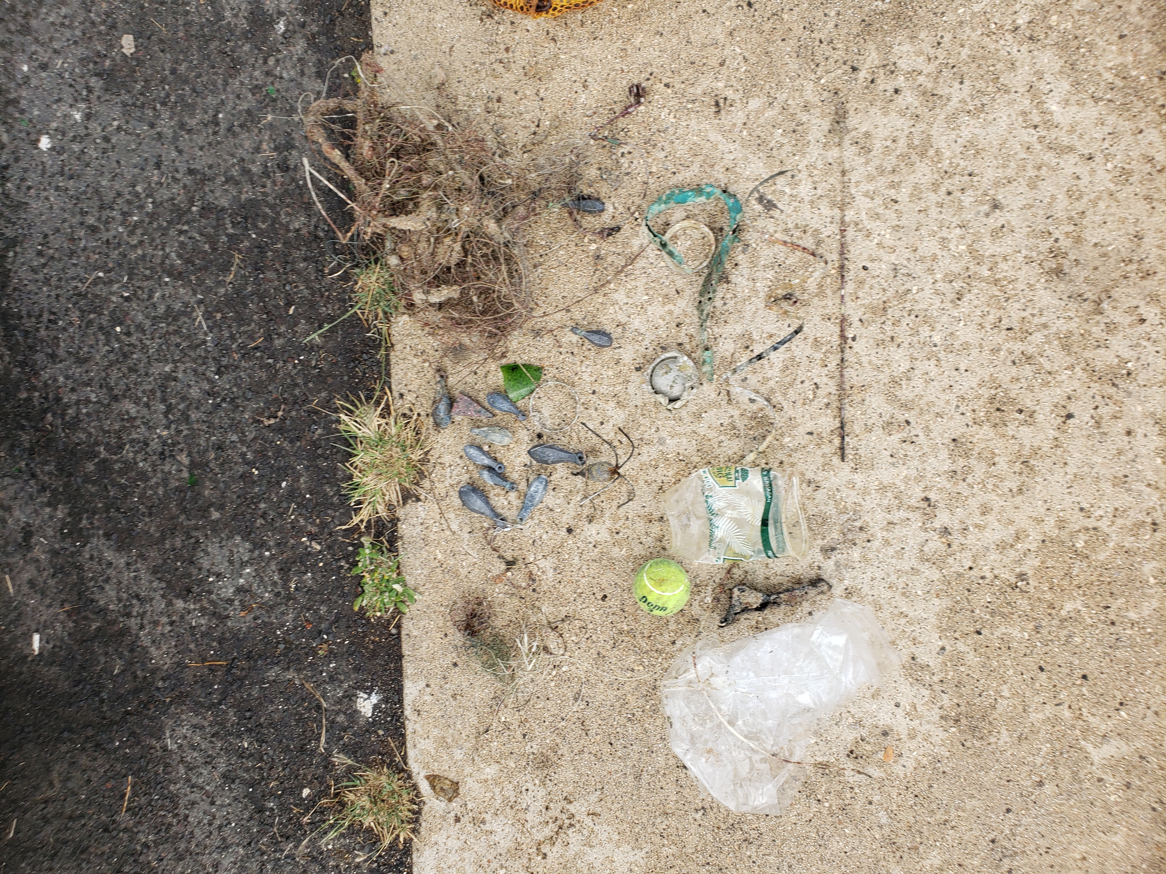
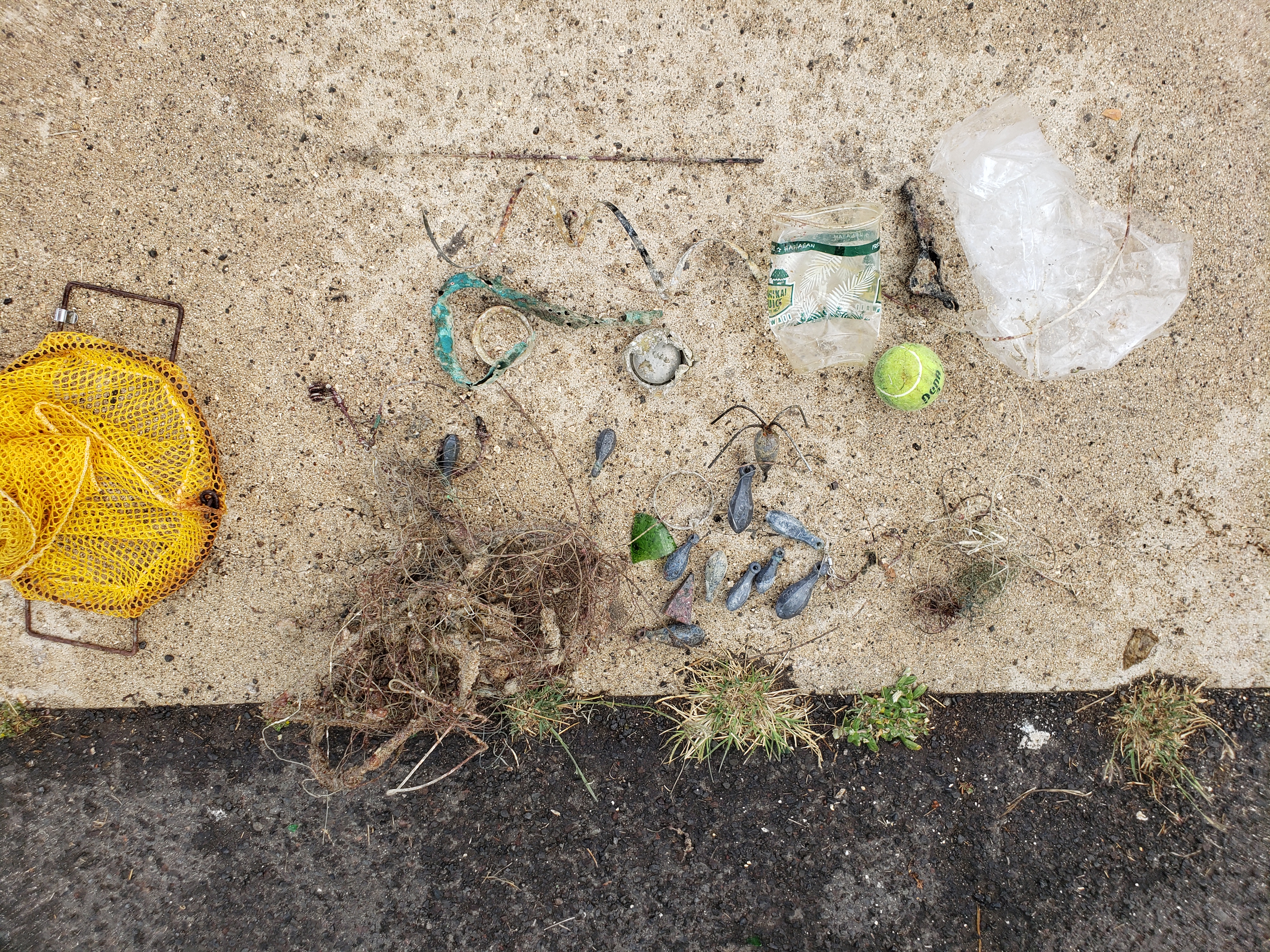
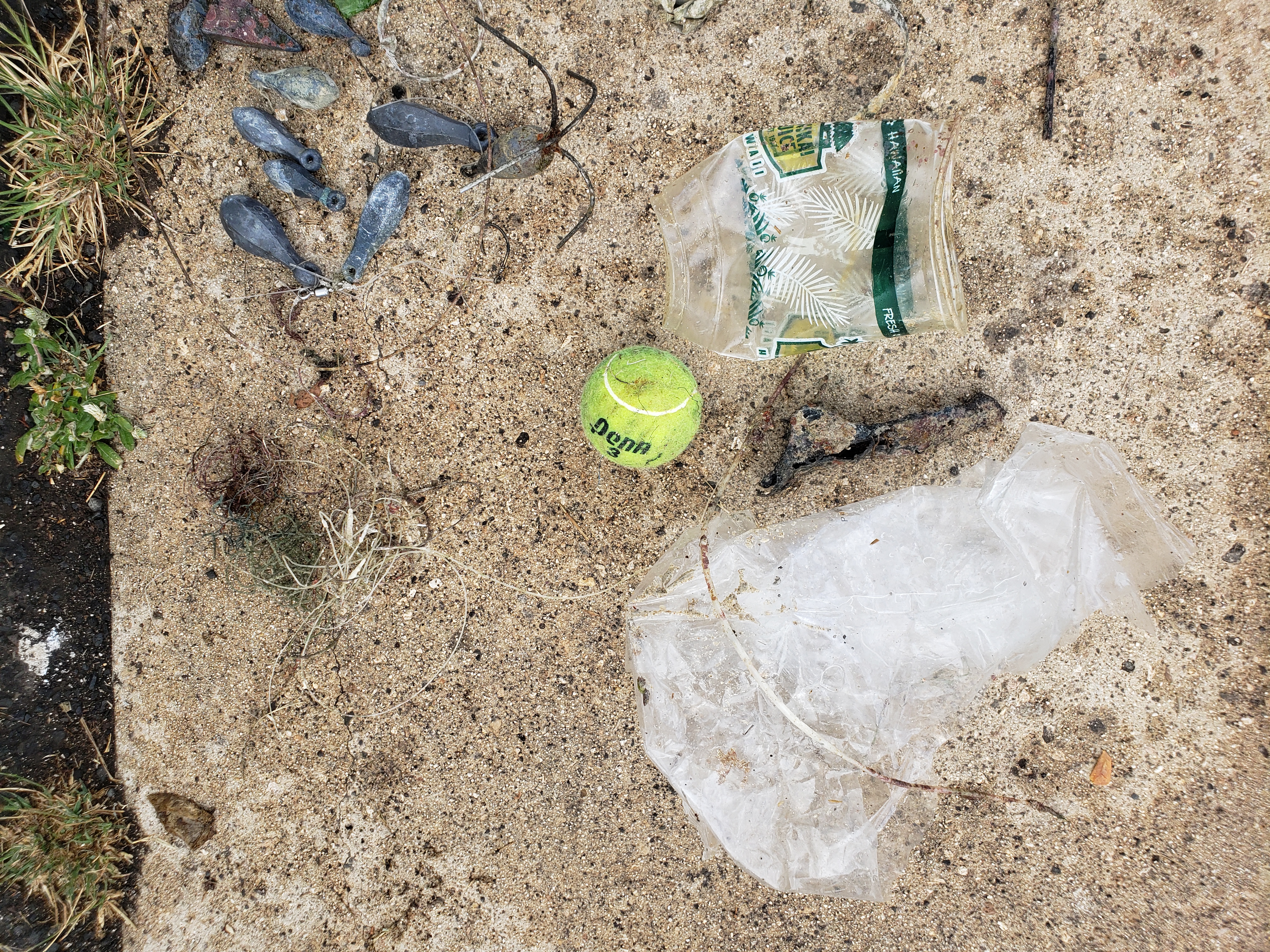
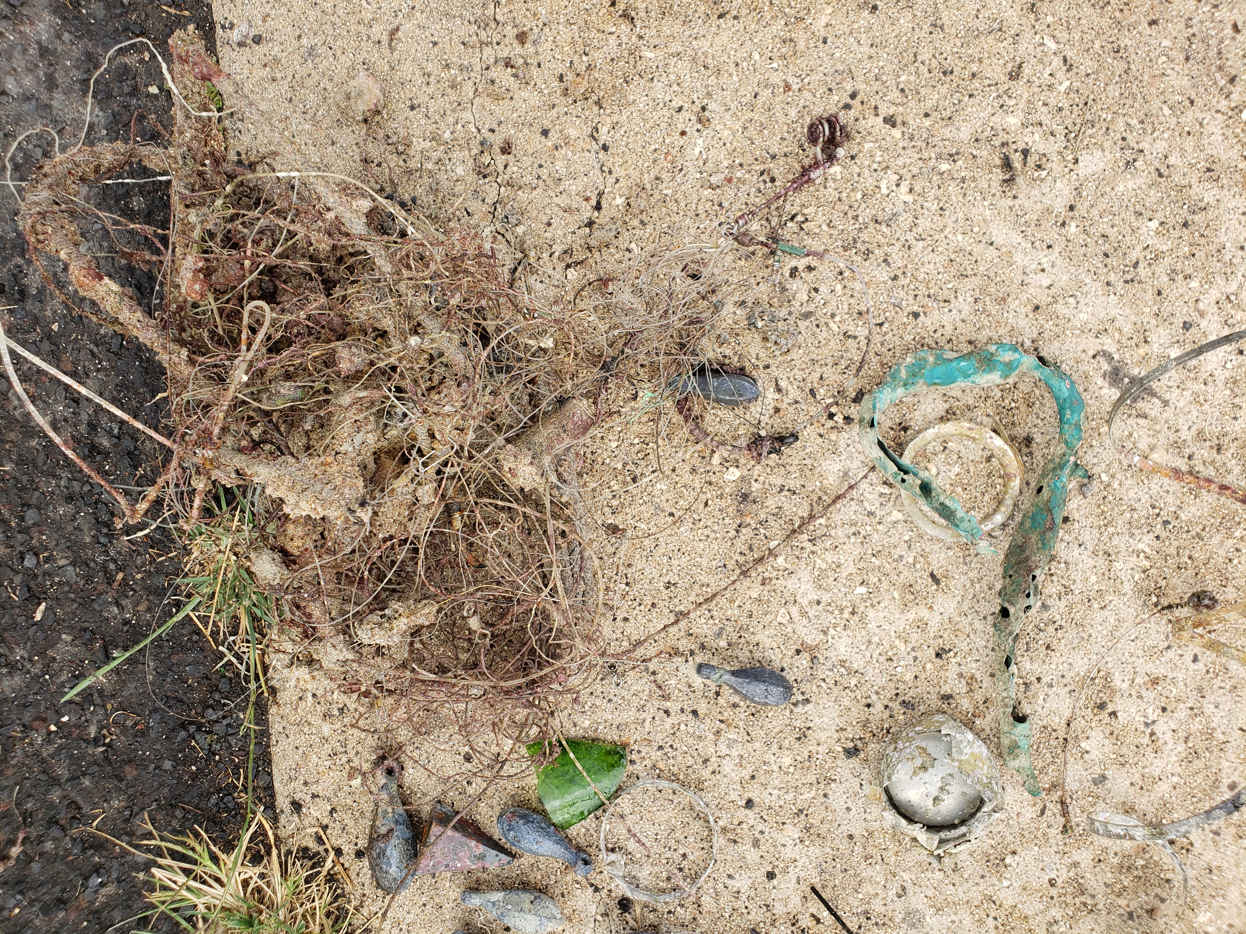
Debris Items Collected
| plastic materials collected | |
|---|---|
| Balls | 1 |
| Cups, Plates, Forks, Knives, Spoons (plastic) | 1 |
| Fishing: Line | 100 |
| Fishing: Lures, Rods/poles | 1 |
| Plastic Fragments | 1 |
| Rope (plastic/nylon) | 5 |
| glass materials collected | |
|---|---|
| Glass & Ceramic Fragments | 2 |
| metal materials collected | |
|---|---|
| Beverage Cans (aluminium) | 1 |
| Pipes & Rebar | 1 |
| Metal Fragments | 2 |
| Fishing: Sinkers, Lures, Hooks | 25 |
| rubber materials collected | |
|---|---|
| Rubber Fragments | 1 |
| cloth materials collected | |
|---|---|
| Rope And String (cloth) | 1 |
Additional Information
No
Tennis ball
Hooks
Fishing line
Metal
Comments and Feedback
Local fishing and homeless area.


