
Dive Against Debris Data Submission
Nugal Piramida
27 June, 2024
- Team Leader
- Bojan Runtić
- Number of Participants
- 4
- Total Debris Collected
- 0 lbs (estimated)
43.278819, 17.032345
Survey Information
- Location Name
- Nugal Piramida
- Organization/Dive Centre
- More Sub d.o.o
- City
- Makarska
- Country
- Croatia
- Date
- 27 June, 2024
- Survey Duration
- 41 Minutes
- GPS Coordinates
- Latitude: 43.278819
Longitude: 17.032345
- Weather Conditions
-
Calm
- Survey Depth Range
- 3–33 meters
- Area Surveyed
- 676 m2
- Dominant Substrate
- rock
- Ecosystem
- rocky reef
- Wave Conditions
- Calm (glassy to rippled) for waves 0 – 0.1 meter high
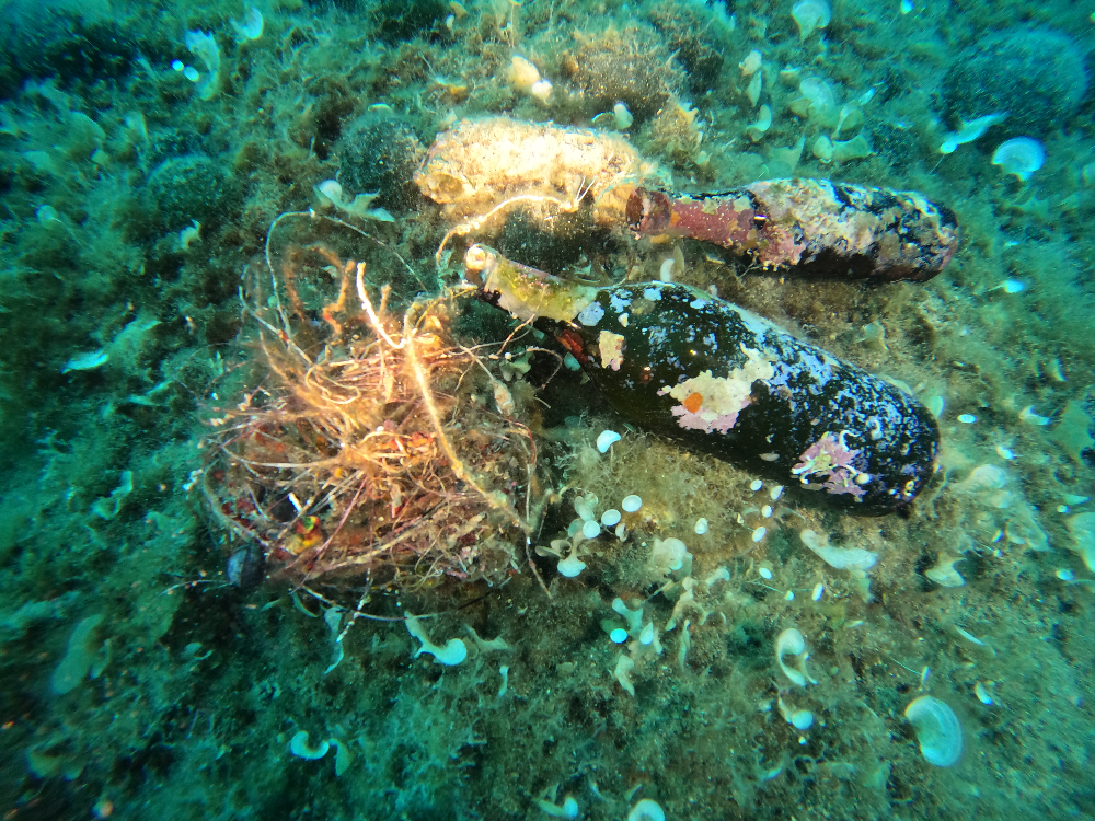
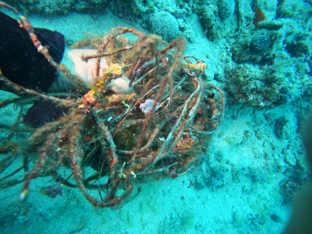
Survey Photos

Debris Items Collected
Additional Information
Fishing
Very old 30y,Fishing lines
Fishing Netz
3 Glas bottles
Comments and Feedback
We need fishing lines take out!
Maybe need 10 20 dives more !


