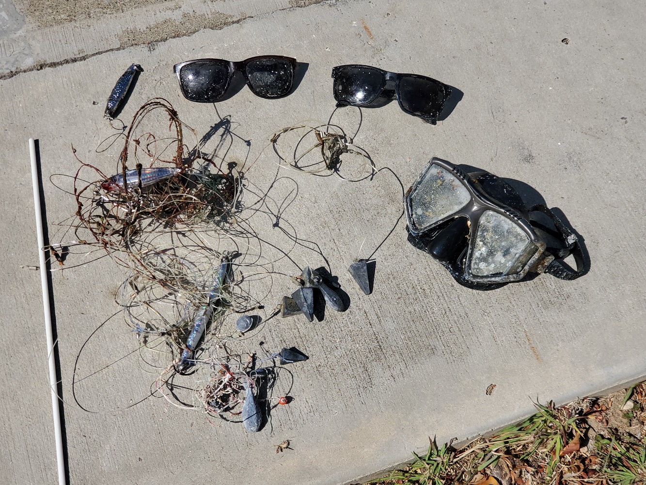
Mike Boat, , US Naval Station Guantanamo Bay, Cuba
17 April, 2021
- Team Leader
- Jerry Lawson
- Number of Participants
- 5
- Total Debris Collected
- 4 lbs (estimated)
19.899875680415, -75.166862576694
Survey Information
- Location Name
- Mike Boat, , US Naval Station Guantanamo Bay, Cuba
- Organization/Dive Centre
- City
- US Naval Station Guantanamo Bay, Cuba
- Country
- Cuba
- Date
- 17 April, 2021
- Survey Duration
- 31 Minutes
- GPS Coordinates
- Latitude: 19.899875680415
Longitude: -75.166862576694
- Weather Conditions
-
Clear / Sunny
- Survey Depth Range
- 62–65 feet
- Area Surveyed
- 650 ft2
- Dominant Substrate
- metal vessel with growth
- Ecosystem
- wreck site -- WWII era landing craft
- Wave Conditions
- Calm (glassy to rippled) for waves 0 – 0.1 meter high
Survey Photos
Debris Items Collected
| plastic materials collected | |
|---|---|
| Fishing: Line | 25 |
| SCUBA & Snorkel Gear-masks, Snorkels, Fins | 1 |
| metal materials collected | |
|---|---|
| Metal Fragments | 2 |
| Fishing: Sinkers, Lures, Hooks | 13 |
| other materials collected | |
|---|---|
| sunglasses | 2 |
| fiberglass rod | 1 |
Additional Information
No - this dive site sees frequent fishing during the nights, and multiple divers during the afternoon and daylight time(s) during the weekends.
monofilament lines & hooks - local populace loses many feet of line regularly. the line(s) present entanglement threats for swimmers, divers and wildlife.
plastic debris from passing ships - many items wash ashore on our beaches, many seemingly from other Caribbean nations - but are likely being dropped or disposed of from passing ships.
plastic trash bags - plastic shopping bags can be carried on the winds for longer distances and seem to always end up in the water at their journey's end - where they can entrap wildlife and choke our reefs.
Comments and Feedback
We decided to use our dive time this day to cleaning one of the most popular dive sites for GTMO, known as the M-Boat. This site sees many divers weekly, and seems to be a popular spot for fishermen as well. This was an initial effort on the site. there is much more monofilament to be removed, though the main entanglement hazards were removed.
location on map will need editing - the lat/long were from data that was pre-Hurricane Sandy from 2012, and the boat was moved due to that and subsequent hurricanes. will update coordinates at first opportunity.


