
Dive Against Debris Data Submission
Maunalua Bay
30 December, 2020
- Team Leader
- Ken and Glenn
- Number of Participants
- 4
- Total Debris Collected
- 750 lbs (estimated)
21.257660211943, -157.75683422342
Survey Information
- Location Name
- Maunalua Bay
- Organization/Dive Centre
- Ocean Defenders Alliance/Island Divers
- City
- Honolulu
- Country
- United States
- Date
- 30 December, 2020
- Survey Duration
- 27 Minutes
- GPS Coordinates
- Latitude: 21.257660211943
Longitude: -157.75683422342
- Weather Conditions
-
Calm
- Survey Depth Range
- 15–44 feet
- Area Surveyed
- 1192.83 ft2
- Dominant Substrate
- coral
- Ecosystem
- coral reef
- Wave Conditions
- Slight for waves 0.5 -1.25 meter high
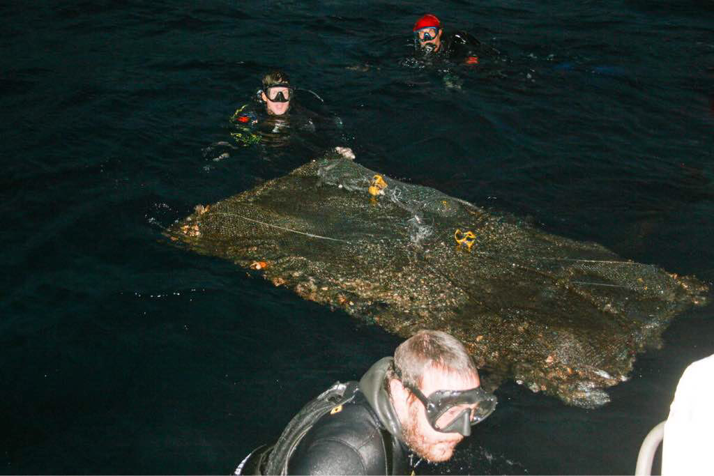
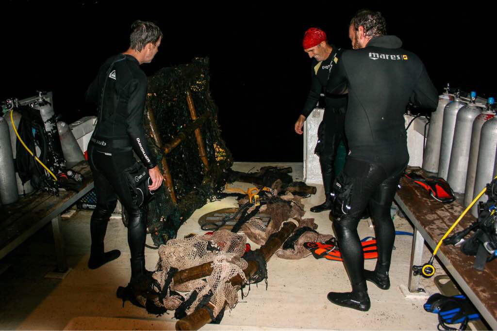
Survey Photos

Debris Items Collected
| plastic materials collected | |
|---|---|
| Buoys & Floats (plastic & Foamed) | 7 |
| Fishing: Line | 16 |
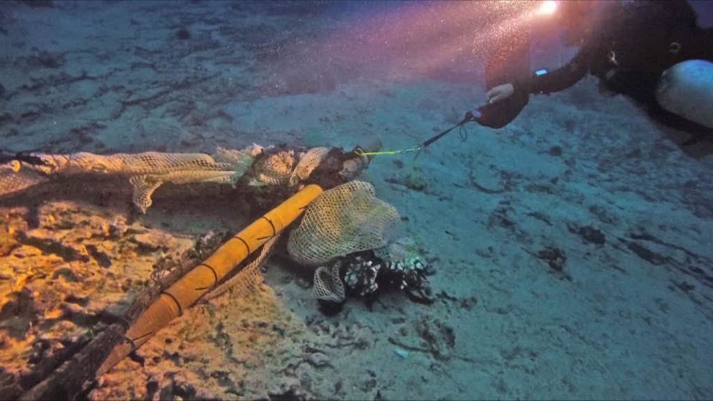
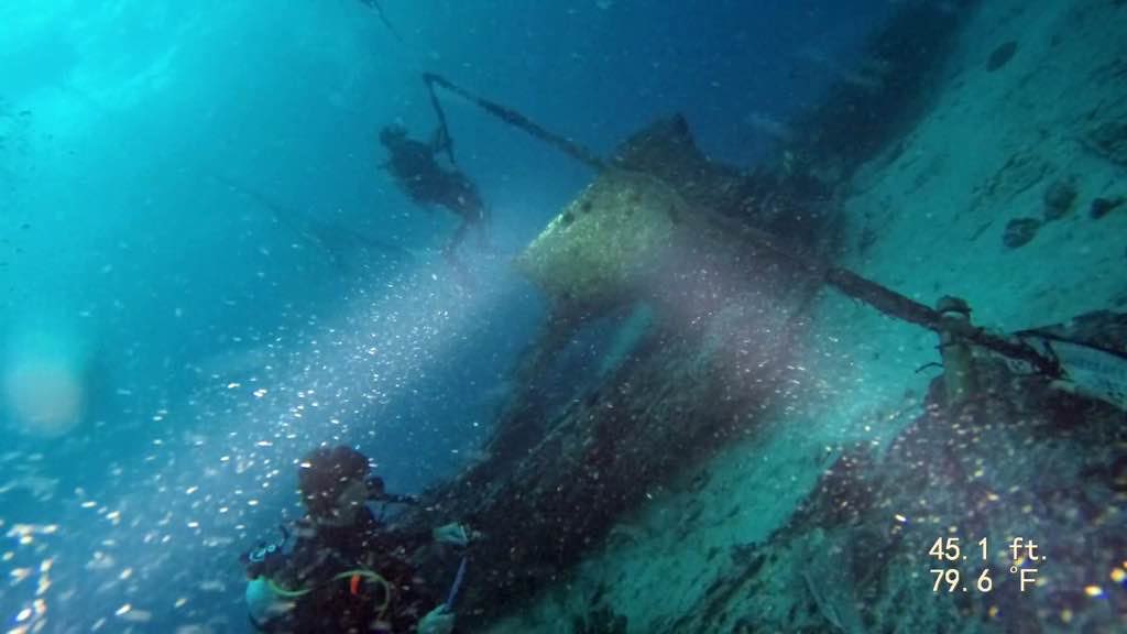
| Fishing: Nets & Pieces Of Nets | 17 |
| Sheeting: Tarpaulin, Plastic Sheets, Palette Wrap | 4 |
| Rope (plastic/nylon) | 29 |
| other materials collected | |
|---|---|
| Bamboo | 14 |
| Entangled Animals | |
|---|---|
| Other Fish | |
| Species or Common Name | Convict Tangs |
| Number Entangled | 37 |
| Status | released unharmed |
| Type of Debris | FAD netting |
| Comments | Small adolescent fish trapped in the netting of the FAD |
| Crustaceans | |
| Species or Common Name | Crabs |
| Number Entangled | 23 |
| Status | released unharmed |
| Type of Debris | FAD |
Additional Information
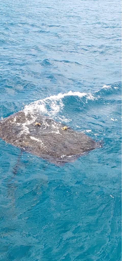
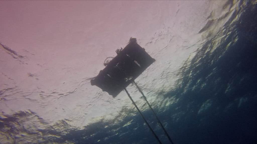
Illegal placement of FAD
Bamboo poles
FAD
Nets
Anchor line
Comments and Feedback
ODA Rapid Response Team removed this debris within a few hours of initial report


