
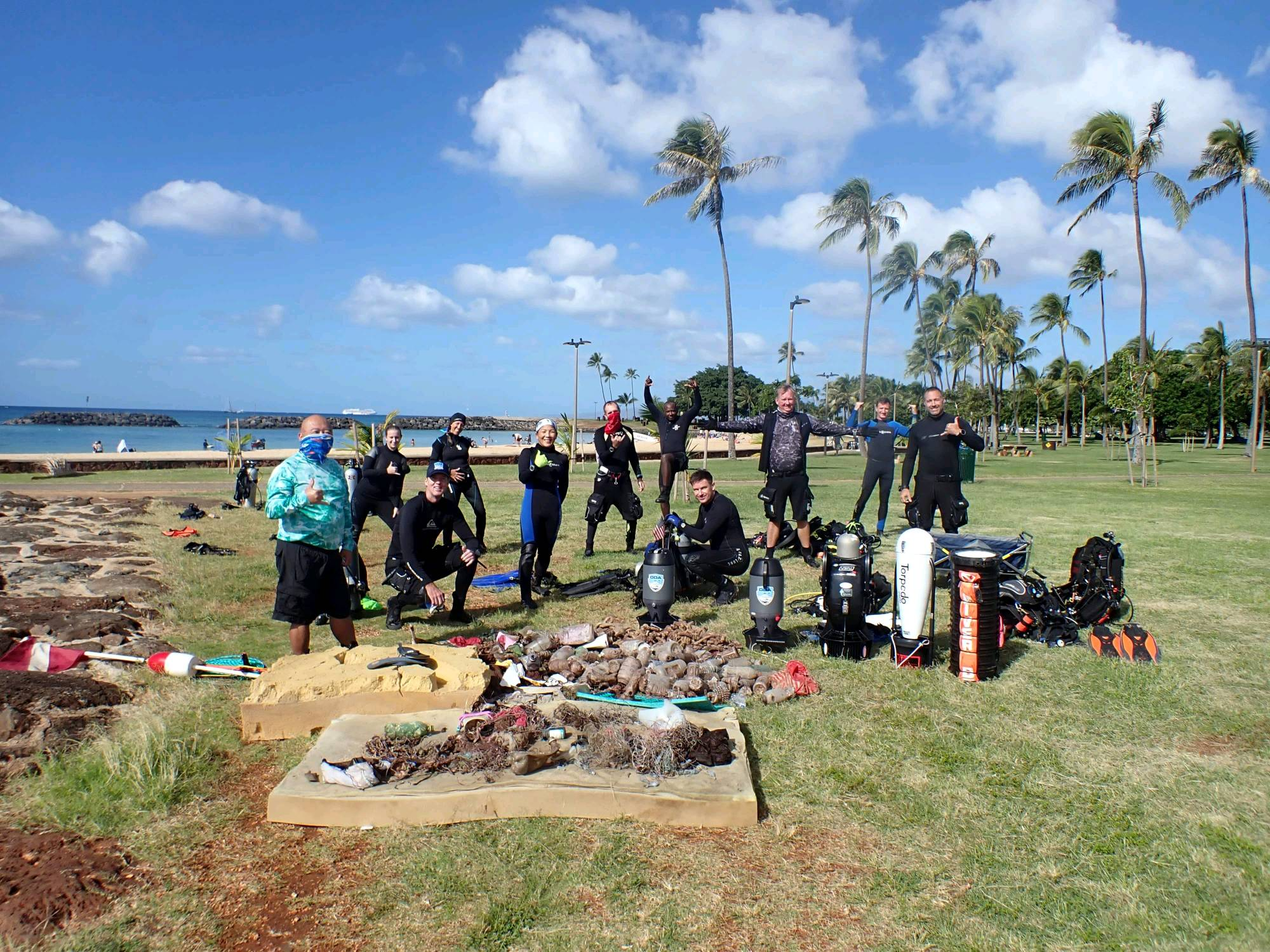
Dive Against Debris Data Submission
Magic Island
28 November, 2020
- Team Leader
- Ken and Glenn
- Number of Participants
- 12
- Total Debris Collected
- 300 lbs (estimated)
21.280771, -157.845905
Survey Information
- Location Name
- Magic Island
- Organization/Dive Centre
- Ocean Defenders Alliance
- City
- Honolulu
- Country
- United States
- Date
- 28 November, 2020
- Survey Duration
- 60 Minutes
- GPS Coordinates
- Latitude: 21.280771
Longitude: -157.845905
- Weather Conditions
-
Fair, calm
- Survey Depth Range
- 8–35 feet
- Area Surveyed
- 20107.5 m2
- Dominant Substrate
- rock
- Ecosystem
- coral reef
- Wave Conditions
- Calm (glassy to rippled) for waves 0 – 0.1 meter high
Survey Photos
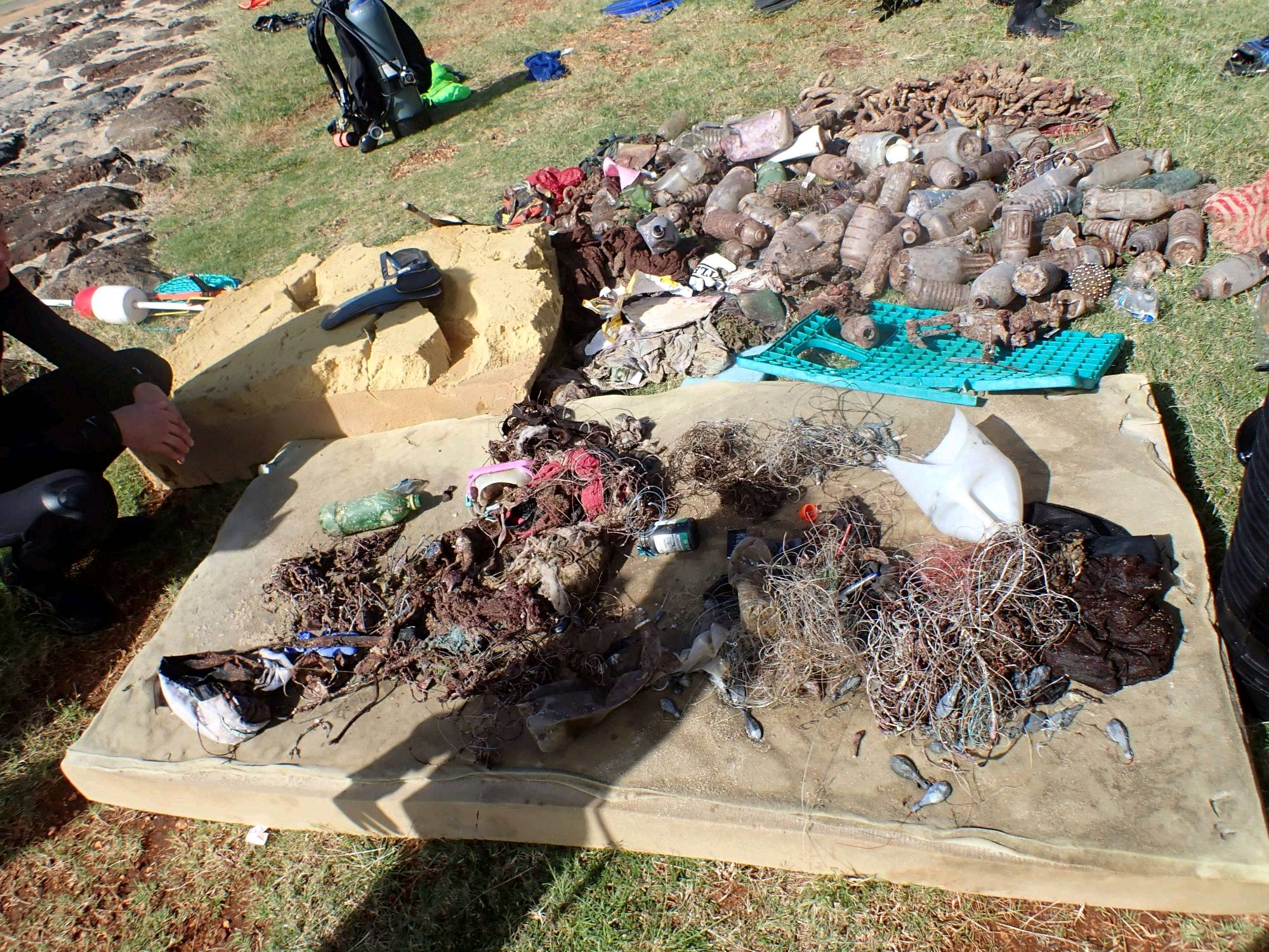
Debris Items Collected
| plastic materials collected | |
|---|---|
| Baskets, Crates | 1 |
| Beverage Bottles: 2 Litres Or More (plastic) | 1 |
| Beverage Bottles: Less Than 2 Litres (plastic) | 40 |
| Fishing: Line | 2000 |
| Fishing: Lures, Rods/poles | 8 |
| metal materials collected | |
|---|---|
| Beverage Cans (aluminium) | 2 |
| cloth materials collected | |
|---|---|
| Cloth Fragments | 8 |
| other materials collected | |
|---|---|
| Queen size mattress | 1 |
| 1 large piece of foam | 2 |
| Entangled Animals | |
|---|---|
| Other Fish | |
| Species or Common Name | Yellowhead Eel |
| Number Entangled | 1 |
| Status | dead |
| Type of Debris | Large hook, line, tackle |
| Comments | Starved to death due to fishing gear blocking his mouth |
Additional Information
Popular fishing spot
Large mattress floating in the surface
See above
Tons of plastic bottles
Comments and Feedback
Fishing line input MUST specify feet or yards of line


