
Dive Against Debris Data Submission
HMS Maori
19 July, 2022
- Team Leader
- Ben Breakspear
- Number of Participants
- 2
- Total Debris Collected
- 0.1 kgs (estimated)
35.903023814955, 14.516690079405
Survey Information
- Location Name
- HMS Maori
- Organization/Dive Centre
- NDS Malta
- Country
- Malta
- Date
- 19 July, 2022
- Survey Duration
- 44 Minutes
- GPS Coordinates
- Latitude: 35.903023814955
Longitude: 14.516690079405
- Weather Conditions
-
Calm
- Survey Depth Range
- 4–8 meters
- Area Surveyed
- 200 m2
- Dominant Substrate
- rock
- Ecosystem
- rocky reef
- Wave Conditions
- Calm (glassy to rippled) for waves 0 – 0.1 meter high
Survey Photos
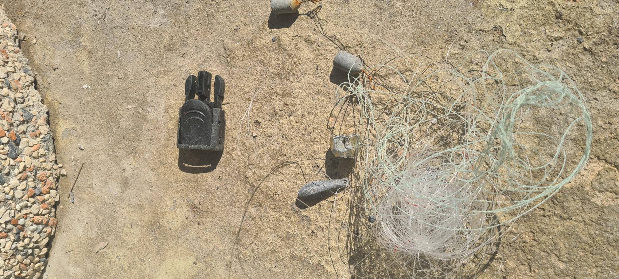
Debris Items Collected
| plastic materials collected | |
|---|---|
| Fishing: Line | 1 |
| Fishing: Lures, Rods/poles | 3 |
| Plastic Fragments | 1 |
Additional Information
Fishing line
Broken scuba gear
Comments and Feedback
A few fishing areas around the wreck of the Maori, so fishing equipment can often be found in the water. There is a lack of bins here so plastic debris is often found by the entrance to the water.


