
Dive Against Debris Data Submission
Edmonds fishing pier
12 May, 2018
- Team Leader
- Rick Grove
- Number of Participants
- 6
- Total Debris Collected
- 30 lbs (estimated)
47.810987984063, -122.38967185313
Survey Information
- Location Name
- Edmonds fishing pier
- Organization/Dive Centre
- Emerald Sea Dive Club
- City
- Edmonds
- Country
- United States
- Date
- 12 May, 2018
- Survey Duration
- 50 Minutes
- GPS Coordinates
- Latitude: 47.810987984063
Longitude: -122.38967185313
- Weather Conditions
-
Pleasant - Sunny for most of the week. Rained one day. High temps in the 60s - 70s
- Survey Depth Range
- 30–70 feet
- Area Surveyed
- 2700 ft2
- Dominant Substrate
- gravel
- Ecosystem
- pier
- Wave Conditions
- Slight for waves 0.5 -1.25 meter high
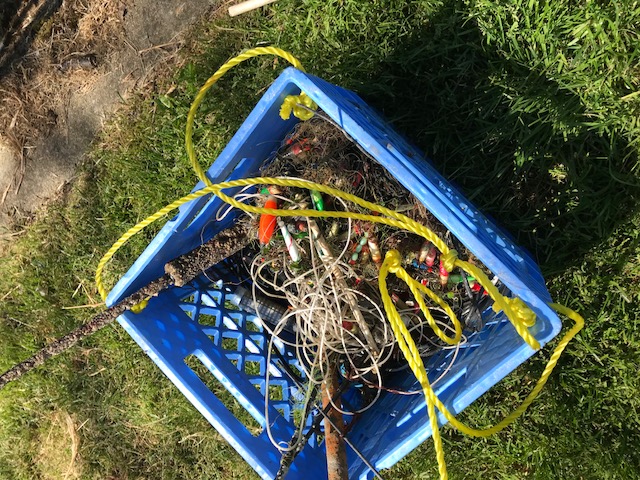
Survey Photos
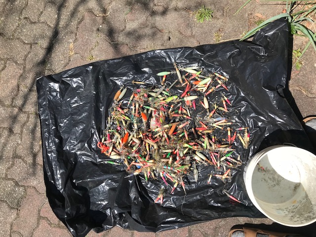
Debris Items Collected
| plastic materials collected | |
|---|---|
| Bait Containers, Packaging | 24 |
| Fishing: Line | 100 |
| Fishing: Lures, Rods/poles | 30 |
| metal materials collected | |
|---|---|
| Batteries: AA, AAA, C & D, 6V, 9V, Etc. | 1 |
| Pipes & Rebar | 1 |
| Metal Fragments | 2 |
| Fishing: Sinkers, Lures, Hooks | 125 |
| mixed materials collected | |
|---|---|
| Computer Equipment & Other Electronic Devices | 3 |
| Entangled Animals | |
|---|---|
| Crustaceans | |
| Species or Common Name | Dugeness crab |
| Number Entangled | 1 |
| Status | released unharmed |
| Type of Debris | fishing line |
Additional Information
It's a fishing pier - so there's plenty of snagged fishing tackle in the area.
fishing tackle
fishing line


