
Dive Against Debris Data Submission
Chabahar
17 March, 2023
- Team Leader
- Behnazbani
- Number of Participants
- 3
- Total Debris Collected
- 20 kgs (estimated)
25.304479, 60.589978
Survey Information
- Location Name
- Chabahar
- Organization/Dive Centre
- Banidive
- City
- Chabahar
- Country
- Iran
- Date
- 17 March, 2023
- Survey Duration
- 50 Minutes
- GPS Coordinates
- Latitude: 25.304479
Longitude: 60.589978
- Weather Conditions
-
Calm
- Survey Depth Range
- 5–16 meters
- Area Surveyed
- 5628.41 m2
- Dominant Substrate
- rock
- Ecosystem
- rocky reef
- Wave Conditions
- Calm (glassy to rippled) for waves 0 – 0.1 meter high
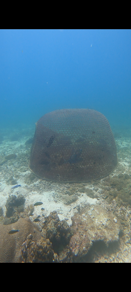
Survey Photos


Debris Items Collected
| metal materials collected | |
|---|---|
| Strapping Bands (metal) | 1 |
| Wire, Wire Mesh & Barbed Wire | 2 |
| Fishing: Traps & Pots | 2 |
| Entangled Animals | |
|---|---|
| Other Fish | |
| Species or Common Name | Butterfly Fish, Trigger Fish, Parot Fish |
| Number Entangled | 3 |
| Status | injured |
| Type of Debris | Fishing cage |
Additional Information
Over fishing


