
Dive Against Debris Data Submission
Carys Fort Reeef Deep Ledge
4 December, 2018
- Team Leader
- Dan Dawson
- Number of Participants
- 6
- Total Debris Collected
- 430 lbs (measured)
25.22189, -80.21149
Survey Information
- Location Name
- Carys Fort Reeef Deep Ledge
- Organization/Dive Centre
- Horizon Divers
- City
- Key Largo
- Country
- United States
- Date
- 4 December, 2018
- Survey Duration
- 60 Minutes
- GPS Coordinates
- Latitude: 25.22189
Longitude: -80.21149
- Weather Conditions
-
Flat calm seas with little current, but only about 20ft of visibility. Sunny and warm one the surface and 78 - 80 water temps.
- Survey Depth Range
- 45–75 feet
- Area Surveyed
- 2540 ft2
- Dominant Substrate
- area where coral and sand meet
- Ecosystem
- coral reef
- Wave Conditions
- Calm (glassy to rippled) for waves 0 – 0.1 meter high
Survey Photos
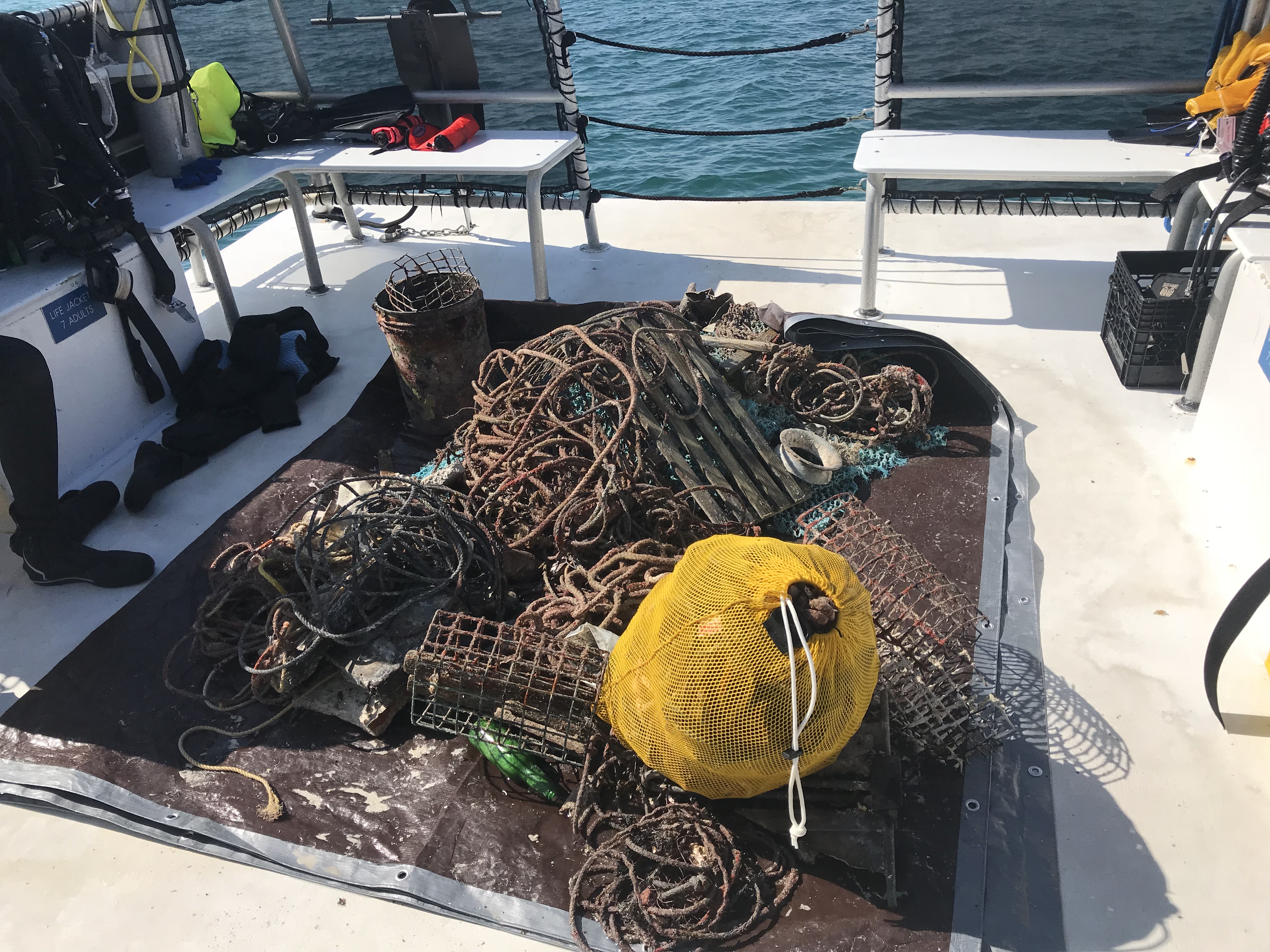
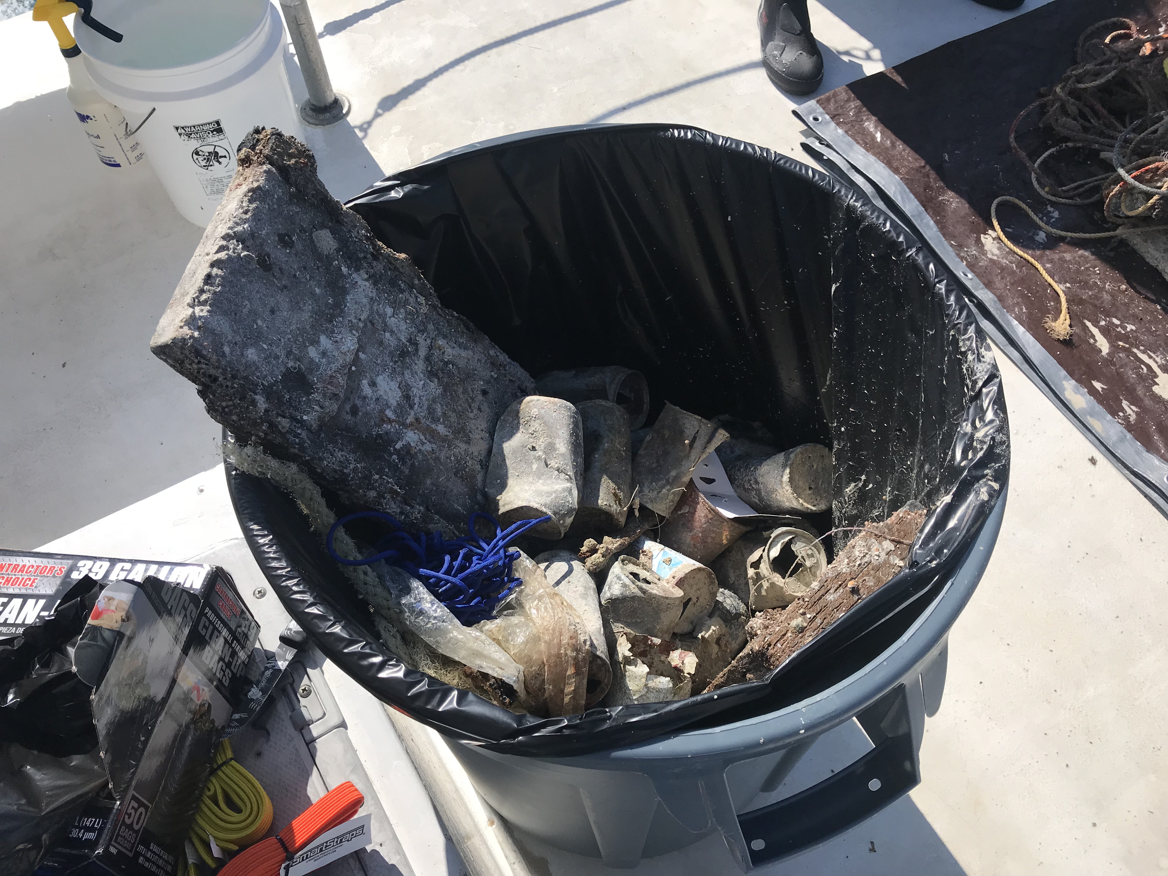
Debris Items Collected
| plastic materials collected | |
|---|---|
| Bags-grocery/retail (plastic) | 4 |
| Bait Containers, Packaging | 2 |
| Baskets, Crates | 2 |
| Beverage Bottles: Less Than 2 Litres (plastic) | 5 |
| Buckets, Drums & Jerrycans-2 Liters Or More | 2 |
| Cups, Plates, Forks, Knives, Spoons (plastic) | 20 |
| Fishing: Line | 110 |
| Fishing: Nets & Pieces Of Nets | 3 |
| Rope (plastic/nylon) | 800 |
| glass materials collected | |
|---|---|
| Beverage Bottles (glass) | 40 |
| metal materials collected | |
|---|---|
| Wire, Wire Mesh & Barbed Wire | 6 |
| Fishing: Traps & Pots | 8 |
| wood materials collected | |
|---|---|
| Pallets | 2 |
| Wood Fragments | 50 |
| Fishing: Traps & Pots | 5 |
| mixed materials collected | |
|---|---|
| Bricks, Cinderblocks & Chunks Of Cement | 4 |
Additional Information
It was debris we have been seeing since Irma in 2017
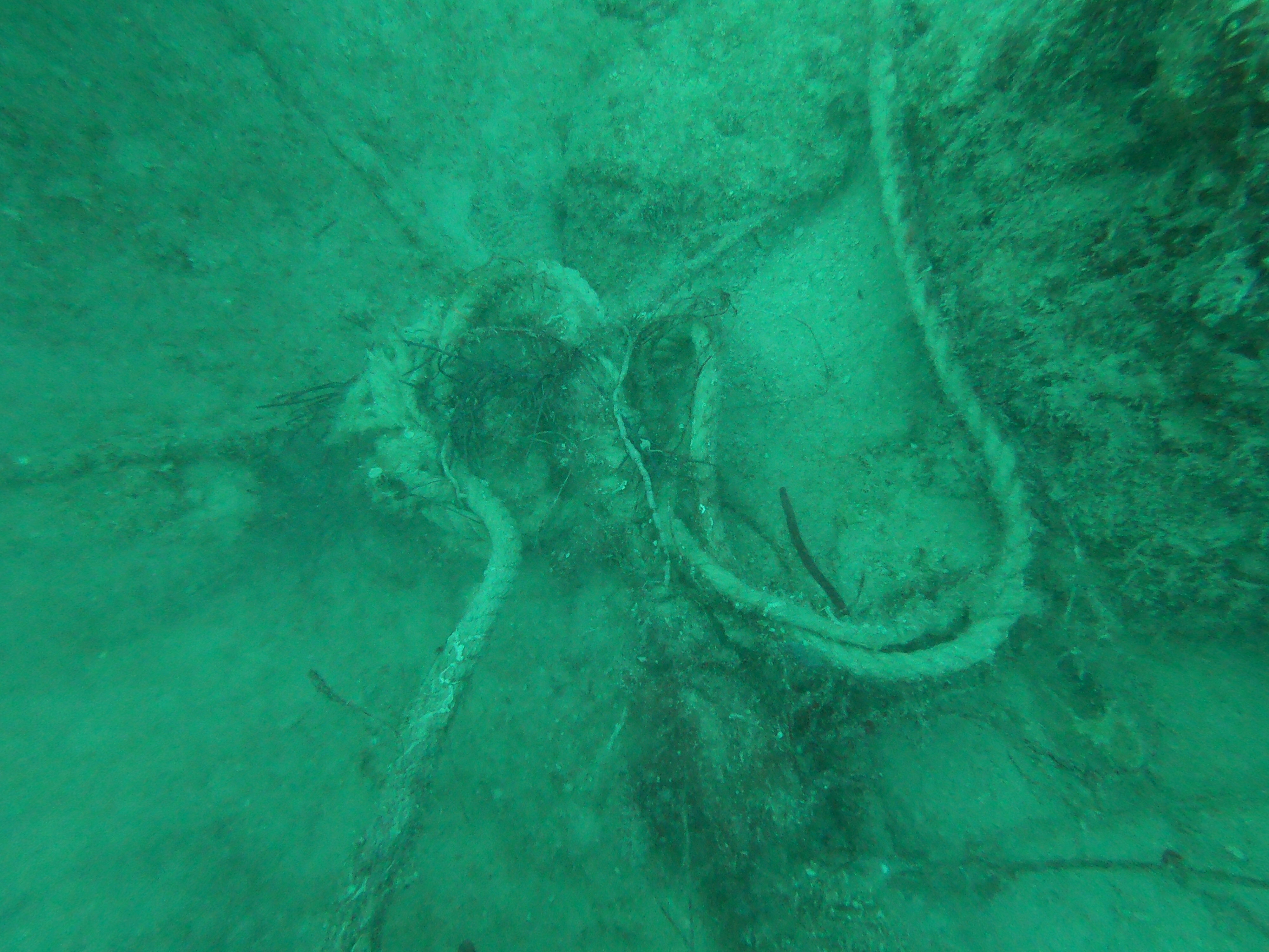
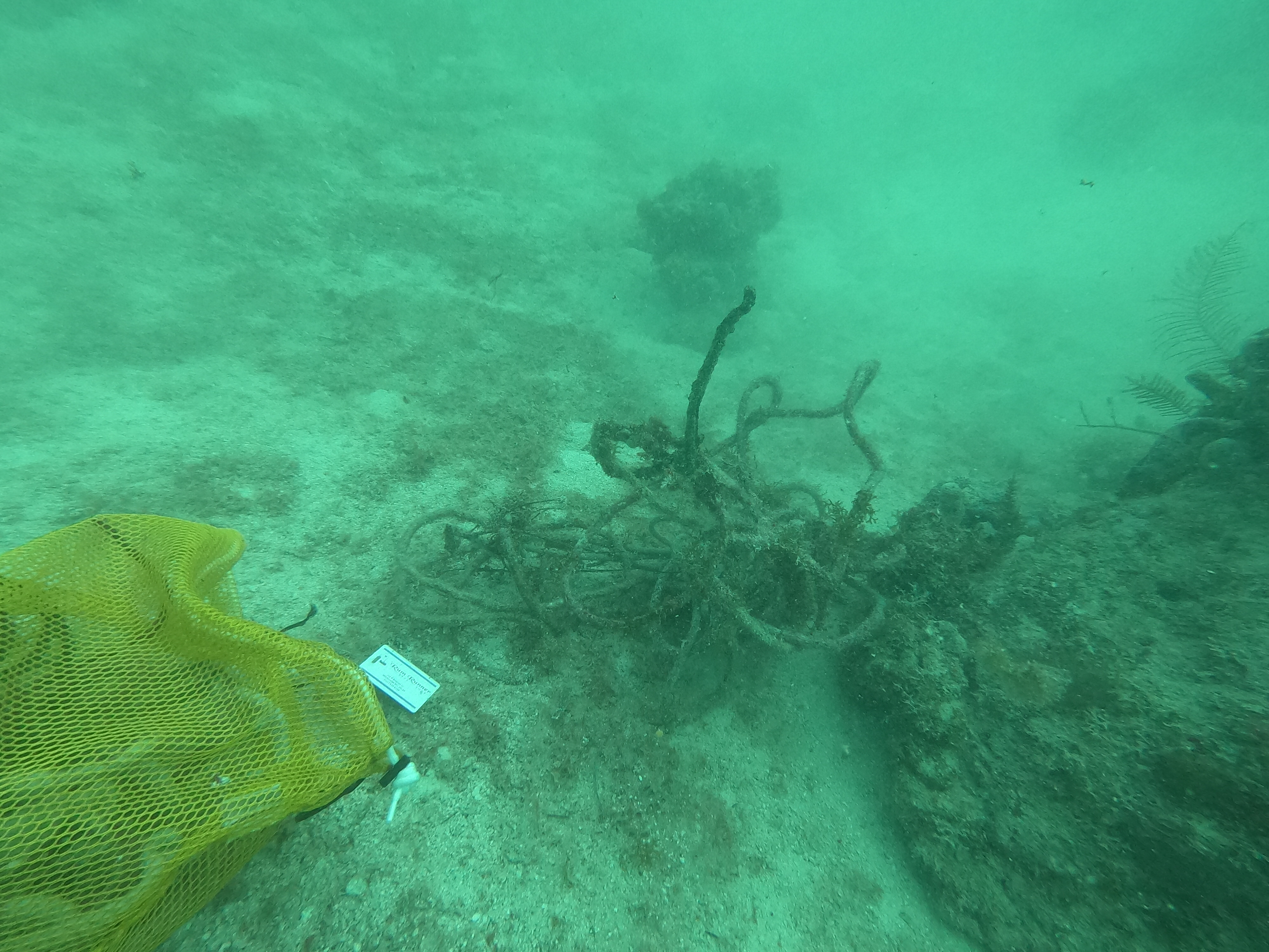
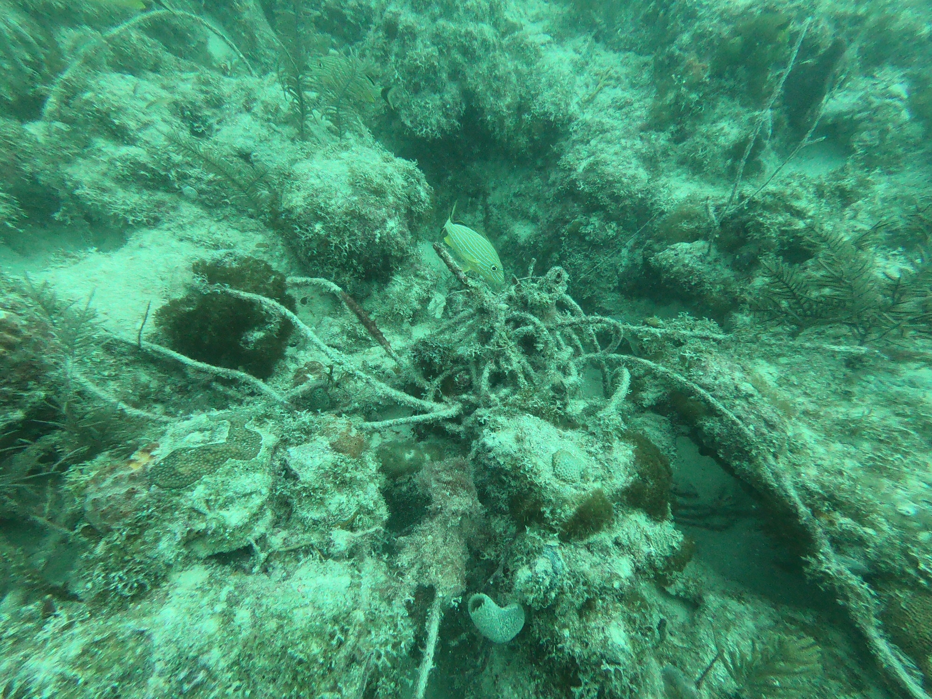
Large fishing net buried in the sand!
anchor line and lobster pot lined wrapped around the reef
Comments and Feedback
There is still more to get picked up from the ledge and we will head back out to get that soon!


