
Dive Against Debris Data Submission
Alligator
18 December, 2018
- Team Leader
- Cortney Benson
- Number of Participants
- 2
- Total Debris Collected
- 500 lbs (estimated)
24.850961, -80.616993
Survey Information
- Location Name
- Alligator
- Organization/Dive Centre
- Key Dives/FKNMS
- City
- Islamorada
- Country
- United States
- Date
- 18 December, 2018
- Survey Duration
- 20 Minutes
- GPS Coordinates
- Latitude: 24.850961
Longitude: -80.616993
- Weather Conditions
-
Windy
- Survey Depth Range
- 30–32 feet
- Area Surveyed
- 20 ft2
- Dominant Substrate
- sand
- Ecosystem
- seagrass
- Wave Conditions
- Smooth (wavelets) for waves 0.1 - 0.5 meter high
Survey Photos
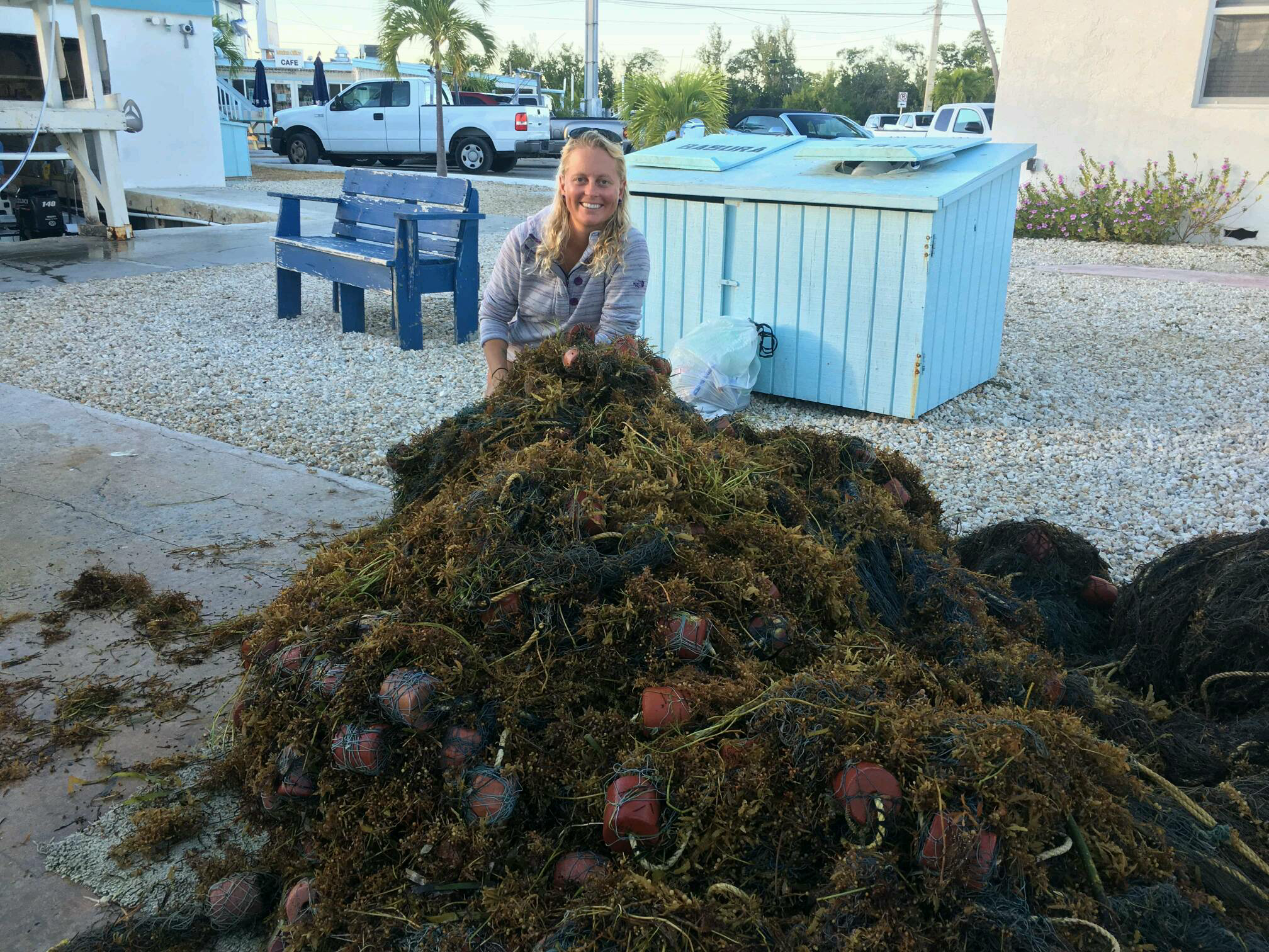
Debris Items Collected
| plastic materials collected | |
|---|---|
| Buoys & Floats (plastic & Foamed) | 30 |
| Fishing: Nets & Pieces Of Nets | 1 |
| metal materials collected | |
|---|---|
| Fishing: Sinkers, Lures, Hooks | 100 |
| Entangled Animals | |
|---|---|
| Other Fish | |
| Species or Common Name | Snapper |
| Number Entangled | 1 |
| Status | dead |
| Type of Debris | Ghost net |
| Comments | The net contained thousands of other fish, crabs etc. That swam out/were thrown back upon removal. |
Additional Information
Commercial fishsing
Ghost net


