
Dive Against Debris Data Submission
ADS10 - Ørneset
5 April, 2021
- Team Leader
- Fredric Ihrsen
- Number of Participants
- 2
- Total Debris Collected
- 6.5 kgs (estimated)
67.225682, 14.616451
Survey Information
- Location Name
- ADS10 - Ørneset
- Organization/Dive Centre
- NORD&NE
- Country
- Norway
- Date
- 5 April, 2021
- Survey Duration
- 51 Minutes
- GPS Coordinates
- Latitude: 67.225682
Longitude: 14.616451
- Weather Conditions
- Survey Depth Range
- 1–28 meters
- Area Surveyed
- 1500 m2
- Dominant Substrate
- rock
- Ecosystem
- kelp
- Wave Conditions
- Smooth (wavelets) for waves 0.1 - 0.5 meter high
Survey Photos
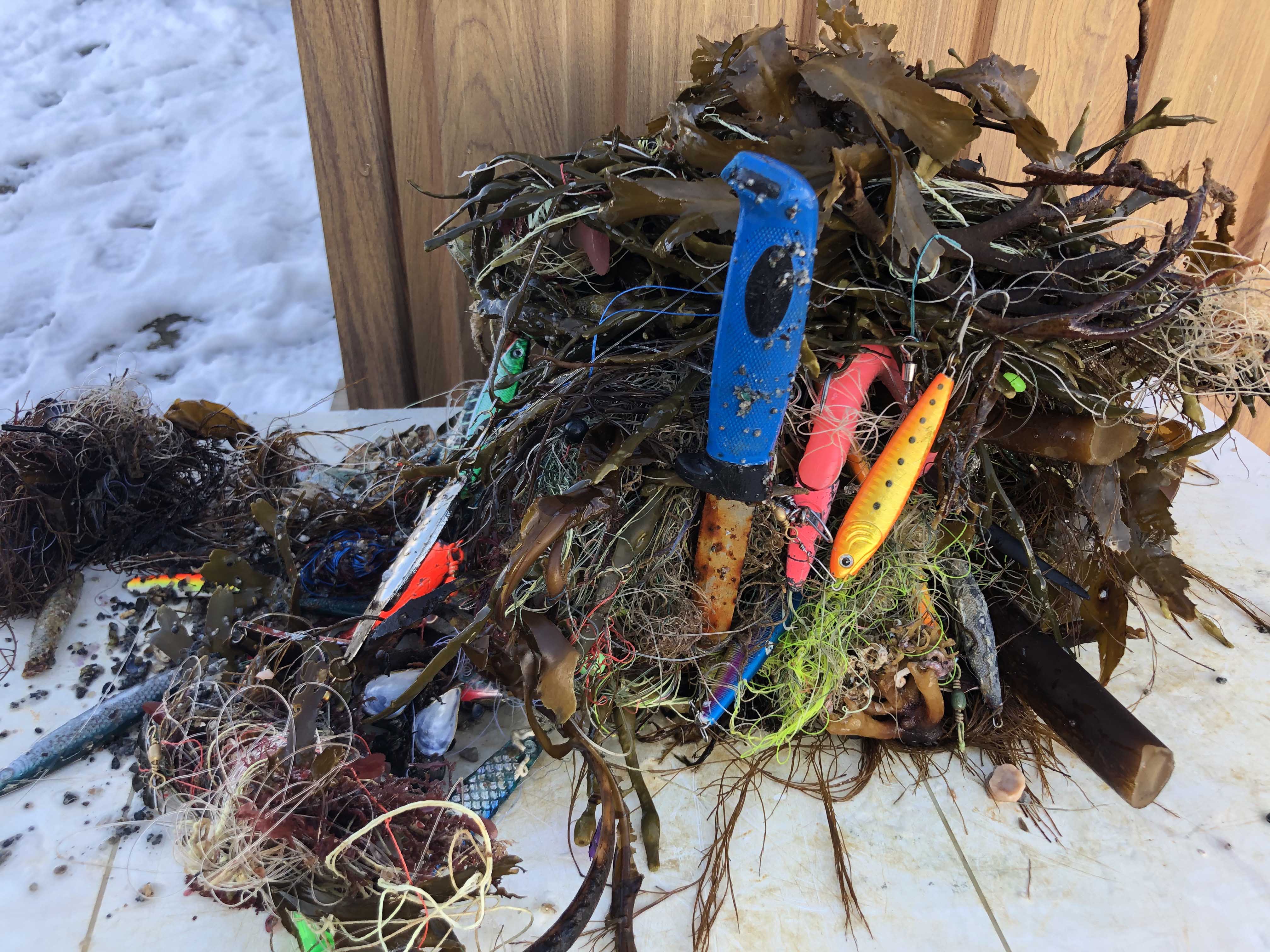
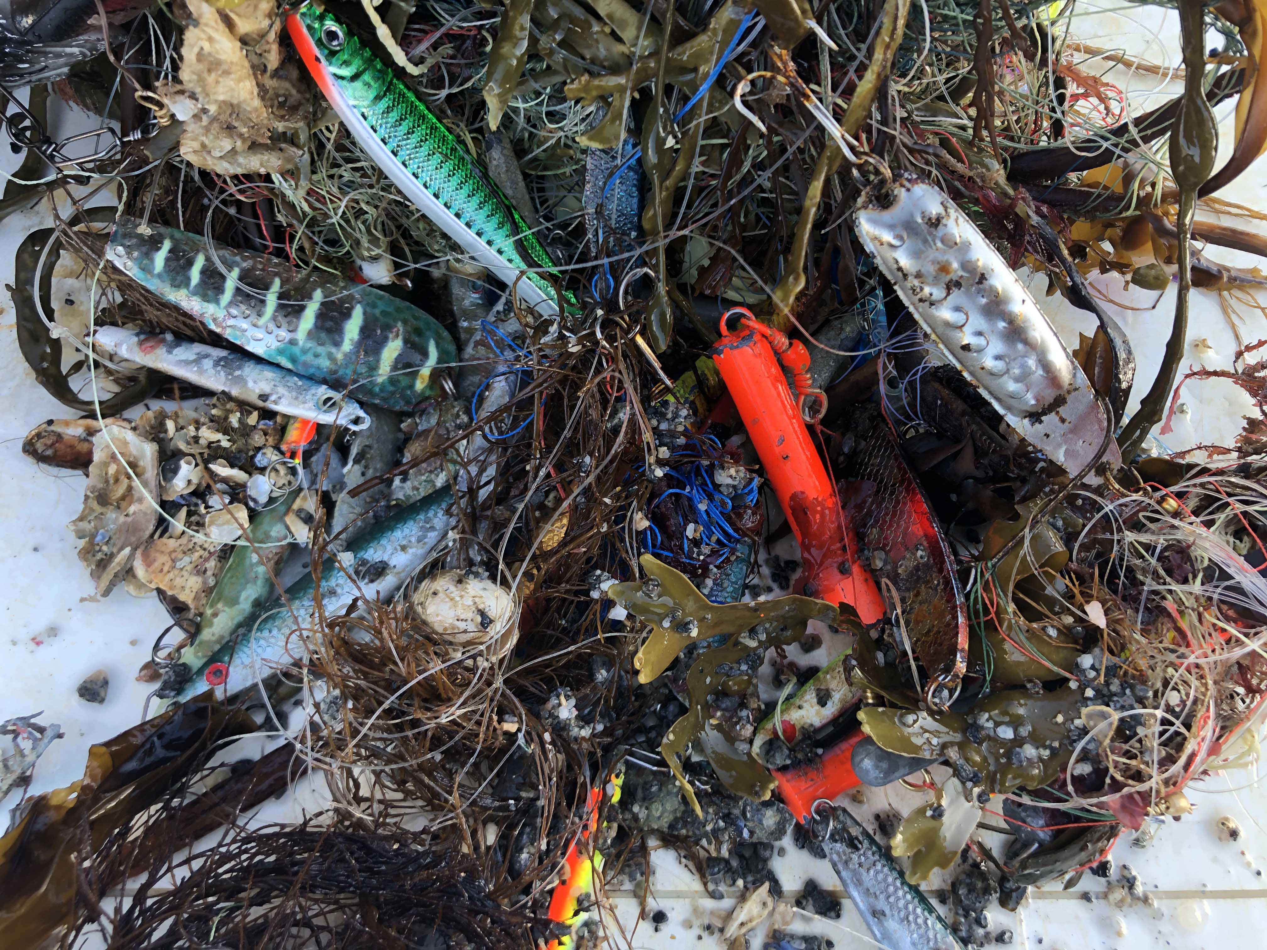
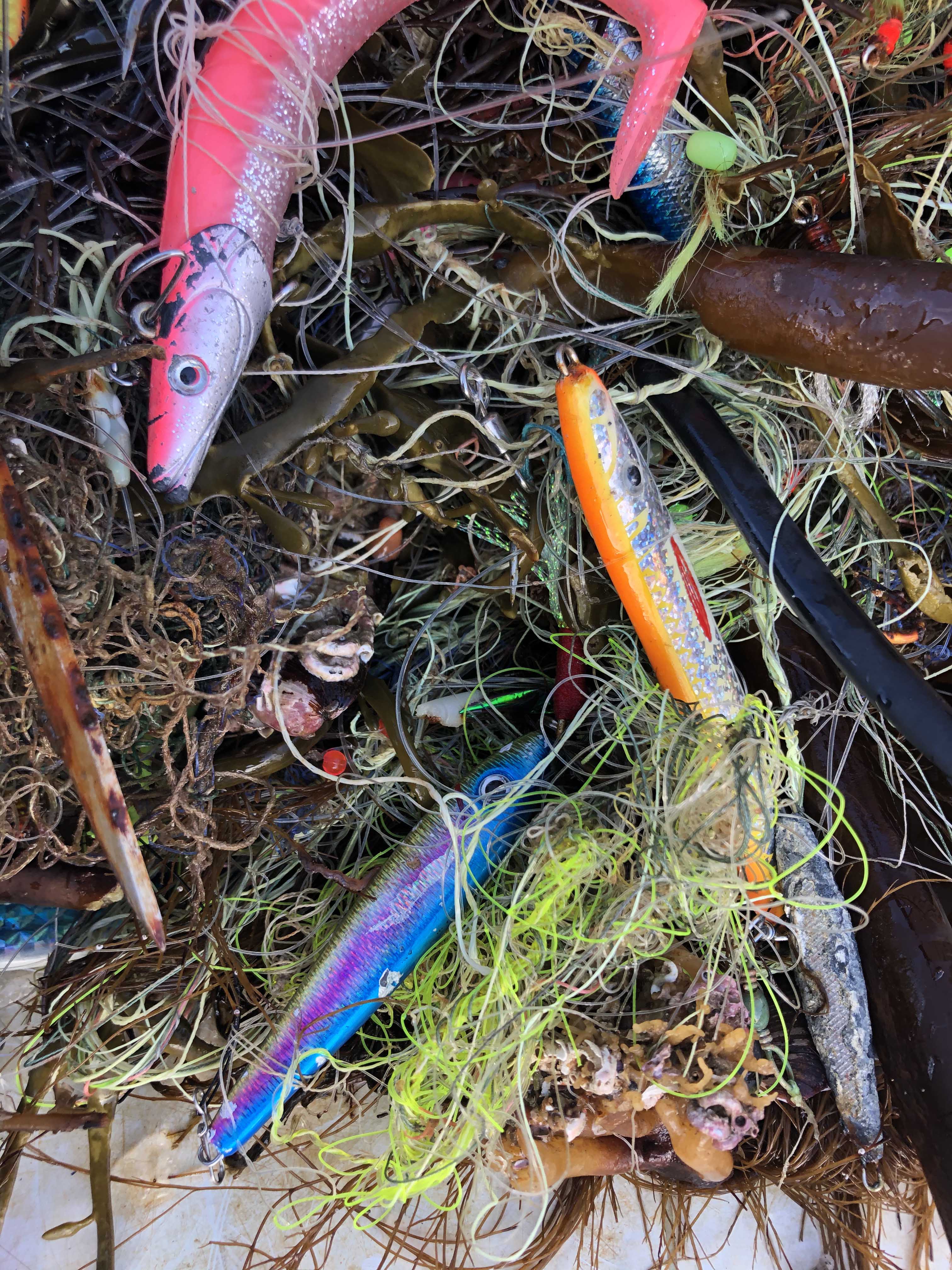
Debris Items Collected
| plastic materials collected | |
|---|---|
| Fishing: Line | 75 |
| Fishing: Lures, Rods/poles | 20 |
| metal materials collected | |
|---|---|
| Forks, Knives, Spoons (cutlery) | 1 |
| Fishing: Sinkers, Lures, Hooks | 50 |


