Cirkewwa Marine Park #386317
0
0
0
3
35.988882646753, 14.327747324839
0
0
0
rock
0
2
0
6
0
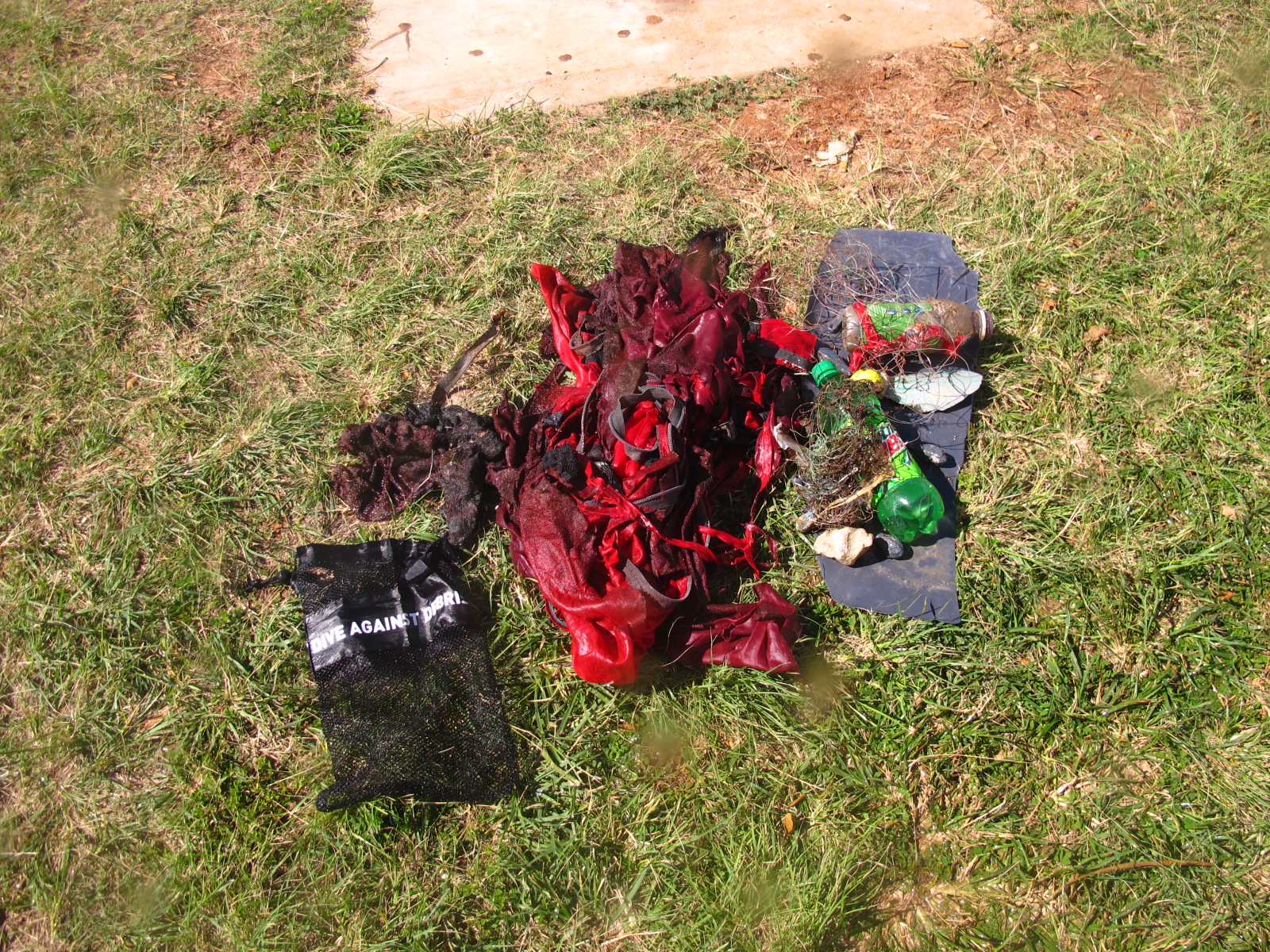
Regular fishing debris brought ashore by stormy weather
This was not an organised collection rather a normal fun dive with a customer
Orange plastic cover from a road works light
Stormy
Orangeshark Dive Centre
Paddy Gilmore
0
0
0
0
0
0
0
0
0
0
0
0
0
0
0
0
0
1
0
1
0
0
0
0
1
0
1
0
1
0
0
0
0
0
0
0
2.00
50
18.00
1.00
0
estimated
0
0
1574.84
0
0
0
0
0
Fishing line with hooks
Trash blown in from overflowing bins
0
On
kilograms
0
I have debris data to report
0
0
0
Smooth (wavelets) for waves 0.1 - 0.5 meter high
0
0
0
Net fragments
Sally Lightfoot Crab
Injured
1
0
0
0
0
m2
0
0
meters
rocky reef
0
0
0
0
0
0
0
0
0
0
0
0
0
0
0
0
0
0
0
0
0
0
0
0
0
0
0
0
0
State\Province
Mellieha
City
Cirkewwa
Map Help
Dive Location
If you know your survey site coordinates, enter them manually in decimal degrees using WGS84 Map Datum. Use the minus sign for latitudes south of the equator and longitudes west of the Prime Meridian to 180 degrees.
If you do not know your survey site coordinates, click the “Map Location” tab to use the map to zoom into your survey site and drop the pin on the map to fall within your survey dive site in the water (not on land or the beach). Ensure you zoom in as much as possible to ensure data accuracy.
Entangled Help