Menu

The Dive Bus Office S20854

5
65
0
0

12.090301, -68.905262

0
0
0
coral
0
0
0
25
0
Lots of rain and flooding
The Dive Bus
Nanne Van Der Heiden
0
2
0
20
0
0
0
0
1
0
0
0
0
0
0
0
0
0
0
12
0
0
0
0
0
0
3
0
0
2
0
0
0
0
0
0
6.50
60
30.00
1.00
0
measured
0
0
0
18
7387.00
0
0
0
0
0
Fish line
Plastic cups
0
On
kilograms
0
I have debris data to report
4
0
0
Smooth (wavelets) for waves 0.1 - 0.5 meter high
0
0
2
0
0
0
0
m2
0
0
meters
coral reef
0
0
0
0
0
0
0
0
0
5
0
0
0
1
0
0
0
4
0
0
0
0
12
0
0
0
0
1
0
Netherlands Antilles
City
Willemstad
Map Help


Dive Location

If you know your survey site coordinates, enter them manually in decimal degrees using WGS84 Map Datum. Use the minus sign for latitudes south of the equator and longitudes west of the Prime Meridian to 180 degrees.

If you do not know your survey site coordinates, click the “Map Location” tab to use the map to zoom into your survey site and drop the pin on the map to fall within your survey dive site in the water (not on land or the beach). Ensure you zoom in as much as possible to ensure data accuracy.

Entangled Help


Use the vertical tabs below to record any entangled animals you found of each type.

Polo Beach north

3
50
2
0

20.689969731215, -156.44710242908

0
0
0
sand
0
0
0
0
0
No
No
No
Rake
Lightly raining
12
Sunglasses
Susan
0
0
0
9
0
0
0
0
10
0
0
0
0
0
0
0
0
1
0
16
0
0
0
0
0
0
3
0
0
0
0
0
4
0
0
0
16.00
45
45.00
40.00
0
estimated
0
0
22990.70
0
0
0
0
0
Sunglasses
Plastic
Cans
0
On
pounds
0
I have debris data to report
1
0
0
Smooth (wavelets) for waves 0.1 - 0.5 meter high
0
0
1
0
5
2
0
m2
0
0
meters
coral reef
0
0
0
0
0
0
0
0
0
0
0
0
0
0
0
0
23
0
0
0
0
0
0
0
0
0
0
0
0
United States
State\Province
Hi
City
Wailea
Map Help


Dive Location

If you know your survey site coordinates, enter them manually in decimal degrees using WGS84 Map Datum. Use the minus sign for latitudes south of the equator and longitudes west of the Prime Meridian to 180 degrees.

If you do not know your survey site coordinates, click the “Map Location” tab to use the map to zoom into your survey site and drop the pin on the map to fall within your survey dive site in the water (not on land or the beach). Ensure you zoom in as much as possible to ensure data accuracy.
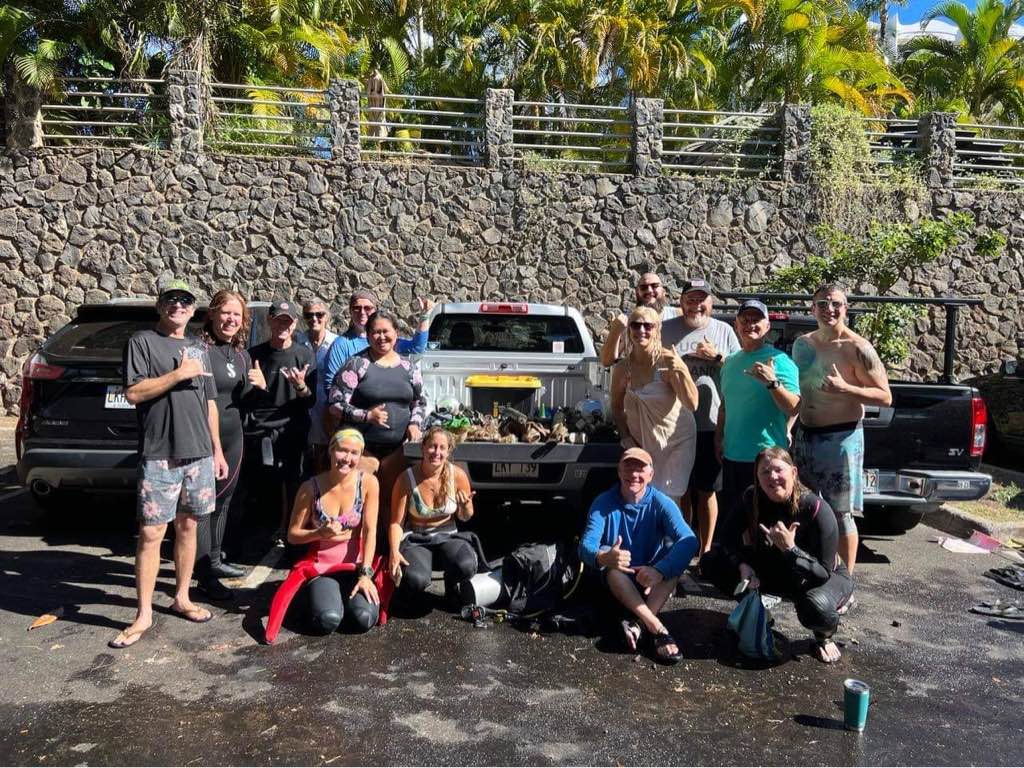
Entangled Help


Use the vertical tabs below to record any entangled animals you found of each type.

Sasamat Lake

13
4
0
0

49.323302, -122.893608

1
0
0
silt
0
1
0
0
0
No
Bathtub
Mixed
1
3
0
1
1
1
3
1
1
1
Lawn chair
Boat paddle
Wood pile
Wood pole
Road sign
Jewelry
Sunglasses
Mesh bag
Bathtub
Anchor
Divers for Cleaner Lakes and Oceans
Henry Wang
0
0
0
8
0
0
0
0
3
0
0
0
0
2
0
0
0
0
0
4
0
0
0
0
0
0
0
0
0
0
0
0
0
0
0
0
271.50
46
53.00
10.00
2
measured
0
0
64936.20
0
0
0
0
0
Beer cans
0
On
pounds
0
I have debris data to report
17
0
0
Calm (glassy to rippled) for waves 0 – 0.1 meter high
0
0
3
0
0
0
0
ft2
0
0
feet
other
8
0
0
0
0
0
0
0
0
8
5
0
0
0
1
2
71
0
0
0
6
0
9
0
0
0
0
2
0
Canada
State\Province
British Columbia
City
Vancouver
Map Help


Dive Location

If you know your survey site coordinates, enter them manually in decimal degrees using WGS84 Map Datum. Use the minus sign for latitudes south of the equator and longitudes west of the Prime Meridian to 180 degrees.

If you do not know your survey site coordinates, click the “Map Location” tab to use the map to zoom into your survey site and drop the pin on the map to fall within your survey dive site in the water (not on land or the beach). Ensure you zoom in as much as possible to ensure data accuracy.

Entangled Help


Use the vertical tabs below to record any entangled animals you found of each type.

Ecosystem Other
Silt

DROC-Canyon

1
2

19.75718, -70.52068

coral
Some wind and waves from the north....
1
Label for cleaning product plastic paper mix
Divecenter Merlin
Christian Harder
2
2
0.08
63
19.00
9.00
estimated
2350.00
On
kilograms
I have debris data to report
Slight for waves 0.5 -1.25 meter high m2
meters
coral reef
Dominican Republic
State\Province
Puerto Plata
City
Sosua
Map Help


Dive Location

If you know your survey site coordinates, enter them manually in decimal degrees using WGS84 Map Datum. Use the minus sign for latitudes south of the equator and longitudes west of the Prime Meridian to 180 degrees.

If you do not know your survey site coordinates, click the “Map Location” tab to use the map to zoom into your survey site and drop the pin on the map to fall within your survey dive site in the water (not on land or the beach). Ensure you zoom in as much as possible to ensure data accuracy.

Entangled Help


Use the vertical tabs below to record any entangled animals you found of each type.

DROC-Los Cabezos

19.75778, -70.51851

rock
Partially sinking of the Coonaco..... Used the Drums to lift it and did lose some of them....
Regular
Divecenter Merlin
Christian Harder
2
126.00
60
6.00
5.00
estimated
600.00
On
kilograms
I have debris data to report
Calm (glassy to rippled) for waves 0 – 0.1 meter high m2
meters
coral reef
7
Dominican Republic
State\Province
Puerto Plata
City
Sosua
Map Help


Dive Location

If you know your survey site coordinates, enter them manually in decimal degrees using WGS84 Map Datum. Use the minus sign for latitudes south of the equator and longitudes west of the Prime Meridian to 180 degrees.

If you do not know your survey site coordinates, click the “Map Location” tab to use the map to zoom into your survey site and drop the pin on the map to fall within your survey dive site in the water (not on land or the beach). Ensure you zoom in as much as possible to ensure data accuracy.

Entangled Help


Use the vertical tabs below to record any entangled animals you found of each type.

La Mer S28906

15
0
3
0

25.222833, 55.253291

0
0
0
sand
0
1
1
1
0
Construction Site
Underwear
Calm
2
4
8
3
2
3
Cutlery
Ppe masks
Sanitary pads
Socks
Swimming Cap
3 pairs of underwear
Chloe Blue Diving Club
Chloe
0
0
0
6
24
0
0
0
0
10
0
0
0
0
0
0
0
2
0
2
0
0
0
0
0
0
3
0
0
0
0
0
0
0
0
0
5.00
57
5.40
1.00
4
estimated
0
0
0
0
1437.40
0
0
2
0
0
Cigarette butts
Sanitary pads
Beer cans
0
On
kilograms
0
I have debris data to report
0
0
0
Smooth (wavelets) for waves 0.1 - 0.5 meter high
0
0
0
0
6
0
0
m2
0
0
meters
rocky reef
0
0
0
0
0
0
0
0
0
0
0
0
0
0
1
0
0
6
0
0
0
0
0
2
0
0
0
0
0
United Arab Emirates
City
Dubai
Map Help


Dive Location

If you know your survey site coordinates, enter them manually in decimal degrees using WGS84 Map Datum. Use the minus sign for latitudes south of the equator and longitudes west of the Prime Meridian to 180 degrees.

If you do not know your survey site coordinates, click the “Map Location” tab to use the map to zoom into your survey site and drop the pin on the map to fall within your survey dive site in the water (not on land or the beach). Ensure you zoom in as much as possible to ensure data accuracy.

Entangled Help


Use the vertical tabs below to record any entangled animals you found of each type.

Osezaki, Shizuoka, Japan

20

35.024955, 138.78715

sand
4
1
2
Sunny
Marine House Lei Aloha, Marine Spot Partner
Yamada Naoyuki
10
1.00
40
11.00
3.00
estimated
4532.00
Diving equipment (snorkel)
Plastic nets
Plastic bags
On
kilograms
I have debris data to report
Calm (glassy to rippled) for waves 0 – 0.1 meter high m2
7
feet
rocky reef
8
2
Japan
City
Numazu
Map Help


Dive Location

If you know your survey site coordinates, enter them manually in decimal degrees using WGS84 Map Datum. Use the minus sign for latitudes south of the equator and longitudes west of the Prime Meridian to 180 degrees.

If you do not know your survey site coordinates, click the “Map Location” tab to use the map to zoom into your survey site and drop the pin on the map to fall within your survey dive site in the water (not on land or the beach). Ensure you zoom in as much as possible to ensure data accuracy.

Entangled Help


Use the vertical tabs below to record any entangled animals you found of each type.

Crystal Bay

15
52
2

-8.715681, 115.457371

coral
8
1
4

-8.7151611, 115.4590565

No
Plastic stool
Cooking pots
Sunny
1
Plastic stool
IOP
Arya
4
1
5
13
5
3
18.10
60
7.60
5.00
1
measured
700.00
1
fishing line
rice bags
plastic fragments
On
kilograms
I have debris data to report
Calm (glassy to rippled) for waves 0 – 0.1 meter high
9
m2
meters
coral reef
7
3
2
Indonesia
Map Help


Dive Location

If you know your survey site coordinates, enter them manually in decimal degrees using WGS84 Map Datum. Use the minus sign for latitudes south of the equator and longitudes west of the Prime Meridian to 180 degrees.

If you do not know your survey site coordinates, click the “Map Location” tab to use the map to zoom into your survey site and drop the pin on the map to fall within your survey dive site in the water (not on land or the beach). Ensure you zoom in as much as possible to ensure data accuracy.

Entangled Help


Use the vertical tabs below to record any entangled animals you found of each type.

Morganey

0
4
0
0

15.733103442385, -96.149664822426

2
0
0
sand
4
0
0
13
0
Deck chair
Fair
Huatulco Dive Center
David-Alexandre Gassin
0
0
0
0
0
0
0
0
0
0
0
0
0
0
0
0
0
0
0
2
0
0
0
0
0
0
0
0
0
0
0
0
0
0
0
0
2.00
54
7.00
3.00
0
estimated
0
0
1026.41
0
0
0
0
0
Fishing line
Mesh bag
Single use plastic
0
On
kilograms
0
I have debris data to report
0
0
0
Slight for waves 0.5 -1.25 meter high
0
0
1
0
4
0
0
m2
0
0
meters
rocky reef
0
0
0
0
0
0
0
0
0
0
0
0
0
0
0
0
0
0
0
0
0
0
0
0
0
0
0
0
0
Mexico
State\Province
Oaxaca
City
Huatulco
Map Help


Dive Location

If you know your survey site coordinates, enter them manually in decimal degrees using WGS84 Map Datum. Use the minus sign for latitudes south of the equator and longitudes west of the Prime Meridian to 180 degrees.

If you do not know your survey site coordinates, click the “Map Location” tab to use the map to zoom into your survey site and drop the pin on the map to fall within your survey dive site in the water (not on land or the beach). Ensure you zoom in as much as possible to ensure data accuracy.

Entangled Help


Use the vertical tabs below to record any entangled animals you found of each type.

ADS323 - Tung Ping Chau

4
6

22.545909, 114.431823

sand
3
2
Sunny with rainy patches
Tursiopsdivers
Eszter
3
3
2
9
3
2.06
35
6.30
1.00
6
measured
91.71
On
kilograms
I have debris data to report
Calm (glassy to rippled) for waves 0 – 0.1 meter high
1
m2
meters
coral reef
2
2
1
1
1
Hong Kong S.A.R., China
City
Tung Ping Chau island
Map Help


Dive Location

If you know your survey site coordinates, enter them manually in decimal degrees using WGS84 Map Datum. Use the minus sign for latitudes south of the equator and longitudes west of the Prime Meridian to 180 degrees.

If you do not know your survey site coordinates, click the “Map Location” tab to use the map to zoom into your survey site and drop the pin on the map to fall within your survey dive site in the water (not on land or the beach). Ensure you zoom in as much as possible to ensure data accuracy.

Entangled Help


Use the vertical tabs below to record any entangled animals you found of each type.

Subscribe to