Menu

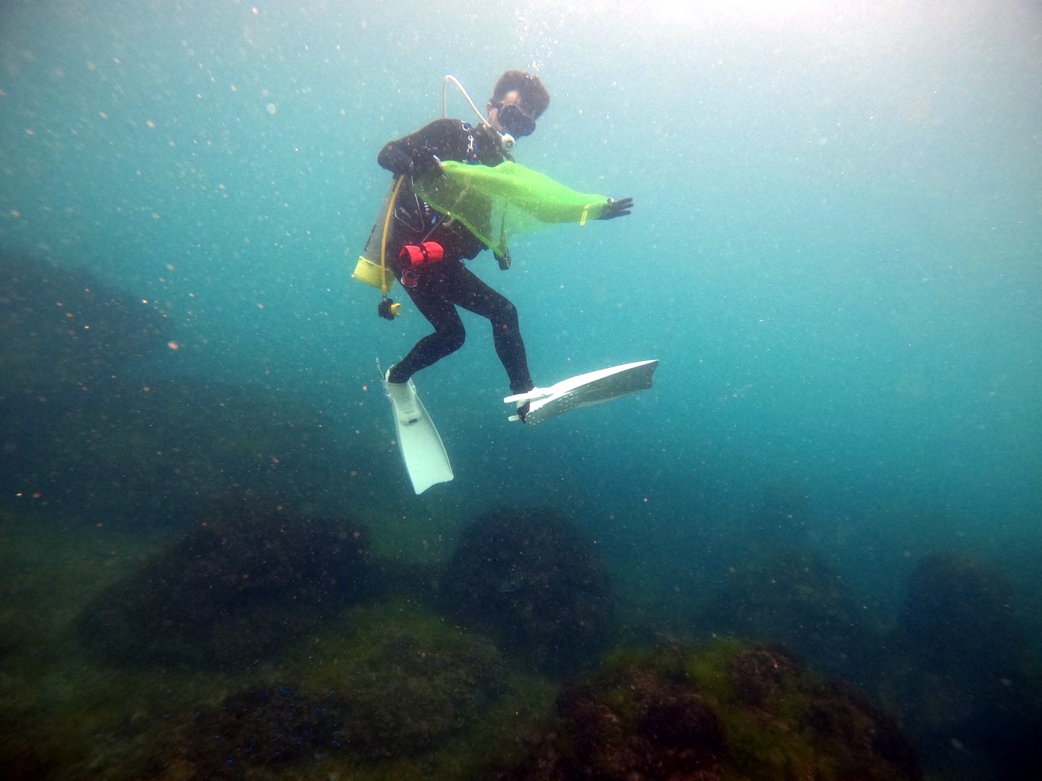
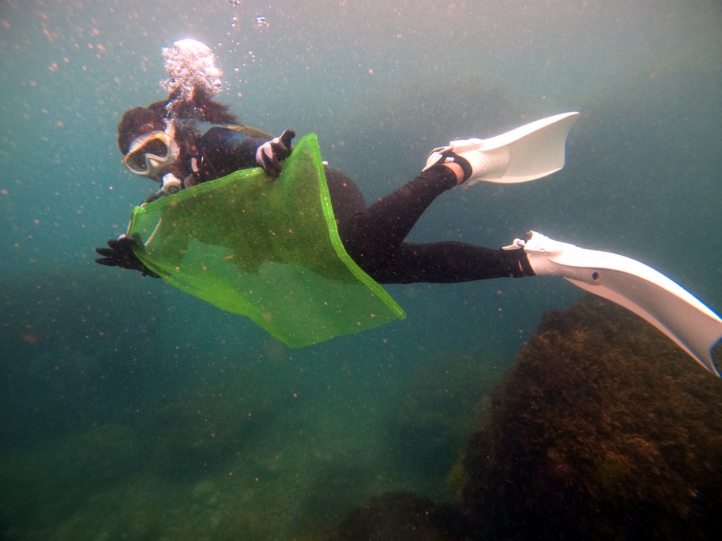
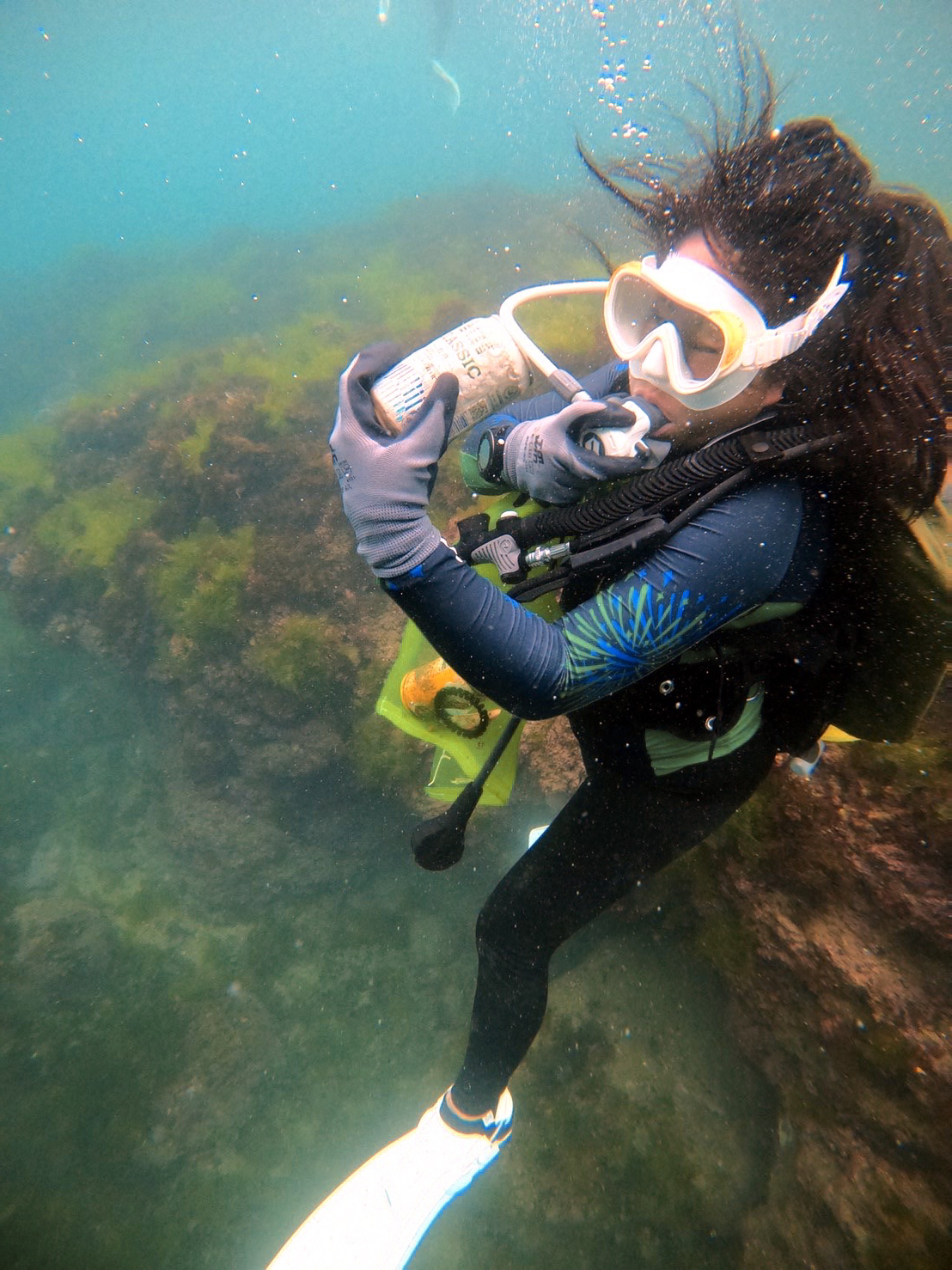
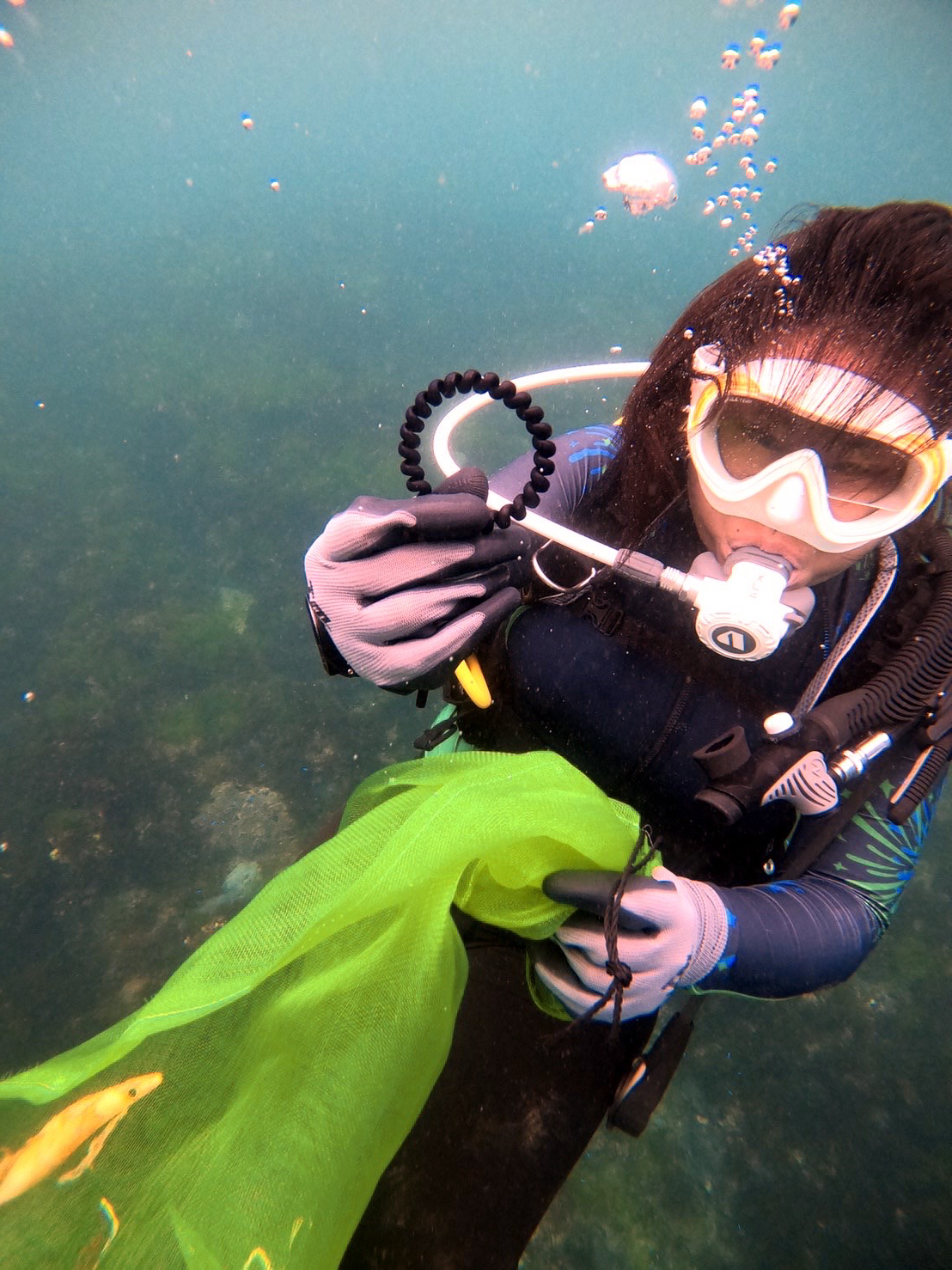
Playas del Coco Bay - Costa Rica

sand

10.559037193768, -85.699653142103

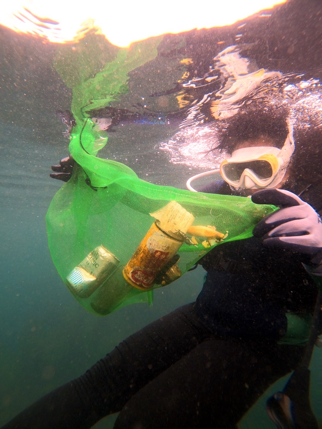
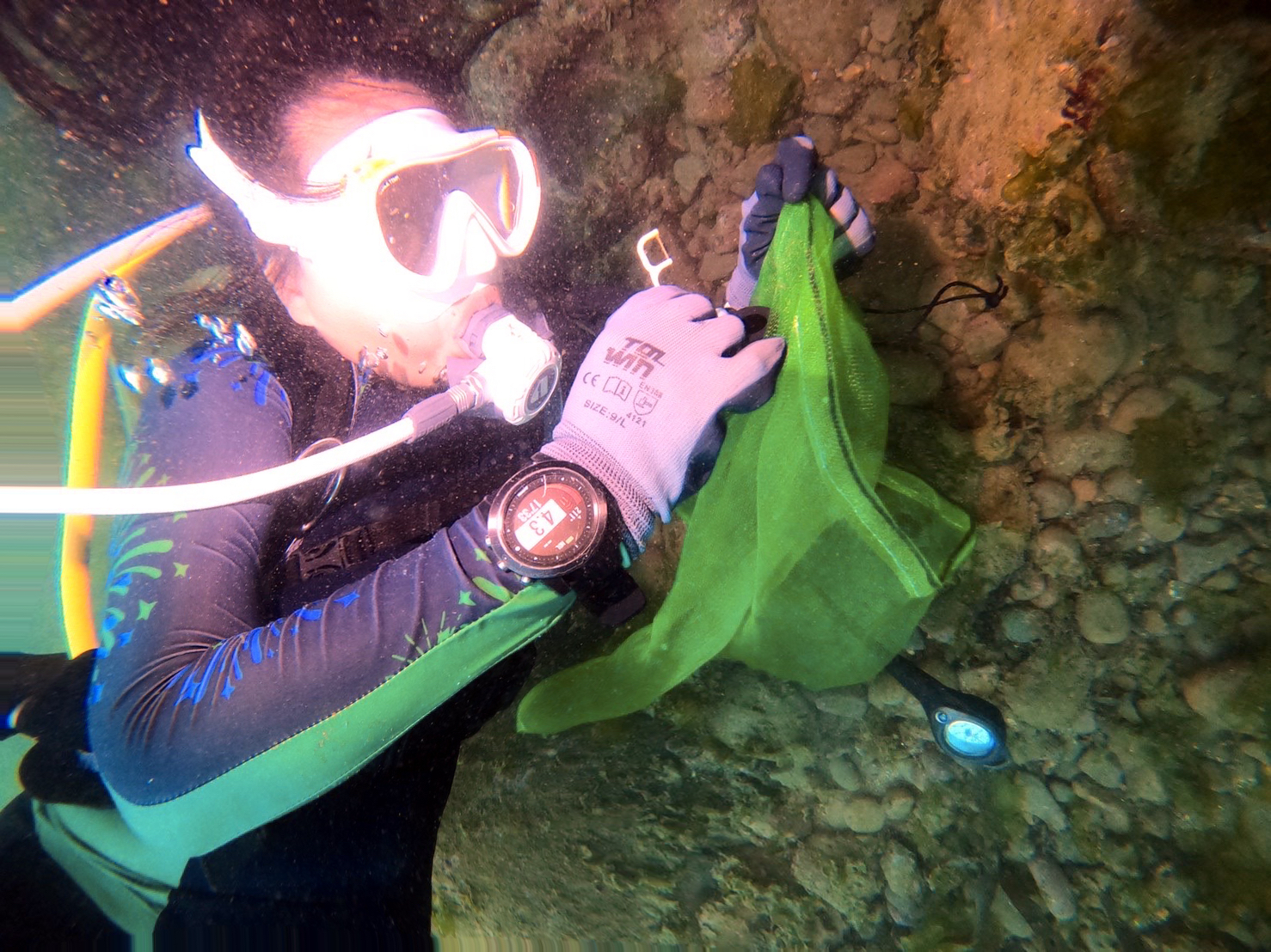
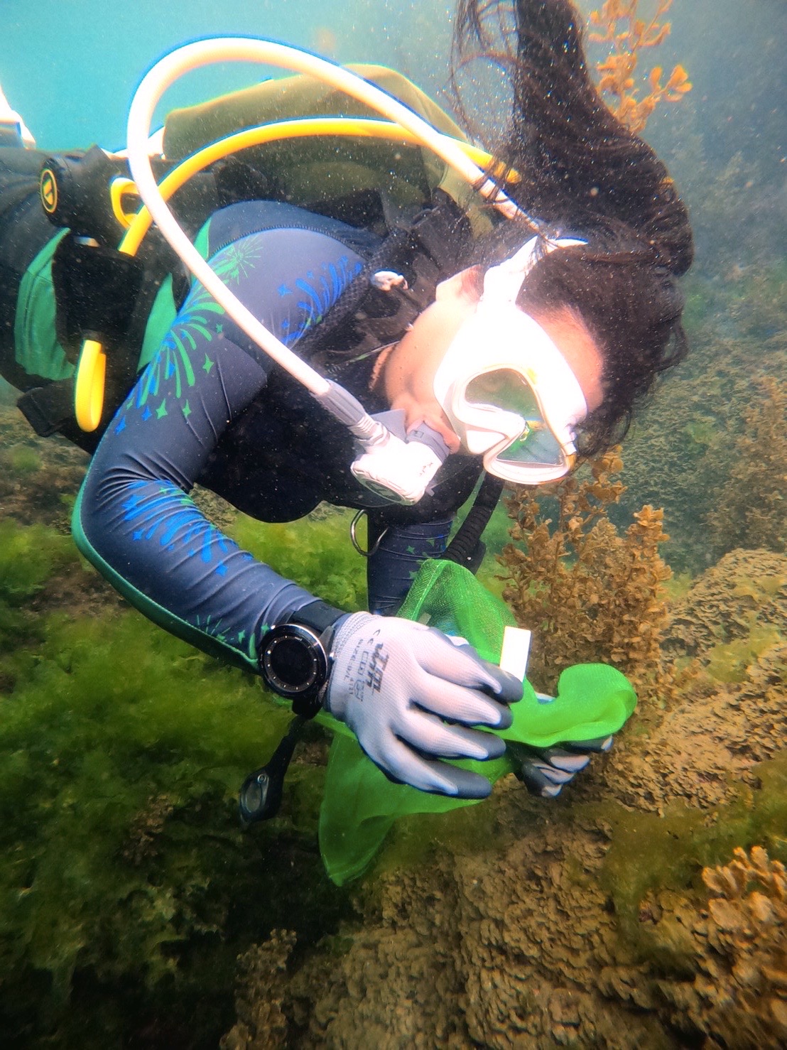
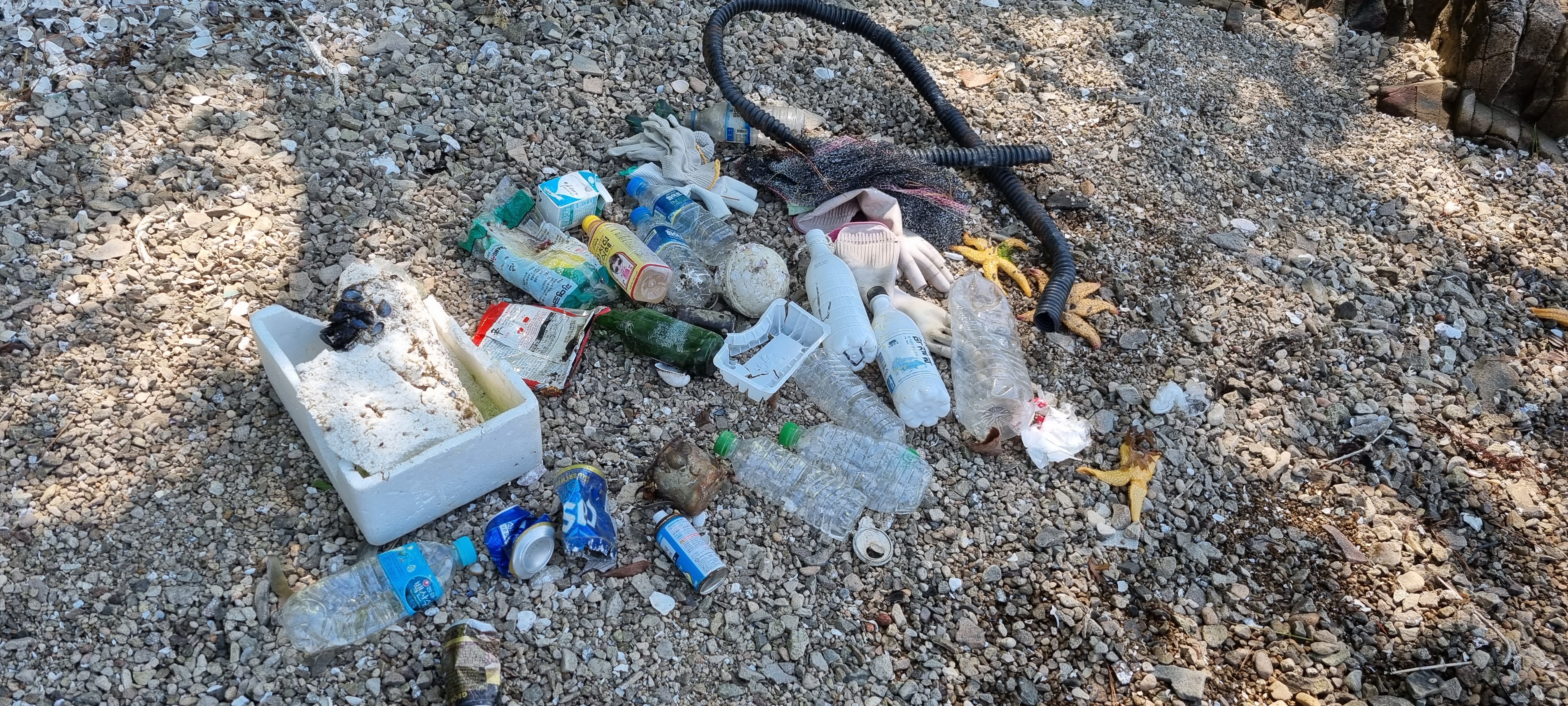
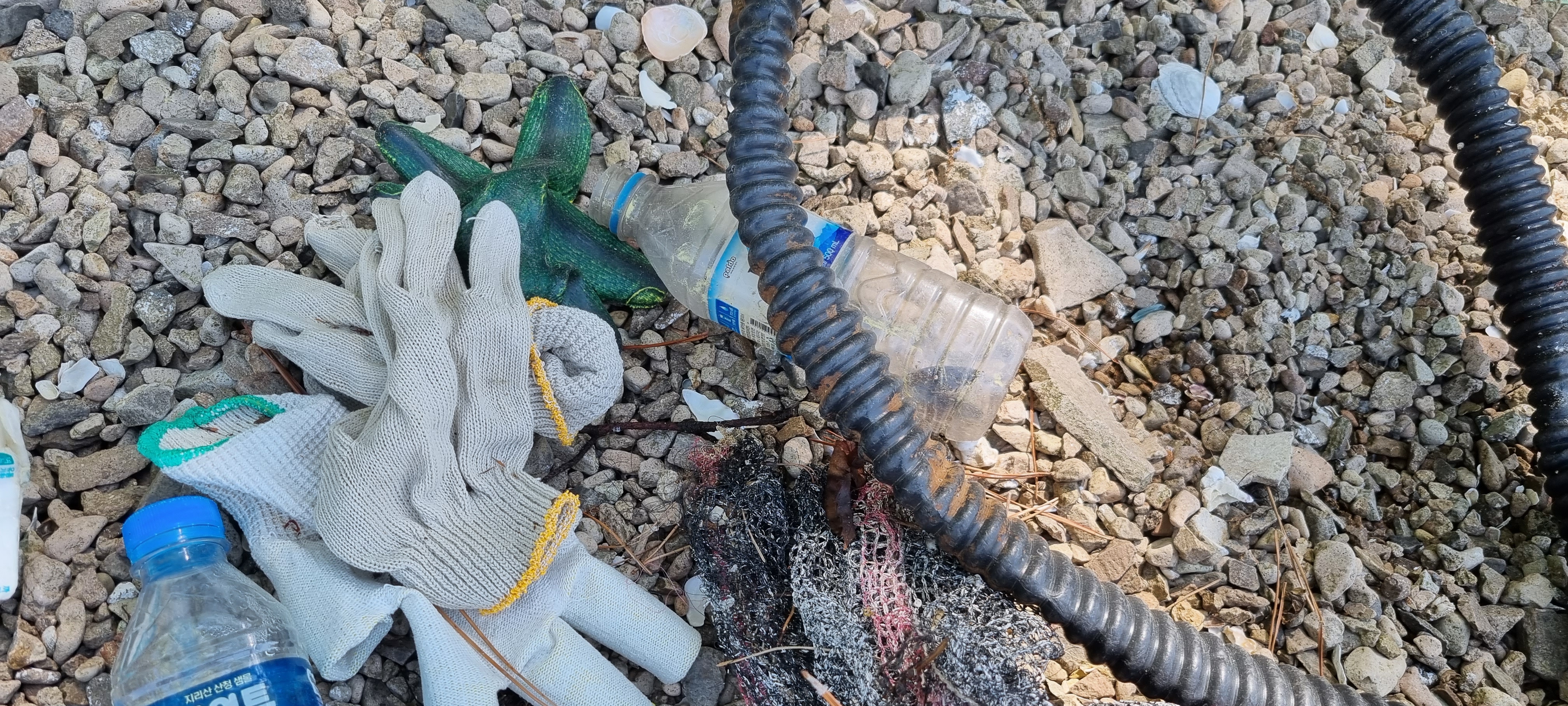
Fisherman and local boat owners throwing thrash in the bay
Sunny with one or two ours of rain every afternoon. Calm conditions not much wind.
Rich Coast Diving
Niels Prinssen
3
12
20.00
120
9.00
7.00
estimated
200.00
On
kilograms
I have debris data to report
15
Calm (glassy to rippled) for waves 0 – 0.1 meter high m2
meters
other
6
Costa Rica
State\Province
Guanacaste
City
Playas del Coco
Map Help


Dive Location

If you know your survey site coordinates, enter them manually in decimal degrees using WGS84 Map Datum. Use the minus sign for latitudes south of the equator and longitudes west of the Prime Meridian to 180 degrees.

If you do not know your survey site coordinates, click the “Map Location” tab to use the map to zoom into your survey site and drop the pin on the map to fall within your survey dive site in the water (not on land or the beach). Ensure you zoom in as much as possible to ensure data accuracy.

Entangled Help


Use the vertical tabs below to record any entangled animals you found of each type.

Ecosystem Other
Sandy bottom flat

Key Largo Dry Rocks: Christ of the Abyss S2061

0
0
0
0

25.12, -80.3

0
0
0
coral
0
0
0
0
0
1
Key
Silent World Dive Center
Matt
0
0
0
0
0
0
0
0
0
0
0
0
0
0
0
0
0
0
0
2
0
0
0
0
0
0
0
0
0
0
0
0
0
0
0
0
0.01
45
25.00
10.00
0
estimated
0
0
12000.00
0
0
0
0
0
0
On
pounds
0
I have debris data to report
0
0
0
Calm (glassy to rippled) for waves 0 – 0.1 meter high
0
0
0
0
0
0
0
ft2
0
0
feet
coral reef
0
0
0
0
0
0
0
0
0
0
0
0
0
0
0
0
0
0
0
0
0
0
0
0
0
0
0
0
0
United States
Map Help


Dive Location

If you know your survey site coordinates, enter them manually in decimal degrees using WGS84 Map Datum. Use the minus sign for latitudes south of the equator and longitudes west of the Prime Meridian to 180 degrees.

If you do not know your survey site coordinates, click the “Map Location” tab to use the map to zoom into your survey site and drop the pin on the map to fall within your survey dive site in the water (not on land or the beach). Ensure you zoom in as much as possible to ensure data accuracy.

Entangled Help


Use the vertical tabs below to record any entangled animals you found of each type.

Temple Reef

0
0
0
0

11.942929, 79.859607

0
0
0
sand
0
0
0
0
0
No
Stuck in the nets
Temple Adventures
Shreya
0
0
0
0
0
0
0
0
0
0
0
0
0
0
0
0
0
0
0
2
0
0
0
0
0
0
0
0
0
0
0
0
0
0
0
0
0.20
59
18.00
16.00
0
measured
0
0
0
1
493.94
0
0
0
0
0
Fishing nets
Metal hooks
0
On
kilograms
0
I have debris data to report
0
0
0
Smooth (wavelets) for waves 0.1 - 0.5 meter high
0
0
0
Dead
Rabbit Fish
1
Nets
0
0
0
0
m2
0
0
meters
other
0
0
0
0
0
0
0
0
0
0
0
0
0
0
0
0
0
0
0
0
0
0
0
0
0
0
0
0
0
India
State\Province
Pondicherry (Puducherry)
City
Puducherry
Map Help


Dive Location

If you know your survey site coordinates, enter them manually in decimal degrees using WGS84 Map Datum. Use the minus sign for latitudes south of the equator and longitudes west of the Prime Meridian to 180 degrees.

If you do not know your survey site coordinates, click the “Map Location” tab to use the map to zoom into your survey site and drop the pin on the map to fall within your survey dive site in the water (not on land or the beach). Ensure you zoom in as much as possible to ensure data accuracy.

Entangled Help


Use the vertical tabs below to record any entangled animals you found of each type.

Plus Dive

rock

25.126318, 121.8321152

TingTing Huang
2
1
1
-2
1.00
50
22.00
222.00
measured
1
5.00
On
kilograms
I have debris data to report
2
Smooth (wavelets) for waves 0.1 - 0.5 meter high m2
meters
rocky reef
-6
Taiwan
Map Help


Dive Location

If you know your survey site coordinates, enter them manually in decimal degrees using WGS84 Map Datum. Use the minus sign for latitudes south of the equator and longitudes west of the Prime Meridian to 180 degrees.

If you do not know your survey site coordinates, click the “Map Location” tab to use the map to zoom into your survey site and drop the pin on the map to fall within your survey dive site in the water (not on land or the beach). Ensure you zoom in as much as possible to ensure data accuracy.

Entangled Help


Use the vertical tabs below to record any entangled animals you found of each type.

Nursery - Netrani Island

gravel

14.018651061447, 74.327405738598

Plastic bottles and snack packets.
Normal wind
Cloudy
No strong currents
The Reef Adventures
Shanthanu S
5
16.00
40
8.00
3.00
measured
11.00
Plastic Bottles
Fishing Nets
Snack packets
On
kilograms
I have debris data to report
Calm (glassy to rippled) for waves 0 – 0.1 meter high m2
meters
rocky reef
India
State\Province
Karnataka
City
Murdeshwar
Map Help


Dive Location

If you know your survey site coordinates, enter them manually in decimal degrees using WGS84 Map Datum. Use the minus sign for latitudes south of the equator and longitudes west of the Prime Meridian to 180 degrees.

If you do not know your survey site coordinates, click the “Map Location” tab to use the map to zoom into your survey site and drop the pin on the map to fall within your survey dive site in the water (not on land or the beach). Ensure you zoom in as much as possible to ensure data accuracy.

Entangled Help


Use the vertical tabs below to record any entangled animals you found of each type.

Plus Dive

rock

25.126325121351, 121.83211326599

sunny
TingTing Huang
2
1
0
1
1
1.00
50
22.00
22.00
measured
1
5.00
On
kilograms
Our Survey Site was free of debris
Smooth (wavelets) for waves 0.1 - 0.5 meter high
1
m2
meters
rocky reef
1
3
1
Taiwan
Map Help


Dive Location

If you know your survey site coordinates, enter them manually in decimal degrees using WGS84 Map Datum. Use the minus sign for latitudes south of the equator and longitudes west of the Prime Meridian to 180 degrees.

If you do not know your survey site coordinates, click the “Map Location” tab to use the map to zoom into your survey site and drop the pin on the map to fall within your survey dive site in the water (not on land or the beach). Ensure you zoom in as much as possible to ensure data accuracy.

Entangled Help


Use the vertical tabs below to record any entangled animals you found of each type.

Bari Reef

3
coral

12.167607355845, -68.287949394036

Comb
Calm; wind building over previous 4 days
Dive Friends Bonaire
Linden Wyatt
1
1
3
2.00
57
66.00
5.00
estimated
90000.00
2
Plastic cup--very common
Pieces of rubber tire
On
pounds
I have debris data to report
Calm (glassy to rippled) for waves 0 – 0.1 meter high ft2
feet
coral reef
Netherlands Antilles
Map Help


Dive Location

If you know your survey site coordinates, enter them manually in decimal degrees using WGS84 Map Datum. Use the minus sign for latitudes south of the equator and longitudes west of the Prime Meridian to 180 degrees.

If you do not know your survey site coordinates, click the “Map Location” tab to use the map to zoom into your survey site and drop the pin on the map to fall within your survey dive site in the water (not on land or the beach). Ensure you zoom in as much as possible to ensure data accuracy.

Entangled Help


Use the vertical tabs below to record any entangled animals you found of each type.

Gusan Beach

35.081427068155, 128.56250870472

5
rock
1

35.081427068155, 128.56250870472

This area is an uninhabited island 10 minutes away by boat from the local area, and you can see a lot of groceries by merchants.
Normar
Ocean Line Dive Center
JONG KOOK, LEE
1
4
6
1
11
1
2.00
44
17.00
3.00
estimated
200.00
On
kilograms
I have debris data to report
1
Calm (glassy to rippled) for waves 0 – 0.1 meter high
5
m2
meters
rocky reef
1
4
South Korea
State\Province
Gyungsangnam-do
City
MASAN
Map Help


Dive Location

If you know your survey site coordinates, enter them manually in decimal degrees using WGS84 Map Datum. Use the minus sign for latitudes south of the equator and longitudes west of the Prime Meridian to 180 degrees.

If you do not know your survey site coordinates, click the “Map Location” tab to use the map to zoom into your survey site and drop the pin on the map to fall within your survey dive site in the water (not on land or the beach). Ensure you zoom in as much as possible to ensure data accuracy.

Entangled Help


Use the vertical tabs below to record any entangled animals you found of each type.

Shibusawa

0
0
0
0

34.72773246989, 138.99777876029

0
0
0
sand
0
2
0
0
0
Fine
Dive Terry’s
Mitsuko
0
0
0
0
0
0
0
0
0
0
0
0
0
0
0
0
0
0
0
4
0
0
0
0
0
0
1
0
0
0
0
0
0
0
0
0
0.50
30
22.00
10.00
0
estimated
0
0
9654.16
0
0
0
0
0
0
On
kilograms
0
I have debris data to report
0
0
0
Smooth (wavelets) for waves 0.1 - 0.5 meter high
0
0
0
0
0
0
0
m2
0
0
meters
rocky reef
0
0
0
0
0
0
0
0
0
0
0
0
0
0
0
0
0
0
0
0
0
0
0
0
0
0
0
0
0
Japan
State\Province
Shizuoka
City
Kawadu
Map Help


Dive Location

If you know your survey site coordinates, enter them manually in decimal degrees using WGS84 Map Datum. Use the minus sign for latitudes south of the equator and longitudes west of the Prime Meridian to 180 degrees.

If you do not know your survey site coordinates, click the “Map Location” tab to use the map to zoom into your survey site and drop the pin on the map to fall within your survey dive site in the water (not on land or the beach). Ensure you zoom in as much as possible to ensure data accuracy.

Entangled Help


Use the vertical tabs below to record any entangled animals you found of each type.

La Perouse

rock

20.5979905, -156.4204539

No
Slight to moderate wind
Scott Treanor
2
4.00
61
47.00
12.00
estimated
12000.00
Visibility was low
On
pounds
I have debris data to report
1
Slight for waves 0.5 -1.25 meter high ft2
1
Heavy duty fishing line
Coral
feet
coral reef
United States
State\Province
HI
City
Kihei
Map Help


Dive Location

If you know your survey site coordinates, enter them manually in decimal degrees using WGS84 Map Datum. Use the minus sign for latitudes south of the equator and longitudes west of the Prime Meridian to 180 degrees.

If you do not know your survey site coordinates, click the “Map Location” tab to use the map to zoom into your survey site and drop the pin on the map to fall within your survey dive site in the water (not on land or the beach). Ensure you zoom in as much as possible to ensure data accuracy.

Entangled Help


Use the vertical tabs below to record any entangled animals you found of each type.

Subscribe to