Menu

Umm Almaradem Island

0
0
0
3

28.676435, 48.656103

0
0
0
sand
0
0
0
0
0
Nautilus Diving Center
Saleh Alsaleh
0
0
0
0
0
0
0
0
3
0
0
0
0
0
0
0
0
0
0
4
0
0
0
0
0
0
0
0
0
0
0
0
0
0
0
0
4.00
50
20.00
5.00
0
estimated
0
0
100.00
0
0
0
0
0
0
On
kilograms
0
I have debris data to report
5
0
0
Smooth (wavelets) for waves 0.1 - 0.5 meter high
0
0
0
Fishing nets
Sea snail
Dead
5
0
0
0
0
m2
0
0
meters
coral reef
0
0
0
0
0
0
0
0
0
0
1
0
0
0
0
0
0
0
0
0
0
0
0
0
0
0
0
0
0
Kuwait
City
Kuwait
Map Help


Dive Location

If you know your survey site coordinates, enter them manually in decimal degrees using WGS84 Map Datum. Use the minus sign for latitudes south of the equator and longitudes west of the Prime Meridian to 180 degrees.

If you do not know your survey site coordinates, click the “Map Location” tab to use the map to zoom into your survey site and drop the pin on the map to fall within your survey dive site in the water (not on land or the beach). Ensure you zoom in as much as possible to ensure data accuracy.

Entangled Help


Use the vertical tabs below to record any entangled animals you found of each type.

Catalina Wall

100
coral
50
10
20

18.368598837157, -68.998886400341

car tires, Barbie doll, flip flops
DANA & IVAN CERNY FOUNDATION
Chloe von Kaenel
1
2
2
-1
12
10
0
19
100
10
40
1
200.00
100
30.00
1.00
15
estimated
400.00
3
On
kilograms
I have debris data to report
29
Calm (glassy to rippled) for waves 0 – 0.1 meter high
10
20
m2
meters
coral reef
4
10
15
19
Dominican Republic
State\Province
ALTAG
City
BAYAHIBE
Map Help


Dive Location

If you know your survey site coordinates, enter them manually in decimal degrees using WGS84 Map Datum. Use the minus sign for latitudes south of the equator and longitudes west of the Prime Meridian to 180 degrees.

If you do not know your survey site coordinates, click the “Map Location” tab to use the map to zoom into your survey site and drop the pin on the map to fall within your survey dive site in the water (not on land or the beach). Ensure you zoom in as much as possible to ensure data accuracy.
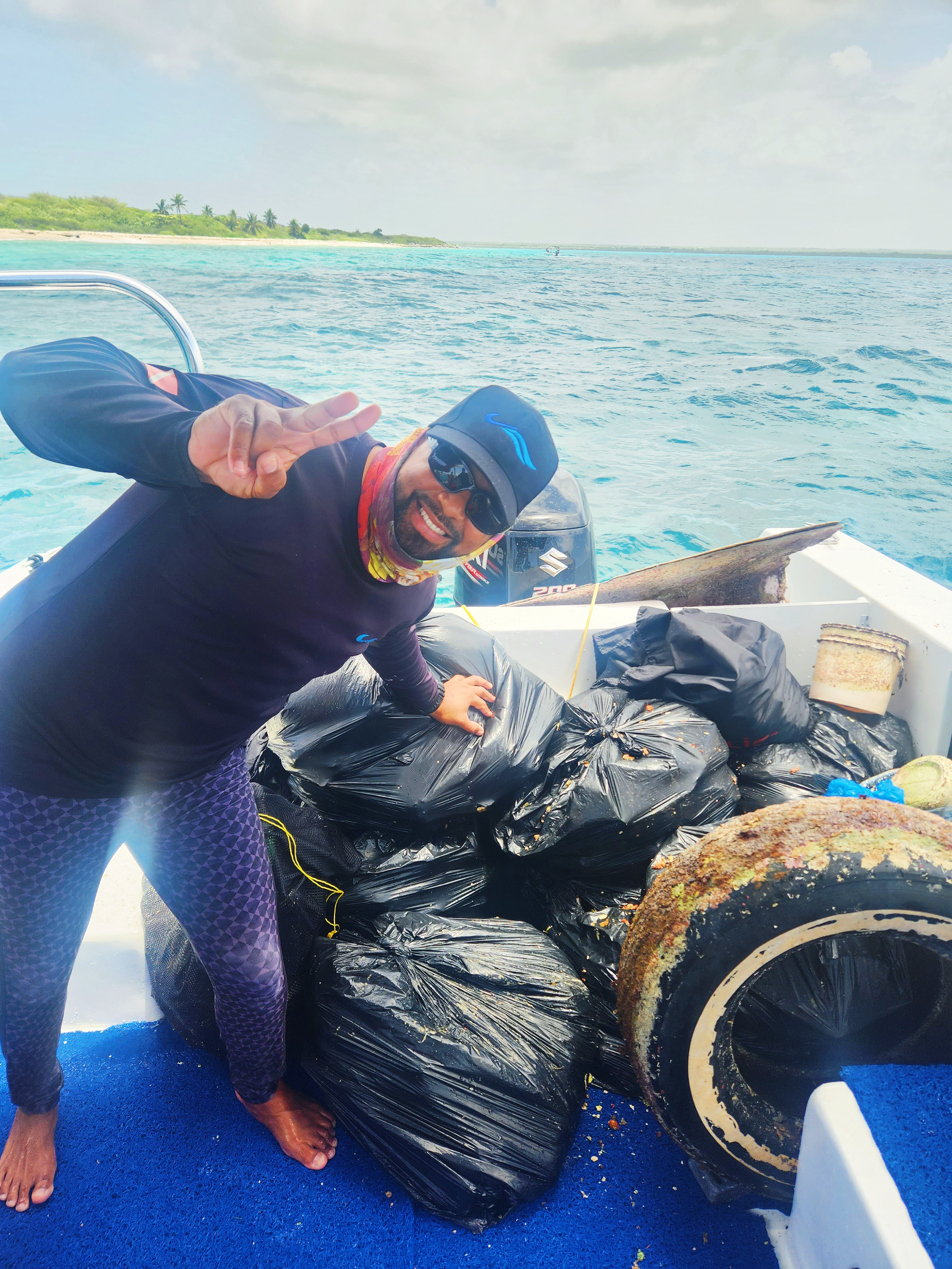
Entangled Help


Use the vertical tabs below to record any entangled animals you found of each type.

Pomonte Wreck

0
0
0
0

42.443732, 10.79119

0
0
0
sand
0
0
0
0
0
These was a lor of current
Yes
The site was Almost completala Clean
Bandaid
Drift
SOTTOLONDA Diving Center
Chiara Ghiggi
0
0
0
0
0
0
0
0
0
0
0
0
0
0
0
0
0
0
0
5
0
0
0
0
0
0
0
0
0
0
0
0
0
0
0
0
0.00
20
12.00
5.00
0
measured
0
0
1760.24
0
0
0
0
0
Plastic
0
On
kilograms
0
Our Survey Site was free of debris
0
0
0
Calm (glassy to rippled) for waves 0 – 0.1 meter high
0
0
0
0
0
0
0
m2
0
0
meters
seagrass
0
0
0
0
0
0
0
0
0
0
0
0
0
0
0
0
0
0
0
0
0
0
0
0
0
0
0
0
0
Italy
State\Province
Livorno
City
Pomonte
Map Help


Dive Location

If you know your survey site coordinates, enter them manually in decimal degrees using WGS84 Map Datum. Use the minus sign for latitudes south of the equator and longitudes west of the Prime Meridian to 180 degrees.

If you do not know your survey site coordinates, click the “Map Location” tab to use the map to zoom into your survey site and drop the pin on the map to fall within your survey dive site in the water (not on land or the beach). Ensure you zoom in as much as possible to ensure data accuracy.
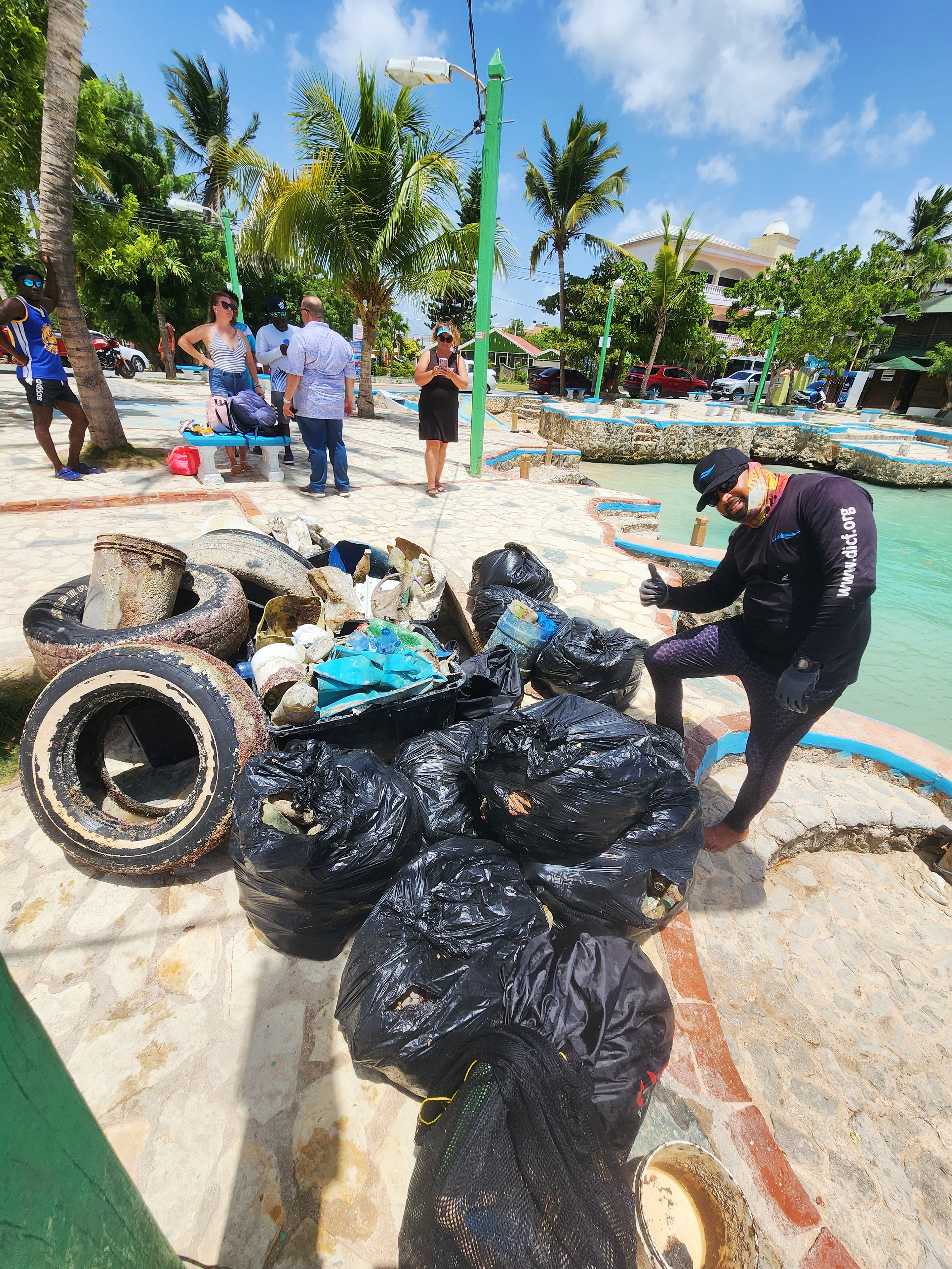
Entangled Help


Use the vertical tabs below to record any entangled animals you found of each type.

Putataua S36044

0
4
0
0

-35.026397807871, 173.91476748645

2
0
1
rock
0
0
0
8
0
Divezone Bay of Islands
DZ
0
0
0
0
0
0
0
0
0
0
0
0
0
2
0
0
0
0
0
6
0
0
0
0
0
0
1
0
2
0
0
0
1
0
0
0
7.00
20
9.00
5.00
0
estimated
0
83
39723.50
0
0
0
0
0
1
On
kilograms
0
I have debris data to report
0
0
0
Smooth (wavelets) for waves 0.1 - 0.5 meter high
0
0
0
0
1
0
0
m2
0
0
meters
rocky reef
1
0
0
0
0
0
0
0
0
2
1
0
0
0
0
0
0
0
0
0
0
0
0
0
0
0
0
0
0
New Zealand
City
Kerikeri
Map Help


Dive Location

If you know your survey site coordinates, enter them manually in decimal degrees using WGS84 Map Datum. Use the minus sign for latitudes south of the equator and longitudes west of the Prime Meridian to 180 degrees.

If you do not know your survey site coordinates, click the “Map Location” tab to use the map to zoom into your survey site and drop the pin on the map to fall within your survey dive site in the water (not on land or the beach). Ensure you zoom in as much as possible to ensure data accuracy.

Entangled Help


Use the vertical tabs below to record any entangled animals you found of each type.

KOGANEZAKI

0
0
0
0

34.843223032956, 138.7637514494

0
0
0
sand
0
0
0
0
0
o ring
o ring
fine
Dive Terry’s
Mitsuko
0
0
0
0
0
0
0
0
1
0
0
0
0
0
0
0
0
0
0
6
0
0
0
0
0
0
0
0
0
0
0
0
0
0
0
0
0.10
35
16.00
5.00
0
estimated
0
0
3539.19
0
0
0
0
0
0
On
kilograms
0
I have debris data to report
0
0
0
Slight for waves 0.5 -1.25 meter high
0
0
0
0
0
0
0
m2
0
0
meters
rocky reef
0
0
0
0
0
0
0
0
0
0
0
0
0
0
0
0
0
0
0
0
0
0
0
0
0
0
0
0
0
Japan
State\Province
Shizuoka
City
nishiizu
Map Help


Dive Location

If you know your survey site coordinates, enter them manually in decimal degrees using WGS84 Map Datum. Use the minus sign for latitudes south of the equator and longitudes west of the Prime Meridian to 180 degrees.

If you do not know your survey site coordinates, click the “Map Location” tab to use the map to zoom into your survey site and drop the pin on the map to fall within your survey dive site in the water (not on land or the beach). Ensure you zoom in as much as possible to ensure data accuracy.

Entangled Help


Use the vertical tabs below to record any entangled animals you found of each type.

Pappa Bear

1

24.823583, -80.6517

coral
10
500ft rope
4
anchor & chain
Amanda Hudon
20
214.00
45
80.00
60.00
30
measured
3000.00
On
pounds
I have debris data to report
1
Calm (glassy to rippled) for waves 0 – 0.1 meter high ft2
feet
coral reef
6
United States
Map Help


Dive Location

If you know your survey site coordinates, enter them manually in decimal degrees using WGS84 Map Datum. Use the minus sign for latitudes south of the equator and longitudes west of the Prime Meridian to 180 degrees.

If you do not know your survey site coordinates, click the “Map Location” tab to use the map to zoom into your survey site and drop the pin on the map to fall within your survey dive site in the water (not on land or the beach). Ensure you zoom in as much as possible to ensure data accuracy.

Entangled Help


Use the vertical tabs below to record any entangled animals you found of each type.

Pappa Bear

24.823583, -80.6517

0
coral
10
650ft line
4
anchor & chain
Key Dives
Amanda Hudon
20
240.00
45
80.00
59.00
29
measured
3000.00
On
pounds
I have debris data to report
1
Calm (glassy to rippled) for waves 0 – 0.1 meter high ft2
feet
coral reef
United States
Map Help


Dive Location

If you know your survey site coordinates, enter them manually in decimal degrees using WGS84 Map Datum. Use the minus sign for latitudes south of the equator and longitudes west of the Prime Meridian to 180 degrees.

If you do not know your survey site coordinates, click the “Map Location” tab to use the map to zoom into your survey site and drop the pin on the map to fall within your survey dive site in the water (not on land or the beach). Ensure you zoom in as much as possible to ensure data accuracy.

Entangled Help


Use the vertical tabs below to record any entangled animals you found of each type.

Scuba Republic House Reef

5
1

-0.442641, 130.753435

sand
1
3
Fair weather with frequent rain showers.
Scuba Republic
Maria Paula Sidaoui
6
1
0.15
79
18.00
5.00
measured
25.00
Fishing Line
General Plastic Waste
On
kilograms
I have debris data to report
Calm (glassy to rippled) for waves 0 – 0.1 meter high m2
meters
coral reef
1
1
Indonesia
City
Waigeo
Map Help


Dive Location

If you know your survey site coordinates, enter them manually in decimal degrees using WGS84 Map Datum. Use the minus sign for latitudes south of the equator and longitudes west of the Prime Meridian to 180 degrees.

If you do not know your survey site coordinates, click the “Map Location” tab to use the map to zoom into your survey site and drop the pin on the map to fall within your survey dive site in the water (not on land or the beach). Ensure you zoom in as much as possible to ensure data accuracy.

Entangled Help


Use the vertical tabs below to record any entangled animals you found of each type.

DIVE AGAINST DEBRIS UTILA

27
3
coral
31
2

16.064559054268, -86.963943714651

no
high heal shoe
a bit of rain one week before
College of Diving
Renata Bonfa
1
18
10
71
8
66.00
39
20.00
7.00
measured
100.00
plastic bottle
wrapper
On
pounds
I have debris data to report
10
Smooth (wavelets) for waves 0.1 - 0.5 meter high
bottle
arrow crab
Released Unharmed
1
m2
2
1
plastic
worm
Released Unharmed
meters
coral reef
18
Honduras
State\Province
bay islands
City
Utila
Map Help


Dive Location

If you know your survey site coordinates, enter them manually in decimal degrees using WGS84 Map Datum. Use the minus sign for latitudes south of the equator and longitudes west of the Prime Meridian to 180 degrees.

If you do not know your survey site coordinates, click the “Map Location” tab to use the map to zoom into your survey site and drop the pin on the map to fall within your survey dive site in the water (not on land or the beach). Ensure you zoom in as much as possible to ensure data accuracy.

Entangled Help


Use the vertical tabs below to record any entangled animals you found of each type.

Coral Garden

0
0
0
0

21.767539577652, 38.832460918539

0
0
0
coral
0
0
0
2
0
Calm
Dive Island
Mohammed Abushal
0
0
0
1
0
0
0
0
0
0
0
0
0
0
0
0
0
0
0
3
0
0
0
0
0
0
0
0
0
0
0
0
0
0
0
0
0.10
60
15.00
6.00
0
estimated
0
4
411.44
0
0
0
0
0
Fishing lines
0
On
kilograms
0
I have debris data to report
0
0
0
Smooth (wavelets) for waves 0.1 - 0.5 meter high
0
0
0
0
0
0
0
m2
0
0
meters
coral reef
0
0
0
0
0
0
0
0
0
0
0
0
0
0
0
0
0
0
0
0
0
0
0
0
0
0
0
0
0
Saudi Arabia
State\Province
Makkah
City
Jeddah
Map Help


Dive Location

If you know your survey site coordinates, enter them manually in decimal degrees using WGS84 Map Datum. Use the minus sign for latitudes south of the equator and longitudes west of the Prime Meridian to 180 degrees.

If you do not know your survey site coordinates, click the “Map Location” tab to use the map to zoom into your survey site and drop the pin on the map to fall within your survey dive site in the water (not on land or the beach). Ensure you zoom in as much as possible to ensure data accuracy.

Entangled Help


Use the vertical tabs below to record any entangled animals you found of each type.

Subscribe to