Koh Sak
sand


 Thailand
25
12.942428769825, 100.79174905083
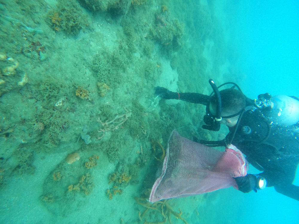
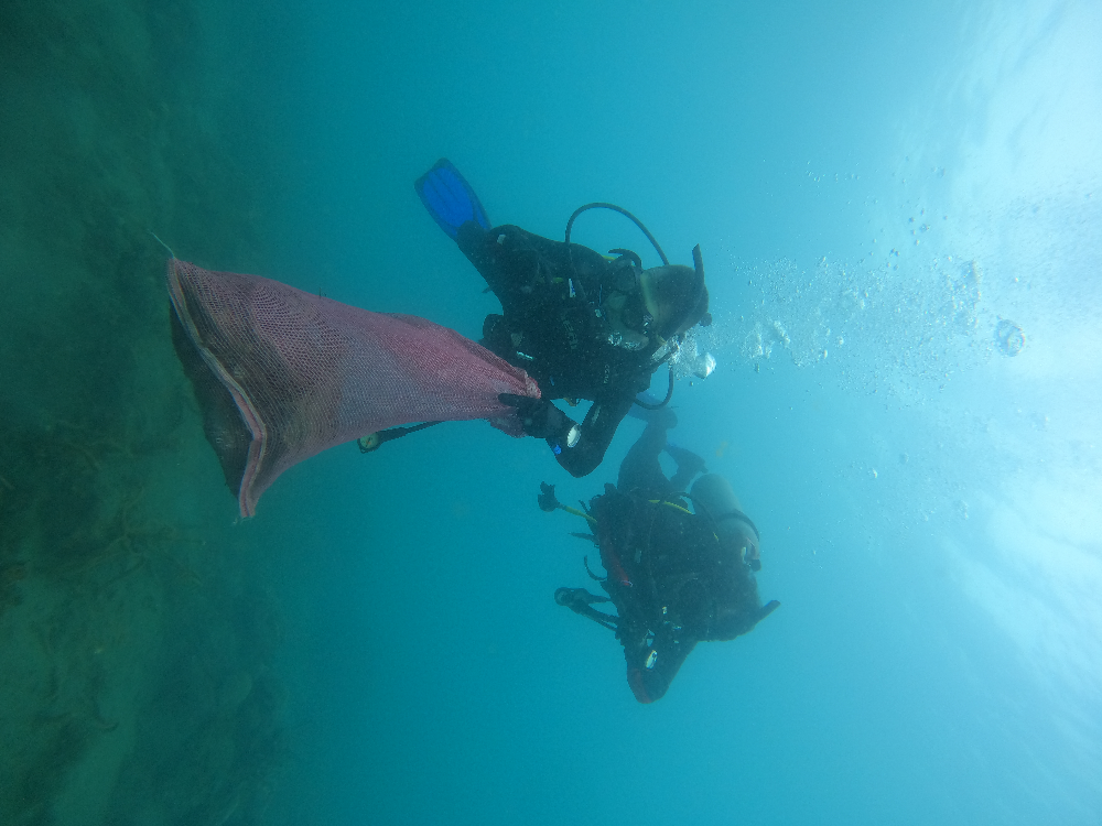
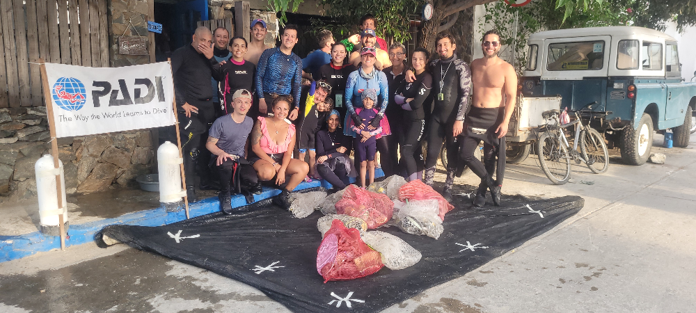
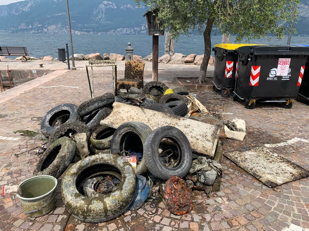
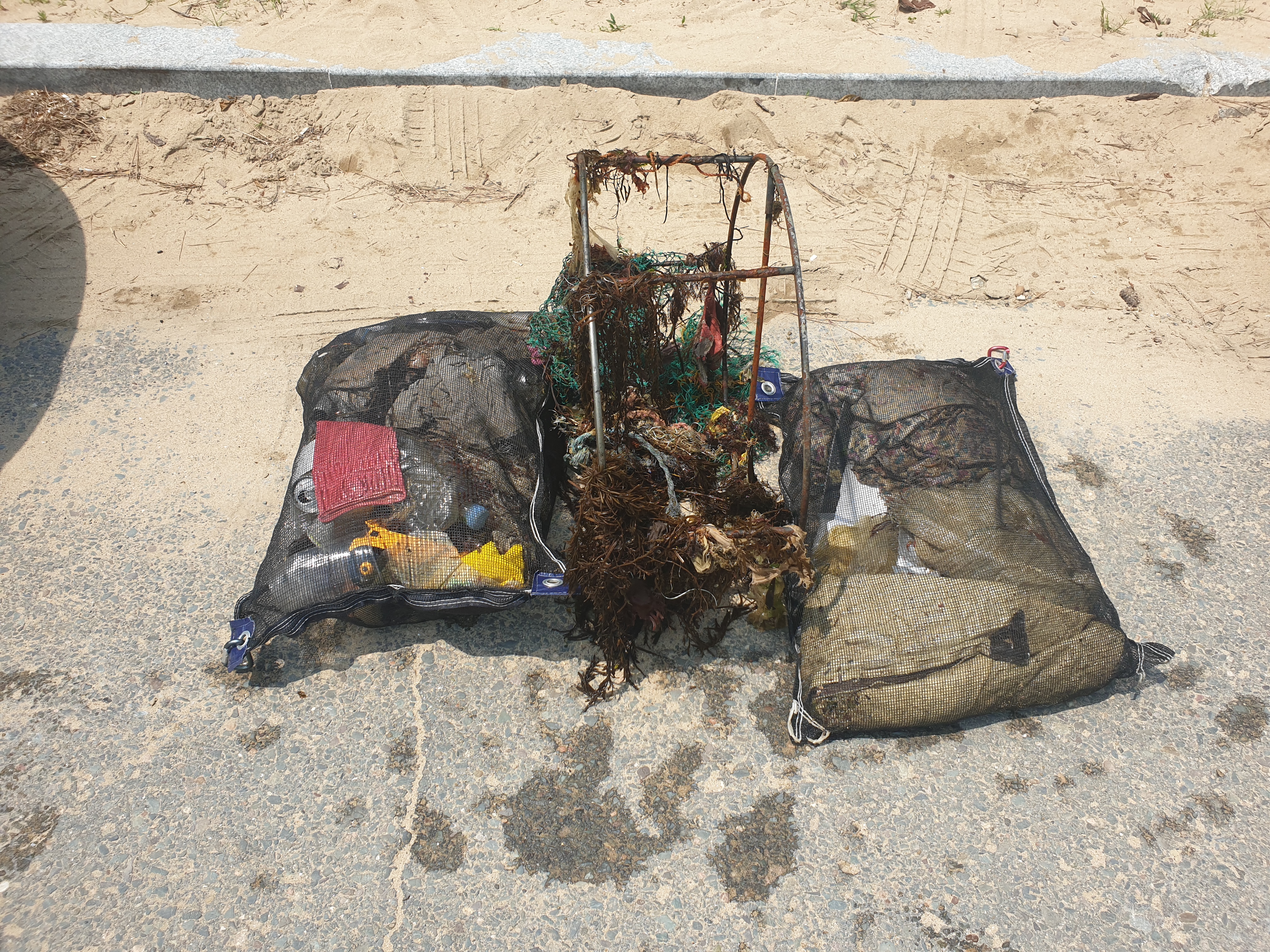
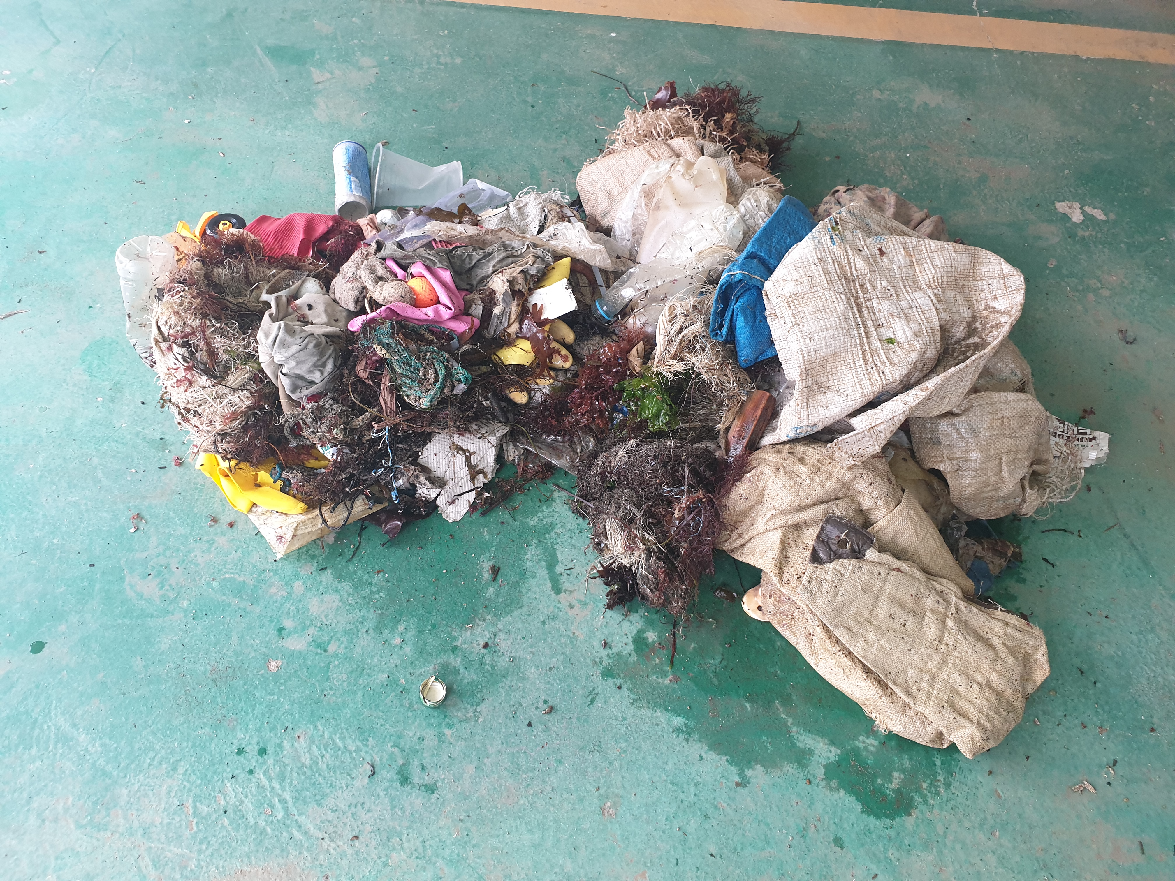
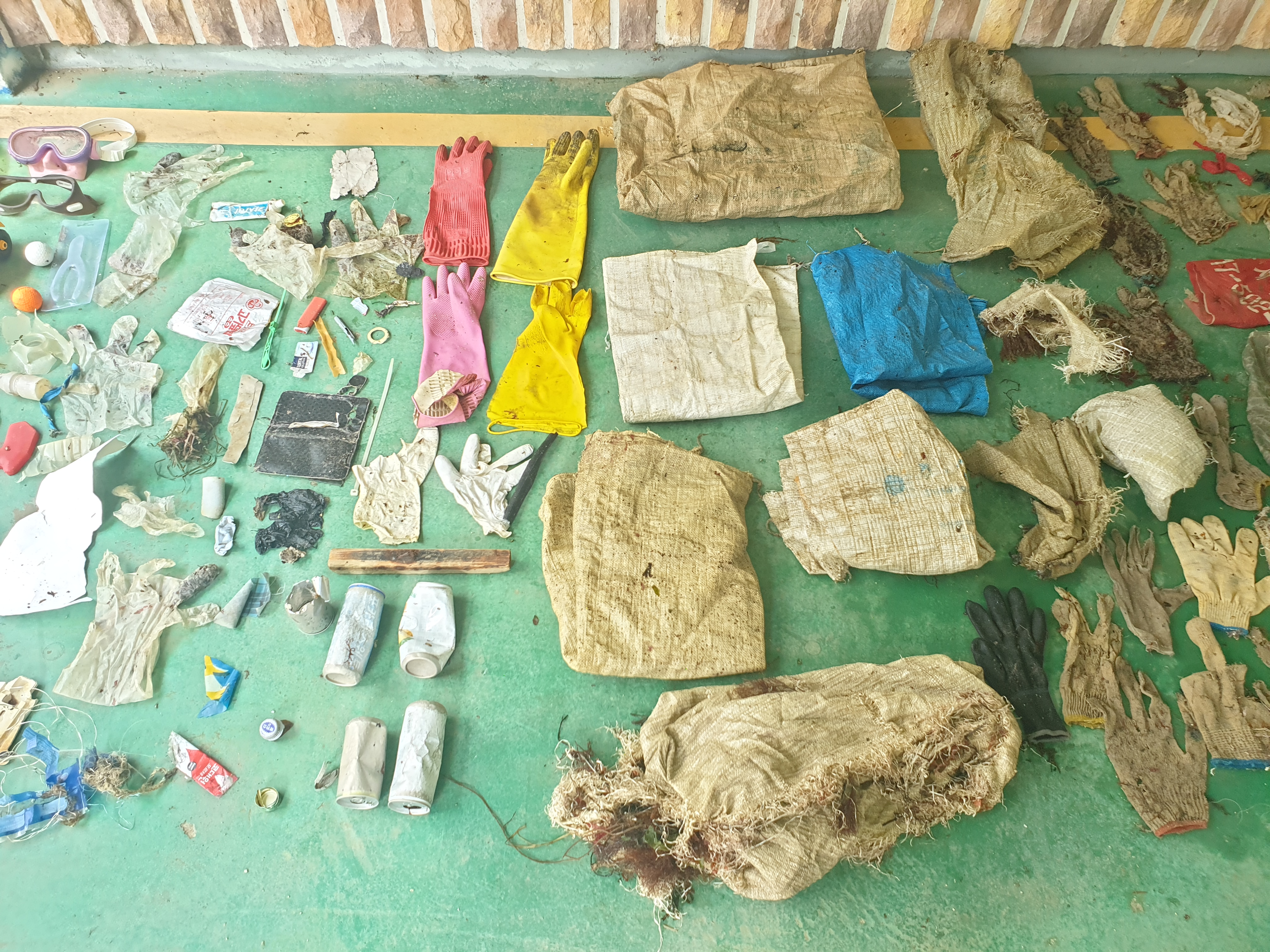
These garbage are come from fisher man boat and sightseeing boat and trash from tourist/resort on the islands.
Orient Blue Dive Center
Kanako Yukinaga
6
10
10
1
50
6
10
30
200.00
50
12.00
3.00
measured
500.00
glass bottle
fishing net
plastic bottles
On
kilograms
I have debris data to report
50
Smooth (wavelets) for waves 0.1 - 0.5 meter high
m2
9
meters
coral reef
5
5
10
5
State\Province
CHONBURI
City
PATTAYA
Map Help
Dive Location
If you know your survey site coordinates, enter them manually in decimal degrees using WGS84 Map Datum. Use the minus sign for latitudes south of the equator and longitudes west of the Prime Meridian to 180 degrees.
If you do not know your survey site coordinates, click the “Map Location” tab to use the map to zoom into your survey site and drop the pin on the map to fall within your survey dive site in the water (not on land or the beach). Ensure you zoom in as much as possible to ensure data accuracy.
Entangled Help
Use the vertical tabs below to record any entangled animals you found of each type.
Ecosystem Other
SAND