Menu

playita

1

18.37299, -68.85307

coral

16.662133118412, -71.510362121743

1
hairnet
slow dive
Anja
1
3
0.01
46
8.90
6.00
estimated
1656.00
On
kilograms
I have debris data to report
Smooth (wavelets) for waves 0.1 - 0.5 meter high m2
meters
coral reef
Dominican Republic
State\Province
la altagracia
City
bayahibe
Map Help


Dive Location

If you know your survey site coordinates, enter them manually in decimal degrees using WGS84 Map Datum. Use the minus sign for latitudes south of the equator and longitudes west of the Prime Meridian to 180 degrees.

If you do not know your survey site coordinates, click the “Map Location” tab to use the map to zoom into your survey site and drop the pin on the map to fall within your survey dive site in the water (not on land or the beach). Ensure you zoom in as much as possible to ensure data accuracy.

Entangled Help


Use the vertical tabs below to record any entangled animals you found of each type.

Magalan

18.36386, -68.841256

coral
1

18.363975112911, -68.841190338135

Slow Dive Casa Chihuahua
Anja
1
4
0.01
71
7.70
3.00
estimated
5043.68
On
kilograms
I have debris data to report
Smooth (wavelets) for waves 0.1 - 0.5 meter high m2
meters
coral reef
Dominican Republic
State\Province
La Altagracia
City
Bayahibe
Map Help


Dive Location

If you know your survey site coordinates, enter them manually in decimal degrees using WGS84 Map Datum. Use the minus sign for latitudes south of the equator and longitudes west of the Prime Meridian to 180 degrees.

If you do not know your survey site coordinates, click the “Map Location” tab to use the map to zoom into your survey site and drop the pin on the map to fall within your survey dive site in the water (not on land or the beach). Ensure you zoom in as much as possible to ensure data accuracy.

Entangled Help


Use the vertical tabs below to record any entangled animals you found of each type.

本部町 給油所下

0
1
0
0

26.631918325537, 127.88531935364

0
0
0
gravel
0
0
0
0
0
森 勇策
0
0
0
0
0
0
0
0
0
0
0
0
0
0
0
0
0
0
0
2
0
0
0
0
0
0
0
0
0
0
0
0
0
0
0
0
0.15
56
16.30
2.00
0
measured
0
0
7147.22
0
0
0
0
0
0
On
kilograms
0
I have debris data to report
0
0
0
Smooth (wavelets) for waves 0.1 - 0.5 meter high
0
0
0
0
0
0
0
m2
0
0
meters
coral reef
0
0
0
0
0
0
0
0
0
0
0
0
0
0
0
0
0
0
0
0
0
0
0
0
1
0
0
0
0
Japan
City
okinawa
Map Help


Dive Location

If you know your survey site coordinates, enter them manually in decimal degrees using WGS84 Map Datum. Use the minus sign for latitudes south of the equator and longitudes west of the Prime Meridian to 180 degrees.

If you do not know your survey site coordinates, click the “Map Location” tab to use the map to zoom into your survey site and drop the pin on the map to fall within your survey dive site in the water (not on land or the beach). Ensure you zoom in as much as possible to ensure data accuracy.
Entangled Help


Use the vertical tabs below to record any entangled animals you found of each type.

Martinusvijver Deinze

50.97873, 3.52822

-2
silt
3

50.97873, 3.52822

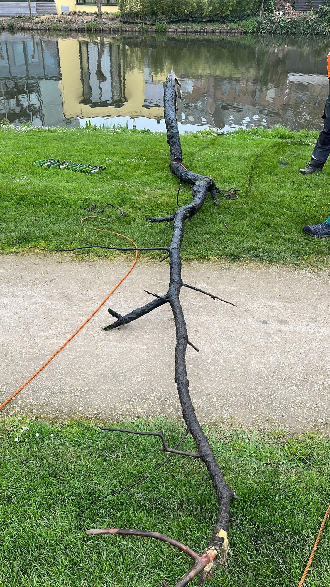
downed trees cause anglers' fishing lines to snag and snap faster.
This is back pernicious for the fish in the pond.
Therefore, at the request of the fishermen, we removed a large tree that was lying underwater after a previous storm.
cold and a lot of rain
6
downed tree
PADI - Bubble and Dive
Mickel Stans
4
0
2
605.00
50
2.00
2.00
estimated
50.00
On
kilograms
I have debris data to report
16
Calm (glassy to rippled) for waves 0 – 0.1 meter high m2
meters
other
Belgium
City
Gentbrugge
Map Help


Dive Location

If you know your survey site coordinates, enter them manually in decimal degrees using WGS84 Map Datum. Use the minus sign for latitudes south of the equator and longitudes west of the Prime Meridian to 180 degrees.

If you do not know your survey site coordinates, click the “Map Location” tab to use the map to zoom into your survey site and drop the pin on the map to fall within your survey dive site in the water (not on land or the beach). Ensure you zoom in as much as possible to ensure data accuracy.
Entangled Help


Use the vertical tabs below to record any entangled animals you found of each type.

Sebastian's Reef

0
0
0
0

12.140590525379, -68.276263170726

0
0
0
sand
0
0
0
0
0
No
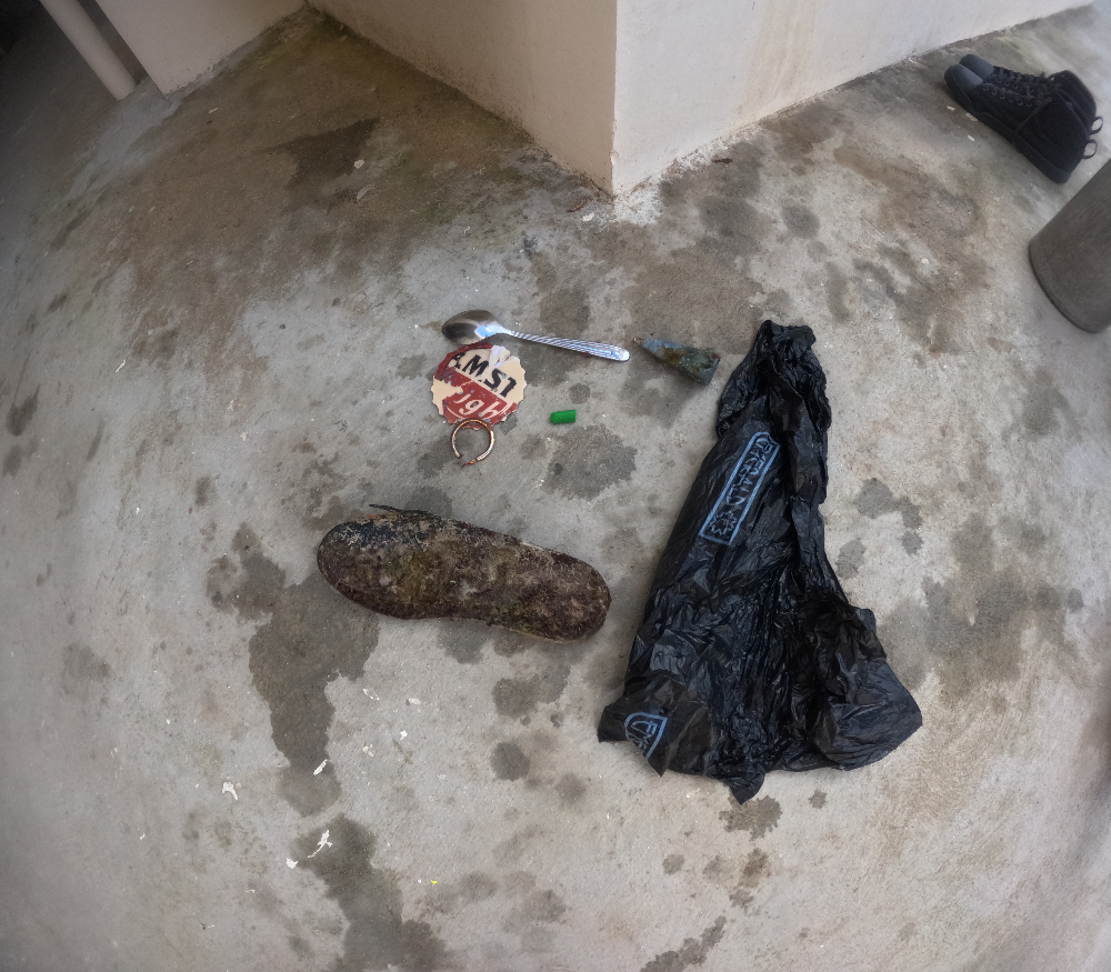
Spoon
Calm
1
Earring
Martijn Klijnstra
Martijn Klijnstra
0
0
0
0
0
0
0
0
0
0
0
0
0
0
0
0
0
0
1
2
0
0
1
0
1
0
0
0
0
0
0
0
0
0
0
0
0.20
20
6.00
1.00
0
estimated
0
0
0
1
47.03
0
0
0
0
0
0
On
kilograms
0
I have debris data to report
0
0
0
Smooth (wavelets) for waves 0.1 - 0.5 meter high
0
0
1
0
0
0
0
m2
0
0
meters
coral reef
1
0
0
0
1
0
0
0
0
0
0
0
0
0
0
0
0
1
0
0
0
0
0
0
0
0
0
0
0
Netherlands Antilles
State\Province
Bonaire
City
Kralendijk
Map Help


Dive Location

If you know your survey site coordinates, enter them manually in decimal degrees using WGS84 Map Datum. Use the minus sign for latitudes south of the equator and longitudes west of the Prime Meridian to 180 degrees.

If you do not know your survey site coordinates, click the “Map Location” tab to use the map to zoom into your survey site and drop the pin on the map to fall within your survey dive site in the water (not on land or the beach). Ensure you zoom in as much as possible to ensure data accuracy.

Entangled Help


Use the vertical tabs below to record any entangled animals you found of each type.

Lake Brantley

0
2
0
0

28.694764, -81.416069

3
0
0
silt
0
3
0
0
0
No
Compound archery bow
Good
1
1
1
1
Christmas tree star topper
Vape pen
Golf club
Compound bow with arrow
Paul Shepherd
0
0
1
3
0
0
0
0
1
3
0
0
0
0
0
0
0
0
0
20
0
0
0
0
0
0
3
0
0
2
0
0
63
0
0
0
58.60
60
19.00
3.00
0
measured
0
0
0
0
12452.80
0
0
0
0
0
Vape pen
Cell phone
0
On
pounds
0
I have debris data to report
13
0
0
Calm (glassy to rippled) for waves 0 – 0.1 meter high
1
0
0
Cans
Crawfish
Released Unharmed
31
0
2
0
0
m2
0
0
meters
seagrass
4
0
0
0
0
0
0
0
0
0
0
0
0
2
0
0
0
103
0
0
0
0
0
0
0
0
0
0
0
United States
State\Province
Florida
City
Longwood
Map Help


Dive Location

If you know your survey site coordinates, enter them manually in decimal degrees using WGS84 Map Datum. Use the minus sign for latitudes south of the equator and longitudes west of the Prime Meridian to 180 degrees.

If you do not know your survey site coordinates, click the “Map Location” tab to use the map to zoom into your survey site and drop the pin on the map to fall within your survey dive site in the water (not on land or the beach). Ensure you zoom in as much as possible to ensure data accuracy.

Entangled Help


Use the vertical tabs below to record any entangled animals you found of each type.

Bio rock Pemuteran

0
0
8
0

-8.136246, 114.649379

0
0
0
sand
0
23
0
0
0
Yes
Shoes
Good weather
Abyss Ocean World
Kadek
0
0
0
27
0
0
0
0
0
0
0
0
0
0
1
0
0
16
0
2
0
0
0
0
0
0
6
0
0
0
0
0
0
0
0
0
2.00
60
12.00
1.00
0
measured
0
0
0
0
5455.00
0
0
0
0
0
Not really much plastics
0
On
kilograms
0
I have debris data to report
0
0
0
Calm (glassy to rippled) for waves 0 – 0.1 meter high
0
0
0
0
0
0
0
m2
0
0
meters
coral reef
0
0
0
0
0
0
0
0
0
0
0
0
0
0
0
0
0
0
0
0
0
0
0
0
0
0
0
0
0
Indonesia
State\Province
Bali
City
Pemuteran
Map Help


Dive Location

If you know your survey site coordinates, enter them manually in decimal degrees using WGS84 Map Datum. Use the minus sign for latitudes south of the equator and longitudes west of the Prime Meridian to 180 degrees.

If you do not know your survey site coordinates, click the “Map Location” tab to use the map to zoom into your survey site and drop the pin on the map to fall within your survey dive site in the water (not on land or the beach). Ensure you zoom in as much as possible to ensure data accuracy.

Entangled Help


Use the vertical tabs below to record any entangled animals you found of each type.

Darwin waterfront Lagoon

0
-7
5
0

-12.468194042665, 130.84757548566

1
1
0
silt
0
15
0
1
1

-12.468194042665, 130.84757548566

Electric scooter
Fine
1
1
1
Shopping trolley
Electric Scooter
Restaurant Chair
Dive Darwin
Todd Hughes
0
1
0
4
-9
0
0
0
0
4
0
0
0
0
1
0
0
3
0
8
0
0
0
0
1
7
0
0
3
2
0
1
0
0
0
102.00
160
9.00
1.00
1
estimated
0
0
0
0
800.00
0
0
0
0
0
plastics
bottles
disposables
0
On
kilograms
0
I have debris data to report
3
0
0
Calm (glassy to rippled) for waves 0 – 0.1 meter high
0
0
2
0
0
0
0
0
m2
0
4
meters
other
0
0
0
0
0
0
0
0
0
0
0
0
0
0
0
0
0
6
0
0
0
0
0
0
0
0
0
0
0
Australia
State\Province
NT
City
Darwin
Map Help


Dive Location

If you know your survey site coordinates, enter them manually in decimal degrees using WGS84 Map Datum. Use the minus sign for latitudes south of the equator and longitudes west of the Prime Meridian to 180 degrees.

If you do not know your survey site coordinates, click the “Map Location” tab to use the map to zoom into your survey site and drop the pin on the map to fall within your survey dive site in the water (not on land or the beach). Ensure you zoom in as much as possible to ensure data accuracy.

Entangled Help


Use the vertical tabs below to record any entangled animals you found of each type.

Ecosystem Other
Mud / Sand Lagoon

Crystal Bay

coral
1

-8.7163932367036, 115.45790227155

1
Plastic Tour Group Bracelet
Ceningan Divers
Casey
2
0.25
55
25.80
10.00
estimated
5000.00
On
kilograms
I have debris data to report
Smooth (wavelets) for waves 0.1 - 0.5 meter high m2
meters
coral reef
Indonesia
Map Help


Dive Location

If you know your survey site coordinates, enter them manually in decimal degrees using WGS84 Map Datum. Use the minus sign for latitudes south of the equator and longitudes west of the Prime Meridian to 180 degrees.

If you do not know your survey site coordinates, click the “Map Location” tab to use the map to zoom into your survey site and drop the pin on the map to fall within your survey dive site in the water (not on land or the beach). Ensure you zoom in as much as possible to ensure data accuracy.

Entangled Help


Use the vertical tabs below to record any entangled animals you found of each type.

Toyapakeh

1
coral

-8.68433461372, 115.48056536523

Ceningan Divers
Casey
2
0.50
54
22.20
5.00
estimated
10000.00
On
kilograms
I have debris data to report
Slight for waves 0.5 -1.25 meter high
2
m2
meters
coral reef
Indonesia
Map Help


Dive Location

If you know your survey site coordinates, enter them manually in decimal degrees using WGS84 Map Datum. Use the minus sign for latitudes south of the equator and longitudes west of the Prime Meridian to 180 degrees.

If you do not know your survey site coordinates, click the “Map Location” tab to use the map to zoom into your survey site and drop the pin on the map to fall within your survey dive site in the water (not on land or the beach). Ensure you zoom in as much as possible to ensure data accuracy.

Entangled Help


Use the vertical tabs below to record any entangled animals you found of each type.

Subscribe to