Menu

Motosuko

0
0
0
0

35.463600506395, 138.60149402332

0
0
0
sand
0
0
0
0
0
None
Yes
None
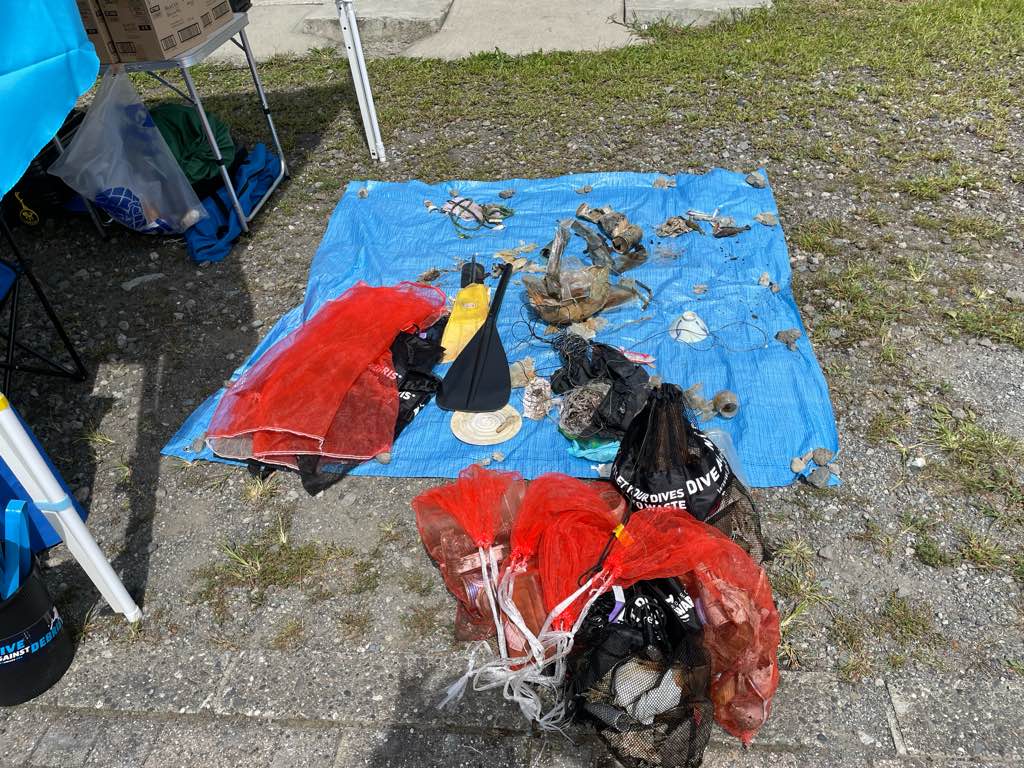
Cans
Sunny
PAPJ
0
0
0
0
0
0
0
0
0
0
0
0
0
0
0
0
0
0
0
99
0
0
0
0
0
0
0
0
0
0
0
0
0
0
0
0
0.00
40
15.00
5.00
0
measured
0
0
50.00
0
0
0
0
0
Cans
Fishing lure
Bottles
0
On
kilograms
0
Our Survey Site was free of debris
0
0
0
Calm (glassy to rippled) for waves 0 – 0.1 meter high
0
0
0
0
0
0
0
m2
0
0
meters
rocky reef
0
0
0
0
0
0
0
0
0
0
0
0
0
0
0
0
0
0
0
0
0
0
0
0
0
0
0
0
0
Japan
State\Province
Yamanashi
City
Motosucho
Map Help


Dive Location

If you know your survey site coordinates, enter them manually in decimal degrees using WGS84 Map Datum. Use the minus sign for latitudes south of the equator and longitudes west of the Prime Meridian to 180 degrees.

If you do not know your survey site coordinates, click the “Map Location” tab to use the map to zoom into your survey site and drop the pin on the map to fall within your survey dive site in the water (not on land or the beach). Ensure you zoom in as much as possible to ensure data accuracy.

Entangled Help


Use the vertical tabs below to record any entangled animals you found of each type.

Ft Wetheril

0
0
1
0

41.47847, -71.362163

0
0
0
sand
0
0
0
0
0
No
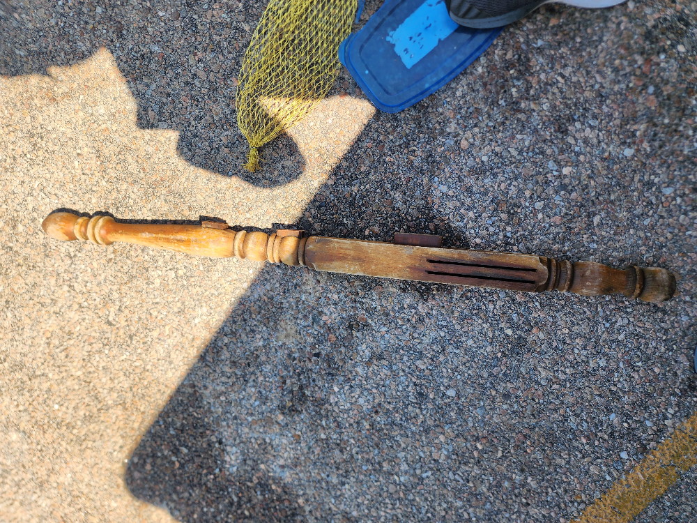
Bed post
Warm, no waves
1
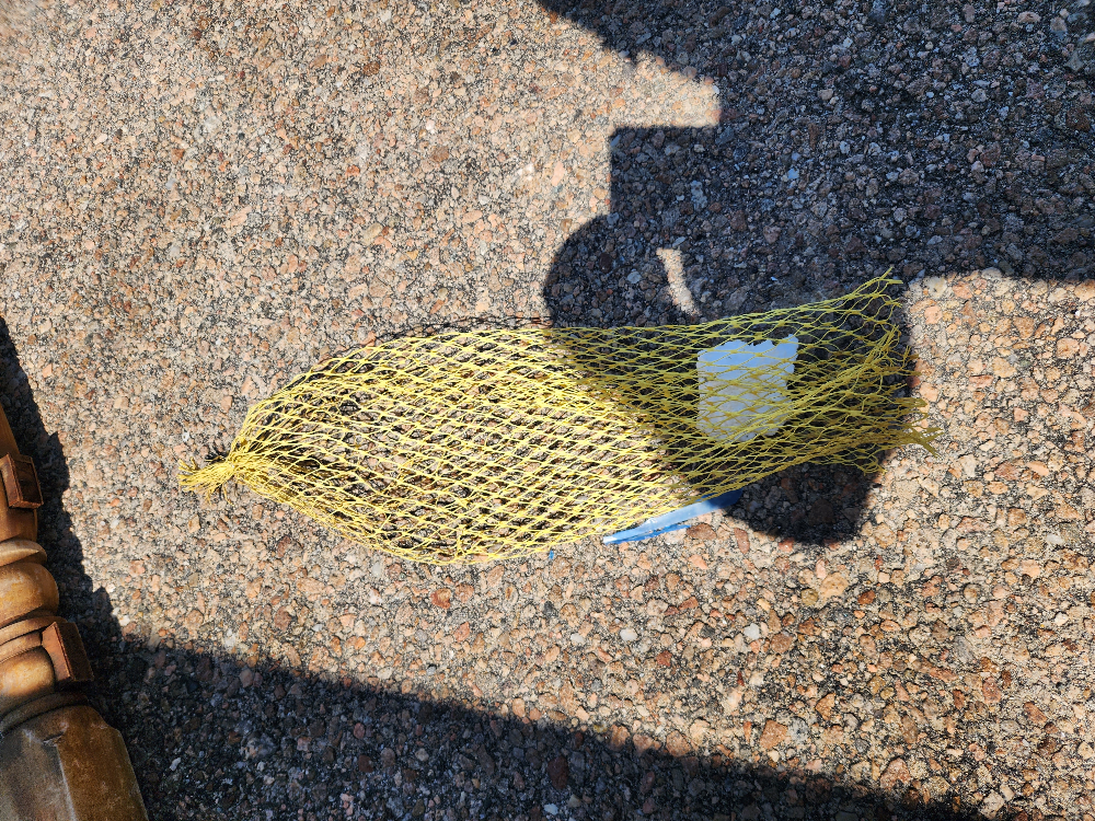
Netting
Dive On It
Anthony Alves
0
0
0
0
0
0
0
0
0
0
0
0
0
0
0
0
0
0
0
2
0
0
0
0
0
0
0
0
0
0
0
0
0
0
0
0
9.00
30
27.00
12.00
0
estimated
0
0
0
0
330.40
0
0
0
0
0
0
On
pounds
0
I have debris data to report
0
0
1
Smooth (wavelets) for waves 0.1 - 0.5 meter high
0
0
0
0
0
0
0
m2
0
0
feet
other
0
0
0
0
0
0
0
0
0
0
0
0
0
0
0
0
0
0
0
0
0
0
0
0
0
0
0
0
0
United States
State\Province
RI
City
Jamestown
Map Help


Dive Location

If you know your survey site coordinates, enter them manually in decimal degrees using WGS84 Map Datum. Use the minus sign for latitudes south of the equator and longitudes west of the Prime Meridian to 180 degrees.

If you do not know your survey site coordinates, click the “Map Location” tab to use the map to zoom into your survey site and drop the pin on the map to fall within your survey dive site in the water (not on land or the beach). Ensure you zoom in as much as possible to ensure data accuracy.
Entangled Help


Use the vertical tabs below to record any entangled animals you found of each type.

Municipal Wharf 2

3
2
0
9

36.603823, -121.889241

5
1
0
sand
0
0
0
10
0
1
light sticks/cyalumes
DOER Marine
Lauren Mackenzie
0
0
0
0
0
0
0
0
0
0
0
0
0
4
0
0
1
0
1
8
0
0
0
0
0
0
1
0
1
0
0
0
0
0
0
0
3.00
50
28.00
15.00
0
estimated
0
0
0
0
450.00
0
0
0
0
0
5
On
pounds
0
I have debris data to report
0
0
0
Smooth (wavelets) for waves 0.1 - 0.5 meter high
0
0
0
Fishing line
Mussel
Released Unharmed
2
0
0
0
0
m2
0
0
feet
rocky reef
1
0
0
0
0
8
0
0
0
0
0
0
0
0
0
0
0
1
0
0
0
0
0
1
0
0
0
0
0
United States
State\Province
CA
City
Monterey
Map Help


Dive Location

If you know your survey site coordinates, enter them manually in decimal degrees using WGS84 Map Datum. Use the minus sign for latitudes south of the equator and longitudes west of the Prime Meridian to 180 degrees.

If you do not know your survey site coordinates, click the “Map Location” tab to use the map to zoom into your survey site and drop the pin on the map to fall within your survey dive site in the water (not on land or the beach). Ensure you zoom in as much as possible to ensure data accuracy.
Entangled Help


Use the vertical tabs below to record any entangled animals you found of each type.

Daymaniyat

0
0
0
2

23.854511, 58.0917

0
0
0
coral
0
0
0
0
0
It's registered as a protected area.
Yes
Nothing
Wavy
Omanta
Behnaz Banirad
0
0
0
0
0
0
0
0
0
0
0
0
0
0
0
0
0
0
0
4
0
0
0
0
0
0
0
0
5
0
0
0
0
0
0
0
5.00
40
10.00
5.00
0
estimated
0
0
0
2
11574.00
0
0
0
0
0
Fish net
Fish line
Net weight
0
On
kilograms
0
I have debris data to report
0
0
0
Slight for waves 0.5 -1.25 meter high
0
0
0
0
0
0
0
m2
1
0
meters
coral reef
0
0
0
0
0
0
0
0
2
0
0
0
0
0
0
0
0
0
0
0
0
0
0
0
0
0
0
0
0
Oman
State\Province
Muscat
City
Muscat
Map Help


Dive Location

If you know your survey site coordinates, enter them manually in decimal degrees using WGS84 Map Datum. Use the minus sign for latitudes south of the equator and longitudes west of the Prime Meridian to 180 degrees.

If you do not know your survey site coordinates, click the “Map Location” tab to use the map to zoom into your survey site and drop the pin on the map to fall within your survey dive site in the water (not on land or the beach). Ensure you zoom in as much as possible to ensure data accuracy.
Entangled Help


Use the vertical tabs below to record any entangled animals you found of each type.

Turunc Pinari Wall

0
1
0
0

36.620203043845, 29.046619488446

0
0
0
rock
0
0
0
20
0
Daily and rental boats
Dive knife
Calm
1
Dive knife
Seahorse Dive Centre
Mark Taylor
0
0
0
0
0
0
0
0
2
0
0
0
0
0
0
0
0
0
0
2
0
0
0
0
0
0
1
0
0
0
0
0
0
0
0
0
1.50
23
18.00
5.00
1
estimated
0
2
7535.63
0
0
0
0
0
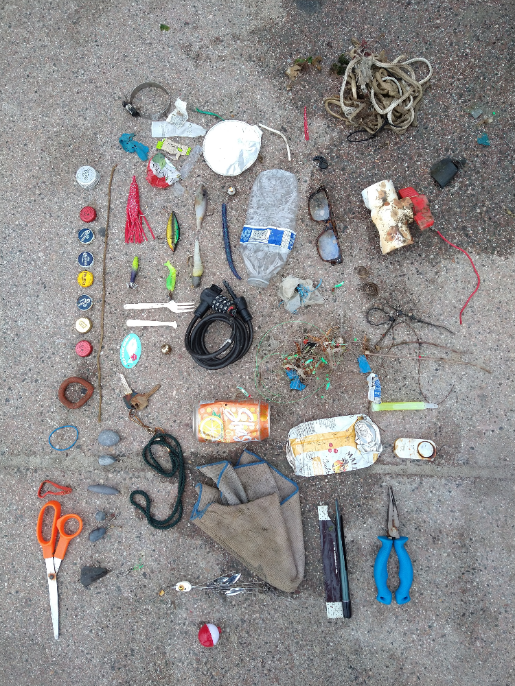
Fishing lines
0
On
kilograms
0
I have debris data to report
1
0
0
Calm (glassy to rippled) for waves 0 – 0.1 meter high
0
0
0
0
0
0
0
m2
0
1
meters
rocky reef
0
0
0
0
0
0
0
0
0
0
0
0
0
0
0
1
0
0
0
0
0
0
2
0
0
0
0
0
0
Turkey
State\Province
Muğla
City
Fethiye
Map Help


Dive Location

If you know your survey site coordinates, enter them manually in decimal degrees using WGS84 Map Datum. Use the minus sign for latitudes south of the equator and longitudes west of the Prime Meridian to 180 degrees.

If you do not know your survey site coordinates, click the “Map Location” tab to use the map to zoom into your survey site and drop the pin on the map to fall within your survey dive site in the water (not on land or the beach). Ensure you zoom in as much as possible to ensure data accuracy.
Entangled Help


Use the vertical tabs below to record any entangled animals you found of each type.

Dubai #647992

0
1
0
0

25.303589471788, 55.304871040635

0
0
0
seagrass
0
0
0
0
0
No
It’s open beach
Plastic
Calm
SCUBA Hub DC
Saeed Majed
0
0
0
0
0
0
0
0
0
0
0
0
0
0
0
0
0
0
1
4
0
0
0
0
0
0
0
0
0
0
0
0
0
0
0
0
1.00
25
10.00
1.00
0
estimated
0
0
2000.00
0
0
0
0
0
Plastic
0
On
kilograms
0
I have debris data to report
0
0
0
Smooth (wavelets) for waves 0.1 - 0.5 meter high
0
0
0
0
0
0
0
m2
0
0
meters
seagrass
0
0
0
0
0
0
0
0
0
0
0
0
0
0
0
0
0
1
0
0
0
0
0
0
0
0
0
0
0
United Arab Emirates
State\Province
Dubai
City
Dubai
Map Help


Dive Location

If you know your survey site coordinates, enter them manually in decimal degrees using WGS84 Map Datum. Use the minus sign for latitudes south of the equator and longitudes west of the Prime Meridian to 180 degrees.

If you do not know your survey site coordinates, click the “Map Location” tab to use the map to zoom into your survey site and drop the pin on the map to fall within your survey dive site in the water (not on land or the beach). Ensure you zoom in as much as possible to ensure data accuracy.

Entangled Help


Use the vertical tabs below to record any entangled animals you found of each type.

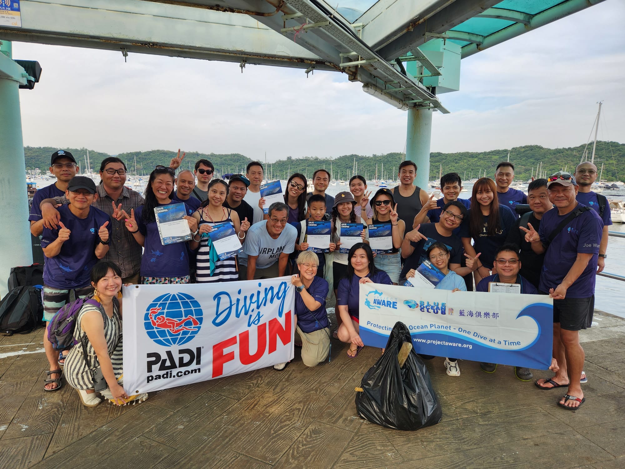
Sai Wan, Sai Kung, Hong Kong 西貢西灣

22
1
11

22.389902656984, 114.38491983982

1
gravel
2

22.389902656984, 114.38491983982

Mainly cloudy with occasional showers and squally thunderstorms. Showers will be heavy at times.
1
1
Surgery Mask
Glass Fiber
Blue Ocean Club Hong Kong
EIAN KEE
1
3
26
1
1
12
1
9.00
60
10.00
1.00
measured
3
1500.00
1
1
On
kilograms
I have debris data to report
1
Calm (glassy to rippled) for waves 0 – 0.1 meter high
1
m2
meters
rocky reef
3
3
1
1
Hong Kong S.A.R., China
City
Hong Kong
Map Help


Dive Location

If you know your survey site coordinates, enter them manually in decimal degrees using WGS84 Map Datum. Use the minus sign for latitudes south of the equator and longitudes west of the Prime Meridian to 180 degrees.

If you do not know your survey site coordinates, click the “Map Location” tab to use the map to zoom into your survey site and drop the pin on the map to fall within your survey dive site in the water (not on land or the beach). Ensure you zoom in as much as possible to ensure data accuracy.

Entangled Help


Use the vertical tabs below to record any entangled animals you found of each type.

Batu Putih

19
17
0
0

-8.720307, 115.91749

0
0
0
coral
0
0
0
0
0
4
2
2
Polystyrene fragments
Detergent wrapper
Shampoo wrapper
SORCE
Georgia
0
0
0
4
0
0
0
0
0
1
4
0
0
0
1
0
0
1
0
8
2
0
0
0
0
0
7
0
0
0
0
0
0
0
0
0
2.70
45
18.00
5.00
2
measured
0
0
0
0
1249.04
0
0
0
1
0
0
On
kilograms
0
I have debris data to report
1
0
0
Calm (glassy to rippled) for waves 0 – 0.1 meter high
0
0
1
0
0
0
0
m2
0
0
meters
coral reef
0
0
0
0
0
0
0
0
0
2
0
0
0
0
0
0
0
0
0
0
0
0
0
0
0
0
0
0
0
Indonesia
State\Province
Lombok
City
Sekotong West Lombok
Map Help


Dive Location

If you know your survey site coordinates, enter them manually in decimal degrees using WGS84 Map Datum. Use the minus sign for latitudes south of the equator and longitudes west of the Prime Meridian to 180 degrees.

If you do not know your survey site coordinates, click the “Map Location” tab to use the map to zoom into your survey site and drop the pin on the map to fall within your survey dive site in the water (not on land or the beach). Ensure you zoom in as much as possible to ensure data accuracy.

Entangled Help


Use the vertical tabs below to record any entangled animals you found of each type.

Coral Beach

8
7
0
0

-8.730056, 115.910593

0
0
1
coral
0
1
0
0
0
1
1
2
2
Pill case
Sunglasses
Hair ties
Laundry detergent wrapper
SORCE
0
0
0
1
0
0
0
0
0
0
0
0
0
0
0
0
0
1
0
3
0
0
0
0
0
0
1
0
0
0
0
0
0
0
0
0
0.80
45
18.00
5.00
0
measured
0
0
0
0
7335.23
0
0
0
0
0
0
On
kilograms
0
I have debris data to report
1
0
0
Calm (glassy to rippled) for waves 0 – 0.1 meter high
0
0
0
0
0
0
0
m2
0
0
meters
coral reef
0
0
0
0
0
0
0
0
0
0
0
0
0
0
0
0
0
0
0
0
0
0
0
0
0
0
0
0
0
Indonesia
City
Sekotong
Map Help


Dive Location

If you know your survey site coordinates, enter them manually in decimal degrees using WGS84 Map Datum. Use the minus sign for latitudes south of the equator and longitudes west of the Prime Meridian to 180 degrees.

If you do not know your survey site coordinates, click the “Map Location” tab to use the map to zoom into your survey site and drop the pin on the map to fall within your survey dive site in the water (not on land or the beach). Ensure you zoom in as much as possible to ensure data accuracy.

Entangled Help


Use the vertical tabs below to record any entangled animals you found of each type.

Manta point

0
0
0
0

-8.793611, 115.525985

0
0
0
coral
0
0
0
0
0
Sunny
Purple Dive Penida
Yvonne ng
0
0
0
0
0
0
0
0
0
0
0
0
0
0
0
0
0
0
0
3
0
0
0
0
0
0
0
0
0
0
0
0
0
0
0
0
0.20
49
21.00
5.00
1
estimated
0
0
891.54
0
0
0
0
0
0
On
kilograms
0
I have debris data to report
0
0
0
Slight for waves 0.5 -1.25 meter high
0
0
0
0
0
0
0
m2
0
0
meters
coral reef
0
0
0
0
0
0
0
0
0
0
0
0
0
0
0
0
0
0
0
0
0
0
0
0
0
0
0
0
0
Indonesia
City
Nusa Penida
Map Help


Dive Location

If you know your survey site coordinates, enter them manually in decimal degrees using WGS84 Map Datum. Use the minus sign for latitudes south of the equator and longitudes west of the Prime Meridian to 180 degrees.

If you do not know your survey site coordinates, click the “Map Location” tab to use the map to zoom into your survey site and drop the pin on the map to fall within your survey dive site in the water (not on land or the beach). Ensure you zoom in as much as possible to ensure data accuracy.

Entangled Help


Use the vertical tabs below to record any entangled animals you found of each type.

Subscribe to