Menu

Mayday - Bocas Dive Center

17
12

9.3350924910319, -82.241227116729

sand
6
6

9.3350924910319, -82.241227116729

Bocas Dive Center
Leandro
6
10
3
8
4
22
8
100
2
10
1
2
143.00
45
8.00
2.00
estimated
200.00
10
On
pounds
I have debris data to report
10
Calm (glassy to rippled) for waves 0 – 0.1 meter high
7
2
19
m2
meters
coral reef
10
2
4
10
9
120
4
3
Panama
State\Province
Bocas del Toro
City
Isla Colon
Map Help


Dive Location

If you know your survey site coordinates, enter them manually in decimal degrees using WGS84 Map Datum. Use the minus sign for latitudes south of the equator and longitudes west of the Prime Meridian to 180 degrees.

If you do not know your survey site coordinates, click the “Map Location” tab to use the map to zoom into your survey site and drop the pin on the map to fall within your survey dive site in the water (not on land or the beach). Ensure you zoom in as much as possible to ensure data accuracy.

Entangled Help


Use the vertical tabs below to record any entangled animals you found of each type.

Mayday - Bocas Dive Center

3
16

9.3350746351628, -82.241241839494

sand
4

9.3350746351628, -82.241241839494

Bocas Dive Center
Leandro
4
16
3
2
5
2
14
5
2
2
75.00
45
10.00
2.00
estimated
200.00
4
On
pounds
I have debris data to report
12
Calm (glassy to rippled) for waves 0 – 0.1 meter high
3
1
6
m2
meters
coral reef
3
4
7
4
4
80
Panama
State\Province
Bocas del Toro
City
Isla Colon
Map Help


Dive Location

If you know your survey site coordinates, enter them manually in decimal degrees using WGS84 Map Datum. Use the minus sign for latitudes south of the equator and longitudes west of the Prime Meridian to 180 degrees.

If you do not know your survey site coordinates, click the “Map Location” tab to use the map to zoom into your survey site and drop the pin on the map to fall within your survey dive site in the water (not on land or the beach). Ensure you zoom in as much as possible to ensure data accuracy.
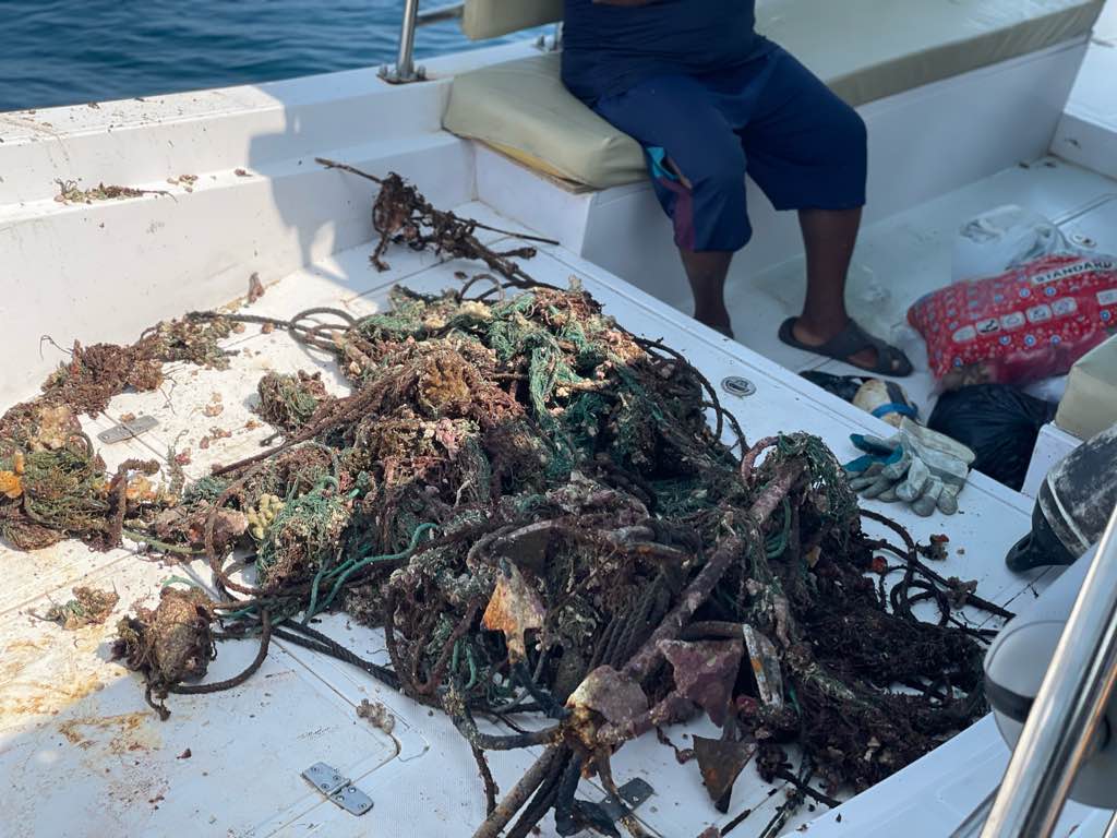
Entangled Help


Use the vertical tabs below to record any entangled animals you found of each type.

Mayday - Bocas Dive Center

11

9.3350640484128, -82.241241839494

sand
10

9.3350640484128, -82.241241839494

Bocas Dive Center
Leandro
7
3
14
1
75
2
3
80.00
45
10.00
2.00
estimated
200.00
5
On
pounds
I have debris data to report
10
Smooth (wavelets) for waves 0.1 - 0.5 meter high
3
1
9
m2
meters
coral reef
3
-1
4
2
3
2
3
8
70
3
Panama
State\Province
Bocas del Toro
City
Isla Colon
Map Help


Dive Location

If you know your survey site coordinates, enter them manually in decimal degrees using WGS84 Map Datum. Use the minus sign for latitudes south of the equator and longitudes west of the Prime Meridian to 180 degrees.

If you do not know your survey site coordinates, click the “Map Location” tab to use the map to zoom into your survey site and drop the pin on the map to fall within your survey dive site in the water (not on land or the beach). Ensure you zoom in as much as possible to ensure data accuracy.
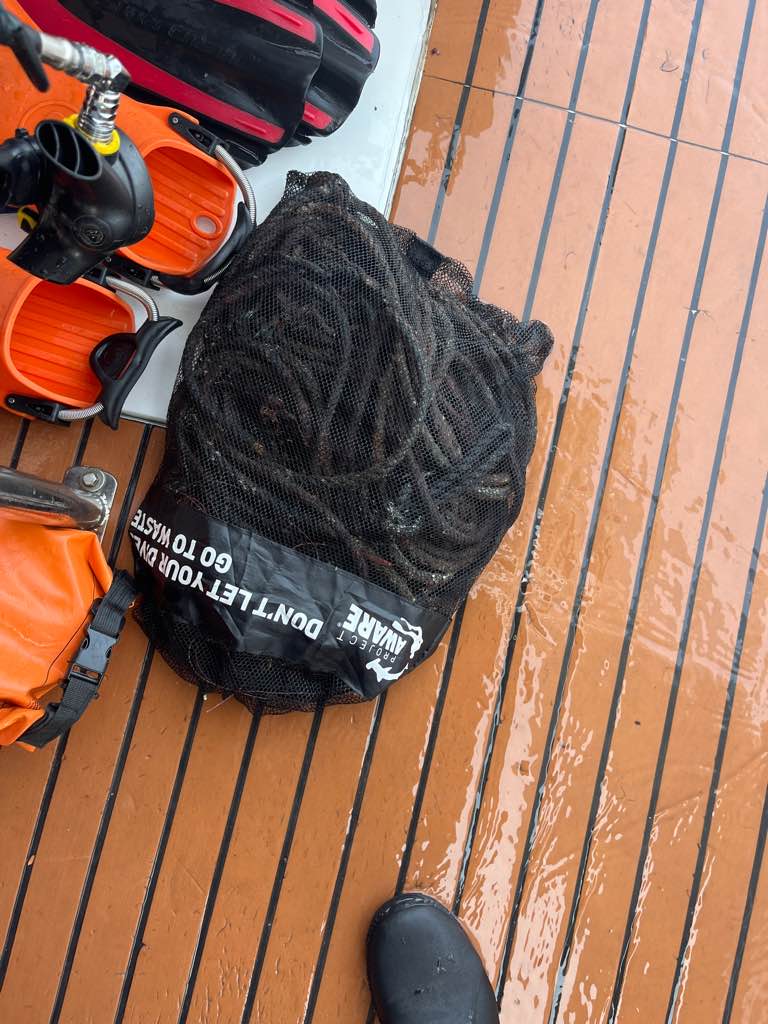
Entangled Help


Use the vertical tabs below to record any entangled animals you found of each type.

Cais dos Pescadores

17
2
5

38.697261736489, -9.4180666634375

silt
11
4

38.697261736489, -9.4180666634375

1
2
2
2
1
Glasses
Fishing: traps & pots
Electrical wires
Tools
Pier defense
Associação Juvenil Claro/ Clube Naval de Cascais
Teresa Vale & Carolina Gonçalves
3
6
20
20
10
1
4
0
5
400.00
60
5.00
2.00
estimated
5
3283.39
1
3
On
kilograms
I have debris data to report
9
Calm (glassy to rippled) for waves 0 – 0.1 meter high
3
3
2
m2
2
meters
other
2
1
2
3
2
7
7
1
1
Portugal
City
Cascais
Map Help


Dive Location

If you know your survey site coordinates, enter them manually in decimal degrees using WGS84 Map Datum. Use the minus sign for latitudes south of the equator and longitudes west of the Prime Meridian to 180 degrees.

If you do not know your survey site coordinates, click the “Map Location” tab to use the map to zoom into your survey site and drop the pin on the map to fall within your survey dive site in the water (not on land or the beach). Ensure you zoom in as much as possible to ensure data accuracy.
Entangled Help


Use the vertical tabs below to record any entangled animals you found of each type.

Mayday - Bocas Dive Center

12
23

9.3350640484128, -82.241231110658

sand
12
7
2

9.3350640484128, -82.241231110658

Bocas Dive Center
Leandro
2
6
2
13
4
9
100
1
5
115.00
45
10.00
3.00
estimated
200.00
21
On
pounds
I have debris data to report
12
Calm (glassy to rippled) for waves 0 – 0.1 meter high
10
3
9
m2
meters
coral reef
10
6
6
5
90
3
Panama
State\Province
Bocas del Toro
City
Isla Colom
Map Help


Dive Location

If you know your survey site coordinates, enter them manually in decimal degrees using WGS84 Map Datum. Use the minus sign for latitudes south of the equator and longitudes west of the Prime Meridian to 180 degrees.

If you do not know your survey site coordinates, click the “Map Location” tab to use the map to zoom into your survey site and drop the pin on the map to fall within your survey dive site in the water (not on land or the beach). Ensure you zoom in as much as possible to ensure data accuracy.
Entangled Help


Use the vertical tabs below to record any entangled animals you found of each type.

Mayday - Bocas Dive Center

9
19

9.3350755072578, -82.241201119841

sand
13
-4

9.3350755072578, -82.241201119841

Bocas Dive Center
Leandro
1
4
3
-1
4
1
7
18
6
67
2
5
-2
1
110.00
45
9.00
3.00
estimated
200.00
2
8
On
pounds
I have debris data to report
4
Calm (glassy to rippled) for waves 0 – 0.1 meter high
8
2
9
m2
meters
coral reef
7
3
1
12
79
2
1
1
Panama
State\Province
Bocas del Toro
City
Isla Colon
Map Help


Dive Location

If you know your survey site coordinates, enter them manually in decimal degrees using WGS84 Map Datum. Use the minus sign for latitudes south of the equator and longitudes west of the Prime Meridian to 180 degrees.

If you do not know your survey site coordinates, click the “Map Location” tab to use the map to zoom into your survey site and drop the pin on the map to fall within your survey dive site in the water (not on land or the beach). Ensure you zoom in as much as possible to ensure data accuracy.

Entangled Help


Use the vertical tabs below to record any entangled animals you found of each type.

Mayday - Bocas Dive Center

14
9
1

9.3350534616625, -82.241220381822

sand
10
9

9.3350534616625, -82.241220381822

Bocas Dive Center
Leandro
1
7
3
1
8
4
5
15
2
6
88
-2
7
140.00
45
10.00
3.00
estimated
120.00
2
9
On
pounds
I have debris data to report
10
Calm (glassy to rippled) for waves 0 – 0.1 meter high
4
14
m2
meters
coral reef
8
3
1
1
5
12
23
124
1
Panama
State\Province
Bocas del Toro
City
Isla Colon
Map Help


Dive Location

If you know your survey site coordinates, enter them manually in decimal degrees using WGS84 Map Datum. Use the minus sign for latitudes south of the equator and longitudes west of the Prime Meridian to 180 degrees.

If you do not know your survey site coordinates, click the “Map Location” tab to use the map to zoom into your survey site and drop the pin on the map to fall within your survey dive site in the water (not on land or the beach). Ensure you zoom in as much as possible to ensure data accuracy.

Entangled Help


Use the vertical tabs below to record any entangled animals you found of each type.

Willow Beach

sand
1

35.88812634259, -114.68252187304

i take a group of people out every saturday out to Willow beach to do 2 divers
no
all of it
sunny and clear
anchors
propane barbecer
kayak paddle
fishing poles
fishing net
fold up recliner chair
phones
Anchors rope
floor mat
hats
clothing and shoes
2
1
1
5
1
1
1
3
1
2
7
Mana Scuba
ken wige
1
5
1
2
110.00
97
44.00
28.00
3
estimated
1500.00
3
bottles cans
clothing
On
pounds
I have debris data to report
34
Smooth (wavelets) for waves 0.1 - 0.5 meter high
2
none
1
none
1
12
1
ft2
3
5
feet
other
8
2
1
29
3
2
United States
State\Province
NV
City
las vegas
Map Help


Dive Location

If you know your survey site coordinates, enter them manually in decimal degrees using WGS84 Map Datum. Use the minus sign for latitudes south of the equator and longitudes west of the Prime Meridian to 180 degrees.

If you do not know your survey site coordinates, click the “Map Location” tab to use the map to zoom into your survey site and drop the pin on the map to fall within your survey dive site in the water (not on land or the beach). Ensure you zoom in as much as possible to ensure data accuracy.

Entangled Help


Use the vertical tabs below to record any entangled animals you found of each type.

Ecosystem Other
sand

ADS323 - Tung Ping Chau

3
21
1

22.544949681583, 114.4317198412

sand
1
25
We have a strong typhoon and a black rain storm
Tursiopsdivers
Elaine
3
2
2.62
24
3.00
1.00
measured
80.98
1
On
kilograms
I have debris data to report
Smooth (wavelets) for waves 0.1 - 0.5 meter high
1
m2
meters
coral reef
3
Hong Kong S.A.R., China
Map Help


Dive Location

If you know your survey site coordinates, enter them manually in decimal degrees using WGS84 Map Datum. Use the minus sign for latitudes south of the equator and longitudes west of the Prime Meridian to 180 degrees.

If you do not know your survey site coordinates, click the “Map Location” tab to use the map to zoom into your survey site and drop the pin on the map to fall within your survey dive site in the water (not on land or the beach). Ensure you zoom in as much as possible to ensure data accuracy.

Entangled Help


Use the vertical tabs below to record any entangled animals you found of each type.

ADS323 - Tung Ping Chau

8
16
6

22.544949681583, 114.4317198412

sand
6
36
1
We have a strong typhoon and a black rain storm from last week.
Wheel
We have a strong typhoon and a black rain storm
Tursiopsdivers
Elaine
6
1
4
8.00
53
9.40
1.00
measured
240.66
1
On
kilograms
I have debris data to report
Smooth (wavelets) for waves 0.1 - 0.5 meter high
2
m2
21
meters
coral reef
1
4
Hong Kong S.A.R., China
Map Help


Dive Location

If you know your survey site coordinates, enter them manually in decimal degrees using WGS84 Map Datum. Use the minus sign for latitudes south of the equator and longitudes west of the Prime Meridian to 180 degrees.

If you do not know your survey site coordinates, click the “Map Location” tab to use the map to zoom into your survey site and drop the pin on the map to fall within your survey dive site in the water (not on land or the beach). Ensure you zoom in as much as possible to ensure data accuracy.

Entangled Help


Use the vertical tabs below to record any entangled animals you found of each type.

Subscribe to