Menu

Scuba Republic House Reef

9

-0.442641, 130.753435

sand
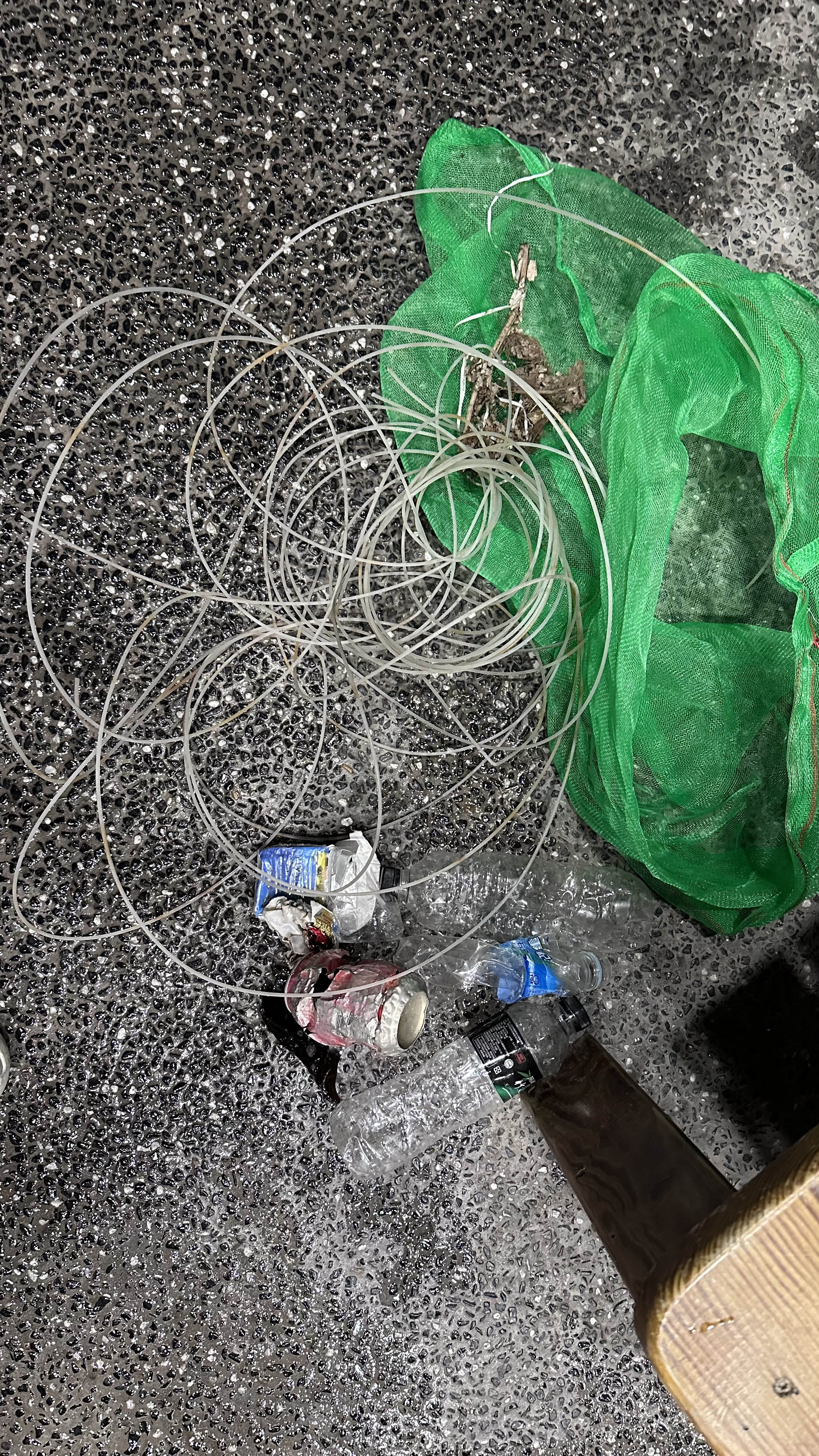
Wind possible culprite for blowing trash into nearby reef.
Similar amount of trash from previous Dive Against Debris dives.
Tinfoil
Mostly Sunny, Light Rainfall, Moderate Wind
Indo Ocean Project
Michael van Zyl
1
3
1
9
0.55
61
20.00
5.00
measured
25.00
Plastic Bottles
Plastic Food Packaging
Paper Food Packing
On
pounds
I have debris data to report
Smooth (wavelets) for waves 0.1 - 0.5 meter high m2
meters
coral reef
1
Indonesia
City
Waigeo
Map Help


Dive Location

If you know your survey site coordinates, enter them manually in decimal degrees using WGS84 Map Datum. Use the minus sign for latitudes south of the equator and longitudes west of the Prime Meridian to 180 degrees.

If you do not know your survey site coordinates, click the “Map Location” tab to use the map to zoom into your survey site and drop the pin on the map to fall within your survey dive site in the water (not on land or the beach). Ensure you zoom in as much as possible to ensure data accuracy.

Entangled Help


Use the vertical tabs below to record any entangled animals you found of each type.

Sharp Island

22
2
sand

22.363565691876, 114.2974493585

Diving Express
Lau Tsz Sum
1
20
10.74
60
8.00
2.00
3
measured
9403.00
1
On
kilograms
I have debris data to report
4
Calm (glassy to rippled) for waves 0 – 0.1 meter high
1
1
1
m2
1
meters
coral reef
3
6
6
3
Hong Kong S.A.R., China
Map Help


Dive Location

If you know your survey site coordinates, enter them manually in decimal degrees using WGS84 Map Datum. Use the minus sign for latitudes south of the equator and longitudes west of the Prime Meridian to 180 degrees.

If you do not know your survey site coordinates, click the “Map Location” tab to use the map to zoom into your survey site and drop the pin on the map to fall within your survey dive site in the water (not on land or the beach). Ensure you zoom in as much as possible to ensure data accuracy.
Entangled Help


Use the vertical tabs below to record any entangled animals you found of each type.

Deep Cove Government Dock

0
0
0
0

49.326812634529, -122.94735561281

0
0
0
silt
0
0
0
0
0
No
E bike
Sunny
27
6
1
1
1
1
1
1
1
2
Sunglasses
Boat paddles
Fire extinguisher
Anchor
E bicycle
Metal chair
Dive flag
Dive reel
Propeller
Metal water bottles
Divers for Cleaner Lakes and Oceans
Henry Wang
0
0
0
0
0
0
0
0
0
0
0
0
0
0
0
0
0
0
0
11
0
0
0
0
0
0
0
0
0
0
0
0
2
0
1
1
502.00
50
49.00
10.00
7
measured
0
0
32838.60
0
2
0
0
0
Bottles
0
On
pounds
0
I have debris data to report
104
0
0
Calm (glassy to rippled) for waves 0 – 0.1 meter high
0
0
0
Crab
Crabs
Released Unharmed
10
0
0
0
0
ft2
7
0
feet
other
87
0
0
0
0
0
0
0
1
19
19
0
0
0
0
10
2
0
0
0
1
0
80
0
0
0
0
5
0
Canada
State\Province
British Columbia
City
North Vancouver
Map Help


Dive Location

If you know your survey site coordinates, enter them manually in decimal degrees using WGS84 Map Datum. Use the minus sign for latitudes south of the equator and longitudes west of the Prime Meridian to 180 degrees.

If you do not know your survey site coordinates, click the “Map Location” tab to use the map to zoom into your survey site and drop the pin on the map to fall within your survey dive site in the water (not on land or the beach). Ensure you zoom in as much as possible to ensure data accuracy.

Entangled Help


Use the vertical tabs below to record any entangled animals you found of each type.

Ecosystem Other
Silt

Deep Cove Government Dock

0
0
0
0

49.326812634529, -122.94735561281

0
0
0
silt
0
0
0
0
0

49.325868804299, -122.94553789479

No
Sunny
1
1
Anchor
Chain
Divers for Cleaner Lakes and Oceans
Henry Wang
0
0
0
0
0
0
0
0
0
0
0
0
0
0
0
0
0
0
0
1
0
0
0
0
0
0
0
0
0
0
0
0
0
0
0
0
300.00
70
41.00
35.00
0
estimated
0
0
8016.19
0
0
0
0
0
0
On
pounds
0
I have debris data to report
0
0
0
Calm (glassy to rippled) for waves 0 – 0.1 meter high
0
0
0
0
0
0
0
ft2
1
0
feet
other
0
0
0
0
0
0
0
0
0
0
1
0
0
0
0
0
0
0
0
0
0
0
0
0
0
0
0
0
0
Canada
State\Province
British Columbia
City
North Vancouver
Map Help


Dive Location

If you know your survey site coordinates, enter them manually in decimal degrees using WGS84 Map Datum. Use the minus sign for latitudes south of the equator and longitudes west of the Prime Meridian to 180 degrees.

If you do not know your survey site coordinates, click the “Map Location” tab to use the map to zoom into your survey site and drop the pin on the map to fall within your survey dive site in the water (not on land or the beach). Ensure you zoom in as much as possible to ensure data accuracy.
Entangled Help


Use the vertical tabs below to record any entangled animals you found of each type.

Ecosystem Other
Silt

Wood Lake

0
2
1
0

49.45871396836, -121.85690219566

0
0
0
silt
0
0
0
0
1

49.458221023259, -121.85625214572

No
Bikini
Sunny
5
1
1
Sunglasses
Boat paddle
Coin
Divers for Cleaner Lakes and Oceans
Henry Wang
0
0
0
5
0
0
0
0
1
0
0
0
0
0
0
0
0
0
0
1
0
0
0
0
0
0
1
0
0
0
0
0
1
0
0
0
16.10
57
27.00
3.00
0
measured
0
0
25880.00
0
0
0
0
0
Beer cans
0
On
pounds
0
I have debris data to report
2
0
0
Calm (glassy to rippled) for waves 0 – 0.1 meter high
0
0
1
0
0
0
0
ft2
0
0
feet
other
0
0
0
0
0
0
0
0
0
4
0
0
0
0
0
0
1
68
0
0
0
0
0
0
0
0
0
0
0
Canada
State\Province
British Columbia
City
Mission
Map Help


Dive Location

If you know your survey site coordinates, enter them manually in decimal degrees using WGS84 Map Datum. Use the minus sign for latitudes south of the equator and longitudes west of the Prime Meridian to 180 degrees.

If you do not know your survey site coordinates, click the “Map Location” tab to use the map to zoom into your survey site and drop the pin on the map to fall within your survey dive site in the water (not on land or the beach). Ensure you zoom in as much as possible to ensure data accuracy.
Entangled Help


Use the vertical tabs below to record any entangled animals you found of each type.

Ecosystem Other
Silt

Cat Lake

0
2
0
0
0
0
0
silt
0
0
1
0
0

49.800018541094, -123.1106355826

No
Sunny
1
Vape
Divers for Cleaner Lakes and Oceans
Henry
0
0
0
0
0
0
0
0
0
0
0
0
0
0
0
0
0
0
0
1
0
0
0
0
0
0
0
0
0
0
0
0
0
0
0
0
2.00
14
29.00
13.00
1
measured
0
0
2595.73
0
0
0
0
0
0
On
pounds
0
I have debris data to report
0
0
0
Calm (glassy to rippled) for waves 0 – 0.1 meter high
0
0
0
0
0
0
0
ft2
0
0
feet
other
0
0
0
0
0
0
0
0
0
0
1
0
0
0
0
0
0
3
0
0
0
0
0
0
0
0
0
0
0
Canada
State\Province
British Columbia
City
Squamish
Map Help


Dive Location

If you know your survey site coordinates, enter them manually in decimal degrees using WGS84 Map Datum. Use the minus sign for latitudes south of the equator and longitudes west of the Prime Meridian to 180 degrees.

If you do not know your survey site coordinates, click the “Map Location” tab to use the map to zoom into your survey site and drop the pin on the map to fall within your survey dive site in the water (not on land or the beach). Ensure you zoom in as much as possible to ensure data accuracy.

Entangled Help


Use the vertical tabs below to record any entangled animals you found of each type.

Ecosystem Other
Silt

Belcarra

0
0
0
0

49.313033375165, -122.92872456509

0
0
0
silt
0
0
0
0
0
No
Sunny
Divers for cleaner lakes and oceans
Henry Wang
0
0
0
0
0
0
0
0
0
0
0
0
0
0
0
0
0
0
0
1
0
0
0
0
0
0
0
0
0
0
0
0
0
0
0
0
0.50
1
13.00
13.00
0
measured
0
0
110.00
0
0
0
0
0
0
On
pounds
0
I have debris data to report
0
0
0
Calm (glassy to rippled) for waves 0 – 0.1 meter high
0
0
0
0
0
0
0
ft2
0
0
feet
other
0
0
0
0
0
0
0
0
0
0
1
0
0
0
0
0
0
0
0
0
0
0
0
0
0
0
0
0
0
Canada
State\Province
British Columbia
City
Port Moody
Map Help


Dive Location

If you know your survey site coordinates, enter them manually in decimal degrees using WGS84 Map Datum. Use the minus sign for latitudes south of the equator and longitudes west of the Prime Meridian to 180 degrees.

If you do not know your survey site coordinates, click the “Map Location” tab to use the map to zoom into your survey site and drop the pin on the map to fall within your survey dive site in the water (not on land or the beach). Ensure you zoom in as much as possible to ensure data accuracy.

Entangled Help


Use the vertical tabs below to record any entangled animals you found of each type.

Ecosystem Other
Silt

Stay Reef/Royal Carribbean

1

25.727633, -80.099467

coral
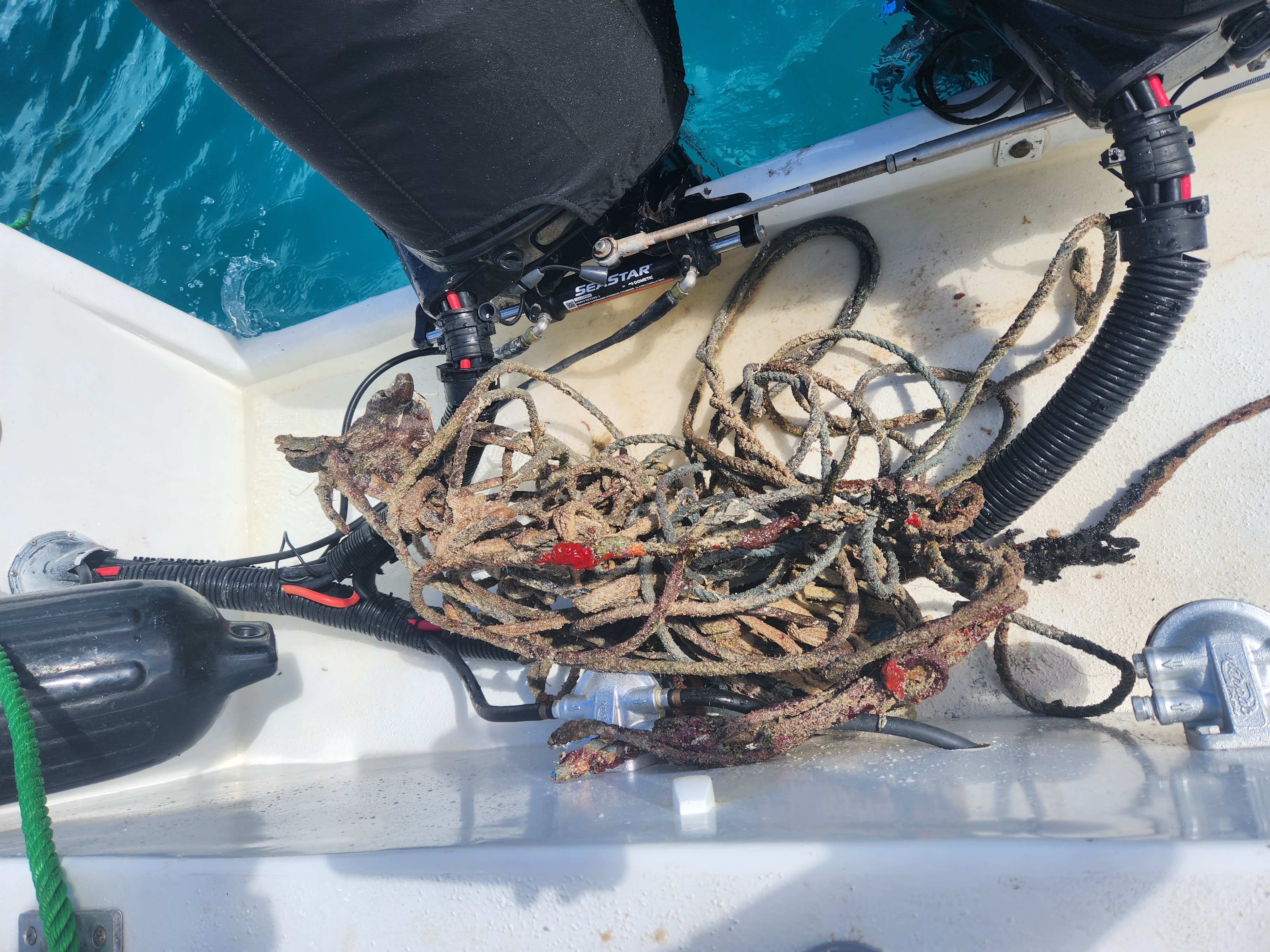
giant metal cage piece (~50 lbs) that took 5 divers to safely bring to the surface!
mostly clear and calm morning conditions, stormy afternoons/evenings
1
giant metal cage piece (~50 lbs)
Debris Free Oceans/Deco Divers
Bonnie Waxman
1
24
85.00
60
32.00
10.00
measured
100.00
On
pounds
I have debris data to report
2
Smooth (wavelets) for waves 0.1 - 0.5 meter high
18
1
ft2
6
1
feet
coral reef
6
1
2
6
United States
State\Province
Florida
City
Miami
Map Help


Dive Location

If you know your survey site coordinates, enter them manually in decimal degrees using WGS84 Map Datum. Use the minus sign for latitudes south of the equator and longitudes west of the Prime Meridian to 180 degrees.

If you do not know your survey site coordinates, click the “Map Location” tab to use the map to zoom into your survey site and drop the pin on the map to fall within your survey dive site in the water (not on land or the beach). Ensure you zoom in as much as possible to ensure data accuracy.

Entangled Help


Use the vertical tabs below to record any entangled animals you found of each type.

Paradise Reef

25.65905, -80.097317

coral
2
mostly clear mornings, thunderstorms in afternoons and evenings
1
metal anchor
Debris Free Oceans/Deco Divers
Bonnie Waxman
24
24.00
60
23.00
10.00
measured
100.00
1
anchor lodged in the reef
rope
On
pounds
I have debris data to report
4
Smooth (wavelets) for waves 0.1 - 0.5 meter high
4
ft2
5
feet
coral reef
4
United States
State\Province
Florida
City
Miami
Map Help


Dive Location

If you know your survey site coordinates, enter them manually in decimal degrees using WGS84 Map Datum. Use the minus sign for latitudes south of the equator and longitudes west of the Prime Meridian to 180 degrees.

If you do not know your survey site coordinates, click the “Map Location” tab to use the map to zoom into your survey site and drop the pin on the map to fall within your survey dive site in the water (not on land or the beach). Ensure you zoom in as much as possible to ensure data accuracy.

Entangled Help


Use the vertical tabs below to record any entangled animals you found of each type.

Dhigurah Harbor

2

3.5400521, 72.932813

coral
2
3
Local fishing gear and construction debris.
Rainy and Cloudy
SOP education ltd & White Sand Dhigurah
Jie Mu
1
8
2.60
45
29.00
6.00
1
measured
280.00
fishing line
cement bag
On
kilograms
I have debris data to report
Smooth (wavelets) for waves 0.1 - 0.5 meter high m2
meters
coral reef
Maldives
Map Help


Dive Location

If you know your survey site coordinates, enter them manually in decimal degrees using WGS84 Map Datum. Use the minus sign for latitudes south of the equator and longitudes west of the Prime Meridian to 180 degrees.

If you do not know your survey site coordinates, click the “Map Location” tab to use the map to zoom into your survey site and drop the pin on the map to fall within your survey dive site in the water (not on land or the beach). Ensure you zoom in as much as possible to ensure data accuracy.

Entangled Help


Use the vertical tabs below to record any entangled animals you found of each type.

Subscribe to