Menu

Kimi Evias

3

38.630337237351, 24.125068151592

4
3
4
sand
19
20
4

38.630337237351, 24.125068151592

Saucepan
Calm sea
Aegean Seals D.C.
Efstratios Synodis
2
4
3
8
3
0
2
1
2
4
2
5
3
8
4
19
4
8
3
1
0
500.00
60
5.00
2.00
estimated
5
3
0
1
1500.00
13
1
On
kilograms
3
I have debris data to report
10
4
2
Calm (glassy to rippled) for waves 0 – 0.1 meter high
3
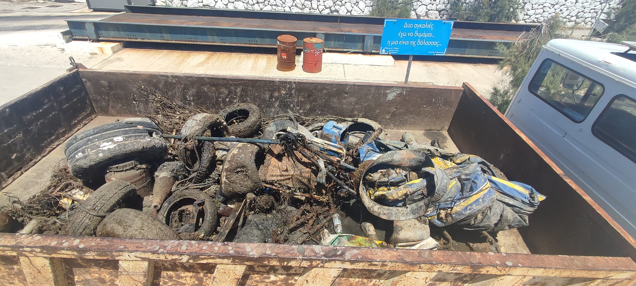
fishing line
1
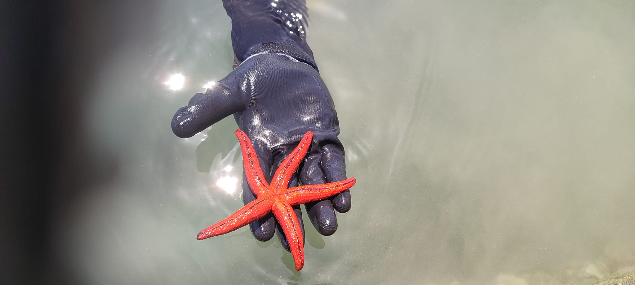
Released Unharmed
SEA STAR
3
1
m2
10
meters
other
1
1
1
1
0
2
2
2
1
1
3
1
1
10
1
2
2
Greece
State\Province
Evia
City
Chalkida
Map Help


Dive Location

If you know your survey site coordinates, enter them manually in decimal degrees using WGS84 Map Datum. Use the minus sign for latitudes south of the equator and longitudes west of the Prime Meridian to 180 degrees.

If you do not know your survey site coordinates, click the “Map Location” tab to use the map to zoom into your survey site and drop the pin on the map to fall within your survey dive site in the water (not on land or the beach). Ensure you zoom in as much as possible to ensure data accuracy.

Entangled Help


Use the vertical tabs below to record any entangled animals you found of each type.

Ecosystem Other
MUD

La plage Shore

0
0
0
0

21.709126, 39.083116

0
0
0
coral
0
0
0
0
0
No
Dive pro sport Center
Waleed Abdelmoubdy
0
0
0
0
0
0
0
0
0
0
0
0
0
2
0
0
0
0
0
5
0
0
0
0
0
0
0
0
0
0
0
0
0
0
0
0
5.00
56
14.00
10.00
0
estimated
0
0
0
0
386.74
0
0
0
0
0
Plastics
0
On
kilograms
0
I have debris data to report
0
0
0
Slight for waves 0.5 -1.25 meter high
0
0
0
0
0
0
0
m2
0
0
meters
coral reef
7
0
0
0
0
0
0
0
0
0
0
0
0
0
0
0
0
0
0
0
0
0
0
0
0
0
0
0
0
Saudi Arabia
State\Province
Makkah Province
City
Jeddah
Map Help


Dive Location

If you know your survey site coordinates, enter them manually in decimal degrees using WGS84 Map Datum. Use the minus sign for latitudes south of the equator and longitudes west of the Prime Meridian to 180 degrees.

If you do not know your survey site coordinates, click the “Map Location” tab to use the map to zoom into your survey site and drop the pin on the map to fall within your survey dive site in the water (not on land or the beach). Ensure you zoom in as much as possible to ensure data accuracy.
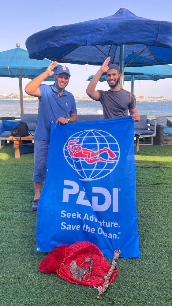
Entangled Help


Use the vertical tabs below to record any entangled animals you found of each type.

Gold Coast Seaway

1
rock
40

-27.936903307944, 153.42546164989

Well known rock fishing and boat fishing location.
Southerly Winds, small amount of rain but mostly fine.
iDive
David Bates
2
0
2.00
71
9.00
4.00
measured
52
100.00
Fishing line
Lead sinkers
On
kilograms
I have debris data to report
Smooth (wavelets) for waves 0.1 - 0.5 meter high m2
meters
other
1
Australia
State\Province
QLD
City
Gold Coast
Map Help


Dive Location

If you know your survey site coordinates, enter them manually in decimal degrees using WGS84 Map Datum. Use the minus sign for latitudes south of the equator and longitudes west of the Prime Meridian to 180 degrees.

If you do not know your survey site coordinates, click the “Map Location” tab to use the map to zoom into your survey site and drop the pin on the map to fall within your survey dive site in the water (not on land or the beach). Ensure you zoom in as much as possible to ensure data accuracy.

Entangled Help


Use the vertical tabs below to record any entangled animals you found of each type.

Lighthouse/ Bannerfish Bay

3
123
0
0

28.498747, 34.51991

0
0
0
sand
0
1
0
4
0
No
Windy
25
4
1
Chewing gum
Fibre glass
Candle
Red Sea Tribe
Rachel Shelley
0
0
0
26
187
0
2
0
0
0
0
0
0
0
0
0
45
2
31
6
0
0
0
0
0
0
6
0
0
0
0
2
0
0
0
0
3.00
49
23.20
1.00
0
estimated
0
0
3196.60
0
0
0
2
0
Cigarette butts
Plastic fragments
Glass fragments
0
On
kilograms
0
I have debris data to report
0
0
0
Smooth (wavelets) for waves 0.1 - 0.5 meter high
3
0
0
Carpet fragment
Crab - species unknown
Released Unharmed
1
0
0
0
0
m2
0
0
meters
coral reef
1
0
0
0
0
12
0
3
0
0
0
0
0
30
0
0
0
0
0
0
0
0
127
0
0
0
0
0
0
Egypt
State\Province
South Sinai
City
Dahab
Map Help


Dive Location

If you know your survey site coordinates, enter them manually in decimal degrees using WGS84 Map Datum. Use the minus sign for latitudes south of the equator and longitudes west of the Prime Meridian to 180 degrees.

If you do not know your survey site coordinates, click the “Map Location” tab to use the map to zoom into your survey site and drop the pin on the map to fall within your survey dive site in the water (not on land or the beach). Ensure you zoom in as much as possible to ensure data accuracy.
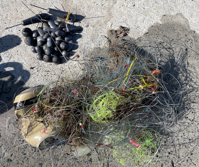
Entangled Help


Use the vertical tabs below to record any entangled animals you found of each type.

Trash Derby 7

24.837222, -80.655

coral
0
3 anchors with chain, bait cage, 100' of rope, 150' of monofilament line
3
Anchors and Chain
Key Dives
Morgan Gardner
14
1
419.55
40
80.00
30.00
measured
1000.00
On
pounds
I have debris data to report
Smooth (wavelets) for waves 0.1 - 0.5 meter high ft2
-2
feet
coral reef
United States
State\Province
FL
City
Islamorada
Map Help


Dive Location

If you know your survey site coordinates, enter them manually in decimal degrees using WGS84 Map Datum. Use the minus sign for latitudes south of the equator and longitudes west of the Prime Meridian to 180 degrees.

If you do not know your survey site coordinates, click the “Map Location” tab to use the map to zoom into your survey site and drop the pin on the map to fall within your survey dive site in the water (not on land or the beach). Ensure you zoom in as much as possible to ensure data accuracy.

Entangled Help


Use the vertical tabs below to record any entangled animals you found of each type.

Trash Derby 6

24.823333, -80.655278

coral
1
6 anchors, monofilament line, rope, bait cage, and anchor chains
6
2
Anchor
Chain
Key Dives
Morgan Gardner
14
1
187.59
40
85.00
30.00
measured
1000.00
On
pounds
I have debris data to report
Smooth (wavelets) for waves 0.1 - 0.5 meter high ft2
feet
coral reef
United States
State\Province
FL
City
Islamorada
Map Help


Dive Location

If you know your survey site coordinates, enter them manually in decimal degrees using WGS84 Map Datum. Use the minus sign for latitudes south of the equator and longitudes west of the Prime Meridian to 180 degrees.

If you do not know your survey site coordinates, click the “Map Location” tab to use the map to zoom into your survey site and drop the pin on the map to fall within your survey dive site in the water (not on land or the beach). Ensure you zoom in as much as possible to ensure data accuracy.

Entangled Help


Use the vertical tabs below to record any entangled animals you found of each type.

Trash Derby 5

24.805278, -80.657222

1
coral
1
1 piece of trap concrete, 3 pieces of trap wood, beer can, piece of sheet metal, 2 anchors and chains, glass bottle, deep sea lure, 350' of trap rope, 2 metal trap pieces, 300' of monofilament line, 10 metal leaders
Key Dives
Michael Ryan
20
157.70
40
85.00
35.00
measured
10
1000.00
On
pounds
I have debris data to report
1
Smooth (wavelets) for waves 0.1 - 0.5 meter high
3
ft2
1
feet
coral reef
3
1
2
United States
State\Province
FL
City
Islamorada
Map Help


Dive Location

If you know your survey site coordinates, enter them manually in decimal degrees using WGS84 Map Datum. Use the minus sign for latitudes south of the equator and longitudes west of the Prime Meridian to 180 degrees.

If you do not know your survey site coordinates, click the “Map Location” tab to use the map to zoom into your survey site and drop the pin on the map to fall within your survey dive site in the water (not on land or the beach). Ensure you zoom in as much as possible to ensure data accuracy.

Entangled Help


Use the vertical tabs below to record any entangled animals you found of each type.

Trash Derby 4

2

24.987222, -80.68

coral
1
600' of rope, 300' of monofilament fishing line, 2 buoys, 20 pieces of wood from traps, 2 large ghost nets (approx 500 sq ft) with weights along the bottom
Key Dives
Michael Ryan
19
2
1
185.00
40
85.00
35.00
measured
1
1000.00
On
pounds
I have debris data to report
Smooth (wavelets) for waves 0.1 - 0.5 meter high
19
ft2
feet
coral reef
United States
State\Province
FL
City
Islamorada
Map Help


Dive Location

If you know your survey site coordinates, enter them manually in decimal degrees using WGS84 Map Datum. Use the minus sign for latitudes south of the equator and longitudes west of the Prime Meridian to 180 degrees.

If you do not know your survey site coordinates, click the “Map Location” tab to use the map to zoom into your survey site and drop the pin on the map to fall within your survey dive site in the water (not on land or the beach). Ensure you zoom in as much as possible to ensure data accuracy.

Entangled Help


Use the vertical tabs below to record any entangled animals you found of each type.

Trash Derby 3

25.174444, -80.628611

1
coral
1
50' of fishing line, 150' of rope, bait cage, and fishing pole
Key Dives
Michael Ryan
19
77.70
40
80.00
30.00
measured
1
1000.00
On
pounds
I have debris data to report
Smooth (wavelets) for waves 0.1 - 0.5 meter high ft2
1
feet
coral reef
United States
State\Province
FL
City
Islamorada
Map Help


Dive Location

If you know your survey site coordinates, enter them manually in decimal degrees using WGS84 Map Datum. Use the minus sign for latitudes south of the equator and longitudes west of the Prime Meridian to 180 degrees.

If you do not know your survey site coordinates, click the “Map Location” tab to use the map to zoom into your survey site and drop the pin on the map to fall within your survey dive site in the water (not on land or the beach). Ensure you zoom in as much as possible to ensure data accuracy.

Entangled Help


Use the vertical tabs below to record any entangled animals you found of each type.

Trash Derby 2

24.923333, -80.500556

1
coral
1
1 fishing pole, 7 anchors, 225' of rope, 25' of fishing line, 1 bottle, 1 hat
7
Anchor
Key Dives
Michael Ryan
22
261.00
40
85.00
35.00
measured
1000.00
On
pounds
I have debris data to report
1
Smooth (wavelets) for waves 0.1 - 0.5 meter high
1
ft2
feet
coral reef
United States
State\Province
FL
City
Islamorada
Map Help


Dive Location

If you know your survey site coordinates, enter them manually in decimal degrees using WGS84 Map Datum. Use the minus sign for latitudes south of the equator and longitudes west of the Prime Meridian to 180 degrees.

If you do not know your survey site coordinates, click the “Map Location” tab to use the map to zoom into your survey site and drop the pin on the map to fall within your survey dive site in the water (not on land or the beach). Ensure you zoom in as much as possible to ensure data accuracy.

Entangled Help


Use the vertical tabs below to record any entangled animals you found of each type.

Subscribe to