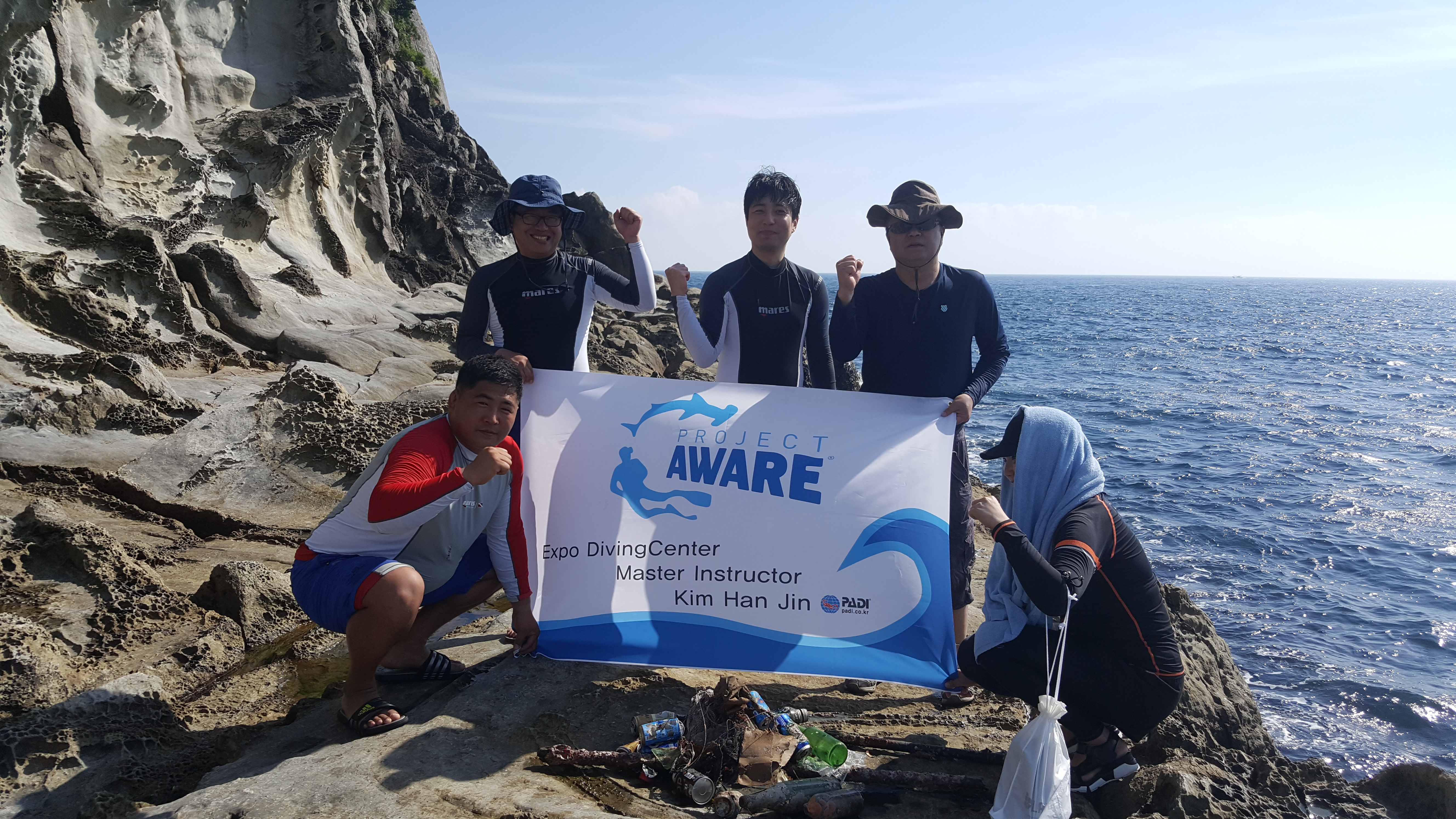
Moderate to rough for waves greater than 1.25 meters
0
1
0
0
0
1
0
m2
0
0
meters
kelp
3
0
0
0
3
0
0
0
8
3
0
0
2
0
0
0
1
0
0
0
0
0
0
0
0
0
0
0
Australia
State\Province
NSW
City
Sydney
Map Help
Dive Location
If you know your survey site coordinates, enter them manually in decimal degrees using WGS84 Map Datum. Use the minus sign for latitudes south of the equator and longitudes west of the Prime Meridian to 180 degrees.
If you do not know your survey site coordinates, click the “Map Location” tab to use the map to zoom into your survey site and drop the pin on the map to fall within your survey dive site in the water (not on land or the beach). Ensure you zoom in as much as possible to ensure data accuracy.
Entangled Help
Use the vertical tabs below to record any entangled animals you found of each type.
Would like to thank the seven divers (Maria, Hilary, Beth, Paul, Heath and Mike) who joined me on this dive, to Kevin for captaining the boat, and to Cheryl for assisting at the surface in her kayak.
Most of what we found can probably be attributed to the fishermen who frequent this popular fishing hole in Kane's Creek.
An old, rusted, rear brake drum from a large truck.
Heavy rain for one day 4 days prior to the dive. Clear the rest of the week. Temperatures 55 - 80 degrees F.
1
Bell anchor
Aquatic Adventures
Wayne Summers
0
2
7
4
187.00
70
16.00
3.00
2
measured
22000.00
Fishing line and lures -- dangerous to both aquatic life and to swimmers in the area
Rusted metal car parts, anchors, etc -- the rust is toxic to the ecosystem and a potential hazard to swimmers
Plastics -- because they do not decompose
On
pounds
I have debris data to report
5
Calm (glassy to rippled) for waves 0 – 0.1 meter high
ft2
feet
other
1
1
1
2
8
Language
English
United States
State\Province
VA
City
Alexandria
Map Help
Dive Location
If you know your survey site coordinates, enter them manually in decimal degrees using WGS84 Map Datum. Use the minus sign for latitudes south of the equator and longitudes west of the Prime Meridian to 180 degrees.
If you do not know your survey site coordinates, click the “Map Location” tab to use the map to zoom into your survey site and drop the pin on the map to fall within your survey dive site in the water (not on land or the beach). Ensure you zoom in as much as possible to ensure data accuracy.
Entangled Help
Use the vertical tabs below to record any entangled animals you found of each type.
Smooth (wavelets) for waves 0.1 - 0.5 meter high
m2
meters
kelp
Language
English
Norway
Map Help
Dive Location
If you know your survey site coordinates, enter them manually in decimal degrees using WGS84 Map Datum. Use the minus sign for latitudes south of the equator and longitudes west of the Prime Meridian to 180 degrees.
If you do not know your survey site coordinates, click the “Map Location” tab to use the map to zoom into your survey site and drop the pin on the map to fall within your survey dive site in the water (not on land or the beach). Ensure you zoom in as much as possible to ensure data accuracy.
Entangled Help
Use the vertical tabs below to record any entangled animals you found of each type.
We have also found some big items that we were unable to remove. Please see pictures.
Typhoons of the last three weeks
Bra
Three typhoons during the last three consecutive weeks.
T
Tursiopsdiver
6
1
1
2
1
2
1
7.00
83
4.60
2.00
estimated
1
20.00
Metal cans
On
kilograms
I have debris data to report
Calm (glassy to rippled) for waves 0 – 0.1 meter high
1
1
m2
meters
coral reef
1
22
1
Language
English
Hong Kong S.A.R., China
State\Province
Hong Kong
City
Tung Ping Chau island
Map Help
Dive Location
If you know your survey site coordinates, enter them manually in decimal degrees using WGS84 Map Datum. Use the minus sign for latitudes south of the equator and longitudes west of the Prime Meridian to 180 degrees.
If you do not know your survey site coordinates, click the “Map Location” tab to use the map to zoom into your survey site and drop the pin on the map to fall within your survey dive site in the water (not on land or the beach). Ensure you zoom in as much as possible to ensure data accuracy.
Entangled Help
Use the vertical tabs below to record any entangled animals you found of each type.
Smooth (wavelets) for waves 0.1 - 0.5 meter high
m2
meters
kelp
Language
English
Norway
Map Help
Dive Location
If you know your survey site coordinates, enter them manually in decimal degrees using WGS84 Map Datum. Use the minus sign for latitudes south of the equator and longitudes west of the Prime Meridian to 180 degrees.
If you do not know your survey site coordinates, click the “Map Location” tab to use the map to zoom into your survey site and drop the pin on the map to fall within your survey dive site in the water (not on land or the beach). Ensure you zoom in as much as possible to ensure data accuracy.
Entangled Help
Use the vertical tabs below to record any entangled animals you found of each type.
Shortly after we entered the water we saw big bundled up abandoned fishing net that was stuck to a smaller coral (~60 cm in diameter) and floated upwards, about 1.5 m. There were several crabs and a fish trapped in it and seahorse (very rare sighting) was 'sitting' on a branch that was also trapped in this mess. First we cut the fish free then waited for the seashore to swim away. We were very worried that it would get trapped too. So we tried to position ourselves sort of in between the seashore and the fishing gear. Finally the seashore left. Then we carefully cut the fishing net off the coral, carried it to the shore. We cut out the two crabs that were still alive and released them back. We then continued with our dive. After the dive we disposed everything responsibly in clouding the huge mess of fishing net
Typhoons of the last three weeks
Two were alive and released, two were dead
Toy figure
Three typhoons during the last three consecutive weeks.
2
0
0
0
0
0
0
0
0
0
0
0
0
0
0
0
0
0
0
0
Plastic flower pot
Tursiopsdiver
0
0
0
1
0
0
0
0
0
0
0
0
0
2
0
0
0
0
0
2
0
0
2
0
0
0
1
0
0
0
0
0
0
0
15.00
92
4.60
2.00
1
estimated
0
1
16459.40
0
0
0
0
0
Abandoned fishing gear
Metal cans
Plastic
0
On
kilograms
0
I have debris data to report
0
0
0
Calm (glassy to rippled) for waves 0 – 0.1 meter high
0
0
0
Abandoned fishing gear
Released Unharmed
Damsel
Crabs
Released Unharmed
4
1
Fishing gears
0
0
0
0
m2
0
0
meters
coral reef
0
0
0
0
0
0
0
0
0
0
0
0
0
0
3
0
11
0
0
0
0
0
0
0
0
0
0
0
Language
English
Hong Kong S.A.R., China
State\Province
Hong Kong
City
Tung Ping Chau island
Map Help
Dive Location
If you know your survey site coordinates, enter them manually in decimal degrees using WGS84 Map Datum. Use the minus sign for latitudes south of the equator and longitudes west of the Prime Meridian to 180 degrees.
If you do not know your survey site coordinates, click the “Map Location” tab to use the map to zoom into your survey site and drop the pin on the map to fall within your survey dive site in the water (not on land or the beach). Ensure you zoom in as much as possible to ensure data accuracy.
Entangled Help
Use the vertical tabs below to record any entangled animals you found of each type.
Smooth (wavelets) for waves 0.1 - 0.5 meter high
m2
meters
rocky reef
10
Language
English
South Korea
State\Province
유성구
City
대전
Map Help
Dive Location
If you know your survey site coordinates, enter them manually in decimal degrees using WGS84 Map Datum. Use the minus sign for latitudes south of the equator and longitudes west of the Prime Meridian to 180 degrees.
If you do not know your survey site coordinates, click the “Map Location” tab to use the map to zoom into your survey site and drop the pin on the map to fall within your survey dive site in the water (not on land or the beach). Ensure you zoom in as much as possible to ensure data accuracy.
Entangled Help
Use the vertical tabs below to record any entangled animals you found of each type.
Smooth (wavelets) for waves 0.1 - 0.5 meter high
m2
meters
kelp
Language
English
Norway
Map Help
Dive Location
If you know your survey site coordinates, enter them manually in decimal degrees using WGS84 Map Datum. Use the minus sign for latitudes south of the equator and longitudes west of the Prime Meridian to 180 degrees.
If you do not know your survey site coordinates, click the “Map Location” tab to use the map to zoom into your survey site and drop the pin on the map to fall within your survey dive site in the water (not on land or the beach). Ensure you zoom in as much as possible to ensure data accuracy.
Entangled Help
Use the vertical tabs below to record any entangled animals you found of each type.