Menu

La Pinta beach

22
50
1
10

28.08048339679, -16.736062914133

sand
4
1

28.08048339679, -16.736062914133

No
Underpants
Windy 10 knot winds
Excel Scuba Tenerife
Dave Holland
1
3
6
3
8
2
2
10.90
50
8.00
3.00
16
measured
45.00
Plastic
Rope
Netting
On
kilograms
I have debris data to report
1
Smooth (wavelets) for waves 0.1 - 0.5 meter high
2
m2
meters
other
Spain
State\Province
Tenerife
City
Costa Adeje
Map Help


Dive Location

If you know your survey site coordinates, enter them manually in decimal degrees using WGS84 Map Datum. Use the minus sign for latitudes south of the equator and longitudes west of the Prime Meridian to 180 degrees.

If you do not know your survey site coordinates, click the “Map Location” tab to use the map to zoom into your survey site and drop the pin on the map to fall within your survey dive site in the water (not on land or the beach). Ensure you zoom in as much as possible to ensure data accuracy.

Entangled Help


Use the vertical tabs below to record any entangled animals you found of each type.

Ecosystem Other
Sandy

Navy Island Trincomalee

0
0
0
2

8.572068, 81.240146

0
0
0
coral
0
15
0
0
0
Clothes
Sunny day
Kalpitiya Diving Center
Samith Fernando
0
0
0
2
0
0
0
0
0
0
0
0
0
0
0
0
2
0
0
2
0
0
0
0
5
2
5
0
0
0
0
0
0
0
0
0
2.00
52
12.00
5.00
0
measured
0
0
0
0
50.06
0
0
0
0
0
Nets
Bottles
Plastic bag
0
On
kilograms
0
I have debris data to report
0
0
0
Calm (glassy to rippled) for waves 0 – 0.1 meter high
0
0
0
3
0
0
0
m2
0
3
meters
coral reef
0
0
0
0
0
0
0
0
0
0
0
0
0
0
0
0
0
0
0
0
0
0
0
0
0
0
0
0
0
Sri Lanka
State\Province
Eastern Province
City
Trincomalee
Map Help


Dive Location

If you know your survey site coordinates, enter them manually in decimal degrees using WGS84 Map Datum. Use the minus sign for latitudes south of the equator and longitudes west of the Prime Meridian to 180 degrees.

If you do not know your survey site coordinates, click the “Map Location” tab to use the map to zoom into your survey site and drop the pin on the map to fall within your survey dive site in the water (not on land or the beach). Ensure you zoom in as much as possible to ensure data accuracy.
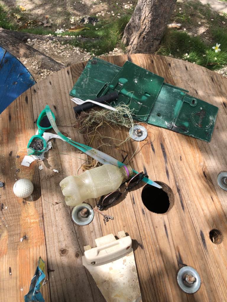
Entangled Help


Use the vertical tabs below to record any entangled animals you found of each type.

Milo's Garden

6

-8.136618, 114.64986

1
sand
14
Cloudy
1
Hygienic Mask
Abyss Ocean World
Debora Ruoss
4
2
1
2
0
3
0
2
2.00
80
18.90
2.00
measured
1161.28
plastic bags
foil wrappers
plastic wrappers
On
kilograms
I have debris data to report
Calm (glassy to rippled) for waves 0 – 0.1 meter high
1
m2
meters
seagrass
13
1
Indonesia
State\Province
Bali
City
Pemuteran
Map Help


Dive Location

If you know your survey site coordinates, enter them manually in decimal degrees using WGS84 Map Datum. Use the minus sign for latitudes south of the equator and longitudes west of the Prime Meridian to 180 degrees.

If you do not know your survey site coordinates, click the “Map Location” tab to use the map to zoom into your survey site and drop the pin on the map to fall within your survey dive site in the water (not on land or the beach). Ensure you zoom in as much as possible to ensure data accuracy.
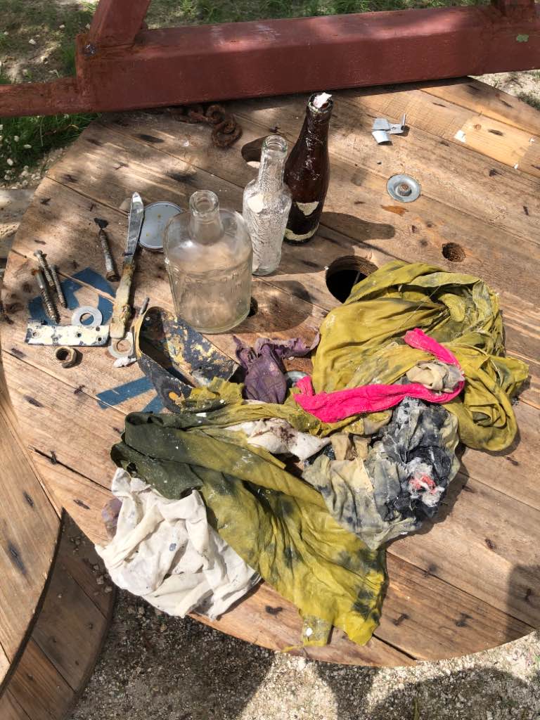
Entangled Help


Use the vertical tabs below to record any entangled animals you found of each type.

SCUBA Hub - Dira Island Dubai

0
3
0
0

25.30344339552, 55.304762510837

0
0
0
sand
1
0
0
0
0
Beach party
Plastic items
Calm
SCUBA Hub Club
Majed Saeed
0
0
0
1
0
0
0
0
0
0
0
0
0
0
0
0
0
1
0
3
0
0
0
0
0
1
0
0
0
0
0
0
0
0
0
0
2.00
35
12.00
1.00
0
estimated
0
0
231.41
0
0
0
0
0
0
On
kilograms
0
I have debris data to report
0
0
0
Smooth (wavelets) for waves 0.1 - 0.5 meter high
0
0
0
0
0
0
0
m2
0
0
meters
coral reef
1
0
0
0
0
0
0
0
0
0
0
0
0
0
0
0
0
1
0
0
0
0
0
0
0
0
0
0
0
United Arab Emirates
State\Province
Dubai
City
Dubai
Map Help


Dive Location

If you know your survey site coordinates, enter them manually in decimal degrees using WGS84 Map Datum. Use the minus sign for latitudes south of the equator and longitudes west of the Prime Meridian to 180 degrees.

If you do not know your survey site coordinates, click the “Map Location” tab to use the map to zoom into your survey site and drop the pin on the map to fall within your survey dive site in the water (not on land or the beach). Ensure you zoom in as much as possible to ensure data accuracy.
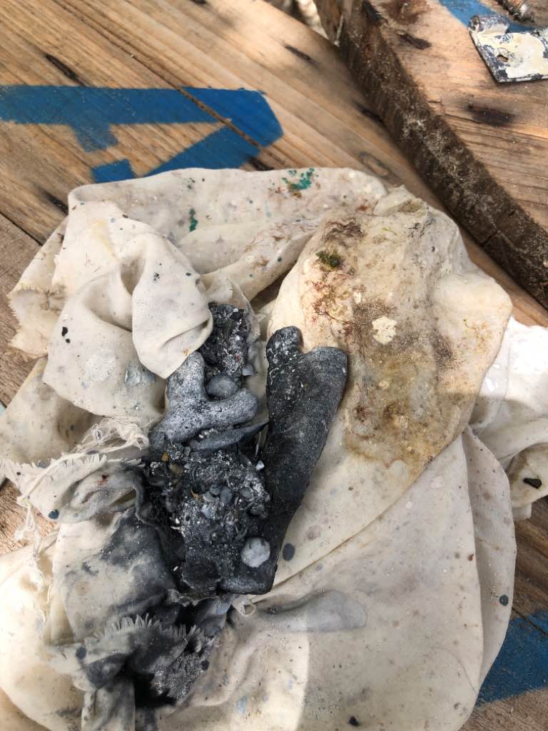
Entangled Help


Use the vertical tabs below to record any entangled animals you found of each type.

Veprika

0
0
0
0

43.283787, 17.025893

0
0
0
rock
0
0
0
0
0
Veprika is beautiful corall reef on rocks!
Tourist rent aBoat traffic
It looks clean till next dive!
More Sub d.o.o
Bojan Runtić
0
0
0
0
0
0
0
0
0
0
0
0
0
0
0
0
0
0
0
3
0
0
0
0
0
0
0
0
0
0
0
0
0
0
0
0
0.00
25
26.00
3.00
0
estimated
0
0
0
0
2657.00
0
0
0
0
0
Glass bottles
Plastic peaces of swimmers
Clothes
0
On
pounds
0
Our Survey Site was free of debris
0
0
0
Smooth (wavelets) for waves 0.1 - 0.5 meter high
0
0
0
0
0
0
0
m2
0
0
meters
coral reef
0
0
0
0
0
0
0
0
0
0
0
0
0
0
0
0
0
0
0
0
0
0
0
0
0
0
0
0
0
Croatia
City
Makarska
Map Help


Dive Location

If you know your survey site coordinates, enter them manually in decimal degrees using WGS84 Map Datum. Use the minus sign for latitudes south of the equator and longitudes west of the Prime Meridian to 180 degrees.

If you do not know your survey site coordinates, click the “Map Location” tab to use the map to zoom into your survey site and drop the pin on the map to fall within your survey dive site in the water (not on land or the beach). Ensure you zoom in as much as possible to ensure data accuracy.

Entangled Help


Use the vertical tabs below to record any entangled animals you found of each type.

Luda Giri

0
0
0
0

4.0928893189631, 73.532890329077

0
0
0
coral
0
0
0
0
0
Shoe
Excellent
Scuba Shack
Philip Jones
0
0
0
0
0
0
0
0
0
0
0
0
0
0
0
0
0
0
0
4
0
0
0
0
0
0
0
0
0
0
0
0
0
0
0
0
0.00
55
30.00
12.00
0
measured
0
0
3126.39
0
0
0
0
0
Cloth
Plastic
0
On
kilograms
0
Our Survey Site was free of debris
0
0
0
Calm (glassy to rippled) for waves 0 – 0.1 meter high
0
0
0
0
0
0
0
m2
0
0
meters
coral reef
0
0
0
0
0
0
0
0
0
0
0
0
0
0
0
0
0
0
0
0
0
0
0
0
0
0
0
0
0
Maldives
City
South male atoll
Map Help


Dive Location

If you know your survey site coordinates, enter them manually in decimal degrees using WGS84 Map Datum. Use the minus sign for latitudes south of the equator and longitudes west of the Prime Meridian to 180 degrees.

If you do not know your survey site coordinates, click the “Map Location” tab to use the map to zoom into your survey site and drop the pin on the map to fall within your survey dive site in the water (not on land or the beach). Ensure you zoom in as much as possible to ensure data accuracy.

Entangled Help


Use the vertical tabs below to record any entangled animals you found of each type.

Life Saving Reef Trincomalee

4
1
0
0

7.5960264, 80.4828811

0
0
0
sand
0
4
0
0
0
Damaged by the hook
A bucket
Entangled
Sunny
Kalpitiya Diving Center
Samith Fernando
0
0
0
3
0
0
0
0
0
0
0
0
0
0
0
0
0
0
0
2
0
0
0
0
2
7
5
0
0
1
1
0
0
0
0
0
3.00
45
8.00
8.00
2
measured
0
0
0
0
70.80
0
0
0
0
0
1
On
kilograms
0
I have debris data to report
0
0
0
Calm (glassy to rippled) for waves 0 – 0.1 meter high
0
0
2
Dead
Moray Eel
1
Fishing line
Dead
Sting Ray
1
0
2
0
0
m2
0
1
0
meters
coral reef
Fishing line
0
0
0
0
0
0
0
0
0
1
0
0
0
0
0
0
0
9
0
0
0
0
0
0
0
0
1
0
0
Sri Lanka
State\Province
Eastern Province
City
Trincomalee
Map Help


Dive Location

If you know your survey site coordinates, enter them manually in decimal degrees using WGS84 Map Datum. Use the minus sign for latitudes south of the equator and longitudes west of the Prime Meridian to 180 degrees.

If you do not know your survey site coordinates, click the “Map Location” tab to use the map to zoom into your survey site and drop the pin on the map to fall within your survey dive site in the water (not on land or the beach). Ensure you zoom in as much as possible to ensure data accuracy.

Entangled Help


Use the vertical tabs below to record any entangled animals you found of each type.

Pange North

5
0
9
0

-6.16746851049, 39.137355164487

0
0
0
coral
0
0
0
5
0
Yes
Windy
One Ocean Zanzibar
One Ocean Zanzibar
0
0
0
8
0
0
0
0
0
0
4
0
0
0
0
0
0
0
0
6
0
0
0
0
4
0
3
0
0
0
0
0
0
0
0
0
26.25
55
14.00
5.00
0
estimated
0
0
4916.21
0
0
0
0
0
Single use plastic for food
Fishing line
Plastic bottles
0
On
kilograms
0
I have debris data to report
0
0
0
Smooth (wavelets) for waves 0.1 - 0.5 meter high
0
0
0
0
0
0
0
m2
0
0
meters
coral reef
0
0
0
0
0
0
0
0
0
0
0
0
0
0
0
0
0
0
0
0
0
0
0
0
0
0
0
0
0
Tanzania
City
Zanzibar
Map Help


Dive Location

If you know your survey site coordinates, enter them manually in decimal degrees using WGS84 Map Datum. Use the minus sign for latitudes south of the equator and longitudes west of the Prime Meridian to 180 degrees.

If you do not know your survey site coordinates, click the “Map Location” tab to use the map to zoom into your survey site and drop the pin on the map to fall within your survey dive site in the water (not on land or the beach). Ensure you zoom in as much as possible to ensure data accuracy.

Entangled Help


Use the vertical tabs below to record any entangled animals you found of each type.

Pange South

3
0
15
3

-6.1839168583352, 39.150623105448

0
0
0
coral
0
0
0
3
0
Yes
One Ocean Zanzibar
One Ocean Zanzibar
0
0
0
3
0
0
0
0
0
0
3
0
0
0
0
0
0
0
0
6
0
0
0
0
0
0
0
0
0
0
0
0
0
0
0
0
26.25
55
18.00
5.00
0
measured
0
0
1337.28
0
0
0
0
0
Single use plastic for food
Fishing line
Plastic bottles
0
On
kilograms
0
I have debris data to report
0
0
0
Slight for waves 0.5 -1.25 meter high
0
0
0
0
0
0
0
m2
0
0
meters
coral reef
0
0
0
0
0
0
0
0
0
0
0
0
0
0
0
0
0
0
0
0
0
0
0
0
0
0
0
0
0
Tanzania
City
Zanzibar
Map Help


Dive Location

If you know your survey site coordinates, enter them manually in decimal degrees using WGS84 Map Datum. Use the minus sign for latitudes south of the equator and longitudes west of the Prime Meridian to 180 degrees.

If you do not know your survey site coordinates, click the “Map Location” tab to use the map to zoom into your survey site and drop the pin on the map to fall within your survey dive site in the water (not on land or the beach). Ensure you zoom in as much as possible to ensure data accuracy.

Entangled Help


Use the vertical tabs below to record any entangled animals you found of each type.

Kimi Evias

3

38.630337237351, 24.125068151592

4
3
4
sand
19
20
4

38.630337237351, 24.125068151592

Saucepan
Calm sea
Aegean Seals D.C.
Efstratios Synodis
2
4
3
8
3
0
2
1
2
4
2
5
3
8
4
19
4
8
3
1
0
500.00
60
5.00
2.00
estimated
5
3
0
1
1500.00
13
1
On
kilograms
3
I have debris data to report
10
4
2
Calm (glassy to rippled) for waves 0 – 0.1 meter high
3
fishing line
1
Released Unharmed
SEA STAR
3
1
m2
10
meters
other
1
1
1
1
0
2
2
2
1
1
3
1
1
10
1
2
2
Greece
State\Province
Evia
City
Chalkida
Map Help


Dive Location

If you know your survey site coordinates, enter them manually in decimal degrees using WGS84 Map Datum. Use the minus sign for latitudes south of the equator and longitudes west of the Prime Meridian to 180 degrees.

If you do not know your survey site coordinates, click the “Map Location” tab to use the map to zoom into your survey site and drop the pin on the map to fall within your survey dive site in the water (not on land or the beach). Ensure you zoom in as much as possible to ensure data accuracy.

Entangled Help


Use the vertical tabs below to record any entangled animals you found of each type.

Ecosystem Other
MUD
Subscribe to