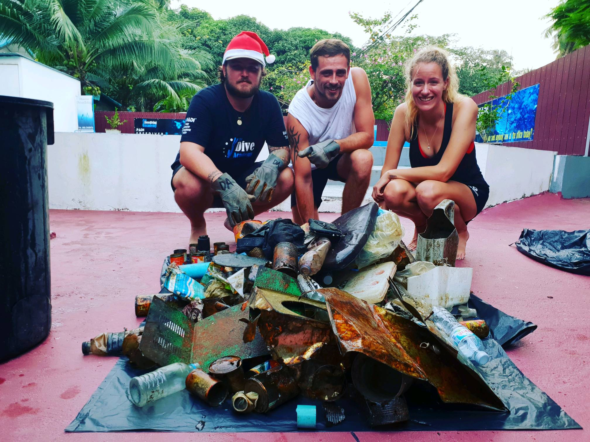
We chose this beach (Playa Esmeralda) to make our dive against debris, because lots of people go there as it is a public beach as well there is a big hotel around. So we thought that it would be a good start. As we did not find any debris (good news) we start to think about the possibility that the current take it to another place.
I filled with 1 at the blank for total weight, because I could not save the survey. How could I continue to contribute even thought my team and I do not find any debris?
Scuba Revolution
Keila Endo Kasai
3
0.00
47
4.80
1.00
estimated
155.56
On
kilograms
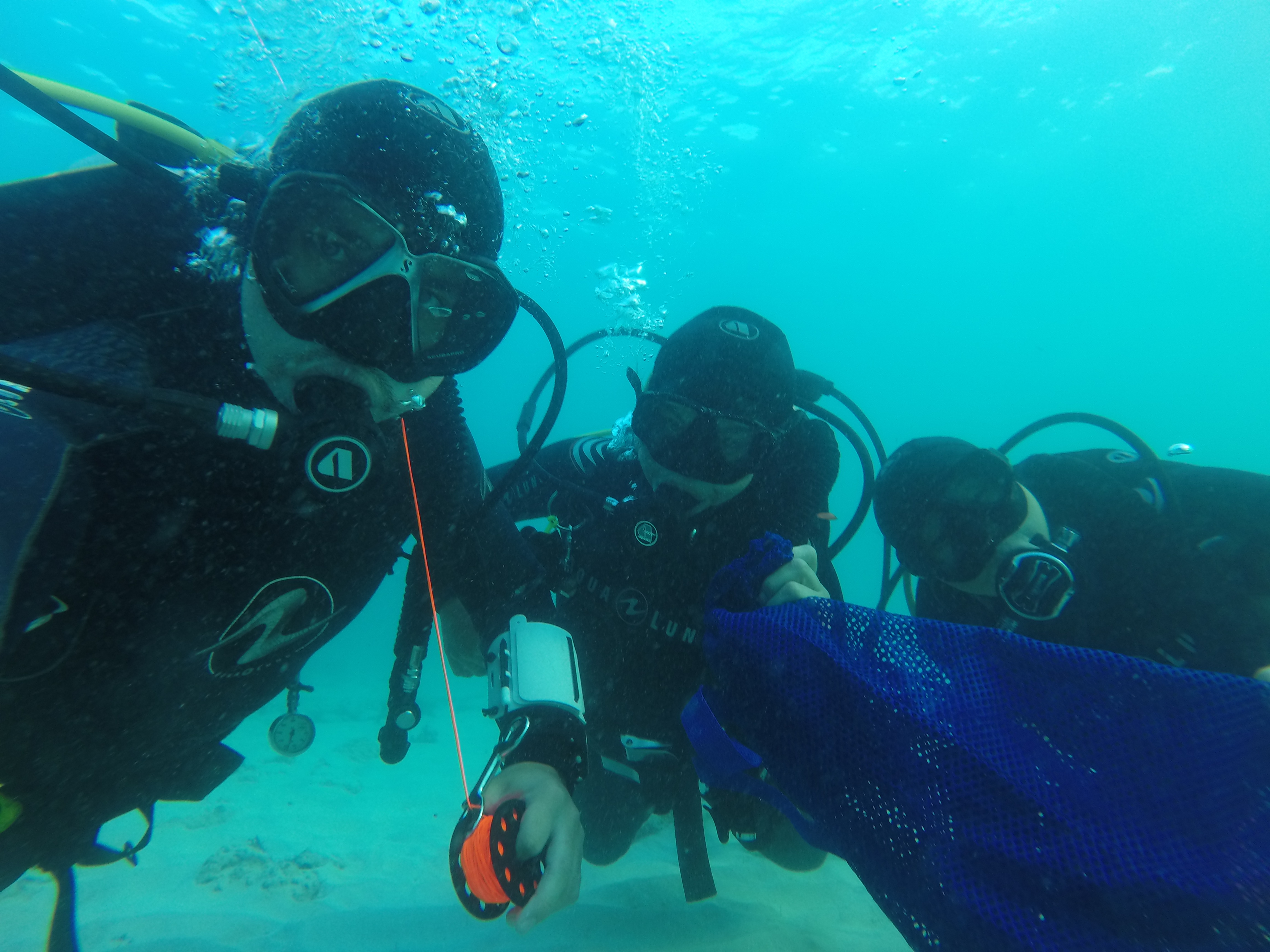
Our Survey Site was free of debris
Calm (glassy to rippled) for waves 0 – 0.1 meter high
m2
meters
seagrass
Mexico
State\Province
Quintana Roo
City
Playa del Carmen
Map Help
Dive Location
If you know your survey site coordinates, enter them manually in decimal degrees using WGS84 Map Datum. Use the minus sign for latitudes south of the equator and longitudes west of the Prime Meridian to 180 degrees.
If you do not know your survey site coordinates, click the “Map Location” tab to use the map to zoom into your survey site and drop the pin on the map to fall within your survey dive site in the water (not on land or the beach). Ensure you zoom in as much as possible to ensure data accuracy.
Entangled Help
Use the vertical tabs below to record any entangled animals you found of each type.
Calm (glassy to rippled) for waves 0 – 0.1 meter high
m2
meters
kelp
Language
English
Norway
Map Help
Dive Location
If you know your survey site coordinates, enter them manually in decimal degrees using WGS84 Map Datum. Use the minus sign for latitudes south of the equator and longitudes west of the Prime Meridian to 180 degrees.
If you do not know your survey site coordinates, click the “Map Location” tab to use the map to zoom into your survey site and drop the pin on the map to fall within your survey dive site in the water (not on land or the beach). Ensure you zoom in as much as possible to ensure data accuracy.
Entangled Help
Use the vertical tabs below to record any entangled animals you found of each type.
Calm (glassy to rippled) for waves 0 – 0.1 meter high
2
0
0
0
0
0
0
m2
0
0
meters
coral reef
0
0
0
0
0
0
0
0
0
2
0
0
0
0
0
0
0
0
0
0
0
2
0
0
0
0
0
1
Language
English
Philippines
State\Province
Negros Oriental
City
Dauin
Map Help
Dive Location
If you know your survey site coordinates, enter them manually in decimal degrees using WGS84 Map Datum. Use the minus sign for latitudes south of the equator and longitudes west of the Prime Meridian to 180 degrees.
If you do not know your survey site coordinates, click the “Map Location” tab to use the map to zoom into your survey site and drop the pin on the map to fall within your survey dive site in the water (not on land or the beach). Ensure you zoom in as much as possible to ensure data accuracy.
Entangled Help
Use the vertical tabs below to record any entangled animals you found of each type.
Calm (glassy to rippled) for waves 0 – 0.1 meter high
0
0
0
0
0
0
0
m2
0
0
meters
rocky reef
0
0
0
0
0
0
0
0
0
0
0
0
0
0
0
0
0
0
0
0
0
0
0
0
0
0
0
0
0
Language
English
Netherlands Antilles
City
Kralendijk
Map Help
Dive Location
If you know your survey site coordinates, enter them manually in decimal degrees using WGS84 Map Datum. Use the minus sign for latitudes south of the equator and longitudes west of the Prime Meridian to 180 degrees.
If you do not know your survey site coordinates, click the “Map Location” tab to use the map to zoom into your survey site and drop the pin on the map to fall within your survey dive site in the water (not on land or the beach). Ensure you zoom in as much as possible to ensure data accuracy.
Entangled Help
Use the vertical tabs below to record any entangled animals you found of each type.
Calm (glassy to rippled) for waves 0 – 0.1 meter high
1
m2
meters
coral reef
1
2
1
Language
English
Singapore
Map Help
Dive Location
If you know your survey site coordinates, enter them manually in decimal degrees using WGS84 Map Datum. Use the minus sign for latitudes south of the equator and longitudes west of the Prime Meridian to 180 degrees.
If you do not know your survey site coordinates, click the “Map Location” tab to use the map to zoom into your survey site and drop the pin on the map to fall within your survey dive site in the water (not on land or the beach). Ensure you zoom in as much as possible to ensure data accuracy.
Entangled Help
Use the vertical tabs below to record any entangled animals you found of each type.
Our dive center in cooperation with american military base in Kuwait scheduled net clean up event on 30th of december 2018.
Firefighter Ax, boat leader, spearfishing gun
31 degrees C air
28 degrees C water
wind 6 knots
no waves/currents/surf
The Palms Dive center
Zhanyla Noruzbaeva
4
5
1
21
3
7
25.00
51
10.00
5.00
measured
29
4
2500.00
Fishing lines, robes, hooks
Plastic bottels and bags
Glass bottles and fast food packeging
On
kilograms
I have debris data to report
7
Calm (glassy to rippled) for waves 0 – 0.1 meter high
1
1
m2
31
meters
coral reef
14
3
1
10
Language
English
Kuwait
City
kuwait
Map Help
Dive Location
If you know your survey site coordinates, enter them manually in decimal degrees using WGS84 Map Datum. Use the minus sign for latitudes south of the equator and longitudes west of the Prime Meridian to 180 degrees.
If you do not know your survey site coordinates, click the “Map Location” tab to use the map to zoom into your survey site and drop the pin on the map to fall within your survey dive site in the water (not on land or the beach). Ensure you zoom in as much as possible to ensure data accuracy.
Entangled Help
Use the vertical tabs below to record any entangled animals you found of each type.
Calm (glassy to rippled) for waves 0 – 0.1 meter high
1
0
1
Casting net
Released Unharmed
No idea
Unknown
Released Unharmed
3
6
Casting net
0
6
0
0
m2
34
0
meters
rocky reef
0
0
0
0
0
0
0
1
0
0
1
0
0
0
0
14
0
3
0
0
1
0
0
0
1
0
0
0
0
Language
English
Australia
State\Province
Queensland
City
Caloundra
Map Help
Dive Location
If you know your survey site coordinates, enter them manually in decimal degrees using WGS84 Map Datum. Use the minus sign for latitudes south of the equator and longitudes west of the Prime Meridian to 180 degrees.
If you do not know your survey site coordinates, click the “Map Location” tab to use the map to zoom into your survey site and drop the pin on the map to fall within your survey dive site in the water (not on land or the beach). Ensure you zoom in as much as possible to ensure data accuracy.
Entangled Help
Use the vertical tabs below to record any entangled animals you found of each type.
The participants: Shannon Witter, Jack Morten and Corey Roulent were completing DAD Specialty Instructor training
Monsoon Rain
The Dive Academy
Paul Meredith
3
6
2
0
0
0
0
0
3
0
0
0
0
0
0
0
1
3
0
4
0
0
0
0
0
0
18
0
0
2
0
0
0
0
0
0
18.00
80
7.00
3.00
0
measured
0
0
0
2
11668.20
0
0
0
0
0
Food Cans
Plastic bottles
Plastic bags
0
On
kilograms
0
I have debris data to report
1
0
0
Calm (glassy to rippled) for waves 0 – 0.1 meter high
4
0
3
0
0
3
0
m2
6
0
meters
coral reef
1
0
3
5
0
0
0
0
0
2
2
0
0
0
0
1
118
0
0
5
10
0
13
0
0
0
7
0
0
Language
English
Thailand
State\Province
Suratthani
City
Koh Tao
Map Help
Dive Location
If you know your survey site coordinates, enter them manually in decimal degrees using WGS84 Map Datum. Use the minus sign for latitudes south of the equator and longitudes west of the Prime Meridian to 180 degrees.
If you do not know your survey site coordinates, click the “Map Location” tab to use the map to zoom into your survey site and drop the pin on the map to fall within your survey dive site in the water (not on land or the beach). Ensure you zoom in as much as possible to ensure data accuracy.
Entangled Help
Use the vertical tabs below to record any entangled animals you found of each type.