Menu

ADS459 - The Cliff

12.174596, -68.291217

coral

12.174476327073, -68.290114402771

Dive friends Bonaire
Roos
3
0.00
90
14.00
6.00
measured
20.00
On
kilograms
Our Survey Site was free of debris
Smooth (wavelets) for waves 0.1 - 0.5 meter high m2
meters
coral reef
Netherlands Antilles
State\Province
Bonaire
Map Help


Dive Location

If you know your survey site coordinates, enter them manually in decimal degrees using WGS84 Map Datum. Use the minus sign for latitudes south of the equator and longitudes west of the Prime Meridian to 180 degrees.

If you do not know your survey site coordinates, click the “Map Location” tab to use the map to zoom into your survey site and drop the pin on the map to fall within your survey dive site in the water (not on land or the beach). Ensure you zoom in as much as possible to ensure data accuracy.

Entangled Help


Use the vertical tabs below to record any entangled animals you found of each type.

3 Rocks

0
0
0
0

25.482575, 56.365359

0
0
0
sand
0
1
0
0
0
Divers Down UAE
Talih
0
0
0
0
0
0
0
0
0
0
0
0
0
0
0
0
0
0
0
2
0
1
0
0
0
0
0
0
0
0
0
0
0
0
0
0
0.20
33
12.00
6.00
0
estimated
0
0
0
0
400.00
0
0
0
0
0
0
On
kilograms
0
I have debris data to report
0
0
0
Calm (glassy to rippled) for waves 0 – 0.1 meter high
0
0
0
0
0
0
0
m2
0
0
meters
rocky reef
0
0
0
0
0
0
0
0
0
0
0
0
0
0
0
0
0
0
0
0
0
0
0
0
0
0
0
0
0
United Arab Emirates
City
Fujairah
Map Help


Dive Location

If you know your survey site coordinates, enter them manually in decimal degrees using WGS84 Map Datum. Use the minus sign for latitudes south of the equator and longitudes west of the Prime Meridian to 180 degrees.

If you do not know your survey site coordinates, click the “Map Location” tab to use the map to zoom into your survey site and drop the pin on the map to fall within your survey dive site in the water (not on land or the beach). Ensure you zoom in as much as possible to ensure data accuracy.

Entangled Help


Use the vertical tabs below to record any entangled animals you found of each type.

Koh Mapring

0
0
0

11.902111248326, 102.41158961149

0
0
0
rock
0
0
0
0
0
Currents
Sif
Good
0
0
0
0
0
0
0
0
0
0
0
0
0
0
0
0
0
0
0
0
Kohmakdivers
Martijn Schaink
0
0
0
0
0
0
0
0
0
0
0
0
0
0
0
0
0
0
0
2
0
0
0
0
0
0
0
0
0
0
0
0
0
0
15.00
60
5.00
1.00
0
estimated
0
0
10.00
0
0
0
0
0
Plastic
Plastic
0
On
kilograms
0
I have debris data to report
0
0
0
Smooth (wavelets) for waves 0.1 - 0.5 meter high
0
0
0
0
0
0
0
m2
0
0
meters
other
0
0
0
0
0
0
0
0
0
0
0
0
0
0
0
0
0
0
0
0
0
0
0
0
0
0
0
0
Thailand
State\Province
Trat
City
Kohmak
Map Help


Dive Location

If you know your survey site coordinates, enter them manually in decimal degrees using WGS84 Map Datum. Use the minus sign for latitudes south of the equator and longitudes west of the Prime Meridian to 180 degrees.

If you do not know your survey site coordinates, click the “Map Location” tab to use the map to zoom into your survey site and drop the pin on the map to fall within your survey dive site in the water (not on land or the beach). Ensure you zoom in as much as possible to ensure data accuracy.

Entangled Help


Use the vertical tabs below to record any entangled animals you found of each type.

ADS368 - South Bay

1
5
9

12.165496, 109.30875

sand
9
Sunny, bit windy in afternoon/evening
Sailing Club Divers
Nicolas Martin
3
4
5.00
45
18.00
13.00
6
estimated
5
900.00
9
On
kilograms
I have debris data to report
1
Calm (glassy to rippled) for waves 0 – 0.1 meter high
7
m2
3
meters
coral reef
4
2
2
5
Vietnam
State\Province
Khanh Hoa
City
Nha Trang
Map Help


Dive Location

If you know your survey site coordinates, enter them manually in decimal degrees using WGS84 Map Datum. Use the minus sign for latitudes south of the equator and longitudes west of the Prime Meridian to 180 degrees.

If you do not know your survey site coordinates, click the “Map Location” tab to use the map to zoom into your survey site and drop the pin on the map to fall within your survey dive site in the water (not on land or the beach). Ensure you zoom in as much as possible to ensure data accuracy.

Entangled Help


Use the vertical tabs below to record any entangled animals you found of each type.

ADS367 - PADI Beach

1
5
1

12.169492, 109.307799

coral
4
Sunny, bit windy in afternoon/evening
Sailing Club Divers
Nicolas Martin
1
4
9.00
48
17.00
4.00
35
estimated
800.00
On
kilograms
I have debris data to report
Calm (glassy to rippled) for waves 0 – 0.1 meter high
3
m2
meters
coral reef
Vietnam
State\Province
Khanh Hoa
City
Nha Trang
Map Help


Dive Location

If you know your survey site coordinates, enter them manually in decimal degrees using WGS84 Map Datum. Use the minus sign for latitudes south of the equator and longitudes west of the Prime Meridian to 180 degrees.

If you do not know your survey site coordinates, click the “Map Location” tab to use the map to zoom into your survey site and drop the pin on the map to fall within your survey dive site in the water (not on land or the beach). Ensure you zoom in as much as possible to ensure data accuracy.

Entangled Help


Use the vertical tabs below to record any entangled animals you found of each type.

Harbour

0
0
156
0

-8.36398, 116.082853

0
0
0
sand
0
98
0
0
0
Yes
Plastic
Calm
Oceans 5
Cedric Cabrieres
0
0
0
83
0
0
0
0
0
0
0
0
3
0
0
0
38
0
0
6
0
0
0
0
104
0
56
0
0
0
0
0
0
0
0
0
100.00
45
15.00
5.00
0
estimated
0
0
0
0
1159.97
0
2
0
0
0
Plastic bag
Plastic food
0
On
kilograms
0
I have debris data to report
19
0
0
Calm (glassy to rippled) for waves 0 – 0.1 meter high
0
0
0
0
0
0
0
m2
0
0
meters
coral reef
0
0
0
0
0
0
0
0
0
0
0
0
0
0
0
0
0
65
0
0
0
0
0
0
0
0
0
0
0
Indonesia
State\Province
Lombok
City
Gili air
Map Help


Dive Location

If you know your survey site coordinates, enter them manually in decimal degrees using WGS84 Map Datum. Use the minus sign for latitudes south of the equator and longitudes west of the Prime Meridian to 180 degrees.

If you do not know your survey site coordinates, click the “Map Location” tab to use the map to zoom into your survey site and drop the pin on the map to fall within your survey dive site in the water (not on land or the beach). Ensure you zoom in as much as possible to ensure data accuracy.

Entangled Help


Use the vertical tabs below to record any entangled animals you found of each type.

Harbour

0
0
203
0

-8.363976, 116.082776

0
0
0
sand
0
103
0
0
0
Yes
Plastic
Calm
Oceans 5
Cedric Cabrieres
0
0
0
67
0
0
0
0
0
0
0
0
0
0
0
0
11
0
0
10
0
0
0
0
52
0
98
0
0
0
0
0
0
0
0
0
180.00
45
15.00
5.00
0
estimated
0
0
0
0
1592.03
0
2
0
0
0
Plastic food
Plastic bags
0
On
kilograms
0
I have debris data to report
32
0
0
Calm (glassy to rippled) for waves 0 – 0.1 meter high
0
0
0
0
0
0
0
m2
0
23
meters
coral reef
0
0
0
0
0
0
0
0
0
0
0
0
0
0
0
0
0
85
0
0
0
0
0
0
0
0
0
0
0
Indonesia
State\Province
Lombok
City
Gili air
Map Help


Dive Location

If you know your survey site coordinates, enter them manually in decimal degrees using WGS84 Map Datum. Use the minus sign for latitudes south of the equator and longitudes west of the Prime Meridian to 180 degrees.

If you do not know your survey site coordinates, click the “Map Location” tab to use the map to zoom into your survey site and drop the pin on the map to fall within your survey dive site in the water (not on land or the beach). Ensure you zoom in as much as possible to ensure data accuracy.

Entangled Help


Use the vertical tabs below to record any entangled animals you found of each type.

ADS455 - House Reef Toberua

1
0
1
0

-17.975254, 178.703459

0
0
0
sand
0
0
0
1
0
No
Nothing unusual
Rain
Toberua Divers
Everette Ingram
0
0
0
0
0
0
0
0
0
0
0
0
0
0
0
0
0
0
0
4
0
0
0
0
0
0
1
0
0
1
0
0
0
0
0
1
4.10
40
12.00
3.00
0
measured
0
0
0
0
533.00
0
0
0
0
0
Glass bottles
Fishing line
0
On
kilograms
0
I have debris data to report
3
0
0
Smooth (wavelets) for waves 0.1 - 0.5 meter high
0
0
0
0
0
0
0
m2
0
0
meters
coral reef
0
0
0
0
0
0
0
0
0
0
0
0
0
0
0
0
0
0
0
0
0
0
0
0
0
0
0
0
0
Fiji
City
Toberua Island
Map Help


Dive Location

If you know your survey site coordinates, enter them manually in decimal degrees using WGS84 Map Datum. Use the minus sign for latitudes south of the equator and longitudes west of the Prime Meridian to 180 degrees.

If you do not know your survey site coordinates, click the “Map Location” tab to use the map to zoom into your survey site and drop the pin on the map to fall within your survey dive site in the water (not on land or the beach). Ensure you zoom in as much as possible to ensure data accuracy.

Entangled Help


Use the vertical tabs below to record any entangled animals you found of each type.

Mashraba

28.4957641, 34.518074

seagrass
1
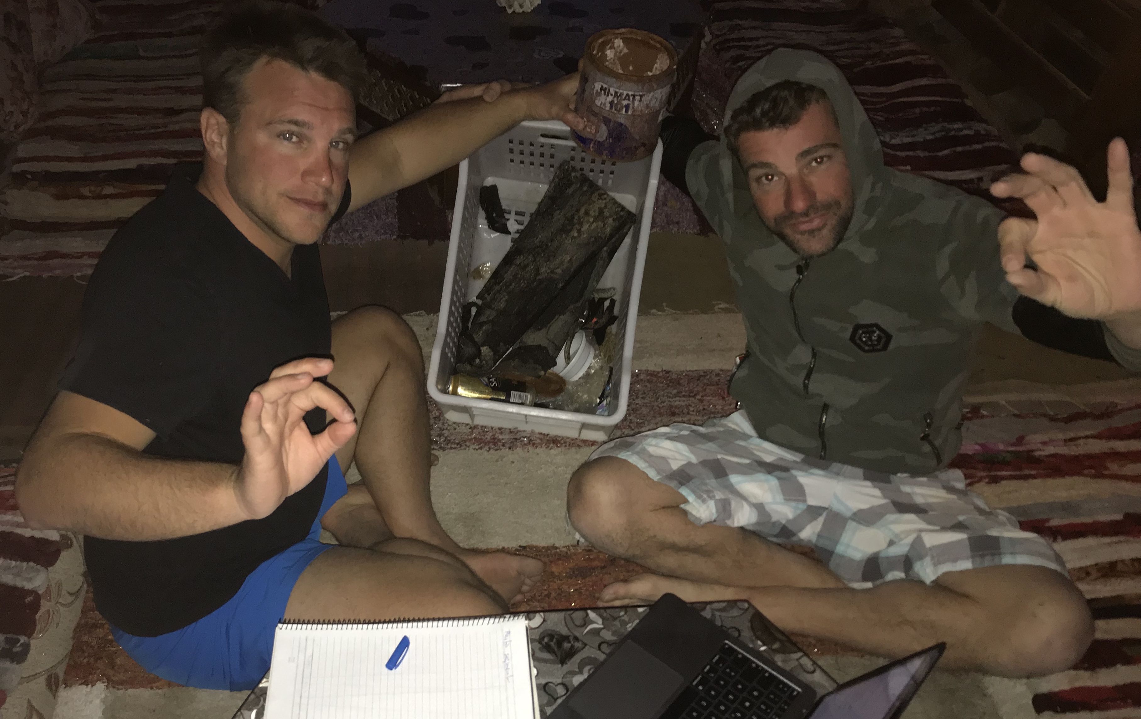
Paint can (5L)
Shiny, 25 Celsius
Adventure Spot Dahab
Sebastian Schäfer
1
3
1
2
1
29
2.00
86
40.00
3.00
measured
3000.00
1
1
Plastic
On
kilograms
I have debris data to report
3
Calm (glassy to rippled) for waves 0 – 0.1 meter high
1
m2
meters
seagrass
1
1
1
3
1
Egypt
City
Dahab
Map Help


Dive Location

If you know your survey site coordinates, enter them manually in decimal degrees using WGS84 Map Datum. Use the minus sign for latitudes south of the equator and longitudes west of the Prime Meridian to 180 degrees.

If you do not know your survey site coordinates, click the “Map Location” tab to use the map to zoom into your survey site and drop the pin on the map to fall within your survey dive site in the water (not on land or the beach). Ensure you zoom in as much as possible to ensure data accuracy.

Entangled Help


Use the vertical tabs below to record any entangled animals you found of each type.

ADS479 - Boca Sami

23

12.146246, -68.999348

14
sand
7
30
Great!
Central Dive Curacao
Marcel Zinnert
4
6
3
21
1
9
5
5
50.00
60
19.00
0.00
7
estimated
8
1872.00
3
On
kilograms
I have debris data to report
26
Calm (glassy to rippled) for waves 0 – 0.1 meter high
3
m2
5
meters
coral reef
1
3
1
2
3
10
13
1
Netherlands Antilles
City
Willemstad
Map Help


Dive Location

If you know your survey site coordinates, enter them manually in decimal degrees using WGS84 Map Datum. Use the minus sign for latitudes south of the equator and longitudes west of the Prime Meridian to 180 degrees.

If you do not know your survey site coordinates, click the “Map Location” tab to use the map to zoom into your survey site and drop the pin on the map to fall within your survey dive site in the water (not on land or the beach). Ensure you zoom in as much as possible to ensure data accuracy.
Entangled Help


Use the vertical tabs below to record any entangled animals you found of each type.

Subscribe to