Menu

Nakijin

1
0
1

26.705672579008, 127.96260742722

0
0
0
coral
0
0
0
0
0
Butterfly net
Good
0
0
0
0
0
0
0
0
0
0
0
0
0
0
0
0
0
0
0
0
John Evans
0
0
0
0
0
0
0
0
1
0
0
0
0
0
0
0
0
0
0
2
0
0
0
0
0
0
0
0
0
0
0
0
0
0
2.00
45
85.00
30.00
0
estimated
0
0
1820.29
0
0
0
0
0
0
On
pounds
0
I have debris data to report
0
0
0
Smooth (wavelets) for waves 0.1 - 0.5 meter high
0
0
0
0
0
0
0
m2
0
0
feet
coral reef
0
0
0
0
0
5
0
0
0
0
0
0
0
0
0
0
2
0
0
0
0
0
0
0
0
0
0
0
Japan
State\Province
Okinawa
City
Nago-Shi
Map Help


Dive Location

If you know your survey site coordinates, enter them manually in decimal degrees using WGS84 Map Datum. Use the minus sign for latitudes south of the equator and longitudes west of the Prime Meridian to 180 degrees.

If you do not know your survey site coordinates, click the “Map Location” tab to use the map to zoom into your survey site and drop the pin on the map to fall within your survey dive site in the water (not on land or the beach). Ensure you zoom in as much as possible to ensure data accuracy.

Entangled Help


Use the vertical tabs below to record any entangled animals you found of each type.

ADS07 - Gildenburgh Water

6

52.553871609955, -0.10533234686636

silt

52.553450659678, -0.1061008534457

calm
Dive in
Lynn Smith
1
1
1.70
75
10.00
2.00
estimated
2921.74
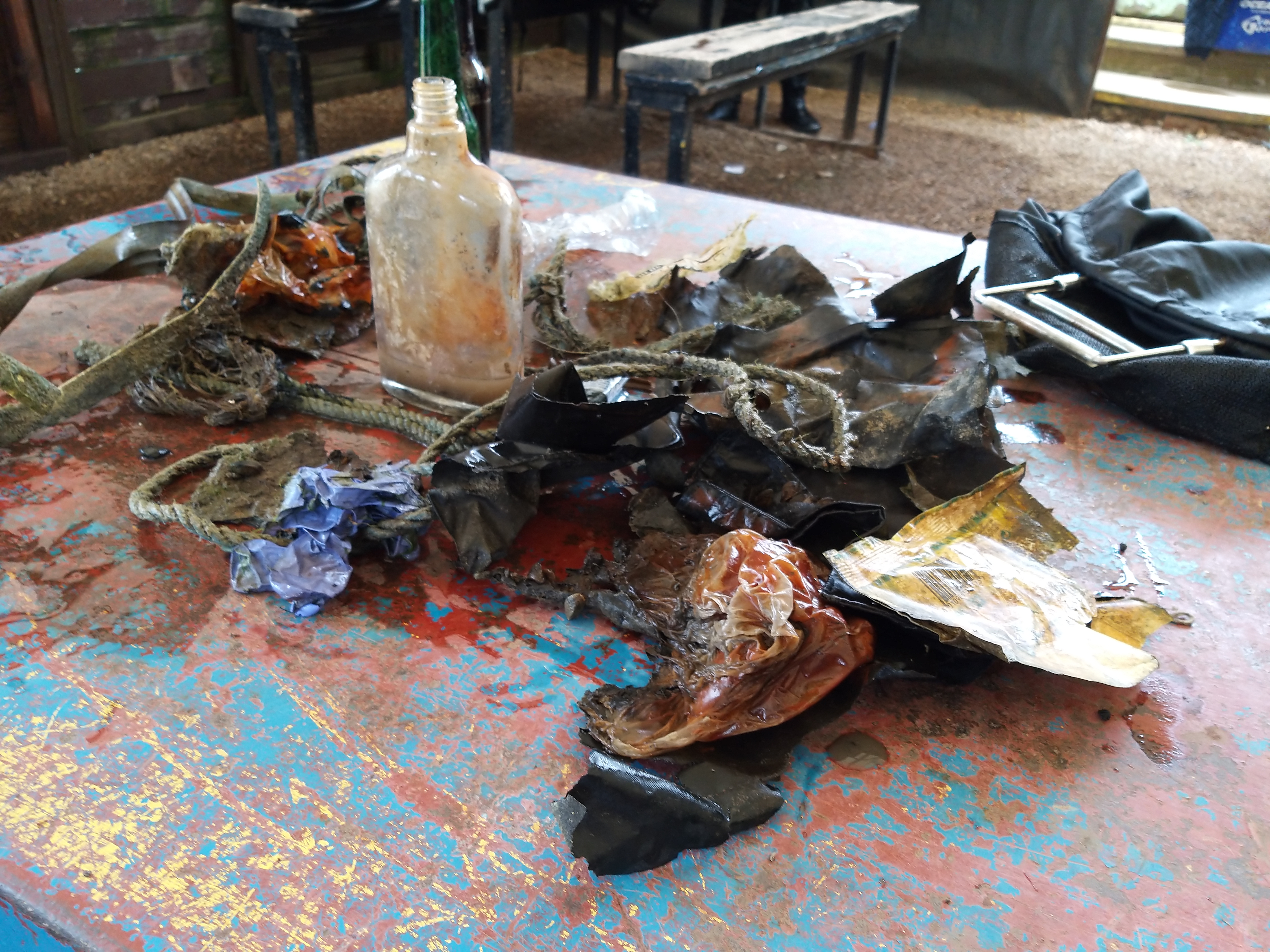
Rope
On
kilograms
I have debris data to report
3
Calm (glassy to rippled) for waves 0 – 0.1 meter high m2
2
meters
other
United Kingdom
State\Province
Cambridgshire
City
Peterborough
Map Help


Dive Location

If you know your survey site coordinates, enter them manually in decimal degrees using WGS84 Map Datum. Use the minus sign for latitudes south of the equator and longitudes west of the Prime Meridian to 180 degrees.

If you do not know your survey site coordinates, click the “Map Location” tab to use the map to zoom into your survey site and drop the pin on the map to fall within your survey dive site in the water (not on land or the beach). Ensure you zoom in as much as possible to ensure data accuracy.
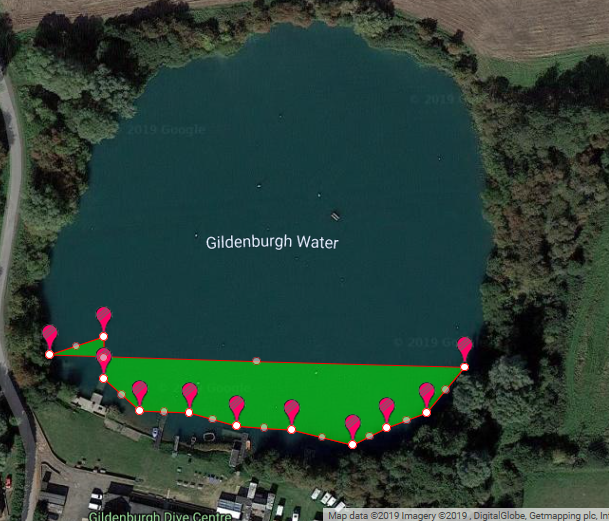
Entangled Help


Use the vertical tabs below to record any entangled animals you found of each type.

ADS216 - USCG Duane

0
0
0
0

24.98966667, -80.382

0
0
0
sand
0
0
0
2
0
Fishing
Rainbow Reef Dive Center/FKNMS
Bella S
0
0
0
0
0
0
0
0
0
0
0
0
0
0
0
0
0
0
0
1
0
0
0
0
0
0
0
0
0
0
0
0
0
0
0
0
0.50
40
120.00
75.00
0
estimated
0
0
0
1
1500.00
0
0
0
0
0
0
On
kilograms
0
I have debris data to report
0
0
0
Calm (glassy to rippled) for waves 0 – 0.1 meter high
0
0
0
0
0
0
0
m2
0
0
feet
coral reef
0
0
0
0
0
0
0
0
0
0
0
0
0
0
0
1
0
0
0
0
0
0
0
0
0
0
0
0
0
United States
State\Province
Florida
City
Key Largo
Map Help


Dive Location

If you know your survey site coordinates, enter them manually in decimal degrees using WGS84 Map Datum. Use the minus sign for latitudes south of the equator and longitudes west of the Prime Meridian to 180 degrees.

If you do not know your survey site coordinates, click the “Map Location” tab to use the map to zoom into your survey site and drop the pin on the map to fall within your survey dive site in the water (not on land or the beach). Ensure you zoom in as much as possible to ensure data accuracy.
Entangled Help


Use the vertical tabs below to record any entangled animals you found of each type.

ADS27 - Permit Ledges

0
0
0
0

25.007575, -80.377769

0
0
0
coral
0
0
0
0
0
Rainbow Reef Dive Center/FKNMS
Jennie H
0
0
0
0
0
0
0
0
0
0
0
0
0
0
0
0
0
0
0
1
0
0
0
0
0
0
0
0
0
0
0
0
0
0
0
0
0.30
45
45.00
12.00
0
estimated
0
0
0
0
2000.00
0
0
0
0
0
0
On
pounds
0
I have debris data to report
0
0
0
Calm (glassy to rippled) for waves 0 – 0.1 meter high
0
0
0
0
0
0
0
m2
0
0
feet
coral reef
0
0
0
0
1
0
0
0
0
0
0
0
0
0
0
0
0
0
0
0
0
0
0
0
0
0
0
0
0
United States
State\Province
Florida
City
Key Largo
Map Help


Dive Location

If you know your survey site coordinates, enter them manually in decimal degrees using WGS84 Map Datum. Use the minus sign for latitudes south of the equator and longitudes west of the Prime Meridian to 180 degrees.

If you do not know your survey site coordinates, click the “Map Location” tab to use the map to zoom into your survey site and drop the pin on the map to fall within your survey dive site in the water (not on land or the beach). Ensure you zoom in as much as possible to ensure data accuracy.

Entangled Help


Use the vertical tabs below to record any entangled animals you found of each type.

ADS59 - Snapper Ledge

0
0
0
0

24.981194, -80.422154

0
0
0
coral
0
0
0
2
0
Fishing
Dive knife
Rainbow Reef Dive Center/FKNMS
Jennie
0
0
0
0
0
0
0
0
0
0
0
0
0
0
0
0
0
0
0
1
0
0
0
0
0
0
0
0
0
0
0
0
0
0
0
0
1.00
45
30.00
7.00
0
estimated
0
0
0
2
297.00
0
0
0
0
0
0
On
pounds
0
I have debris data to report
0
0
0
Calm (glassy to rippled) for waves 0 – 0.1 meter high
0
0
0
0
0
0
0
m2
0
0
feet
coral reef
0
0
0
0
1
0
0
0
0
0
0
0
0
0
0
0
0
0
0
0
0
0
0
0
0
0
0
0
0
United States
State\Province
Florida
City
Key Largo
Map Help


Dive Location

If you know your survey site coordinates, enter them manually in decimal degrees using WGS84 Map Datum. Use the minus sign for latitudes south of the equator and longitudes west of the Prime Meridian to 180 degrees.

If you do not know your survey site coordinates, click the “Map Location” tab to use the map to zoom into your survey site and drop the pin on the map to fall within your survey dive site in the water (not on land or the beach). Ensure you zoom in as much as possible to ensure data accuracy.

Entangled Help


Use the vertical tabs below to record any entangled animals you found of each type.

ADS105 - French Twist

0
0
0
0

25.03428333, -80.34821667

0
0
0
coral
0
0
0
0
0
Sunny
Rainbow Reef Dive Center/FKNMS
Caleb P
0
0
0
0
0
0
0
0
0
0
0
0
0
0
0
0
0
0
0
1
0
0
0
0
0
0
0
0
0
0
0
0
0
0
0
0
0.20
45
45.00
11.00
0
estimated
0
0
0
0
3750.00
0
0
0
0
0
0
On
pounds
0
I have debris data to report
0
0
0
Calm (glassy to rippled) for waves 0 – 0.1 meter high
0
0
0
0
0
0
0
m2
0
0
feet
coral reef
0
0
0
0
0
0
0
0
0
0
0
0
0
0
0
0
0
0
0
0
0
0
1
0
0
0
0
0
0
United States
State\Province
Florida
City
Key Largo
Map Help


Dive Location

If you know your survey site coordinates, enter them manually in decimal degrees using WGS84 Map Datum. Use the minus sign for latitudes south of the equator and longitudes west of the Prime Meridian to 180 degrees.

If you do not know your survey site coordinates, click the “Map Location” tab to use the map to zoom into your survey site and drop the pin on the map to fall within your survey dive site in the water (not on land or the beach). Ensure you zoom in as much as possible to ensure data accuracy.

Entangled Help


Use the vertical tabs below to record any entangled animals you found of each type.

ADS63 - Molasses Deep

0
0
0
0

25.010285, -80.373301

1
0
0
coral
0
0
0
0
0
Fishing
Fishing rod
Rainbow Reef Dive Center/FKNMS
Chris L
0
0
0
0
0
0
0
0
0
0
0
0
0
0
0
0
0
0
0
1
0
0
0
0
0
0
0
0
0
0
0
0
0
0
0
0
2.00
40
70.00
37.00
0
estimated
0
0
0
0
1250.00
0
0
0
0
0
0
On
pounds
0
I have debris data to report
0
0
0
Calm (glassy to rippled) for waves 0 – 0.1 meter high
0
0
0
0
0
0
0
m2
0
0
feet
coral reef
0
0
0
0
0
0
0
0
0
0
0
0
0
0
0
0
0
0
0
0
0
0
0
0
0
0
0
0
0
United States
State\Province
Florida
City
Key Largo
Map Help


Dive Location

If you know your survey site coordinates, enter them manually in decimal degrees using WGS84 Map Datum. Use the minus sign for latitudes south of the equator and longitudes west of the Prime Meridian to 180 degrees.

If you do not know your survey site coordinates, click the “Map Location” tab to use the map to zoom into your survey site and drop the pin on the map to fall within your survey dive site in the water (not on land or the beach). Ensure you zoom in as much as possible to ensure data accuracy.

Entangled Help


Use the vertical tabs below to record any entangled animals you found of each type.

ADS216 - USCG Duane

0
0
0
0

24.98966667, -80.382

0
0
0
sand
0
0
0
0
0
Fishing
Rainbow Reef Dive Center/FKNMS
Chris L
0
0
0
0
0
0
0
0
0
0
0
0
0
0
0
0
0
0
0
1
0
0
0
0
0
0
0
0
0
0
0
0
0
0
0
0
0.50
40
100.00
10.00
0
estimated
0
0
0
3
1000.00
0
0
0
0
0
0
On
pounds
0
I have debris data to report
0
0
0
Calm (glassy to rippled) for waves 0 – 0.1 meter high
0
0
0
0
0
0
0
m2
0
0
feet
coral reef
0
0
0
0
0
0
0
0
0
0
0
0
0
0
0
0
0
0
0
0
0
0
0
0
0
0
0
0
0
United States
State\Province
Florida
City
KEY Largo
Map Help


Dive Location

If you know your survey site coordinates, enter them manually in decimal degrees using WGS84 Map Datum. Use the minus sign for latitudes south of the equator and longitudes west of the Prime Meridian to 180 degrees.

If you do not know your survey site coordinates, click the “Map Location” tab to use the map to zoom into your survey site and drop the pin on the map to fall within your survey dive site in the water (not on land or the beach). Ensure you zoom in as much as possible to ensure data accuracy.

Entangled Help


Use the vertical tabs below to record any entangled animals you found of each type.

ADS424 - New Club Reef

12
30
0
0

24.845218, 51.507888

0
0
0
sand
0
3
0
1
0
No
None
Windy
Qdivers
Jaco
0
0
0
0
0
0
0
0
0
0
0
0
0
0
0
0
0
0
20
3
0
0
0
0
0
2
13
0
0
1
0
0
0
0
0
0
7.00
60
19.00
5.00
0
measured
0
0
0
0
866.00
0
0
0
0
0
Plastic water bottles
Soda cans
0
On
kilograms
0
I have debris data to report
1
0
0
Calm (glassy to rippled) for waves 0 – 0.1 meter high
2
0
0
0
0
0
0
m2
0
4
meters
other
2
0
0
0
0
0
0
0
0
0
0
0
0
0
0
0
0
13
0
0
0
0
0
0
0
0
0
0
0
Qatar
State\Province
Doha
City
Mesaieed
Map Help


Dive Location

If you know your survey site coordinates, enter them manually in decimal degrees using WGS84 Map Datum. Use the minus sign for latitudes south of the equator and longitudes west of the Prime Meridian to 180 degrees.

If you do not know your survey site coordinates, click the “Map Location” tab to use the map to zoom into your survey site and drop the pin on the map to fall within your survey dive site in the water (not on land or the beach). Ensure you zoom in as much as possible to ensure data accuracy.

Entangled Help


Use the vertical tabs below to record any entangled animals you found of each type.

ADS219 - Pickles Reef

0
0
0

24.986848, -80.414711

0
0
0
coral
0
0
0
0
0
Fishing
Calm
0
0
0
0
0
0
0
0
0
0
0
0
0
0
0
0
0
0
0
0
Rainbow Reef Dive Center/FKNMS
Eli Lewis
0
0
0
0
0
0
0
0
0
0
0
0
0
0
0
0
0
0
0
5
0
0
0
0
0
0
0
0
0
0
0
0
0
0
0.50
45
30.00
20.00
0
estimated
0
2
230.84
0
0
0
0
0
0
On
kilograms
0
I have debris data to report
0
0
0
Calm (glassy to rippled) for waves 0 – 0.1 meter high
0
0
0
0
0
0
0
ft2
0
0
feet
coral reef
0
0
0
0
0
0
0
0
0
0
0
0
0
0
2
0
0
0
0
0
0
0
0
0
0
0
0
0
United States
State\Province
FL
City
Key Largo
Map Help


Dive Location

If you know your survey site coordinates, enter them manually in decimal degrees using WGS84 Map Datum. Use the minus sign for latitudes south of the equator and longitudes west of the Prime Meridian to 180 degrees.

If you do not know your survey site coordinates, click the “Map Location” tab to use the map to zoom into your survey site and drop the pin on the map to fall within your survey dive site in the water (not on land or the beach). Ensure you zoom in as much as possible to ensure data accuracy.

Entangled Help


Use the vertical tabs below to record any entangled animals you found of each type.

Subscribe to