Sha'ab El Erg
68
coral
27.39607942564, 33.875297151994
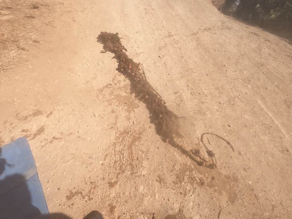
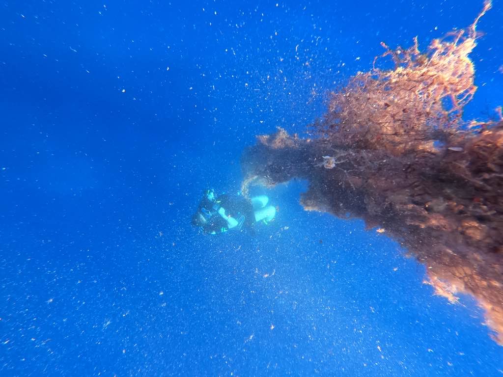
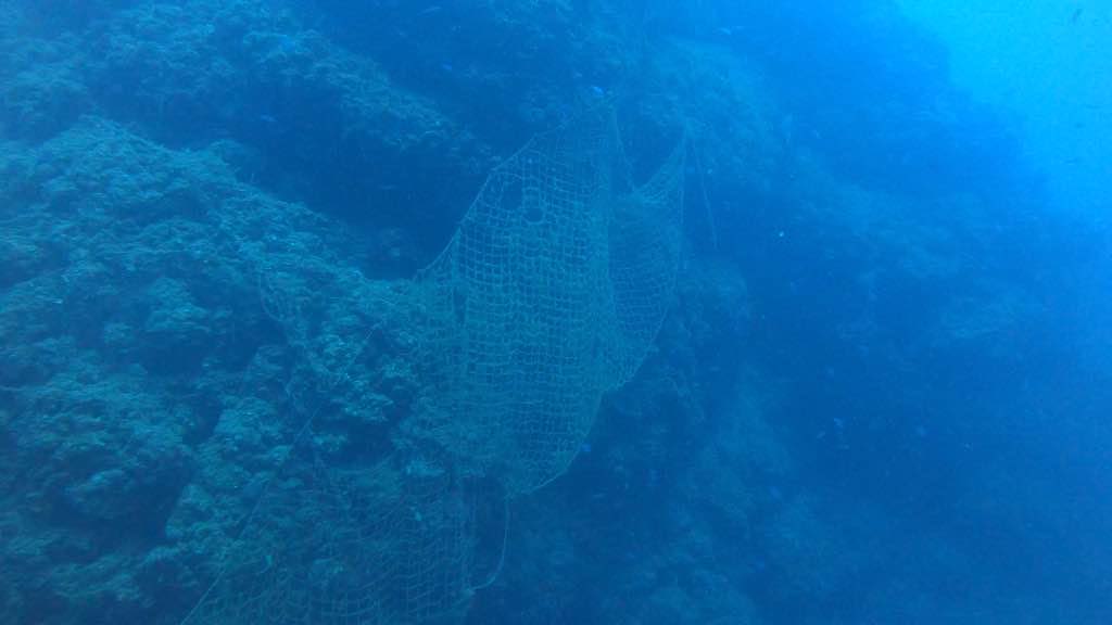
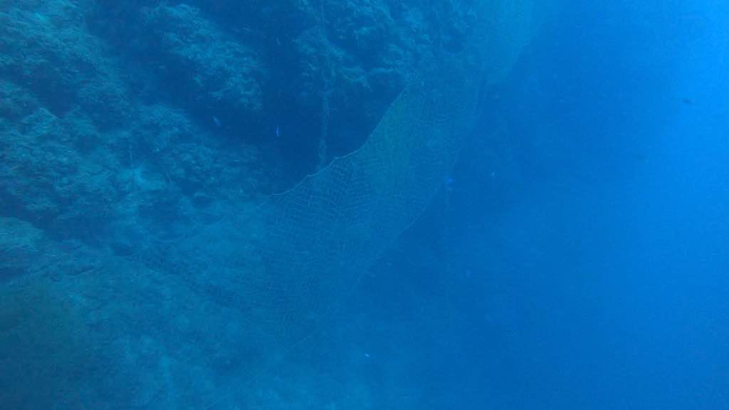
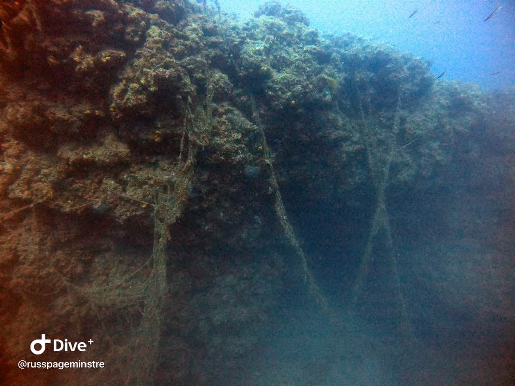
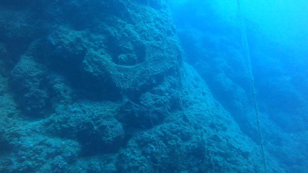
On Friday, the 16th of October 2020; Guides, guests and crew of Emperor Superior liveaboard were forced into action and removed a 100m long ghost fishing net on the very popular dive site Sha'ab El Erg ( Dolphins House). Unfortunately; few fishes and corals were already condemned by this time. They managed to record it, remove it and report it to the authorities.
N/A
Calm
Emperor Divers Red Sea
Ahmed Fouad
6
68.00
70
14.00
8.00
measured
520.00
On
kilograms
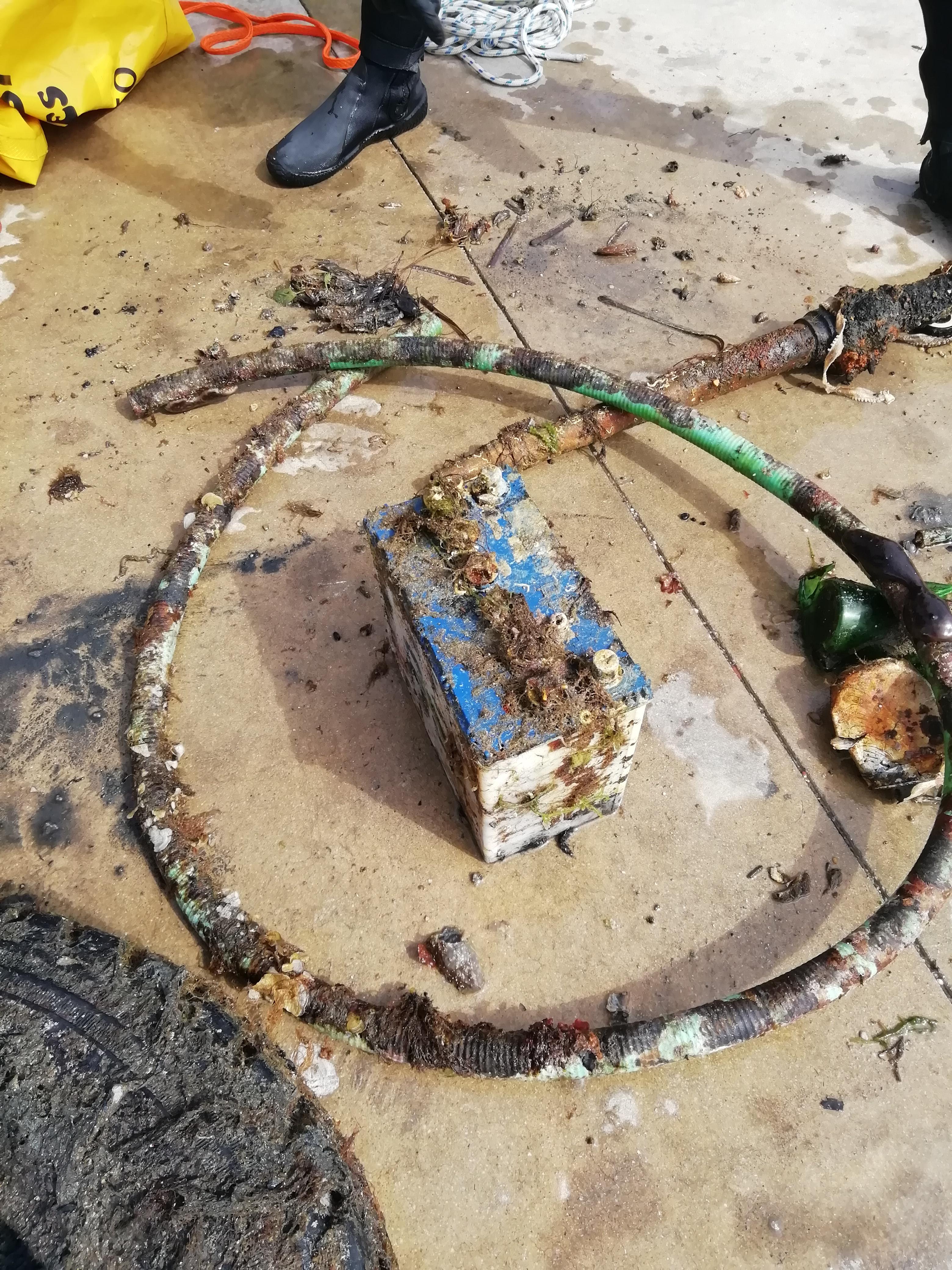
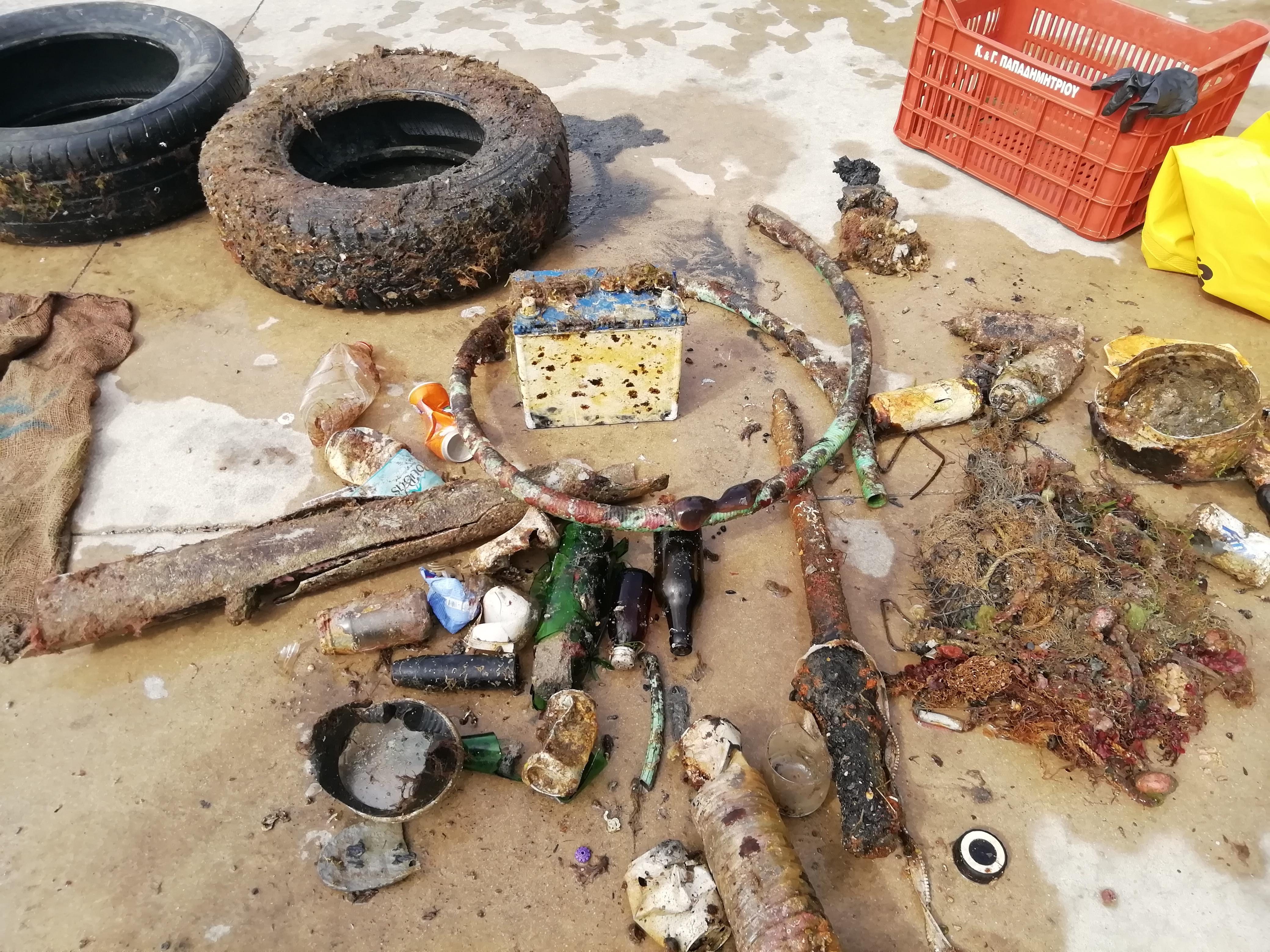
I have debris data to report
Calm (glassy to rippled) for waves 0 – 0.1 meter high
Released Unharmed
Napoleon
26
Butterfly - Sergent - Angel - Trigger
m2


meters
coral reef
City
Hurghada
Map Help
Dive Location
If you know your survey site coordinates, enter them manually in decimal degrees using WGS84 Map Datum. Use the minus sign for latitudes south of the equator and longitudes west of the Prime Meridian to 180 degrees.
If you do not know your survey site coordinates, click the “Map Location” tab to use the map to zoom into your survey site and drop the pin on the map to fall within your survey dive site in the water (not on land or the beach). Ensure you zoom in as much as possible to ensure data accuracy.
Entangled Help