Menu

Caracasbaai

65
sand

12.077321234812, -68.865019918002

FISHERMANS AND PARTIES
Clean up with the group "Youth for climate Curaçao"
BOOTS AND SOCKS
Scubaçao
Juan Pablo Vasquez
9
6.00
60
18.00
2.00
measured
30.00
3
FISHING LINES
PLASTIC
On
kilograms
I have debris data to report
Calm (glassy to rippled) for waves 0 – 0.1 meter high m2
meters
coral reef
1
6
6
Netherlands Antilles
City
Willemstad
Map Help


Dive Location

If you know your survey site coordinates, enter them manually in decimal degrees using WGS84 Map Datum. Use the minus sign for latitudes south of the equator and longitudes west of the Prime Meridian to 180 degrees.

If you do not know your survey site coordinates, click the “Map Location” tab to use the map to zoom into your survey site and drop the pin on the map to fall within your survey dive site in the water (not on land or the beach). Ensure you zoom in as much as possible to ensure data accuracy.

Entangled Help


Use the vertical tabs below to record any entangled animals you found of each type.

Vollen Marina

0
5
0

59.810079907423, 10.485647656489

2
0
0
silt
0
3
0
0
0
Calm
0
0
0
0
0
0
0
0
0
0
0
0
0
0
0
0
0
0
0
0
Oslofjorden Dykkesenter
Monica
0
0
0
2
0
0
0
0
0
0
0
0
0
0
0
0
0
3
0
2
0
0
0
0
0
0
0
0
0
0
0
0
0
0
5.00
30
10.00
2.00
0
estimated
0
1
558.99
0
0
0
1
0
0
On
kilograms
0
I have debris data to report
0
0
0
Calm (glassy to rippled) for waves 0 – 0.1 meter high
0
0
0
0
0
0
0
m2
0
0
meters
other
1
0
0
0
0
0
0
0
0
2
0
0
0
0
0
2
4
0
0
0
0
0
0
0
0
0
0
0
Norway
State\Province
Viken
City
Vollen
Map Help


Dive Location

If you know your survey site coordinates, enter them manually in decimal degrees using WGS84 Map Datum. Use the minus sign for latitudes south of the equator and longitudes west of the Prime Meridian to 180 degrees.

If you do not know your survey site coordinates, click the “Map Location” tab to use the map to zoom into your survey site and drop the pin on the map to fall within your survey dive site in the water (not on land or the beach). Ensure you zoom in as much as possible to ensure data accuracy.

Entangled Help


Use the vertical tabs below to record any entangled animals you found of each type.

ADS587 - Giant's Castle

0
0
0
0

-23.848934, 35.551177

0
0
0
rock
0
0
0
0
0
No
Sunny ne wind
Liquid Dive Adventures
Nadia Rifaat
0
0
0
0
0
0
0
0
0
0
0
0
0
0
0
0
0
0
0
2
0
0
0
0
0
0
0
0
0
0
0
0
0
0
0
0
0.00
20
30.00
24.00
0
estimated
0
0
0
0
40980.40
0
0
0
0
0
0
On
kilograms
0
Our Survey Site was free of debris
0
0
0
Moderate to rough for waves greater than 1.25 meters
0
0
0
0
0
0
0
m2
0
0
meters
rocky reef
0
0
0
0
0
0
0
0
0
0
0
0
0
0
0
0
0
0
0
0
0
0
0
0
0
0
0
0
0
Mozambique
State\Province
Inhambane
City
Tofo
Map Help


Dive Location

If you know your survey site coordinates, enter them manually in decimal degrees using WGS84 Map Datum. Use the minus sign for latitudes south of the equator and longitudes west of the Prime Meridian to 180 degrees.

If you do not know your survey site coordinates, click the “Map Location” tab to use the map to zoom into your survey site and drop the pin on the map to fall within your survey dive site in the water (not on land or the beach). Ensure you zoom in as much as possible to ensure data accuracy.

Entangled Help


Use the vertical tabs below to record any entangled animals you found of each type.

Hayama

6
rock
3

35.283697489809, 139.56574668098

Windstorm night before, sunny most days.
Victoria Sengelman
4
1
1
1
11.00
76
23.00
11.00
estimated
3000.00
On
pounds
I have debris data to report
Slight for waves 0.5 -1.25 meter high ft2
feet
rocky reef
Japan
State\Province
Hayama
Map Help


Dive Location

If you know your survey site coordinates, enter them manually in decimal degrees using WGS84 Map Datum. Use the minus sign for latitudes south of the equator and longitudes west of the Prime Meridian to 180 degrees.

If you do not know your survey site coordinates, click the “Map Location” tab to use the map to zoom into your survey site and drop the pin on the map to fall within your survey dive site in the water (not on land or the beach). Ensure you zoom in as much as possible to ensure data accuracy.

Entangled Help


Use the vertical tabs below to record any entangled animals you found of each type.

ADS314 - Shark Island

0
0
0
0

25.353533, 56.376133

0
0
0
coral
0
0
0
0
0
N/A
Hassan NK Khayal
0
0
0
0
0
0
0
0
0
0
0
0
0
0
0
0
0
0
0
2
0
0
0
0
0
0
0
0
0
0
0
0
0
0
0
0
0.00
60
8.00
3.00
0
estimated
0
0
0
0
50.00
0
0
0
0
0
0
On
kilograms
0
Our Survey Site was free of debris
0
0
0
Calm (glassy to rippled) for waves 0 – 0.1 meter high
0
0
0
0
0
0
0
m2
0
0
meters
coral reef
0
0
0
0
0
0
0
0
0
0
0
0
0
0
0
0
0
0
0
0
0
0
0
0
0
0
0
0
0
United Arab Emirates
Map Help


Dive Location

If you know your survey site coordinates, enter them manually in decimal degrees using WGS84 Map Datum. Use the minus sign for latitudes south of the equator and longitudes west of the Prime Meridian to 180 degrees.

If you do not know your survey site coordinates, click the “Map Location” tab to use the map to zoom into your survey site and drop the pin on the map to fall within your survey dive site in the water (not on land or the beach). Ensure you zoom in as much as possible to ensure data accuracy.

Entangled Help


Use the vertical tabs below to record any entangled animals you found of each type.

ADS268 - Dibba Rock

0
0
0
0

25.6025977, 56.351134

0
0
0
coral
0
0
0
0
0
N/A
Hassan NK Khayal
0
0
0
0
0
0
0
0
0
0
0
0
0
0
0
0
0
0
0
2
0
0
0
0
0
0
0
0
0
0
0
0
0
0
0
0
0.00
60
14.00
4.00
0
estimated
0
0
0
0
50.00
0
0
0
0
0
0
On
kilograms
0
Our Survey Site was free of debris
0
0
0
Calm (glassy to rippled) for waves 0 – 0.1 meter high
0
0
0
0
0
0
0
m2
0
0
meters
coral reef
0
0
0
0
0
0
0
0
0
0
0
0
0
0
0
0
0
0
0
0
0
0
0
0
0
0
0
0
0
United Arab Emirates
Map Help


Dive Location

If you know your survey site coordinates, enter them manually in decimal degrees using WGS84 Map Datum. Use the minus sign for latitudes south of the equator and longitudes west of the Prime Meridian to 180 degrees.

If you do not know your survey site coordinates, click the “Map Location” tab to use the map to zoom into your survey site and drop the pin on the map to fall within your survey dive site in the water (not on land or the beach). Ensure you zoom in as much as possible to ensure data accuracy.

Entangled Help


Use the vertical tabs below to record any entangled animals you found of each type.

ADS656 - Edithburgh Jetty

0
4
0

-35.084931703435, 137.7488066297

9
0
0
sand
0
0
0
20
0
No
Intact glass jar
0
0
0
0
0
0
0
0
0
0
0
0
0
0
0
0
0
0
0
0
Underwater Sports Diving Centre
Wayne Rosenboom
0
0
0
0
1
0
0
0
0
0
0
0
0
3
0
0
0
0
0
2
0
0
0
0
0
0
0
0
0
0
0
0
0
0
8.00
82
4.00
2.00
0
measured
0
15
220.00
0
0
1
1
0
Glass
Fishing line
0
On
kilograms
0
I have debris data to report
0
0
0
Smooth (wavelets) for waves 0.1 - 0.5 meter high
0
0
0
0
0
0
0
m2
0
0
meters
seagrass
2
0
0
0
0
12
0
0
0
0
0
0
0
0
2
0
0
0
0
0
0
361
0
0
0
0
1
0
Australia
State\Province
South Australia
City
Edithburgh
Map Help


Dive Location

If you know your survey site coordinates, enter them manually in decimal degrees using WGS84 Map Datum. Use the minus sign for latitudes south of the equator and longitudes west of the Prime Meridian to 180 degrees.

If you do not know your survey site coordinates, click the “Map Location” tab to use the map to zoom into your survey site and drop the pin on the map to fall within your survey dive site in the water (not on land or the beach). Ensure you zoom in as much as possible to ensure data accuracy.

Entangled Help


Use the vertical tabs below to record any entangled animals you found of each type.

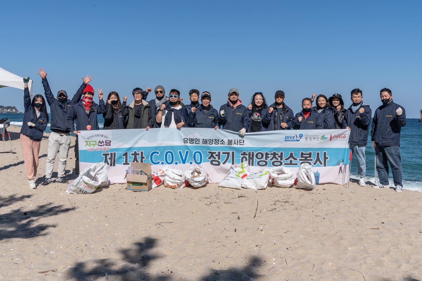
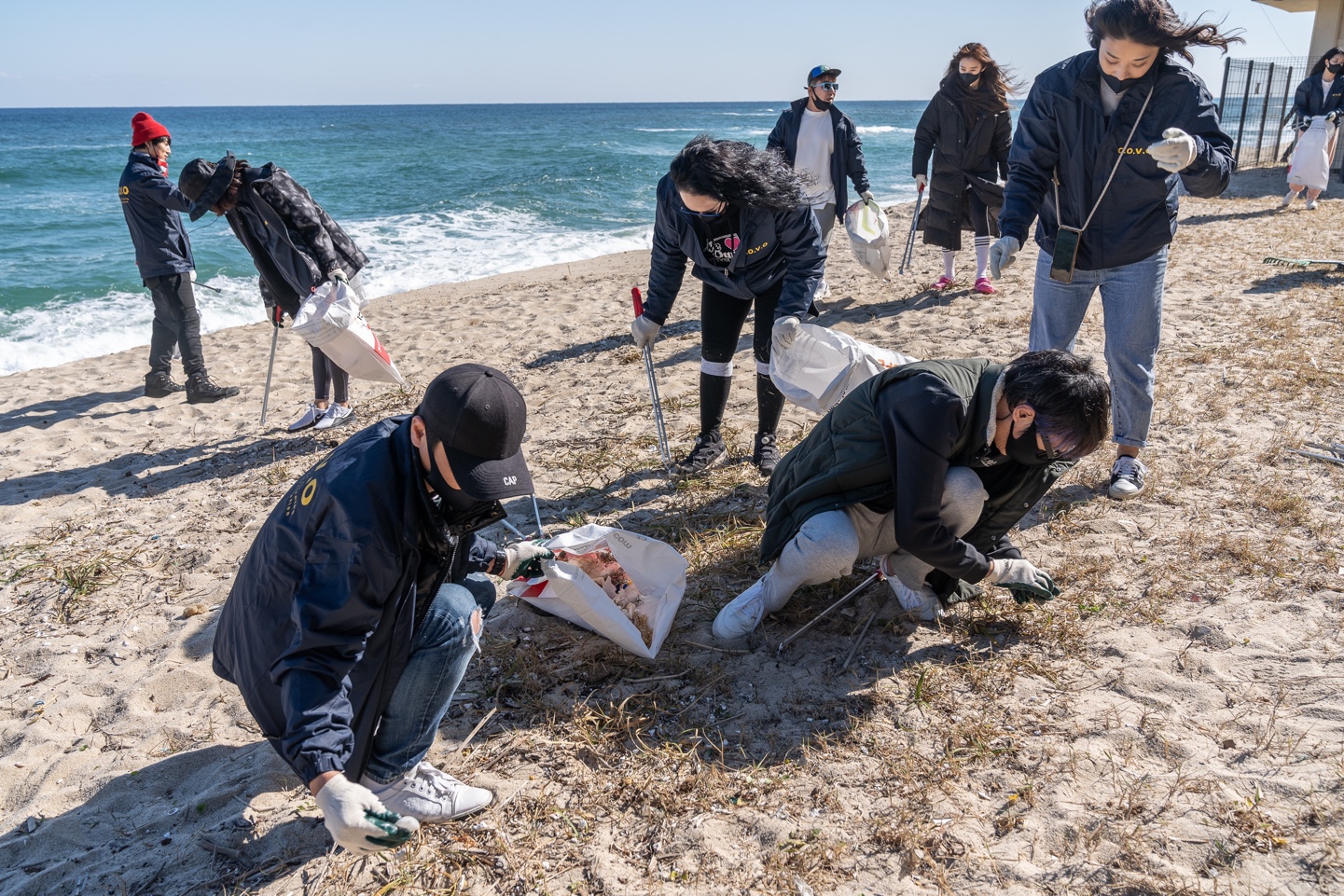
Kangreung

8
2
7

37, 128

8
6
rock
3
5
10
cloudy / Visibility (10m), Cloud (1/10), Temp. (18℃), Wind Dir.(NNE) Wind Speed (7.5m/s),
Dive Nine
KIM TAE HUN
2
8
4
5
30
10
11
7
9
10
2
22
3
3
2
7
2
1
7
3
4
3
7
10.00
31
18.00
5.00
0
estimated
7
2.00
6
4
3
8
On
kilograms
Our Survey Site was free of debris
3
7
Smooth (wavelets) for waves 0.1 - 0.5 meter high
2
3
2
m2
3
2
meters
rocky reef
4
2
2
3
1
2
2
South Korea
State\Province
Kangwondo
City
Gangreung
Map Help


Dive Location

If you know your survey site coordinates, enter them manually in decimal degrees using WGS84 Map Datum. Use the minus sign for latitudes south of the equator and longitudes west of the Prime Meridian to 180 degrees.

If you do not know your survey site coordinates, click the “Map Location” tab to use the map to zoom into your survey site and drop the pin on the map to fall within your survey dive site in the water (not on land or the beach). Ensure you zoom in as much as possible to ensure data accuracy.

Entangled Help


Use the vertical tabs below to record any entangled animals you found of each type.

Tzu-Kuan, Kaohsiung, Taiwan

22
66

22.736828190949, 120.24545575908

silt
17

22.736828190949, 120.24545575908

cloudy
Summit Dive Center
Chung Feng Chang
17
4
6
7
13
11
11
62
15
13
4
100.00
56
3.00
1.00
42
estimated
2.00
1
0
6
On
kilograms
I have debris data to report
Calm (glassy to rippled) for waves 0 – 0.1 meter high m2
meters
other
Taiwan
City
Ping-Tung
Map Help


Dive Location

If you know your survey site coordinates, enter them manually in decimal degrees using WGS84 Map Datum. Use the minus sign for latitudes south of the equator and longitudes west of the Prime Meridian to 180 degrees.

If you do not know your survey site coordinates, click the “Map Location” tab to use the map to zoom into your survey site and drop the pin on the map to fall within your survey dive site in the water (not on land or the beach). Ensure you zoom in as much as possible to ensure data accuracy.
Entangled Help


Use the vertical tabs below to record any entangled animals you found of each type.

ADS13 - Shore Road Pipeline

0
2
0

50.693999998625, -1.928

0
0
0
sand
0
1
0
1
0
Calm
0
0
0
0
0
0
0
0
0
0
0
0
0
0
0
0
0
0
0
0
Poole Diving
Kev Craddock
0
0
0
0
0
0
0
0
0
0
0
0
0
3
0
0
0
0
0
4
0
0
0
0
0
0
0
0
0
0
1
0
0
0
4.90
69
7.00
3.00
0
measured
0
0
4194.09
0
0
0
0
0
0
On
kilograms
0
I have debris data to report
4
1
0
Smooth (wavelets) for waves 0.1 - 0.5 meter high
2
0
0
0
0
0
0
m2
0
0
meters
rocky reef
0
0
0
0
0
0
0
0
0
0
0
0
0
0
0
0
0
0
0
0
0
0
0
0
0
0
1
0
United Kingdom
State\Province
Dorset
City
Poole
Map Help


Dive Location

If you know your survey site coordinates, enter them manually in decimal degrees using WGS84 Map Datum. Use the minus sign for latitudes south of the equator and longitudes west of the Prime Meridian to 180 degrees.

If you do not know your survey site coordinates, click the “Map Location” tab to use the map to zoom into your survey site and drop the pin on the map to fall within your survey dive site in the water (not on land or the beach). Ensure you zoom in as much as possible to ensure data accuracy.
Entangled Help


Use the vertical tabs below to record any entangled animals you found of each type.

Subscribe to