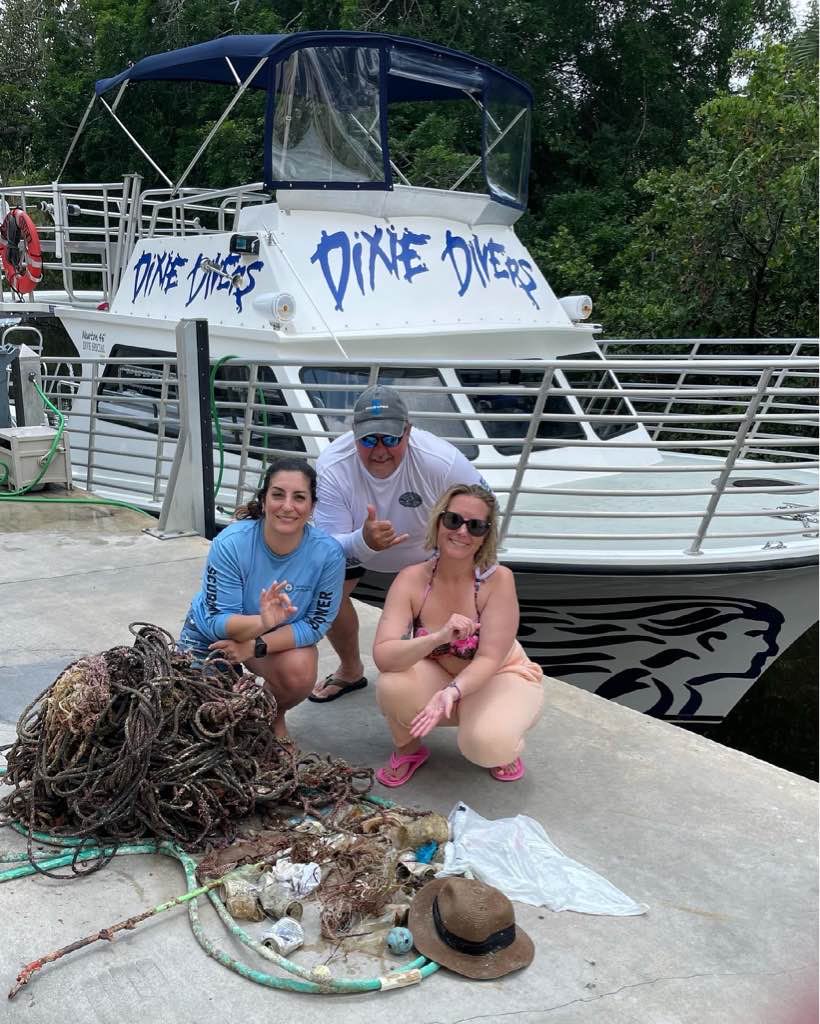
Dive Against Debris - Amy, Nick, Millie, Emily, Ben
1
1
sand
1
18.280936700338, -87.83312093861
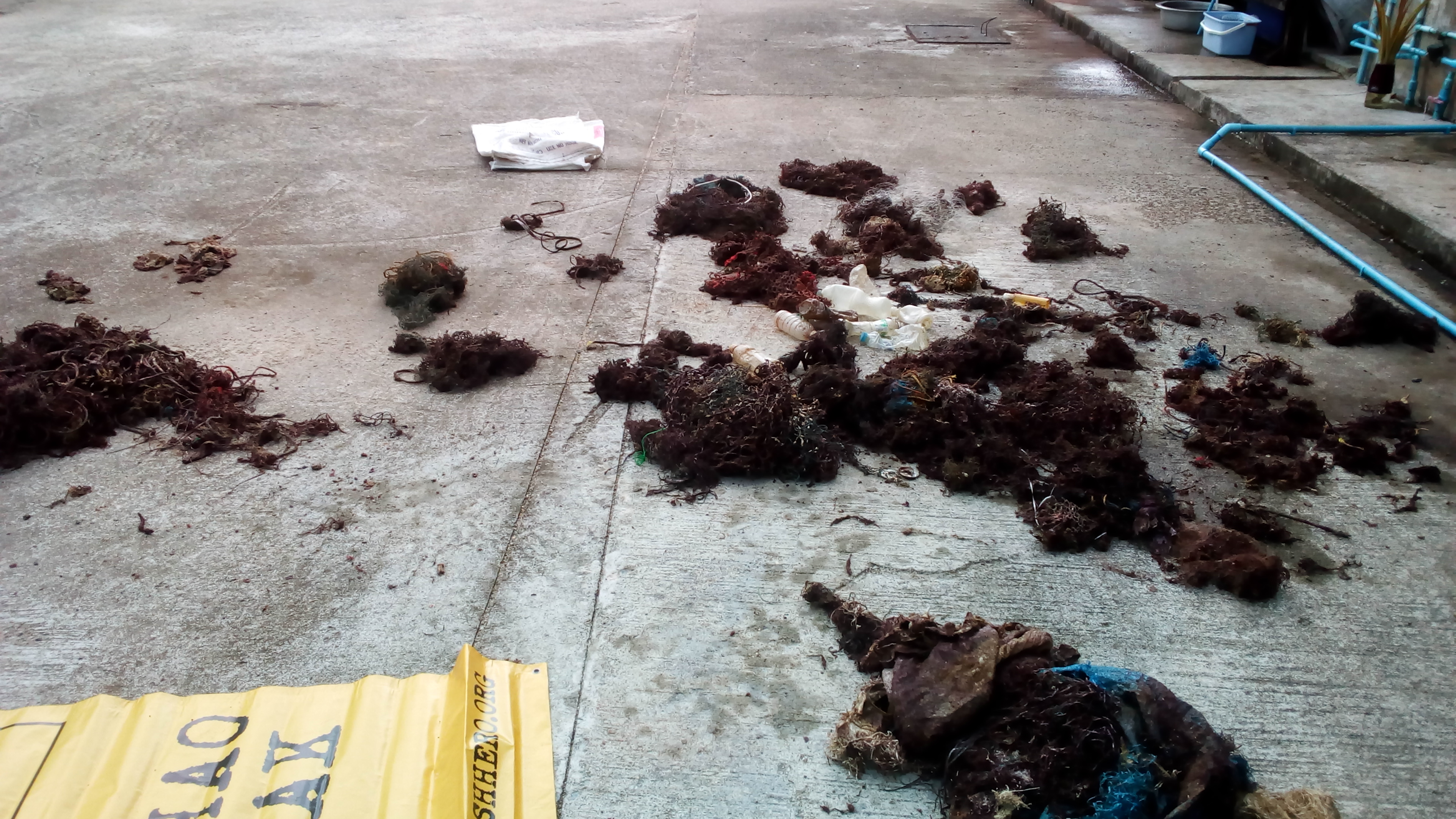
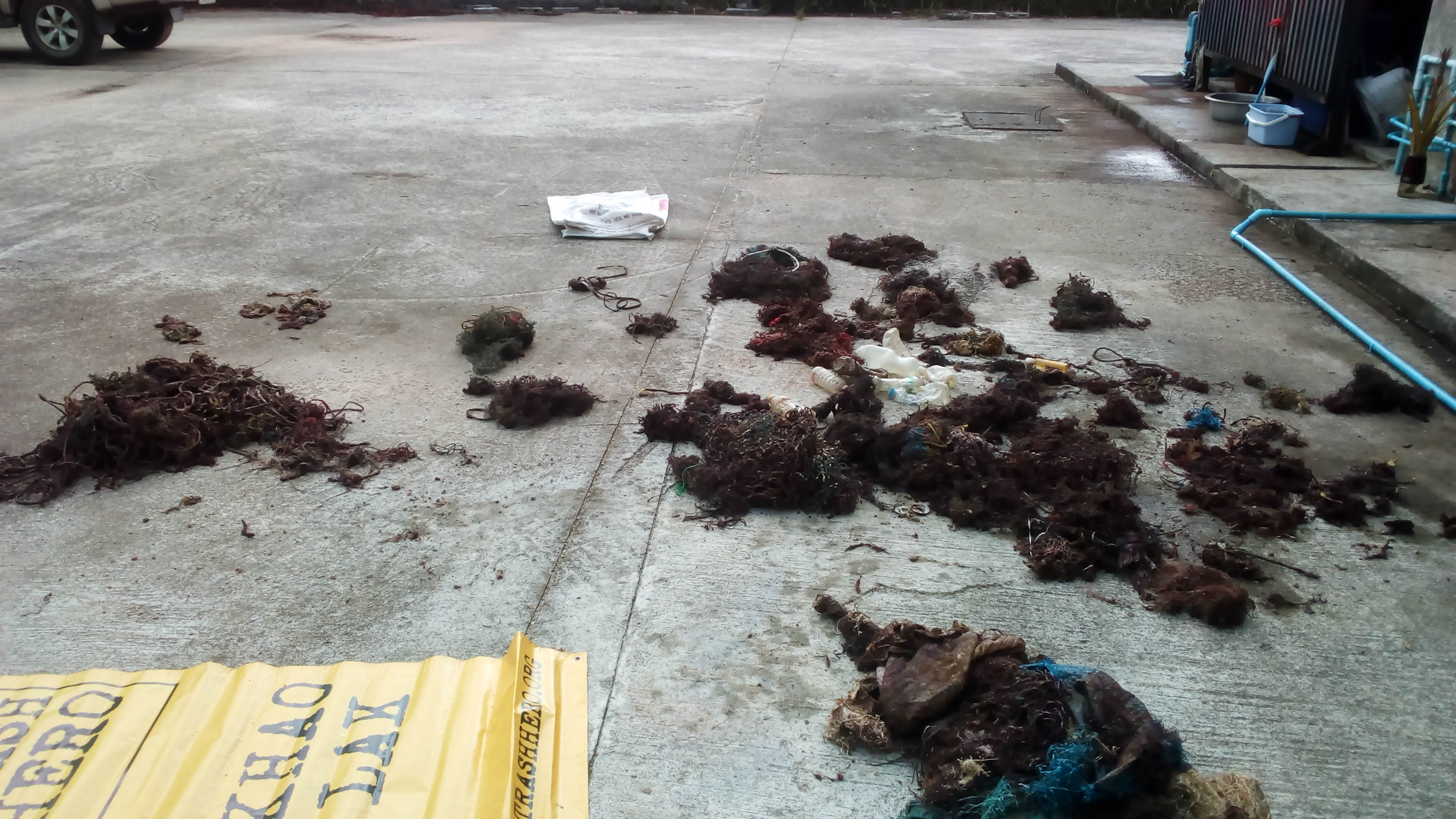
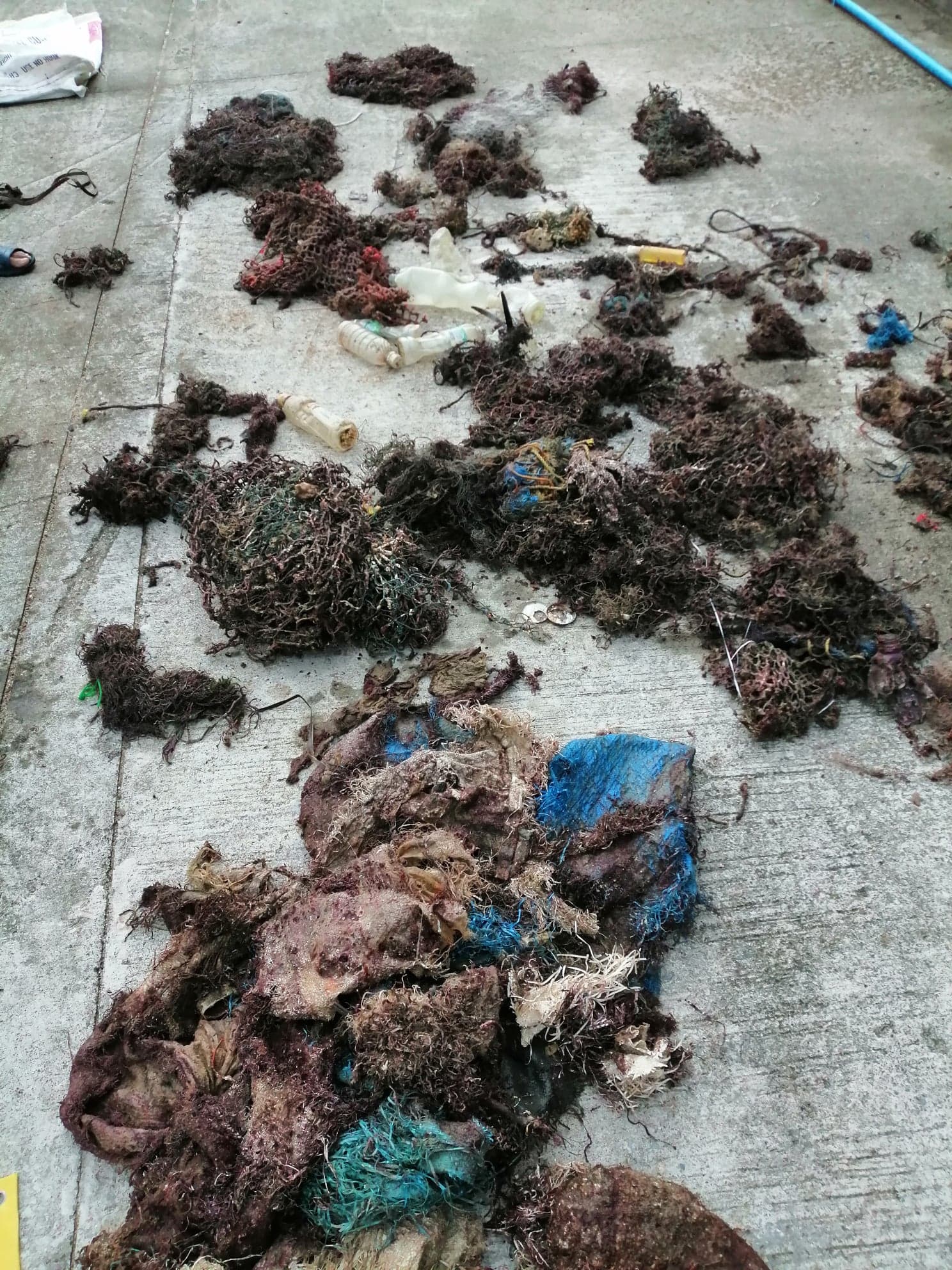
nothing special, human waste.
rope
on and off windy with north to south current. Occasional rain
XTC Dive center
Amy
1
5
3
0.10
40
5.00
2.10
estimated
100000.00
plastic bag
rope
plastic container
On
kilograms
I have debris data to report
Calm (glassy to rippled) for waves 0 – 0.1 meter high
m2

1
meters
seagrass
State\Province
Quintana Roo
City
Xcalak
Map Help
Dive Location
If you know your survey site coordinates, enter them manually in decimal degrees using WGS84 Map Datum. Use the minus sign for latitudes south of the equator and longitudes west of the Prime Meridian to 180 degrees.
If you do not know your survey site coordinates, click the “Map Location” tab to use the map to zoom into your survey site and drop the pin on the map to fall within your survey dive site in the water (not on land or the beach). Ensure you zoom in as much as possible to ensure data accuracy.
Entangled Help