Menu

Lonsdale Quay

9

49.309778227034, -123.08162313641

silt
1
no
sunny
1
2
1
8
2
2
1
styrofoam
coins
bicycle
metal chairs
wood chairs
shopping carts
metal shovel
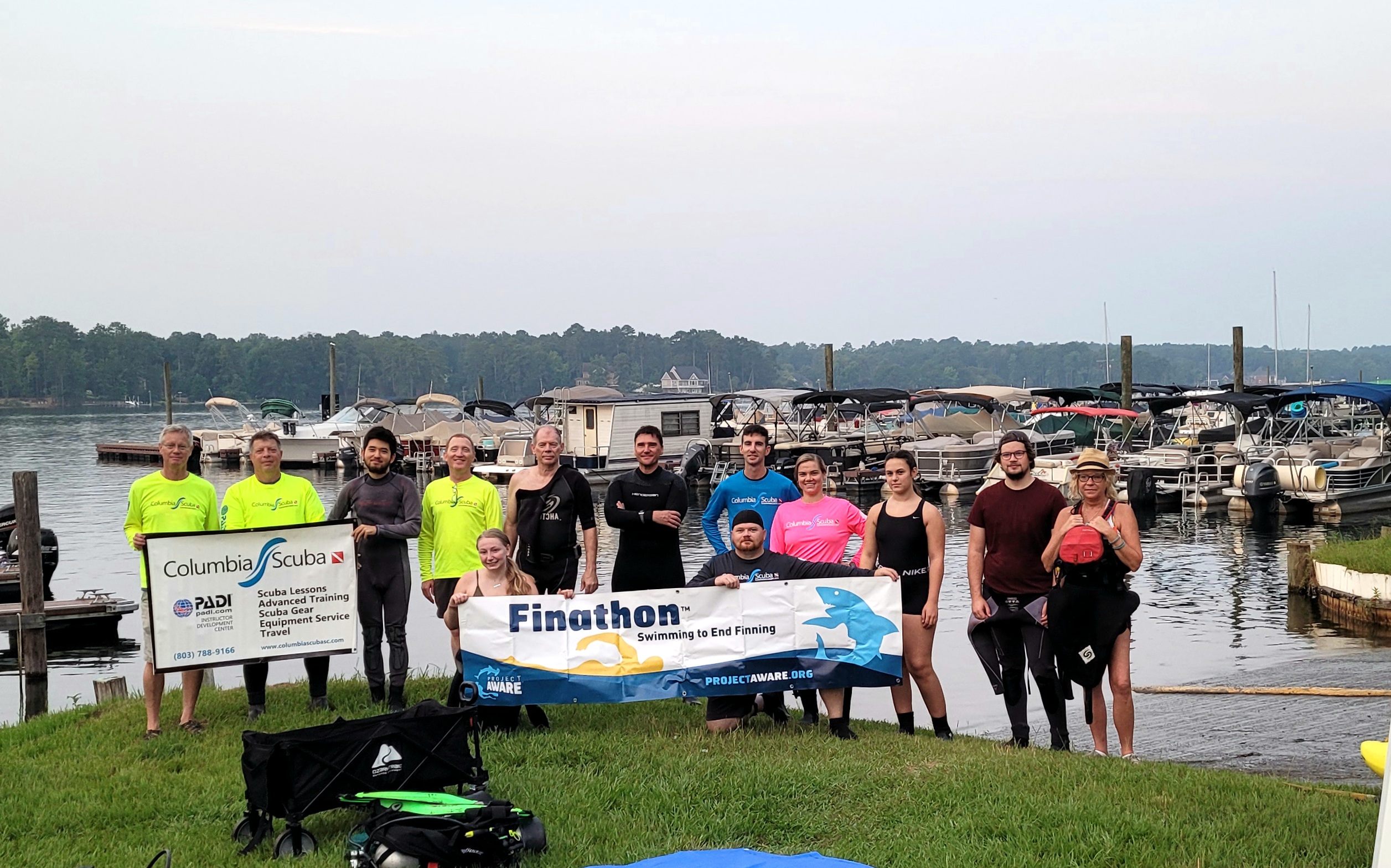
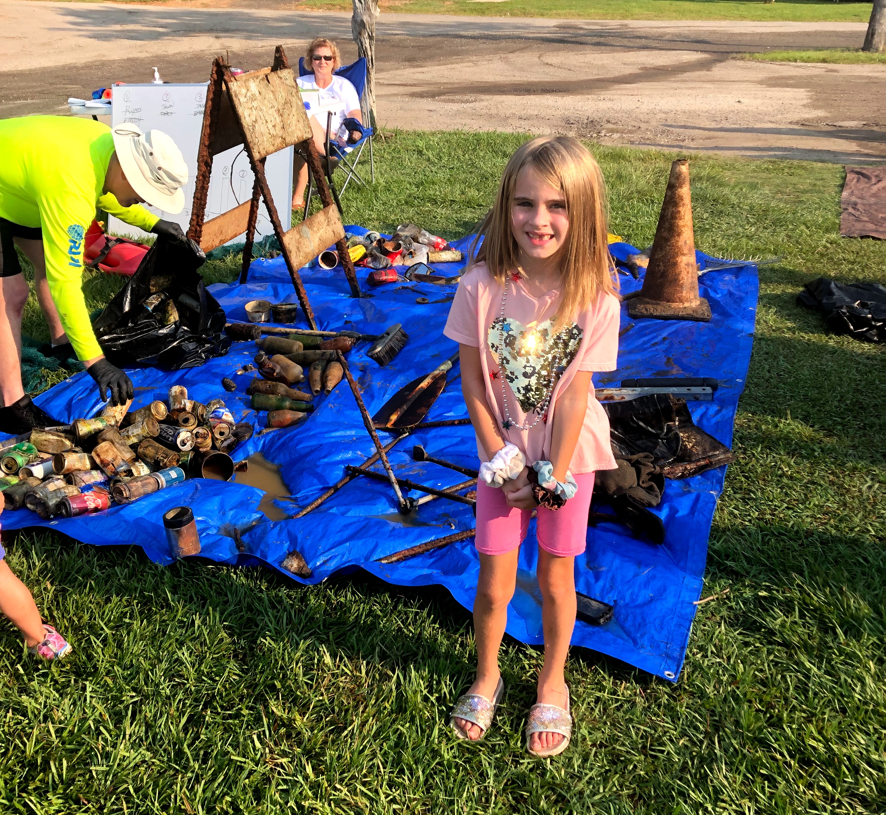
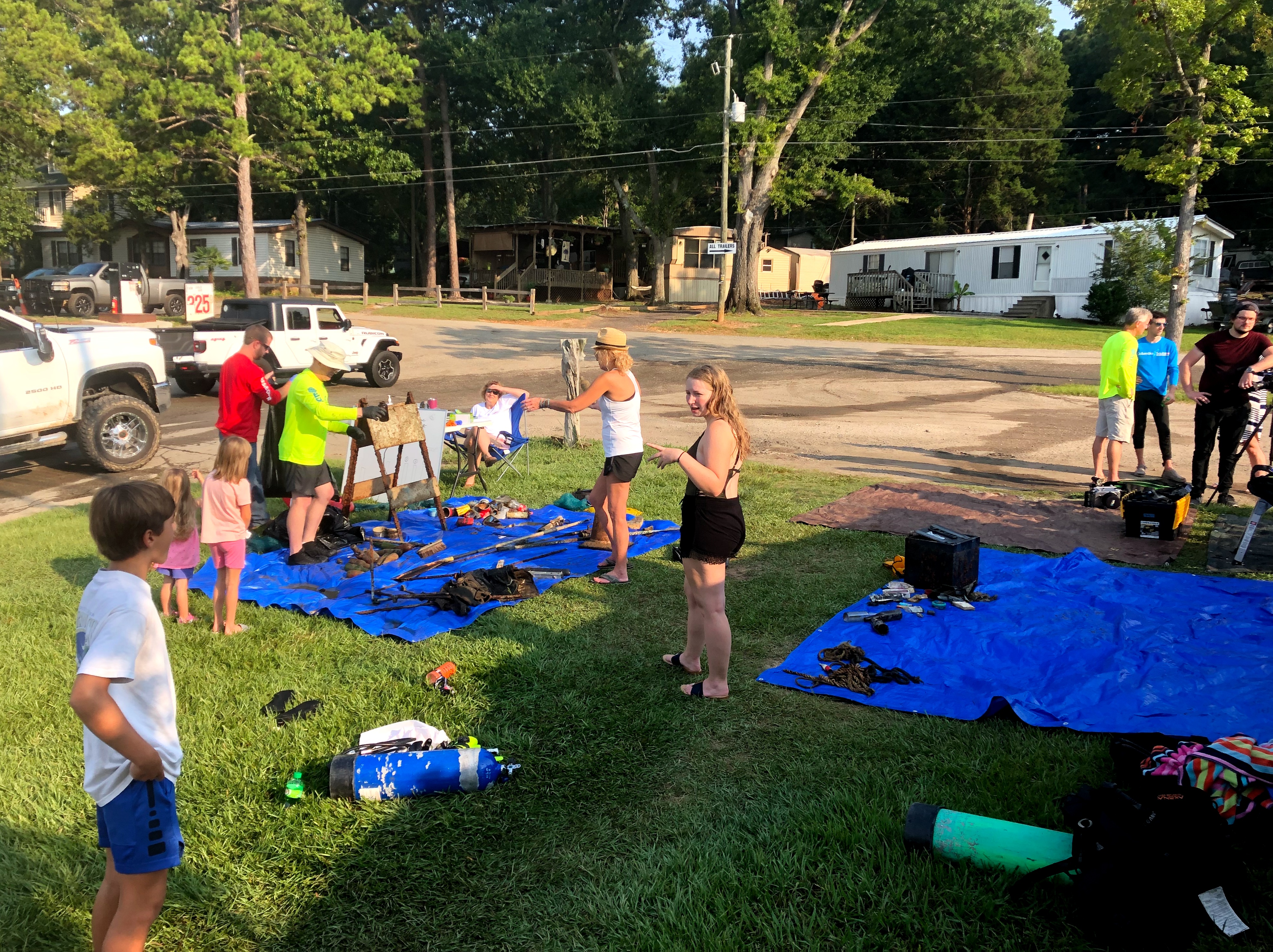
Divers for Cleaner Lakes and Oceans
Henry Wang
3
1
3
1
1
334.60
52
21.00
4.00
measured
22200.00
chairs
On
pounds
I have debris data to report
2
Calm (glassy to rippled) for waves 0 – 0.1 meter high ft2
feet
other
2
2
2
3
6
1
1
2
Canada
State\Province
British Columbia
City
North Vancouver
Map Help


Dive Location

If you know your survey site coordinates, enter them manually in decimal degrees using WGS84 Map Datum. Use the minus sign for latitudes south of the equator and longitudes west of the Prime Meridian to 180 degrees.

If you do not know your survey site coordinates, click the “Map Location” tab to use the map to zoom into your survey site and drop the pin on the map to fall within your survey dive site in the water (not on land or the beach). Ensure you zoom in as much as possible to ensure data accuracy.

Entangled Help


Use the vertical tabs below to record any entangled animals you found of each type.

Ecosystem Other
silt

St Marie Rif

coral

12.198299032549, -69.078830729846

Calm not not much wind
Coral Divers
Koen van de Pol
1
2
0.10
50
16.40
5.00
estimated
500.00
On
kilograms
I have debris data to report
Calm (glassy to rippled) for waves 0 – 0.1 meter high m2
meters
coral reef
Netherlands Antilles
City
Willemstad
Map Help


Dive Location

If you know your survey site coordinates, enter them manually in decimal degrees using WGS84 Map Datum. Use the minus sign for latitudes south of the equator and longitudes west of the Prime Meridian to 180 degrees.

If you do not know your survey site coordinates, click the “Map Location” tab to use the map to zoom into your survey site and drop the pin on the map to fall within your survey dive site in the water (not on land or the beach). Ensure you zoom in as much as possible to ensure data accuracy.

Entangled Help


Use the vertical tabs below to record any entangled animals you found of each type.

Clear Lake underwater island

silt

52.765781469086, -110.60257024489

We also had one great shore support girl and two boat drivers to ferry the group back and forth.
Most of the local cabin owners are very environmentally aware, but due to Covid, we have had an increase in non-locals boating on the lake, and an increase in empty drink containers.
Boaters toss out empties, lose fishing lines.
Men's shorts, probably a bathing suit.
Very warm and sunny
Alberta Adventure Divers
Connie Faas
1
9
1
10.00
51
46.00
15.00
measured
4
19578.00
Fishing lures and line can cause entanglement or cuts for divers
Pop/beer cans and bottles trap smaller fish
On
pounds
I have debris data to report
12
Smooth (wavelets) for waves 0.1 - 0.5 meter high
1
ft2
feet
other
13
Canada
State\Province
ALBERTA
City
WAINWRIGHT
Map Help


Dive Location

If you know your survey site coordinates, enter them manually in decimal degrees using WGS84 Map Datum. Use the minus sign for latitudes south of the equator and longitudes west of the Prime Meridian to 180 degrees.

If you do not know your survey site coordinates, click the “Map Location” tab to use the map to zoom into your survey site and drop the pin on the map to fall within your survey dive site in the water (not on land or the beach). Ensure you zoom in as much as possible to ensure data accuracy.

Entangled Help


Use the vertical tabs below to record any entangled animals you found of each type.

Ecosystem Other
Fresh water lake

Churchill Barrier 1

1
1
1
silt
2

58.893788998511, -2.9004146867045

Football boot and toy guns
Kraken Diving
Rob Slight
3
2
2
1
4
2
10
2
7.00
63
10.00
4.00
5
estimated
1
100.00
Fishing hooks and line
Rope
Plastic
On
kilograms
I have debris data to report
Smooth (wavelets) for waves 0.1 - 0.5 meter high
1
m2
meters
kelp
75
United Kingdom
State\Province
Orkney
Map Help


Dive Location

If you know your survey site coordinates, enter them manually in decimal degrees using WGS84 Map Datum. Use the minus sign for latitudes south of the equator and longitudes west of the Prime Meridian to 180 degrees.

If you do not know your survey site coordinates, click the “Map Location” tab to use the map to zoom into your survey site and drop the pin on the map to fall within your survey dive site in the water (not on land or the beach). Ensure you zoom in as much as possible to ensure data accuracy.

Entangled Help


Use the vertical tabs below to record any entangled animals you found of each type.

Yellow Submarine

2
12

12.16016285382, -68.283816576004

coral
2
6

12.160296789403, -68.281939029694

Dive Friends Bonaire
Jannika
2
4
1.00
45
12.00
1.00
estimated
3241.00
On
kilograms
I have debris data to report
1
Calm (glassy to rippled) for waves 0 – 0.1 meter high
2
m2
1
meters
coral reef
1
1
Netherlands Antilles
Map Help


Dive Location

If you know your survey site coordinates, enter them manually in decimal degrees using WGS84 Map Datum. Use the minus sign for latitudes south of the equator and longitudes west of the Prime Meridian to 180 degrees.

If you do not know your survey site coordinates, click the “Map Location” tab to use the map to zoom into your survey site and drop the pin on the map to fall within your survey dive site in the water (not on land or the beach). Ensure you zoom in as much as possible to ensure data accuracy.

Entangled Help


Use the vertical tabs below to record any entangled animals you found of each type.

Jake's Landing, Lake Murray, SC

0

34.0273642, -81.2255797

1
silt
2
3
59
3

34.027326210843, -81.225571265748

It is a boat marina
An Amazon Basics safe that had been broken open and was taped shut, as if it were stolen and then discarded.
1
1
1
1
1
1
1
1
2
1
1
1
3
1
metal safe
Plastic car bumper
Boat Propeller
Rake
Broom
Traffic Cone
Folding Chair
Traffic/Construction Barrier
Reading glasses
Solar light
Boat guide for trailer
Paddle/Oar
Removable rifle sights
Driver's side mirror from a car
Columbia Scuba
Kris Mattingly
1
13
8
1
3
8
1
187.00
50
20.00
6.00
2
estimated
1
45000.00
On
pounds
I have debris data to report
14
Calm (glassy to rippled) for waves 0 – 0.1 meter high
1
ft2
feet
other
0
1
1
1
1
65
1
United States
State\Province
SC
City
Columbia
Map Help


Dive Location

If you know your survey site coordinates, enter them manually in decimal degrees using WGS84 Map Datum. Use the minus sign for latitudes south of the equator and longitudes west of the Prime Meridian to 180 degrees.

If you do not know your survey site coordinates, click the “Map Location” tab to use the map to zoom into your survey site and drop the pin on the map to fall within your survey dive site in the water (not on land or the beach). Ensure you zoom in as much as possible to ensure data accuracy.

Entangled Help


Use the vertical tabs below to record any entangled animals you found of each type.

Ecosystem Other
Lake, fresh water

Weybourne Chalk Reef

52.94967, 1.14029

4
rock
2

52.948512029455, 1.1509194866435

Fishing along the shore line
Windy, wet
Dive Rutland
Tracey Roberts
2
1
2.00
15
7.00
5.00
measured
10.00
fishing line
On
kilograms
I have debris data to report
Smooth (wavelets) for waves 0.1 - 0.5 meter high
Crabs, shrimps
5
Released Unharmed
Tracey Roberts
m2
meters
rocky reef
United Kingdom
State\Province
Rutland
City
Oakham
Map Help


Dive Location

If you know your survey site coordinates, enter them manually in decimal degrees using WGS84 Map Datum. Use the minus sign for latitudes south of the equator and longitudes west of the Prime Meridian to 180 degrees.

If you do not know your survey site coordinates, click the “Map Location” tab to use the map to zoom into your survey site and drop the pin on the map to fall within your survey dive site in the water (not on land or the beach). Ensure you zoom in as much as possible to ensure data accuracy.

Entangled Help


Use the vertical tabs below to record any entangled animals you found of each type.

Mala pier

20.885161, -156.6879

3
sand

20.8783333, -156.6825

Calm
Maui diving scuba & snorkel center
Johnny
1
6
0.50
44
35.00
9.00
estimated
200.00
Fishing equipment
On
pounds
I have debris data to report
Calm (glassy to rippled) for waves 0 – 0.1 meter high ft2
feet
coral reef
United States
State\Province
Hawaii
City
Lahaina
Map Help


Dive Location

If you know your survey site coordinates, enter them manually in decimal degrees using WGS84 Map Datum. Use the minus sign for latitudes south of the equator and longitudes west of the Prime Meridian to 180 degrees.

If you do not know your survey site coordinates, click the “Map Location” tab to use the map to zoom into your survey site and drop the pin on the map to fall within your survey dive site in the water (not on land or the beach). Ensure you zoom in as much as possible to ensure data accuracy.

Entangled Help


Use the vertical tabs below to record any entangled animals you found of each type.

Cais dos Pescadores

0

38.697155208225, -9.4181608237324

silt
1
The visibility during this survey was really bad, less than 1 meter, which may have contributed to the fact that a lot less debris was collected during this cleanup. However, this is also the 5th cleanup that we have done in this location and with each survey we conduct we collect less and less debris, which can be seen in our data report. In conclusion, we believe there has been a significant change in terms of debris that can be found in that area. We have also seen a lot of community involvement in our surveys with a lot of people wanting to help and participate in our surveys, including the fisherman community.
Fishing activity
Pistol and ammunition
1
1
Anchor
Pistol & Ammunition
Associação Juvenil Claro/ Clube Naval de Cascais
Teresa Vale and Carolina Gonçalves
10
41.00
60
3.40
1.00
3
measured
600.00
Fishing line
On
kilograms
I have debris data to report
Calm (glassy to rippled) for waves 0 – 0.1 meter high m2
meters
other
Portugal
City
Cascais
Map Help


Dive Location

If you know your survey site coordinates, enter them manually in decimal degrees using WGS84 Map Datum. Use the minus sign for latitudes south of the equator and longitudes west of the Prime Meridian to 180 degrees.

If you do not know your survey site coordinates, click the “Map Location” tab to use the map to zoom into your survey site and drop the pin on the map to fall within your survey dive site in the water (not on land or the beach). Ensure you zoom in as much as possible to ensure data accuracy.

Entangled Help


Use the vertical tabs below to record any entangled animals you found of each type.

ADS10 - Ørneset

67.225682, 14.616451

3
rock
15
NORD&NE
Fredric Ihrsen
1
2.40
65
21.00
1.00
measured
41
2500.00
On
kilograms
I have debris data to report
Smooth (wavelets) for waves 0.1 - 0.5 meter high m2
meters
kelp
1
Norway
Map Help


Dive Location

If you know your survey site coordinates, enter them manually in decimal degrees using WGS84 Map Datum. Use the minus sign for latitudes south of the equator and longitudes west of the Prime Meridian to 180 degrees.

If you do not know your survey site coordinates, click the “Map Location” tab to use the map to zoom into your survey site and drop the pin on the map to fall within your survey dive site in the water (not on land or the beach). Ensure you zoom in as much as possible to ensure data accuracy.

Entangled Help


Use the vertical tabs below to record any entangled animals you found of each type.

Subscribe to