Menu

Horseshoe and Grecian Rocks

2

25.08362, -80.17641

coral
3
Hurricane Irma
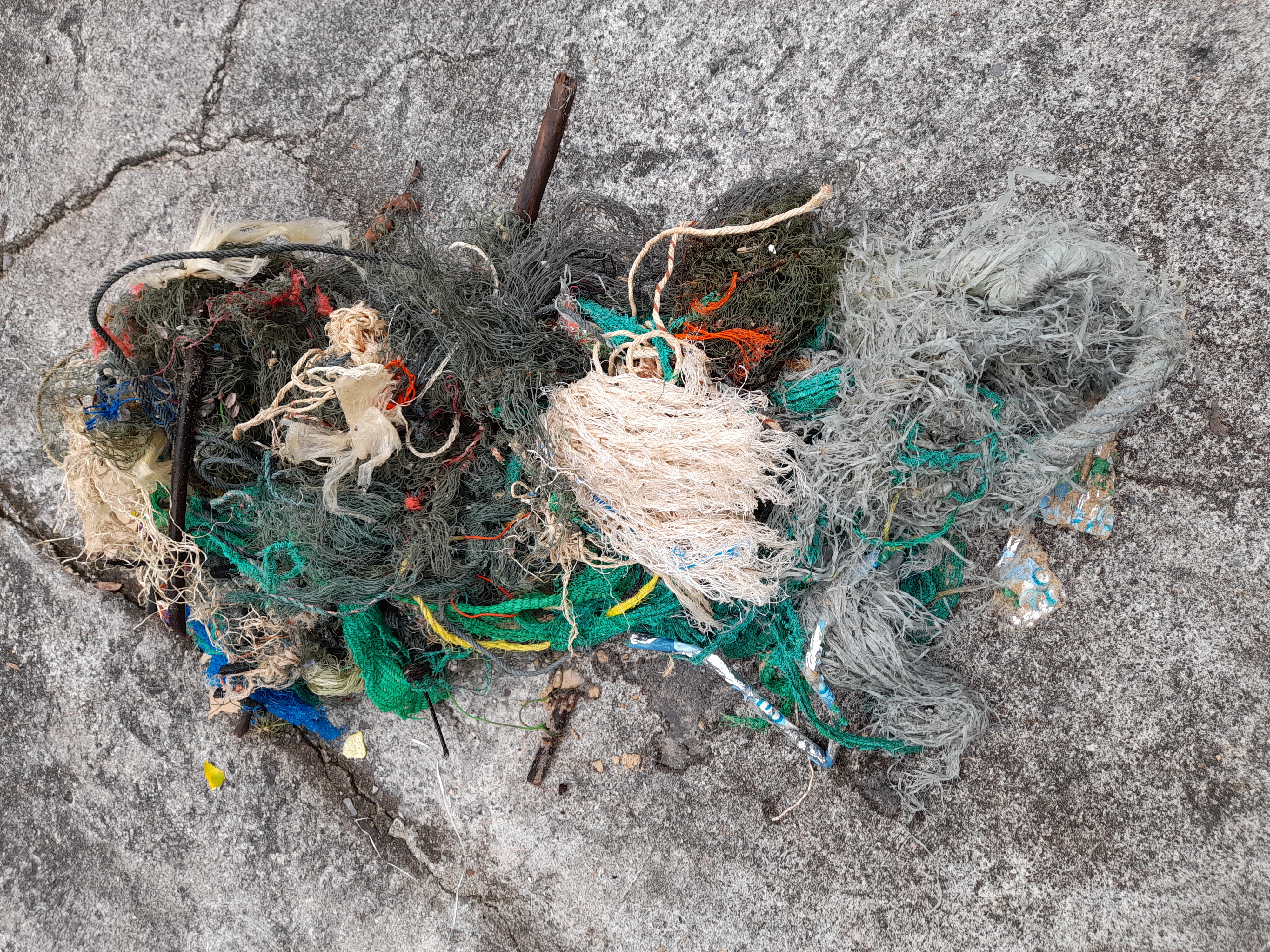
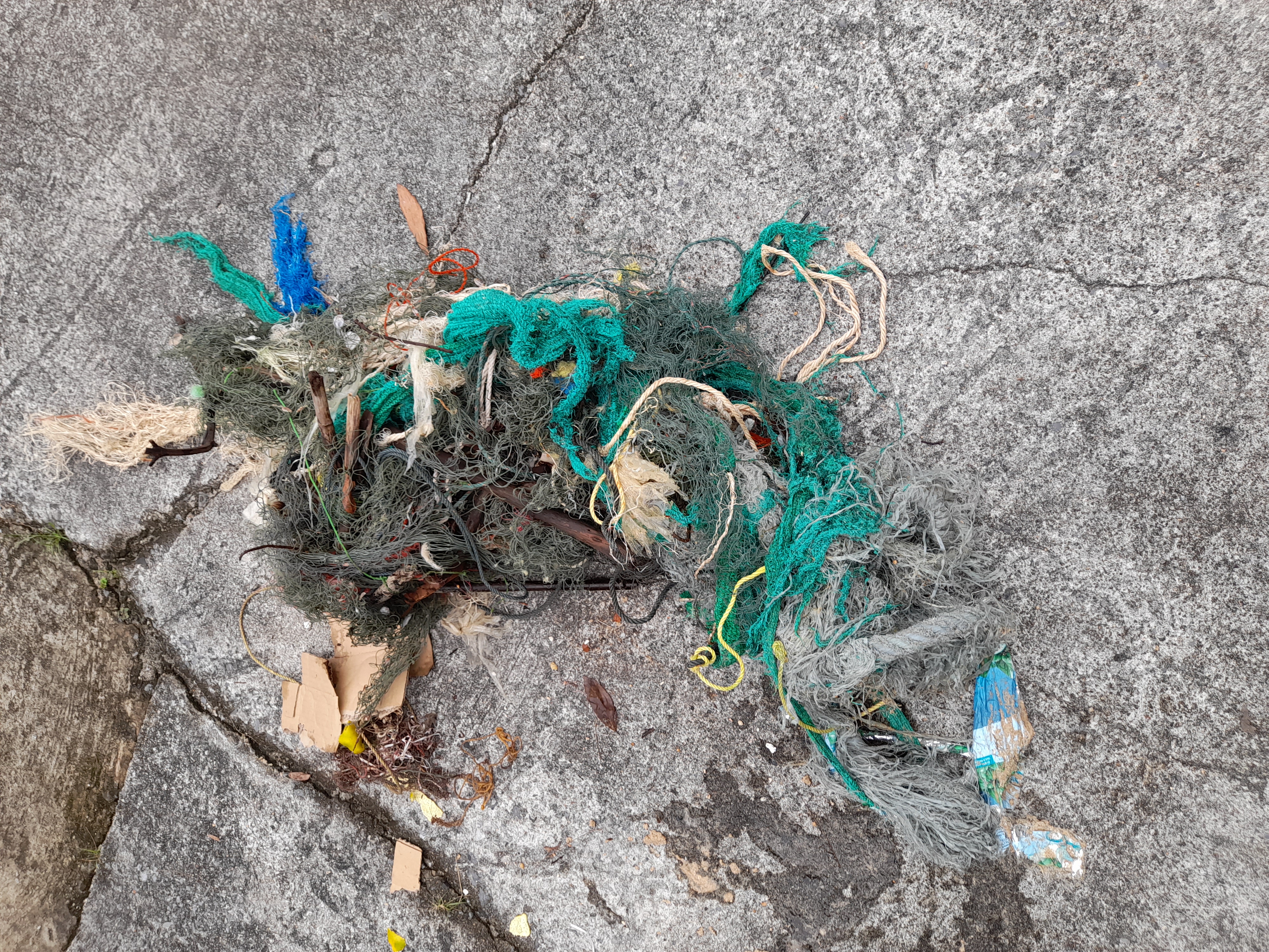
A group of 7 divers helped to clear the debris field north of Horseshoe reef of 1 complete ghost trap, many feet of trap line and general trap debris.
We also cleared the area seaward of Grecian rocks, our intention was to clear the ghost bouys and traps. We recovered 1 ghost trap.
Trapped in a ghost lobster trap
Trap full of lobsters
Island Ventures
Michael Creese
2
7
1
200.00
120
25.00
6.00
6
estimated
3
3
1000.00
Ghost and broken lobster traps
Fishing line
rope
On
pounds
I have debris data to report
18
Smooth (wavelets) for waves 0.1 - 0.5 meter high
15
Lobster traps
Spiney Lobster
Released Unharmed
8
Released Unharmed
ft2
feet
coral reef
2
3
2
United States
State\Province
Florida
City
Key Largo
Map Help


Dive Location

If you know your survey site coordinates, enter them manually in decimal degrees using WGS84 Map Datum. Use the minus sign for latitudes south of the equator and longitudes west of the Prime Meridian to 180 degrees.

If you do not know your survey site coordinates, click the “Map Location” tab to use the map to zoom into your survey site and drop the pin on the map to fall within your survey dive site in the water (not on land or the beach). Ensure you zoom in as much as possible to ensure data accuracy.

Entangled Help


Use the vertical tabs below to record any entangled animals you found of each type.

kobe maiko

5

34.62791, 135.03874

sand
5
1
Noriko Tanaka
2
3
5
1.00
43
6.00
1.00
estimated
2
60.00
On
kilograms
I have debris data to report
Calm (glassy to rippled) for waves 0 – 0.1 meter high
2
1
m2
meters
rocky reef
1
Japan
Map Help


Dive Location

If you know your survey site coordinates, enter them manually in decimal degrees using WGS84 Map Datum. Use the minus sign for latitudes south of the equator and longitudes west of the Prime Meridian to 180 degrees.

If you do not know your survey site coordinates, click the “Map Location” tab to use the map to zoom into your survey site and drop the pin on the map to fall within your survey dive site in the water (not on land or the beach). Ensure you zoom in as much as possible to ensure data accuracy.

Entangled Help


Use the vertical tabs below to record any entangled animals you found of each type.

Khao Na Yak

22

8.5710204828949, 98.209503105881

rock

8.5710204828949, 98.209503105881

G2Similan
Peter Kostial
3
12.00
55
8.00
5.00
10
estimated
204.00
fishing nets
On
kilograms
I have debris data to report
Smooth (wavelets) for waves 0.1 - 0.5 meter high m2
10
meters
rocky reef
Thailand
City
Khao Lak
Map Help


Dive Location

If you know your survey site coordinates, enter them manually in decimal degrees using WGS84 Map Datum. Use the minus sign for latitudes south of the equator and longitudes west of the Prime Meridian to 180 degrees.

If you do not know your survey site coordinates, click the “Map Location” tab to use the map to zoom into your survey site and drop the pin on the map to fall within your survey dive site in the water (not on land or the beach). Ensure you zoom in as much as possible to ensure data accuracy.

Entangled Help


Use the vertical tabs below to record any entangled animals you found of each type.

Osezaki, Shizuoka, Japan

9

35.024955, 138.78715

sand
8
It should be noted that much less marine debris was found by this Dive Against Debris dive compared with our previous August dive. With the holiday season over, much less litter was seen on the beach, and hence lead to a reduction in marine debris.
Sunny
Marine House Lei Aloha, Marine Spot Partner
Iris Law
2
2
13
0.50
45
15.00
6.00
estimated
8259.00
2
Plastic Fragments
Bags-grocery/retail (plastic)
Metal fragments
2
On
kilograms
I have debris data to report
2
Calm (glassy to rippled) for waves 0 – 0.1 meter high m2
2
meters
rocky reef
3
1
1
1
Japan
State\Province
Shizuoka
City
Numazu
Map Help


Dive Location

If you know your survey site coordinates, enter them manually in decimal degrees using WGS84 Map Datum. Use the minus sign for latitudes south of the equator and longitudes west of the Prime Meridian to 180 degrees.

If you do not know your survey site coordinates, click the “Map Location” tab to use the map to zoom into your survey site and drop the pin on the map to fall within your survey dive site in the water (not on land or the beach). Ensure you zoom in as much as possible to ensure data accuracy.

Entangled Help


Use the vertical tabs below to record any entangled animals you found of each type.

ADS345 - Divewise House Reef

4
42
1

35.924292, 14.493816

rock
3
Severe storm over the past week has uncovered historical debris
Firework with parachute
Stormy, rain, wind up to force 7 from east
32
Fibre Glass
Divewise
Howard
6
2
7
1
8
3
1
24.00
70
21.00
2.00
4
estimated
7861.00
17
Glass fragments
Fibre glass
On
kilograms
I have debris data to report
5
3
Slight for waves 0.5 -1.25 meter high
12
3
m2
meters
rocky reef
15
31
10
1
3
7
153
Malta
City
St Julians
Map Help


Dive Location

If you know your survey site coordinates, enter them manually in decimal degrees using WGS84 Map Datum. Use the minus sign for latitudes south of the equator and longitudes west of the Prime Meridian to 180 degrees.

If you do not know your survey site coordinates, click the “Map Location” tab to use the map to zoom into your survey site and drop the pin on the map to fall within your survey dive site in the water (not on land or the beach). Ensure you zoom in as much as possible to ensure data accuracy.

Entangled Help


Use the vertical tabs below to record any entangled animals you found of each type.

Something Special (Bonaire)

1
sand
8

12.161429502167, -68.283816576004

Metal sign saying 'private property no tresspassing'
Calm
1
'Private property' sign (metal)
Claudia Hacke
1
1
1.00
30
4.00
1.50
estimated
60.00
Fishing lines
1
On
kilograms
I have debris data to report
Calm (glassy to rippled) for waves 0 – 0.1 meter high
1
m2
3
meters
coral reef
1
Netherlands Antilles
City
Kralendijk
Map Help


Dive Location

If you know your survey site coordinates, enter them manually in decimal degrees using WGS84 Map Datum. Use the minus sign for latitudes south of the equator and longitudes west of the Prime Meridian to 180 degrees.

If you do not know your survey site coordinates, click the “Map Location” tab to use the map to zoom into your survey site and drop the pin on the map to fall within your survey dive site in the water (not on land or the beach). Ensure you zoom in as much as possible to ensure data accuracy.

Entangled Help


Use the vertical tabs below to record any entangled animals you found of each type.

Captain Foolish

24.839733, -80.626867

coral
Ongoing commercial and recreational fishing
calm
1
anchor and chain
Key Dives
Cortney Benson
2
66.00
45
50.00
30.00
measured
1
5000.00
anchor
fishing debris
On
pounds
I have debris data to report
Smooth (wavelets) for waves 0.1 - 0.5 meter high ft2
1
feet
coral reef
United States
State\Province
FL
City
Islamorada
Map Help


Dive Location

If you know your survey site coordinates, enter them manually in decimal degrees using WGS84 Map Datum. Use the minus sign for latitudes south of the equator and longitudes west of the Prime Meridian to 180 degrees.

If you do not know your survey site coordinates, click the “Map Location” tab to use the map to zoom into your survey site and drop the pin on the map to fall within your survey dive site in the water (not on land or the beach). Ensure you zoom in as much as possible to ensure data accuracy.

Entangled Help


Use the vertical tabs below to record any entangled animals you found of each type.

ADS474 - Yellow Submarine

9

12.158809323006, -68.280972871826

1
sand
10

12.158809323006, -68.280972871826

Saw one green turtle with big fish hook in his mouth.
Inner tire of bicycle
Calm
Dive Freinds
Duncan Versteegh
2
2
1
2
7
3.00
75
10.00
2.00
estimated
3500.00
2
1
fishing line
plastic
2
On
kilograms
I have debris data to report
Calm (glassy to rippled) for waves 0 – 0.1 meter high m2
1
meters
coral reef
1
1
1
2
Netherlands Antilles
City
Kralendijk
Map Help


Dive Location

If you know your survey site coordinates, enter them manually in decimal degrees using WGS84 Map Datum. Use the minus sign for latitudes south of the equator and longitudes west of the Prime Meridian to 180 degrees.

If you do not know your survey site coordinates, click the “Map Location” tab to use the map to zoom into your survey site and drop the pin on the map to fall within your survey dive site in the water (not on land or the beach). Ensure you zoom in as much as possible to ensure data accuracy.

Entangled Help


Use the vertical tabs below to record any entangled animals you found of each type.

CFK Lagoon

9
silt
1

24.584176999746, -81.745114038192

I found a piece of tarp that was destroyed by hurricane Irma in 2016. We are still finding pieces of that tarp in our lagoon 5 years later.
Calm
The College of the Florida Keys
Lucja Rice
1
1
2
1
0.82
90
25.00
15.00
measured
2000.00
On
pounds
I have debris data to report
Calm (glassy to rippled) for waves 0 – 0.1 meter high m2
feet
mangroves
United States
State\Province
Florida
City
Key West
Map Help


Dive Location

If you know your survey site coordinates, enter them manually in decimal degrees using WGS84 Map Datum. Use the minus sign for latitudes south of the equator and longitudes west of the Prime Meridian to 180 degrees.

If you do not know your survey site coordinates, click the “Map Location” tab to use the map to zoom into your survey site and drop the pin on the map to fall within your survey dive site in the water (not on land or the beach). Ensure you zoom in as much as possible to ensure data accuracy.

Entangled Help


Use the vertical tabs below to record any entangled animals you found of each type.

ADS323 - Tung Ping Chau

30
68

22.545909, 114.431823

4
1
sand
3
50
6
2
Diaper, rope (diameter 20cm), surgical masks
Sunny
Tursiopsdivers
Eszter
8
3
4
5
8
1
2
10
3
9
1
2
20.50
48
5.90
1.00
16
measured
2988.31
Plastic wrappers
2
On
kilograms
I have debris data to report
Calm (glassy to rippled) for waves 0 – 0.1 meter high
2
1
Rope, plastic wrap
Rock crab, shrimp
Released Unharmed
3
2
3
m2
meters
coral reef
1
4
1
6
1
2
4
Hong Kong S.A.R., China
Map Help


Dive Location

If you know your survey site coordinates, enter them manually in decimal degrees using WGS84 Map Datum. Use the minus sign for latitudes south of the equator and longitudes west of the Prime Meridian to 180 degrees.

If you do not know your survey site coordinates, click the “Map Location” tab to use the map to zoom into your survey site and drop the pin on the map to fall within your survey dive site in the water (not on land or the beach). Ensure you zoom in as much as possible to ensure data accuracy.

Entangled Help


Use the vertical tabs below to record any entangled animals you found of each type.

Subscribe to