
Dive Against Debris Data Submission
Captain Foolish
19 December, 2021
- Team Leader
- Amanda Hudon
- Number of Participants
- 19
- Total Debris Collected
- 86 lbs (measured)
24.839733, -80.626867
Survey Information
- Location Name
- Captain Foolish
- Organization/Dive Centre
- Key Dives
- Country
- United States
- Date
- 19 December, 2021
- Survey Duration
- 45 Minutes
- GPS Coordinates
- Latitude: 24.839733
Longitude: -80.626867
- Weather Conditions
- Survey Depth Range
- 30–50 feet
- Area Surveyed
- 50000 ft2
- Dominant Substrate
- coral
- Ecosystem
- coral reef
- Wave Conditions
- Calm (glassy to rippled) for waves 0 – 0.1 meter high
Survey Photos
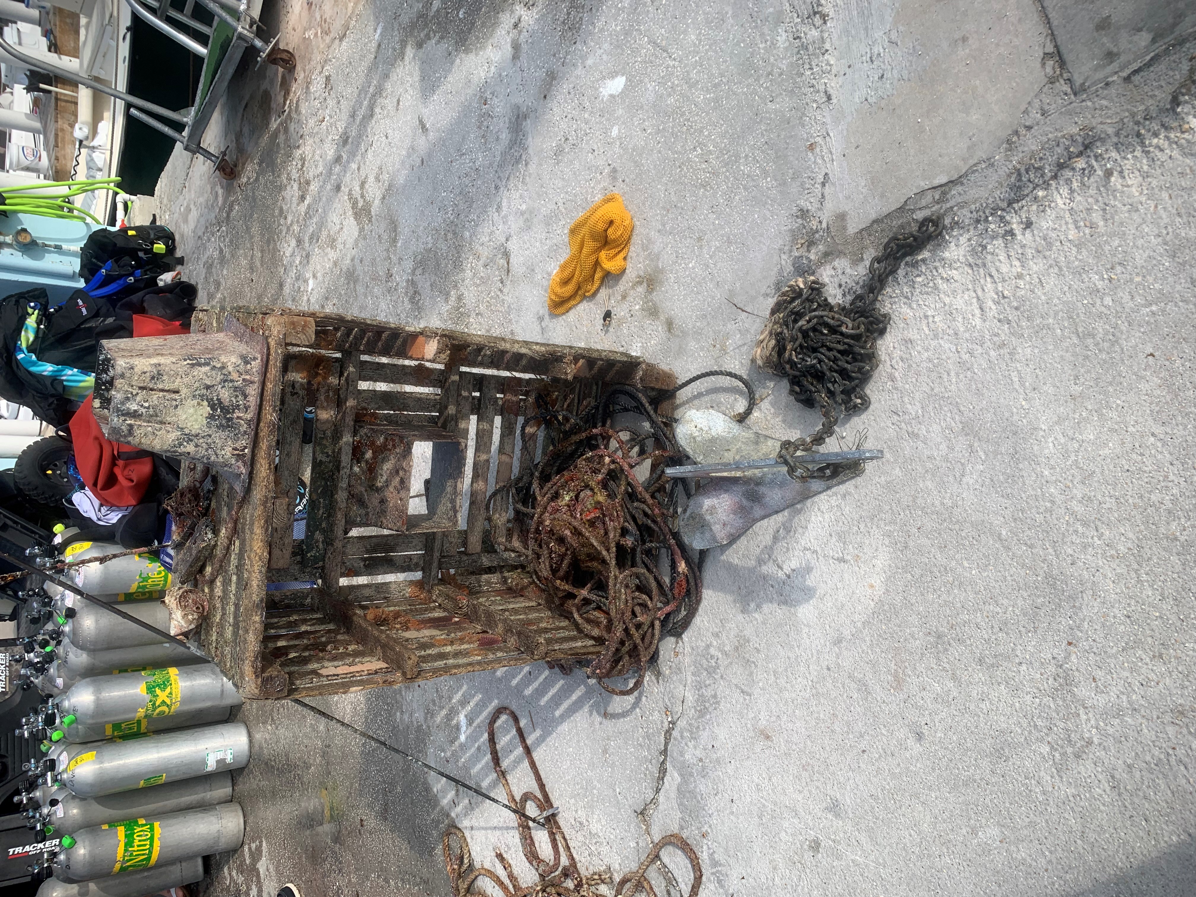
Debris Items Collected
| plastic materials collected | |
|---|---|
| Cups, Plates, Forks, Knives, Spoons (plastic) | 1 |
| Fishing: Line | 7 |
| metal materials collected | |
|---|---|
| Fishing: Sinkers, Lures, Hooks | 3 |
| wood materials collected | |
|---|---|
| Fishing: Traps & Pots | 1 |
| cloth materials collected | |
|---|---|
| Rope And String (cloth) | 17 |
| other materials collected | |
|---|---|
| Anchor & Chain | 1 |
| pole spear | 1 |
| plastic lobster trap entrance | 1 |
Additional Information
Fishing line
Rope
Trap debris


