
Dive Against Debris Data Submission
Pete Tide
30 May, 2021
- Team Leader
- Victoria Sengelman
- Number of Participants
- 7
- Total Debris Collected
- 5 lbs (estimated)
30.288033771636, -87.220834238757
Survey Information
- Location Name
- Pete Tide
- Organization/Dive Centre
- City
- Pensacola
- Country
- United States
- Date
- 30 May, 2021
- Survey Duration
- 19 Minutes
- GPS Coordinates
- Latitude: 30.288033771636
Longitude: -87.220834238757
- Weather Conditions
-
Sunny some wind
- Survey Depth Range
- 93–100 feet
- Area Surveyed
- 170 ft2
- Dominant Substrate
- sand
- Ecosystem
- Wreck Reef
- Wave Conditions
- Smooth (wavelets) for waves 0.1 - 0.5 meter high
Survey Photos
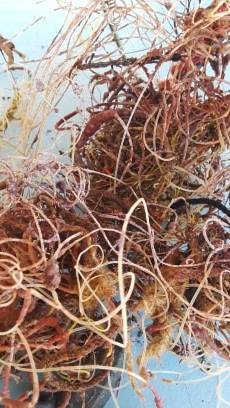
Debris Items Collected
| plastic materials collected | |
|---|---|
| Fishing: Line | 11 |
| Fishing: Lures, Rods/poles | 1 |
| Rope (plastic/nylon) | 2 |
| metal materials collected | |
|---|---|
| Fishing: Sinkers, Lures, Hooks | 5 |
Additional Information
Fishing line
FIshing hooks
Fishing sinkers
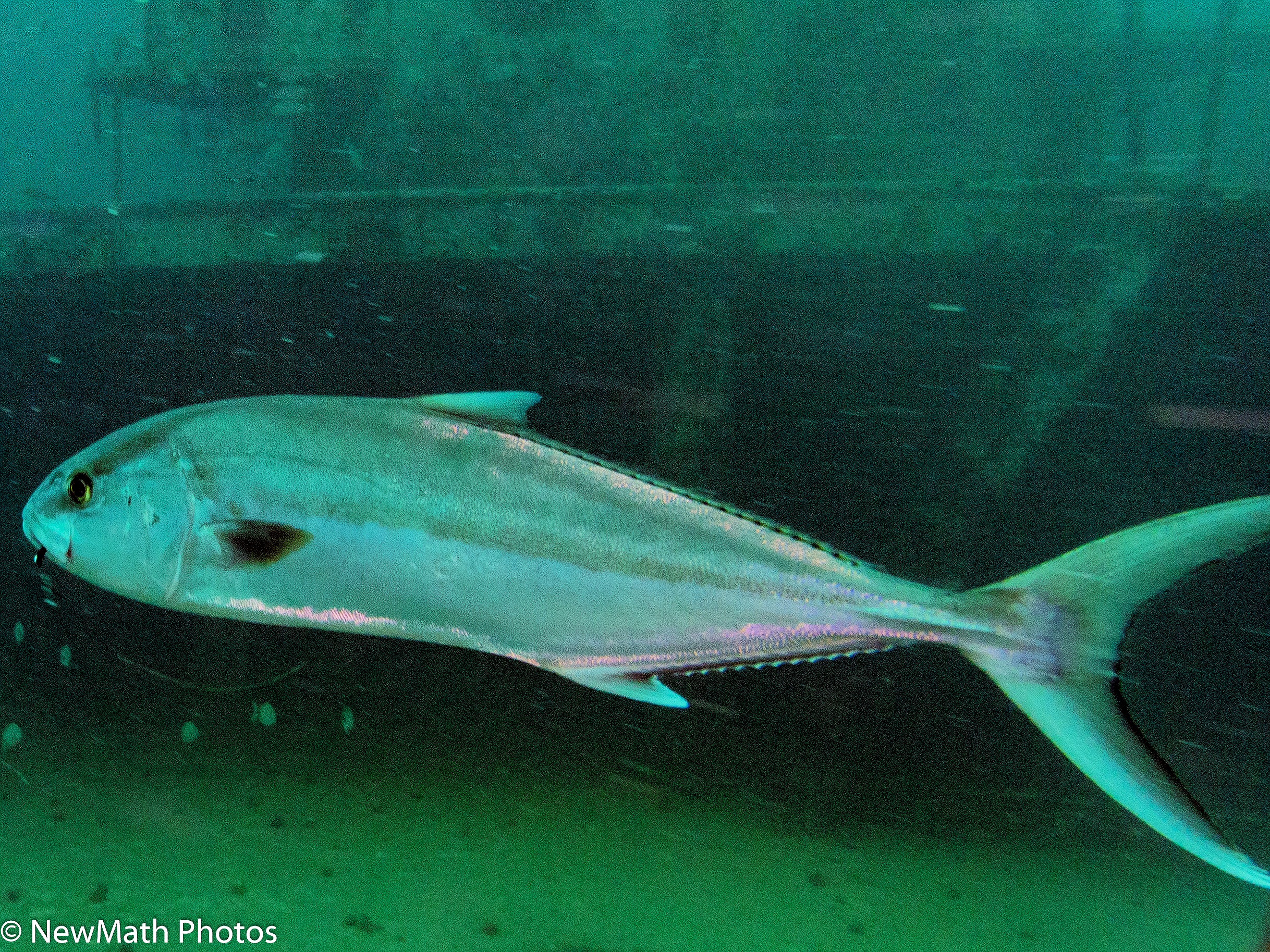
Comments and Feedback
Photo of Alamaco Amber Jack with fishhook and line in mouth. Unable to catch and remove the hook.


