
Dive Against Debris Data Submission
ADS441 - Comal River
18 September, 2018
- Team Leader
- JUSTIN PACKAN
- Number of Participants
- 3
- Total Debris Collected
- 1.5 lbs (estimated)
29.708094, -98.123687
Survey Information
- Location Name
- ADS441 - Comal River
- Organization/Dive Centre
- DIVE WORLD SCUBA
- City
- SAN ANTONIO
- Country
- United States
- Date
- 18 September, 2018
- Survey Duration
- 60 Minutes
- GPS Coordinates
- Latitude: 29.708094
Longitude: -98.123687
- Weather Conditions
-
T-STORM/RAIN
- Survey Depth Range
- 2–14 feet
- Area Surveyed
- 120833 ft2
- Dominant Substrate
- silt
- Ecosystem
- RIVER
- Wave Conditions
- Calm (glassy to rippled) for waves 0 – 0.1 meter high
Survey Photos
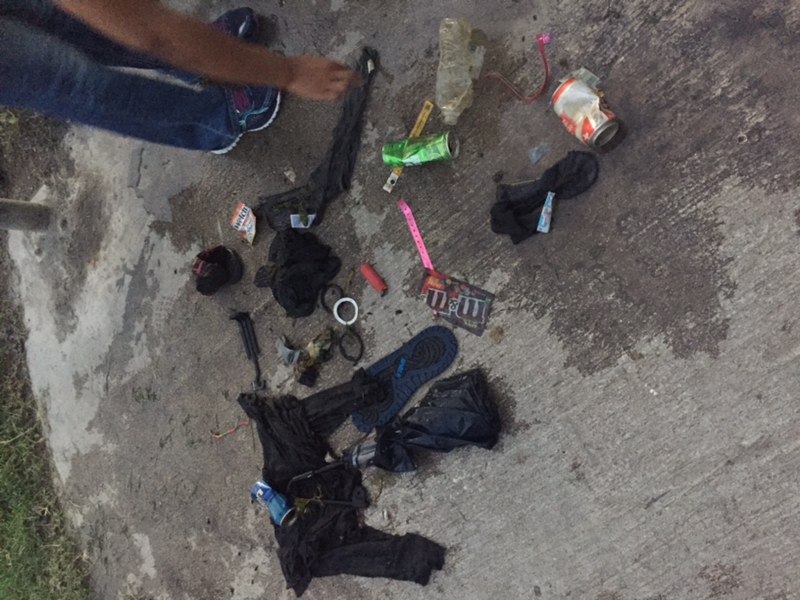
Debris Items Collected
| plastic materials collected | |
|---|---|
| Beverage Bottles: 2 Litres Or More (plastic) | 1 |
| Cigarette Lighters | 1 |
| Cups, Plates, Forks, Knives, Spoons (plastic) | 1 |
| Food Wrappers (plastic) | 5 |
| Plastic Fragments | 1 |
| Strapping Bands (plastic) | 2 |
| metal materials collected | |
|---|---|
| Cans: Food/juice, Other (tin) | 5 |
| rubber materials collected | |
|---|---|
| Rubber Fragments | 1 |
| cloth materials collected | |
|---|---|
| Rope And String (cloth) | 1 |
| Cloth Fragments | 5 |
| mixed materials collected | |
|---|---|
| Shoes-flip Flops, Sandals, Tennis, Etc | 1 |
| other materials collected | |
|---|---|
| Umbrella | 1 |
| Entangled Animals | |
|---|---|
| Crustaceans | |
| Species or Common Name | CRAWFISH |
| Number Entangled | 2 |
| Status | released unharmed |
| Type of Debris | CANS |
Additional Information
River tube area used for recreation and floating.
UMBRELLA
Pay bracelets
Cans
Clothing


