
Dive Against Debris Data Submission
Punta Maroma
8 April, 2018
- Team Leader
- Sabine
- Number of Participants
- 2
- Total Debris Collected
- 0.25 kgs (estimated)
20.725823, -86.9581715
Survey Information
- Location Name
- Punta Maroma
- Organization/Dive Centre
- Easygoing.guide
- City
- Playa del Carmen
- Country
- Mexico
- Date
- 8 April, 2018
- Survey Duration
- 35 Minutes
- GPS Coordinates
- Latitude: 20.725823
Longitude: -86.9581715
- Weather Conditions
-
Rough
- Survey Depth Range
- 8–13 meters
- Area Surveyed
- 244.376 m2
- Dominant Substrate
- coral
- Ecosystem
- coral reef
- Wave Conditions
- Slight for waves 0.5 -1.25 meter high
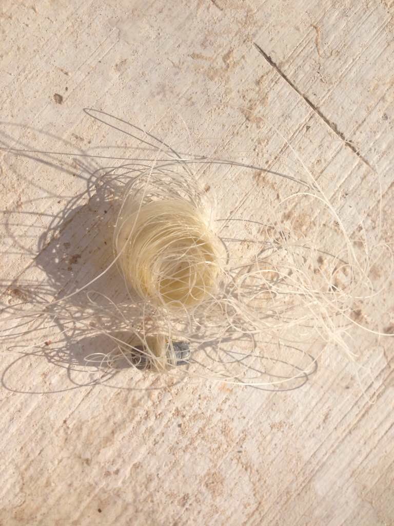
Survey Photos
Debris Items Collected
| plastic materials collected | |
|---|---|
| Fishing: Line | 1 |
| Fishing: Lures, Rods/poles | 1 |
Additional Information
No
50 m fishing line tangled around rocks and corals
50m fishing line tangled around rocks and corals
Comments and Feedback
It would be good to be allowed to enter the length of the line


