
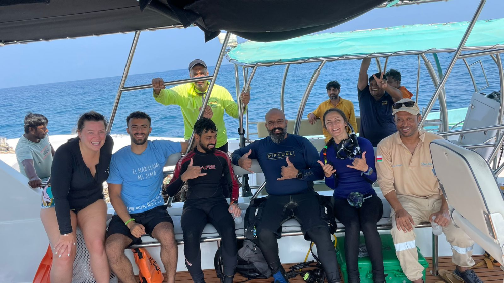
Dive Against Debris Data Submission
Daymaniyat
22 October, 2023
- Team Leader
- Behnaz Banirad
- Number of Participants
- 5
- Total Debris Collected
- 30 kgs (estimated)
23.854511, 58.0917
Survey Information
- Location Name
- Daymaniyat
- Organization/Dive Centre
- Omanta
- City
- Muscat
- Country
- Oman
- Date
- 22 October, 2023
- Survey Duration
- 60 Minutes
- GPS Coordinates
- Latitude: 23.854511
Longitude: 58.0917
- Weather Conditions
-
Wavy
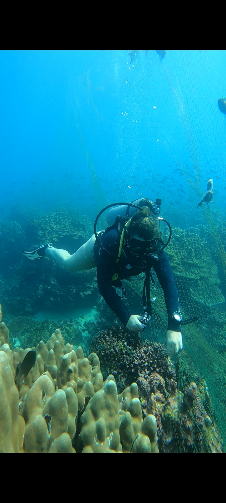
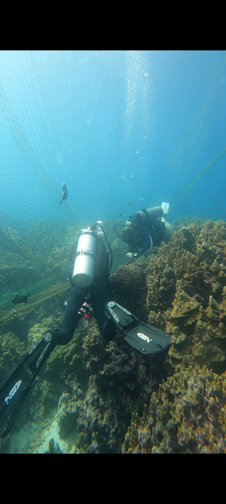
- Survey Depth Range
- 5–10 meters
- Area Surveyed
- 11574 m2
- Dominant Substrate
- coral
- Ecosystem
- coral reef
- Wave Conditions
- Smooth (wavelets) for waves 0.1 - 0.5 meter high
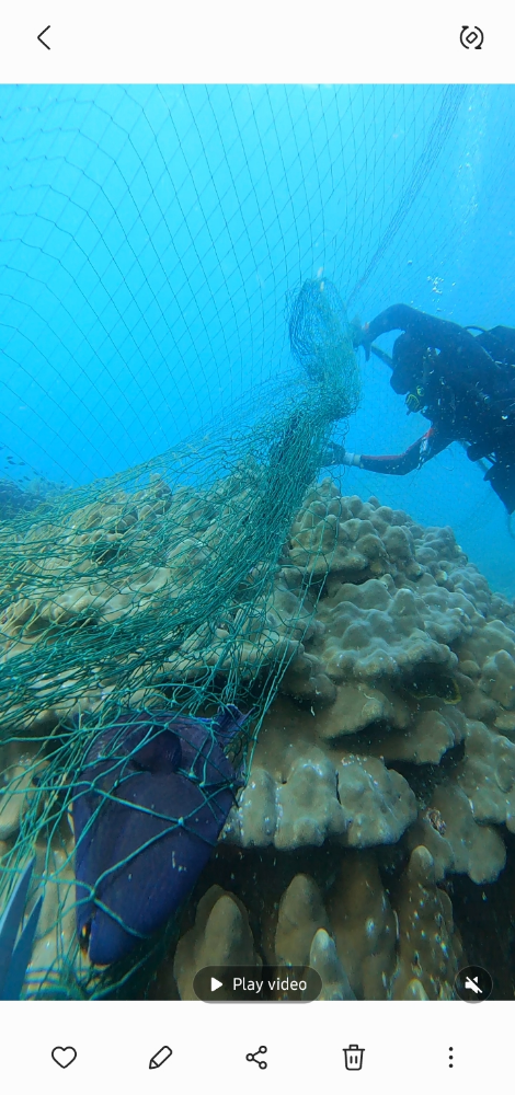
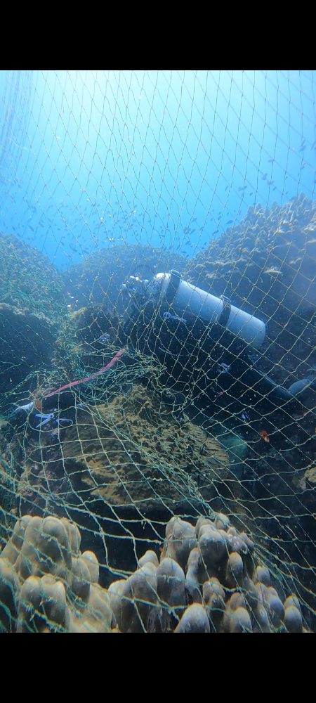
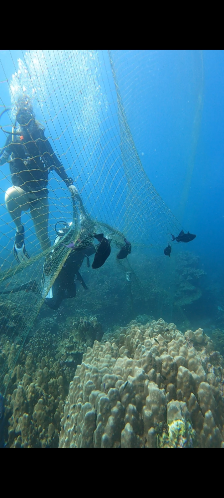
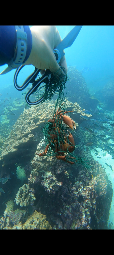
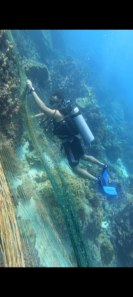
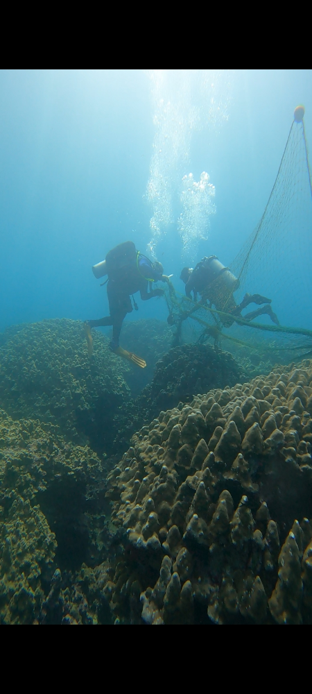
Survey Photos
Debris Items Collected
| plastic materials collected | |
|---|---|
| Buoys & Floats (plastic & Foamed) | 10 |
| Fishing: Line | 2 |
| Fishing: Lures, Rods/poles | 1 |
| Fishing: Nets & Pieces Of Nets | 6 |
| Mesh Bags: Fruit/vegetable/shellfish | 1 |
| Rope (plastic/nylon) | 4 |
| metal materials collected | |
|---|---|
| Pipes & Rebar | 1 |
| Wire, Wire Mesh & Barbed Wire | 1 |
| Fishing: Sinkers, Lures, Hooks | 3 |
| cloth materials collected | |
|---|---|
| Rope And String (cloth) | 6 |
| other materials collected | |
|---|---|
| Ironn anchor | 3 |
| Entangled Animals | |
|---|---|
| Other Fish | |
| Species or Common Name | Trigger Fish |
| Number Entangled | 10 |
| Status | injured |
| Type of Debris | Fish net |
| Crustaceans | |
| Species or Common Name | Crab |
| Number Entangled | 3 |
| Status | released unharmed |
| Type of Debris | Fish net |
Additional Information
Fish net
Fish line
Fish hook


