
Dive Against Debris Data Submission
Tangalooma Wrecks
31 December, 2022
- Team Leader
- Adrian Elliott
- Number of Participants
- 1
- Total Debris Collected
- 14 kgs (measured)
-27.16341160745, 153.36819648743
Survey Information
- Location Name
- Tangalooma Wrecks
- Organization/Dive Centre
- Country
- Australia
- Date
- 31 December, 2022
- Survey Duration
- 240 Minutes
- GPS Coordinates
- Latitude: -27.16341160745
Longitude: 153.36819648743
- Weather Conditions
-
Some showers, 15-20kts SE.
- Survey Depth Range
- 4–13 meters
- Area Surveyed
- 1000 m2
- Dominant Substrate
- sand
- Ecosystem
- Sunken Wrecks
- Wave Conditions
- Calm (glassy to rippled) for waves 0 – 0.1 meter high
Survey Photos
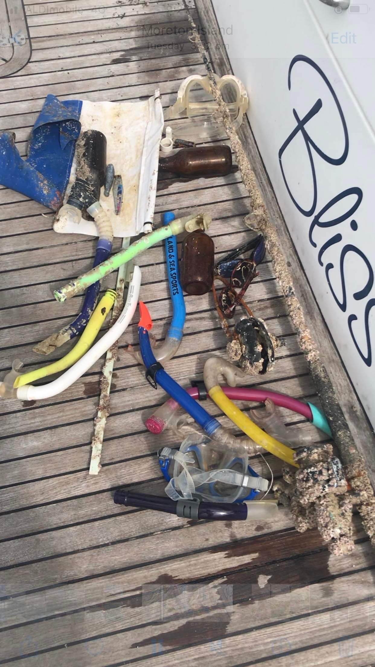
Debris Items Collected
| plastic materials collected | |
|---|---|
| Fishing: Lures, Rods/poles | 4 |
| SCUBA & Snorkel Gear-masks, Snorkels, Fins | 8 |
| glass materials collected | |
|---|---|
| Beverage Bottles (glass) | 1 |
| other materials collected | |
|---|---|
| Sunglasses | 0.1 |
Additional Information
High tourism area.
Comments and Feedback
The area surveyed was a high intensity tourism water sports area. The large area was surveyed with the assistance of an underwater scooter.


