
Dive Against Debris Data Submission
Australian Wreck
2 June, 2019
- Team Leader
- Martin
- Number of Participants
- 2
- Total Debris Collected
- 2.5 kgs (measured)
5.13795, 115.0906
Survey Information
- Location Name
- Australian Wreck
- Organization/Dive Centre
- Oceanic Quest
- City
- Serasa
- Country
- Brunei
- Date
- 2 June, 2019
- Survey Duration
- 30 Minutes
- GPS Coordinates
- Latitude: 5.13795
Longitude: 115.0906
- Weather Conditions
-
evening storms
- Survey Depth Range
- 22–28 meters
- Area Surveyed
- 200 m2
- Dominant Substrate
- other
- Ecosystem
- other
- Wave Conditions
- Slight for waves 0.5 -1.25 meter high
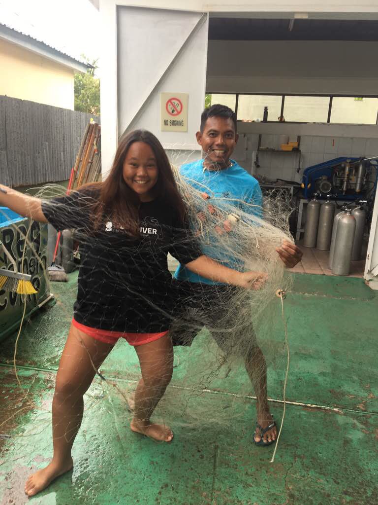
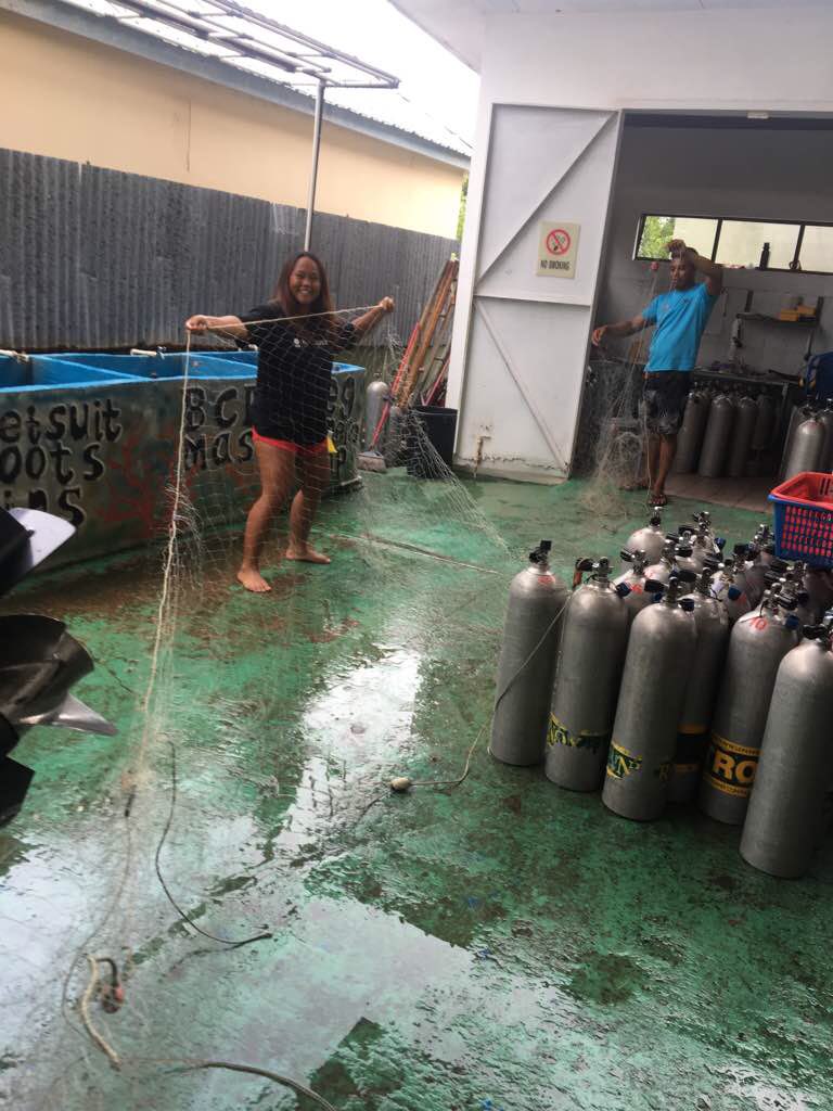
Survey Photos
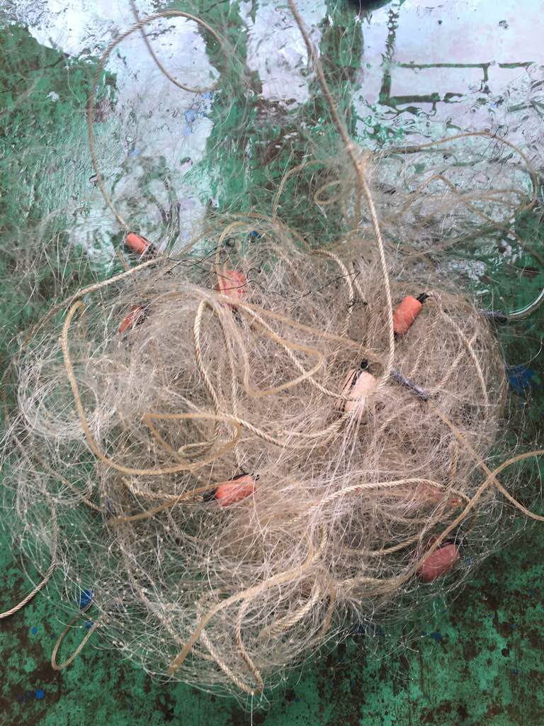
Debris Items Collected
| plastic materials collected | |
|---|---|
| Buoys & Floats (plastic & Foamed) | 14 |
| Fishing: Nets & Pieces Of Nets | 1 |
| Rope (plastic/nylon) | 3 |
| metal materials collected | |
|---|---|
| Fishing: Sinkers, Lures, Hooks | 11 |
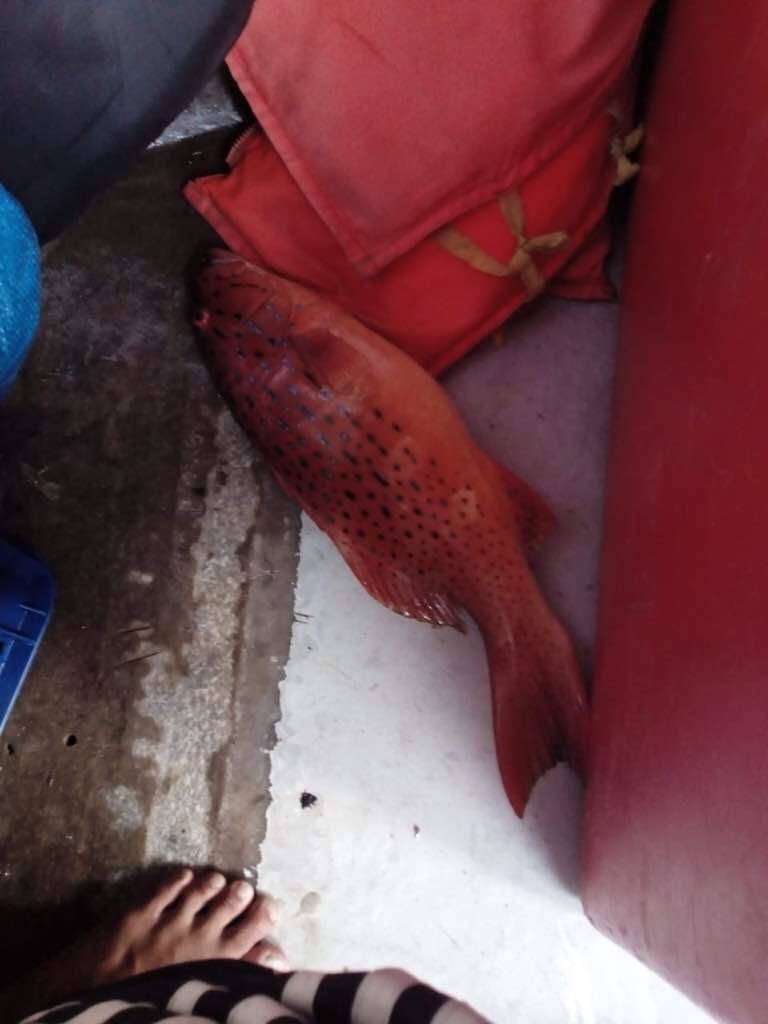
| Entangled Animals | |
|---|---|
| Other Fish | |
| Species or Common Name | Grouper |
| Number Entangled | 1 |
| Status | released unharmed |
| Type of Debris | fishing net |
Additional Information
local fisherman
fishing net
Comments and Feedback
18m long


