
Dive Against Debris Data Submission
Manoel Island - Shipwreck X127
13 January, 2019
- Team Leader
- Alessio Tenenti
- Number of Participants
- 3
- Total Debris Collected
- 15 kgs (estimated)
35.901309559025, 14.503108854464
Survey Information
- Location Name
- Manoel Island - Shipwreck X127
- Organization/Dive Centre
- Orange Shark Diving Centres
- Country
- Malta
- Date
- 13 January, 2019
- Survey Duration
- 45 Minutes
- GPS Coordinates
- Latitude: 35.901309559025
Longitude: 14.503108854464
- Weather Conditions
-
Wind: N 2-5 Bft
- Survey Depth Range
- 2–20 meters
- Area Surveyed
- 4972 m2
- Dominant Substrate
- silt
- Ecosystem
- rocky reef
- Wave Conditions
- Calm (glassy to rippled) for waves 0 – 0.1 meter high
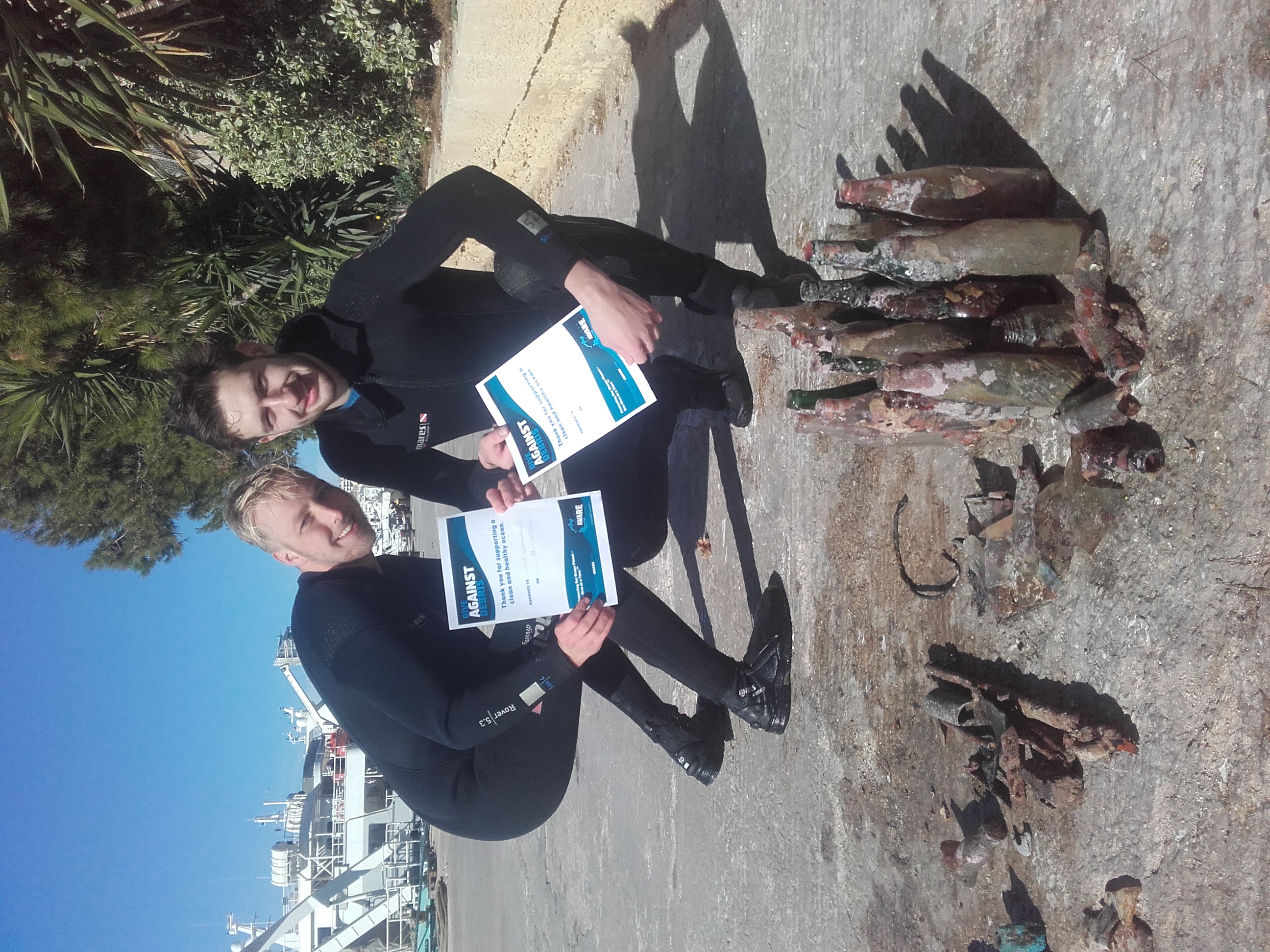
Survey Photos
Debris Items Collected
| glass materials collected | |
|---|---|
| Cups & Plates-tableware/dishes (glass & Ceramic) | 1 |
| Jars-food (glass) | 1 |
| Glass & Ceramic Fragments | 20 |
| Beverage Bottles (glass) | 19 |
| metal materials collected | |
|---|---|
| Metal Fragments | 6 |
| rubber materials collected | |
|---|---|
| Rubber Fragments | 2 |
| cloth materials collected | |
|---|---|
| Cloth Fragments | 2 |
Additional Information
The area is a private marina, workers throw many of their waste directly into the sea.
metal, glass and ceramic fragments


