
Dive Against Debris Data Submission
Municipal Wharf 2
2 September, 2023
- Team Leader
- Lauren Mackenzie
- Number of Participants
- 8
- Total Debris Collected
- 3 lbs (estimated)
36.603823, -121.889241
Survey Information
- Location Name
- Municipal Wharf 2
- Organization/Dive Centre
- DOER Marine
- City
- Monterey
- Country
- United States
- Date
- 2 September, 2023
- Survey Duration
- 50 Minutes
- GPS Coordinates
- Latitude: 36.603823
Longitude: -121.889241
- Weather Conditions
- Survey Depth Range
- 15–28 feet
- Area Surveyed
- 450 m2
- Dominant Substrate
- sand
- Ecosystem
- rocky reef
- Wave Conditions
- Smooth (wavelets) for waves 0.1 - 0.5 meter high
Survey Photos
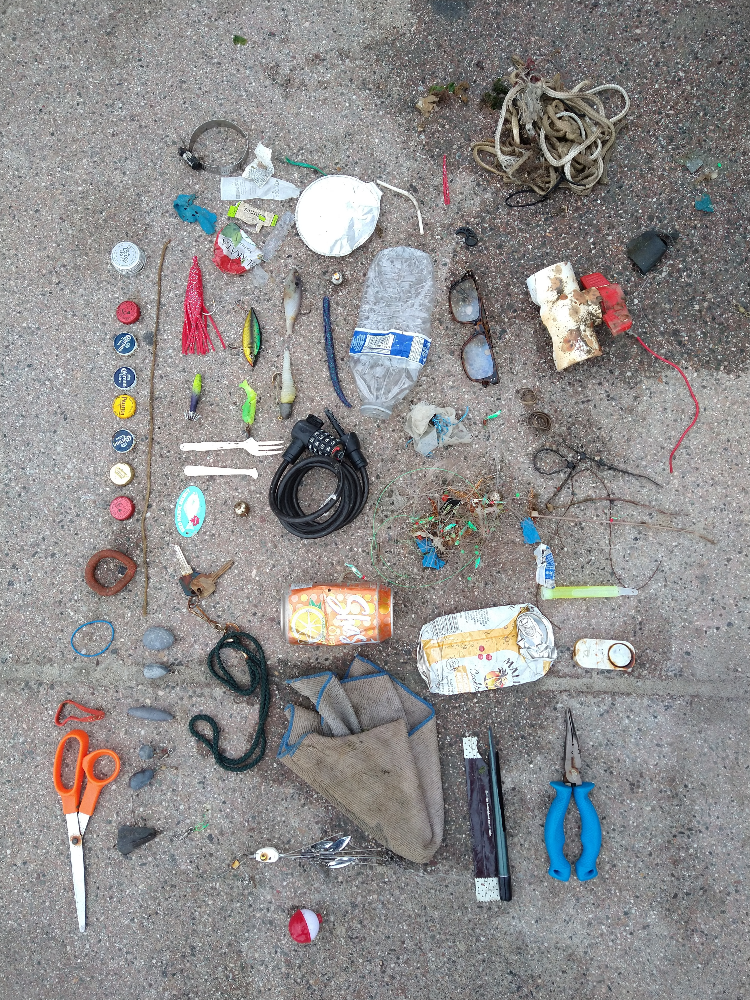
Debris Items Collected
| plastic materials collected | |
|---|---|
| Beverage Bottles: Less Than 2 Litres (plastic) | 1 |
| Buoys & Floats (plastic & Foamed) | 1 |
| Carpet (synthetic) | 1 |
| Fishing: Line | 10 |
| Fishing: Lures, Rods/poles | 5 |
| Fishing: Nets & Pieces Of Nets | 9 |
| Food Wrappers (plastic) | 3 |
| Furnishings (plastic) | 1 |
| Plastic Fragments | 2 |
| Strapping Bands (plastic) | 4 |
| metal materials collected | |
|---|---|
| Beverage Cans (aluminium) | 1 |
| Caps & Lids (metal) | 8 |
| Strapping Bands (metal) | 1 |
| Metal Fragments | 1 |
| rubber materials collected | |
|---|---|
| Rubber Bands | 5 |
| paper materials collected | |
|---|---|
| Paper, Cardboard Fragments | 1 |
| other materials collected | |
|---|---|
| light sticks/cyalumes | 1 |
| Entangled Animals | |
|---|---|
| Crustaceans | |
| Species or Common Name | Mussel |
| Number Entangled | 2 |
| Status | released unharmed |
| Type of Debris | Fishing line |


