
Dive Against Debris Data Submission
La balsa river
25 June, 2023
- Team Leader
- Niki Antram
- Number of Participants
- 2
- Total Debris Collected
- 0.5 kgs (estimated)
-26.685012707521, 153.13520004659
Survey Information
- Location Name
- La balsa river
- Organization/Dive Centre
- City
- Mooloolaba River
- Country
- Australia
- Date
- 25 June, 2023
- Survey Duration
- 60 Minutes
- GPS Coordinates
- Latitude: -26.685012707521
Longitude: 153.13520004659
- Weather Conditions
-
Sunny, light winds, no swell
- Survey Depth Range
- 1–5 meters
- Area Surveyed
- 425.42 m2
- Dominant Substrate
- rock
- Ecosystem
- River
- Wave Conditions
- Calm (glassy to rippled) for waves 0 – 0.1 meter high
Survey Photos
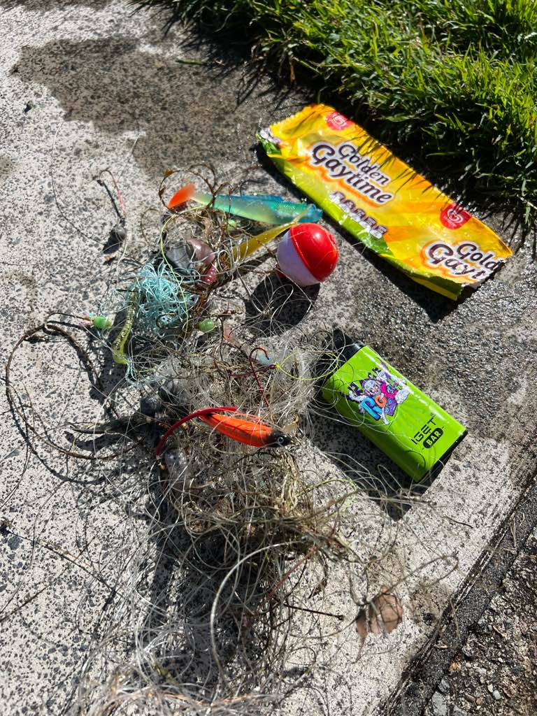
Debris Items Collected
| plastic materials collected | |
|---|---|
| Buoys & Floats (plastic & Foamed) | 1 |
| Fishing: Line | 8 |
| Fishing: Lures, Rods/poles | 3 |
| metal materials collected | |
|---|---|
| Fishing: Sinkers, Lures, Hooks | 6 |
| other materials collected | |
|---|---|
| Ice cream wrapper | 1 |
| Vape | 1 |
Additional Information
No
Vape
Fishing line
Sinkers
Lures


